

cyclone77
-
Posts
18,736 -
Joined
-
Last visited
Content Type
Profiles
Blogs
Forums
American Weather
Media Demo
Store
Gallery
Everything posted by cyclone77
-
DVN just issued the lamest winter storm warning in history. Talk about setting the bar low. Brief snow squalls with most areas seeing a DAB. Might as well just go all in and go with a blizzard warning, or hurricane warning.
-
We had blowing fog here this morning. Don't think I've ever seen that before. There were waves of dense fog whipping horizontally with the gusty south winds over the remaining snow cover. Thought it was blowing snow at first until I realized what it was. All the snow is gone here now, other than piles. Rain mixed with wet snow right at the end. Picked up 0.19" of rain.
-

Winter 2025-26 Medium/Long Range Discussion
cyclone77 replied to michsnowfreak's topic in Lakes/Ohio Valley
I think torchartie did it if I remember right. -
Winter 2025-26 Short Range Discussion
cyclone77 replied to SchaumburgStormer's topic in Lakes/Ohio Valley
Hi-res Canadian flips us over to a brief period of heavy snow on Thursday depositing a quick 2-3". Some other models have hinted at a quick switch to snow before ending as well. Something to watch just for fun. -
Winter 2025-26 Medium/Long Range Discussion
cyclone77 replied to michsnowfreak's topic in Lakes/Ohio Valley
That's a great pattern for the Donners @ Donner Pass. -
Winter 2025-26 Medium/Long Range Discussion
cyclone77 replied to michsnowfreak's topic in Lakes/Ohio Valley
It'd be nice to take advantage of the warmth and get some thunderstorm action but looks like the systems will be very wimpy the next 10-15 days. -
The car washes are gonna look like Walmart on black friday tomorrow.
-
January will be rockin'.
-
-9 here.
-
Winter 2025-26 Medium/Long Range Discussion
cyclone77 replied to michsnowfreak's topic in Lakes/Ohio Valley
If it's not gonna snow I'll take a big rainer. Still a lot of ground to make up in the moisture dept from the dry summer and fall. -
December 11th-14th Double Banger Clippers
cyclone77 replied to Jackstraw's topic in Lakes/Ohio Valley
1.2" here as it winds down. Feels like a win. -
December 11th-14th Double Banger Clippers
cyclone77 replied to Jackstraw's topic in Lakes/Ohio Valley
It's all good, we've had a phenomenal season already. Gonna take a 2-3 week break from snow, but hopefully we can resume the snowy pattern after the New year. -
Really feels like the arctic out there today with snow falling and a temp of 5 degrees. Pretty cool to see how different the weather can vary from season to season. Extreme tropical humidity with 82+ dewpoints, to true arctic conditions a few months later.
-
December 11th-14th Double Banger Clippers
cyclone77 replied to Jackstraw's topic in Lakes/Ohio Valley
Yeah. Precip is sliding southeast. Was able to catch a little bubble of heavy snow as it rode southeast from Cedar Rapids. We're in 1.5-2 mile type vis with pixies now. Very strange how we rode the extreme northern edge with both clippers. Usually back to back clippers vary more in their tracks. -
December 11th-14th Double Banger Clippers
cyclone77 replied to Jackstraw's topic in Lakes/Ohio Valley
Had about a 15 min burst of heavy snow that put down a quick half inch. Back to pixies now. -
December 11th-14th Double Banger Clippers
cyclone77 replied to Jackstraw's topic in Lakes/Ohio Valley
Not a flake here yet. Looks like we may get about what we got with the last clipper, 0.2". -
Have about 3-4" of leftover arctic crust here. Should add 1/3-2/3" of pixies to it tomorrow.
-
December 11th-14th Double Banger Clippers
cyclone77 replied to Jackstraw's topic in Lakes/Ohio Valley
00z are ticking southwest. Looks like another dog turd duster here at best. Bring on the torch. -
December 11th-14th Double Banger Clippers
cyclone77 replied to Jackstraw's topic in Lakes/Ohio Valley
Was able to scrounge up one or two tenths. -
December 11th-14th Double Banger Clippers
cyclone77 replied to Jackstraw's topic in Lakes/Ohio Valley
His version means ground (accumulation) zero. -
December 11th-14th Double Banger Clippers
cyclone77 replied to Jackstraw's topic in Lakes/Ohio Valley
Flakeless so far here. May get a brief burst of light snow to dust up the landscape mid to late evening. Not too optimistic with Saturday wave for this area. Hopefully we can get lucky and squeeze out a fluffy inch along the northern portion of the snow swath. -
Winter 2025-26 Medium/Long Range Discussion
cyclone77 replied to michsnowfreak's topic in Lakes/Ohio Valley
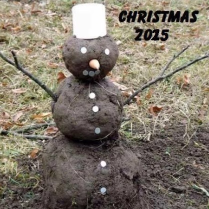
-
Winter 2025-26 Short Range Discussion
cyclone77 replied to SchaumburgStormer's topic in Lakes/Ohio Valley
Dusting to an inch with tomorrow night's wave for this area. Saturday wave looking like a whiff to 2". -
Had an hour period of non-accumulating snow globe action. Always nice to see daytime snow here west of the lakes.
-
Winter 2025-26 Short Range Discussion
cyclone77 replied to SchaumburgStormer's topic in Lakes/Ohio Valley
Peoria looking like the better spot to be for the first wave. Northern IL is trending towards a dog turd duster on the globals.


