LVblizzard
-
Posts
4,960 -
Joined
-
Last visited
Content Type
Profiles
Blogs
Forums
American Weather
Media Demo
Store
Gallery
Everything posted by LVblizzard
-
Not surprised, lots of people went to work or even went for a night out thinking there would be no more than an inch on the ground by now. Instead there’s 3” on untreated roads. I was out delivering food for over 3 hours tonight and I didn’t see a single plow.
-
Looks like around 3” out there. I had to stop DoorDash for the night because the roads were getting too slick for my FWD car. Probably another inch or two tonight. Love these overperformers!
-
Looks like about 1 1/2-2” in and around Allentown. Still coming down too. DoorDash and Uber Eats are an absolute gold mine tonight because of the snow, I don’t think I’ve ever worked a night quite this good.
-
Coming up on an inch in Allentown. Roads are still fine so it’s time to do some DoorDash and make some good money tonight!
-
About half an inch on the ground as light snow continues. Love it!
-
I literally posted an update on my page around 11 am saying the afternoon looks like some scattered snow showers and nothing more. Then that band of snow just appeared out of nowhere on the radar. I don’t think any of the meso models had this, they all held off the accumulating snow till after sunset.
-
Nice band of snow over Lehigh County right now. Coming down pretty good. All surfaces covered but the road.
-
Light snow in Allentown with a dusting on the ground. Not expecting much from this initial wave of snow. The IVT looks like it’ll give us an inch or two tonight though.
-
Actually some decent agreement on the 12z models with the IVT over eastern PA/northern NJ. The wild card is the initial wave of precip tomorrow afternoon. Some models have it, some don’t. If that’s stronger than expected we could get an extra inch or so.
-
12z NAM…aaaaaand it’s gone. Still has the norlun at least.
-
Patiently waiting for someone to blame this NAM run on convective feedback or something. Happens with every storm threat when the models show something we don’t like.
-
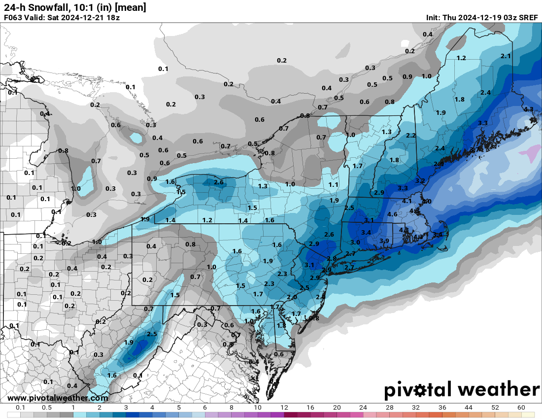
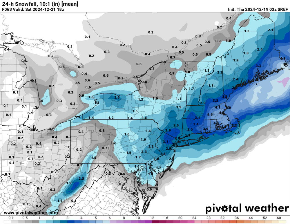
Late night SREF with a pretty sizable shift towards a stronger and farther west system.
-
Very surprised @MJO812hasn’t posted the 15z SREF mean. It’s west and has a large area of 1-3”.
-
Euro backed off significantly for Friday and has nothing for Christmas. Dr. No living up to its name.
-
It’s a Christmas miracle on the Canadian!

-
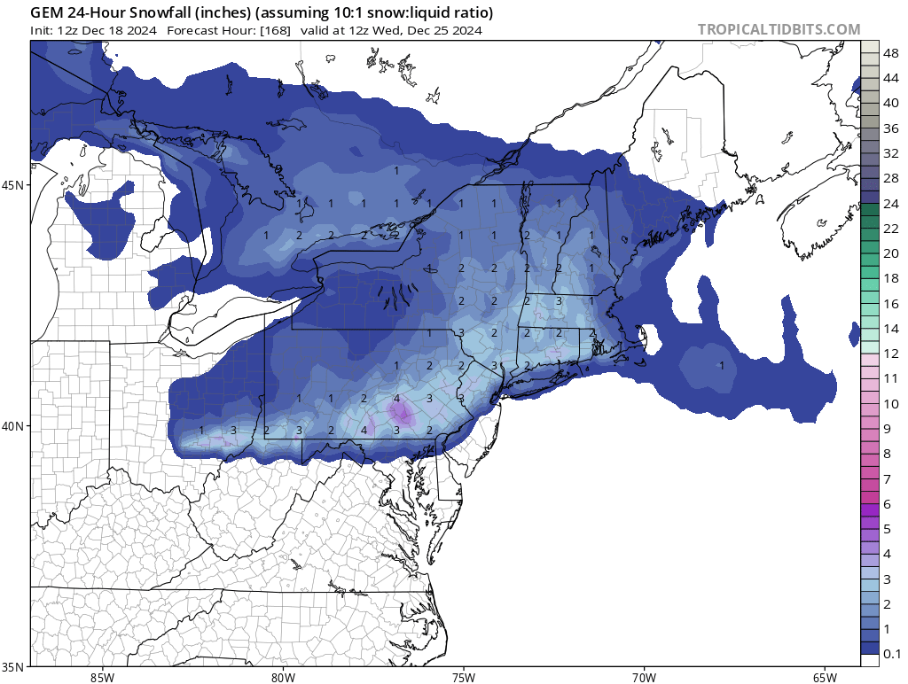
12z NAM/GFS still like an area of 1-3” in the general vicinity of the Delaware River.
-
Also has some mood flakes and a coating on Christmas.
-
18z models target eastern PA for an inverted trough event on Friday evening. The ICON is very aggressive with 1-3" in the Philly area and 2-4" in the LV/Poconos.
-
0z models looking slightly intriguing for Friday night. Probably won't turn into anything plowable/significant but if trends continue we could see a light snow event.
-
Last night’s snow melted before noon today. Now it’s chilly and drizzly and just blah.
-
Finally changed over to mostly sleet here. Still some flakes mixing in. Hopefully the ground is still white in the morning.
-
Steady light snow, all surfaces are covered. Honestly expected it to be sleeting or raining by now.
-
Seems colder than modeled, no? Snow being reported down to central Bucks County. Models (except the RGEM) had the rain/snow line almost to the Lehigh Valley at 7 pm.
-
Flakes starting to fly in Allentown. Eagles winning and Lions losing too…tonight could be a very good night!
-
WWAs expanded to the Lehigh Valley. I’ll be happy if we see an inch of slop before it changes to rain.