
USCAPEWEATHERAF
-
Posts
8,736 -
Joined
-
Last visited
Content Type
Profiles
Blogs
Forums
American Weather
Media Demo
Store
Gallery
Everything posted by USCAPEWEATHERAF
-
 Yes, chaos in the pattern will lead to superstorm potential. The shortwave nature of the pattern on the 12z and 18z runs of the 1-23-2020 cycle of the GFS operational run suggests a massive threat exists in the pattern for New England extreme weather events. The chaos involved in the pattern from troughs to ridges in a short wave pattern suggests too many eggs in the basket and no one will have an idea of the pattern for another six to seven maybe even eight days from today. I could take the morning of the first flakes before we have an idea of the track of the storm. Stay tuned!
 -
Long term pattern is shaping up to bring a parade of massive coastal super storms, at least the potential. A strong combination of a -NAO/-EPO/-AO/+PNA pattern is shaping up around Day 8 onward. Right now nothing is ever set in stone, but the potential exists for a weekend snow threat next weekend first weekend of February 2/3rd or Super Bowl Bomb party once again, like the Blizzards of the past. However, the Patriots will not be participants for the first time in four years. Enough with the sad news, the weather pattern evolving is enough to be satisfied for a temporary rain event this weekend. With the lack of true arctic air in place, we should be glad this storm is in land runner type with rain into Central New England. Otherwise, a mixed precip event would be quite devastating. However, I am confident in a storm happening next weekend, and perhaps a snow threat midweek this upcoming week. Still a ways to go...
-
It appears at this moment that the next three snow threats fall on these dates or combination of dates: 15/16th, 18/19th and 20/21, almost every other day kind of succession pattern as the jet becomes quite active with multiple energetic systems in the flow. As you try and solve a puzzle, you try to fit the pieces in the area you believe it belongs looking at the picture it is supposed to be on the front of the box. Weather forecasting is the same basic idea. The difference and is a major difference is that that puzzle is constantly changing in every direction, every piece is changing, and every place that piece is supposed to be is changing. The weather is a puzzle in constant flux. The idea of weather systems is the transferring of heat from tropics to polar regions. A major storm develops along the boundary between extreme heat and extreme cold. It is meant to transfer that heat to the coldest reaches of the world. The world is constant balance, and needs to remain in this constant balance to sustain life and the human race and everything it encompasses. It is such a perfect design the weather makes no mistakes. However, since human error is a major problem in our lives and since it is all over the place, errors will always happen. We are not perfect. Avoiding going into a religious diatribe, I will go back to the next three events. Right now, the pattern appears to favor EPO ridging combining with the PNAP ridging present. With ridging potential in both locations, we could have a major push of cold air into the eastern 2/3rd of the CONUS in the 15/16th period. The pattern is in flux and there is hardly any agreement overall on the H5 pattern aloft. Some guidance suggests the pattern transitions from a +EPO/-PNA to a -EPO/+PNA then back and forth for these next three events. So it could be a snow event followed by rain event and then back to snow event for SNE. Right now, a lot can change even for an event in the next 72 hours. I will have more tomorrow evening. Unless something big changes.
-
Just to update the area, with another day tomorrow at least 10 degrees F above normal expect temps to drop throughout the week. Snow returns next weekend. Not until then, the threats for this week are rain at this point in SE New England.
-
I-95 corridor from eastern CT to NE MA - 2-4" SE MA interior includes city of Boston, MA 2-4" Cape Cod Canal eastward to Hyannis 4-6" Hyannis eastward to Provincetown 6"+ Snowfall forecasts for the January 7/8, 2029 Snow event
-
**Alert Level - Awareness!** Potential Nor'easter impending day 4 - given both uncertainty and time frame, this level is only for awareness. Given unknown factors at play and will not know the extent of the systems at hand for the next 40 hours, we will not gain confidence until a better consensus develops and we get closer to the event period. January 5th is the date for the nor'easter impact period. We will know the most by 00z Saturday, Friday evening, 7 pm cycle. That is all for this moment, another alert level will be issued tomorrow around the same time, we will either continue alert level awareness or upgrade to potential. The next update tomorrow evening.
-
**signal for a decent moderate snow event is increasing at least for the interior portions of SE MA and the rest of SNE. Cape Cod and the immediate coast is still in question.** A large long wave troughing pattern is developing in the next 48 hours as a major piece of energy amplifies the trough as it enters the eastern US. Still questions to intensity, track of parent system and lack of cold air source. I will keep you abreast of the situation at hand.
-
Happy New Year's Eve!
USCAPEWEATHERAF posted a blog entry in Snowfall Updates and Forecasts 2019-2020 and beyond!
Have a happy New Year's eve of celebration and remembering our past year and last decade of greatness and welcome in a New Year and a new Decade of fun, love, health and wealth to everyone and their family. Love you all. Hope to a snowy winter ahead. -
All I can say to sum up what the pattern looks like the next ten days for coastal SE MA, is "Meh" a good ten day period to write a novel. I will update once something pops on the radar. Enjoy the 50s tomorrow.
-
The next seven to nine days the pattern supports a rathe benign and quiet week, especially from this weekend through next Friday, with temps moderating through the lower 40s for highs support a rather just below average temperatures for early winter and late December period. Averages are rather low this time of the year and into the January into March period for the next year. The 2020 New Year are supportive of a rather snowy period. Latest models in the medium to long range support a reload of cold air into the Arctic and then unleashed into Canada and then the US. End of the month models are showing several coastal storm threats. Time will tell, the NAO goes negative, the PNA goes positive and the AO goes negative. That supports highly anomalous cold in the eastern CONUS and a high likelihood of snow. Time will tell!
-
Simply, forecasting the weather is never perfect. In fact, the unpredictable nature of the weather is what fascinates those of us, who love the weather. The extremes, the puzzles that nature provides. What does allow a storm like Juno, NEMO, JONAS, or even Neptune form and impact us with such tremendous ferocity, I personally still put the Blizzard of 2005 ahead of JUNO, we received 35" of snow in my front yard from that storm. Now what I want to discuss with the viewers is simply the overall synoptic landscape of the weather patterns evolving next week. Right now the Saturday storm looks definite, and I would say we are at the 65% threshold that Cape Cod and SNE will receive a flooding rainstorm. The phase of cold air and the sub-tropical moisture connection is lacking and therefore not a cause for concern. The storm on Tuesday looks like at least a 55% probability for precipitation, question becomes, eventual track of the system. Now, there is a caveat next week that could change the outcome of the Tuesday storm, or become a storm on its own. A large piece of the Polar Vortex that moves south very slowly I might add, out of northern Canada and the Arctic Circle, which is why I know the arctic jet is present. The 12z NAM and GFS have slightly altering scenarios at 84 hours, and that is as far as the NAM goes, so any further is pointless. At 84 hours, the NAM is weaker and less amplified in the arctic jet over central/southern Canada. The GFS is actually more amplified, but the southern energy is too far ahead of the arctic shortwave to have much of a chance to phase. EURO is showing this energy as well, but the models are at odds at location and intensity of the shortwave and how it influences our phantom coastal around 100-120 hours out at this time. Still a lot of details to try and iron out which brings us to the biggest potential of the season to date around the first few days of Christmas week. Around the December 22-25th period, models have been hinting at a potential monster coastal nor'easter developing. The details and the impact that it will happen have yet to be determined. We have a lot of time left before that is even discussed more than at random at this time. So for the timeline I have written below, our certainty is this weekend, this late afternoon into Saturday, a major rainstorm, BUF could see a foot of snow. The further out in time, the more uncertain we are. Thanks for reading. 1.) Friday/Saturday December 13-14th, 2019 - rainstorm 2.) Monday evening/Tuesday morning December 16-17th, 2019 - mixed precipitation event, mainly rain for Cape Cod 3.) Wednesday potential coastal storm, not given yet, potential impacts snow and wind 4.) Following Monday into Wednesday December 23-25th, 2019 - Super Storm type nor'easter, potential for all impacts.
-
Southern New England and most of the I-95 corridor of the NE CONUS is in line for a 1-3 widespread snowfall, and a narrow band or two of 4+ inches.
-
"The Awakening Dawn" - A glimpse into the future!
USCAPEWEATHERAF posted a blog entry in Once a legend always a legend
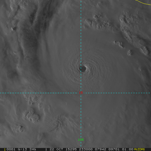
On day in 2005, the weather was at the most volatile point all season, October, month of the great Hurricane Wilma 2005. I had a dream that would spark a journey I have been on for the last fourteen years. In this dream, I saw the catastrophic end to humanity. Whether or not it was a premonition or just simply a basic dream for a developing weather enthusiast in his adolescence, I don't know, but it sparked a creative monster within myself. Struggling with family problems that latter turned into internal emotional distress later down the road, which end up costing my USAF experience to cut short, the weather was an outlet, an intellectual and emotional and a mental release from the reality I was facing within my developing maturation process as well as the developing family dynamics with four children between 15 and 6. My family dynamics truly showed, that not one family ever escapes the torment that life brings on a daily basis. Life torments us on day to day regime. It is how and what we decide to do in the face of that chaos that determines our future. This novel series all came from a dream I had that one evening. The Awakening Dawn - novel one, - From Dawn Until Dusk - novel two, - The End of the Awakening - novel three, -- The friends of Jack and Abi, Marie Givens and Michael Reed who are also dating each other, go on a tremendous journey that impacts their families, their friendships with each other, and the couples inter workings. While their relationships are changing, natural disasters of epic proportions start to develop and impact humanity. The first novel is about three catastrophic plus level hurricanes that make landfall on the US Coastline, East Coast and Gulf Coasts. Hurricane Franklin, Gert and Humberto all reach catastrophic plus levels of 250mph or greater wind speeds sustained, and minimum central pressures of lower than 700mbs. These massive beasts kill over 400,000 each. The total loss of human life just in the US is around 1.7 million. Elsewhere in the Atlantic Ocean territory, over 300,000 additional lives were lost in the Turks and Caicos, Cuba, and the Bahamas. in the second novel, Jack and Abi begin their second chapter with their newly born child, Jaye is born into the world of chaos around them. As newly appointed Joint Weather and Science Center now undergoing development of a new building in northern Florida, it is the combination of Climate Prediction Center, Weather Prediction Center, Storm Prediction Center, National Hurricane Center, National Environmental Prediction Center and other NOAA/NWS services combined with Geological US Survey and other government run organizations regarding science. With the temporary center in Norman, OK their new life has begun. Across the Pacific Ocean, a massive geological eruption of magnetic/magma and energy occurs in the middle of the Philippines archipelago. A combination or sequence of five massive and catastrophic 10.0 or greater magnitude earthquakes erupt from 50 miles east of Luzon, and the eruption line stretched to 50 miles west of Manila, Philippines. Sarah Irving is lost in this disaster as is the other 98% of the 94 million people population. The magnetic energetic pulse emanates towards Japan, erupting near Tokyo and into the city, Japan suffers about 96% of population loss. These pulses head all the way to the Mid-Atlantic Ridge, where the biggest earthquake erupts at 12.5 magnitude about 25 miles east of San Juan, Puerto Rico. When the energy pulse settles down, ending in the Mediterranean Sea, after several more massive and catastrophic quakes erupt the pulse dies in the mountains of Nepal near Mt Everest. The maritime earthquakes caused massive breaks in the earth's crust, allowing very hot gases and magma to flow into the ocean floor and the waters. Several of these quakes allowed the water near Puerto Rico and westward to the East Coast of the US and Gulf of Mexico to heat over 105 degrees Fahrenheit. Oceanic cities and cities along the coasts of countries that relied heavily on the fish industry lost billions of pounds of fish due to the abnormal heating of the ocean water they lived within. Dead fish began to litter the surface across the western Atlantic and western Pacific Oceans. We end the novel with a native of Cuba seeing a patch of dead fish rise to the surface as the red sun sets in the background. in the third novel, the end of the Awakening, society has one choice, live to the end. Catastrophic oceanic changes lead to changes in the atmospheric patterns across the western Hemisphere. As the oceanic Sea Surface Temperatures have rose to 100+ and fish species have died off, humanity looks to other resources to feed the millions. Then as a new monstrous threat is literally a few days away, the 53rd WRS Hurricane Hunters do routine missions and ready for the new hurricane season. On june 11th, 2030, their mission into a newly designated disturbance, designated Invest 90-L the L is the symbol that the invest is in the Atlantic Ocean basin. Flight USAF2411, led by new major of the USAF, the disturbance was nearing the East Coast of the US, but the Gulf Stream was heating all the way to 115F as far north as 42N: 70W locations allowing any disturbance to take advantage of the warmest recorded oceanic surface temperatures in this part of the Globe. The same situations were occurring in the Pacific Ocean. Throughout the hurricane season, a new bread of hurricanes developed due to the warmest temps of the ocean, called the Hyper Cane, dubbed so by Hurricane Specialist Dr. Kerry Emanuel who hypothesized that these monsters were likely back in the time of the dinosaurs, where the oceans were hit by asteroids allowing the ocean to heat to amazing temperatures. 12 of these storms developed, over 500 mph sustained winds, however, part of the theory was that given the intensity of these storms, they were likely extremely small, almost only 20 miles in diameter, but it is just a hypothesis. Then on November 30th, the official last date of the hurricane season, NASA or the remains of the organization detected a 100 miles wide asteroid within three days of an impact on Earth. The last three days, on earth, people were embracing each other and just waiting for the last stone thrown. The end occurred on December 2nd, 2030, the massive 100 miles wide rock spilt the earth in half entering the core, and the core exploded and the earth blew apart into a gazillion pieces. The END! -
Massive Nor'easter Snow Map Final Issuance Here is my snow map for the nor'easter tomorrow morning, final map issuance. From my twitter page
-
The image I will share is the storm and the dynamics associated with the storm potential for tomorrow and the evolution that could help determine a blizzard or a near miss for the Cape and Islands. AS the pressure drops in the low, the intensity and the pressure drop will help determine where the heaviest snows occur northwest of the low's track at the height of the pressure drops. If the storm blows up and deepens 15mb/6-12 hour period, just northwest of that low track will determine the heaviest snowfall rates. Convection will explode, cloud tops will cool rapidly as they expand upwards vertically. Tomorrow's nor'easter and potential impacts will be determined when the low blows up and starts the rapid bombogenesis phase.
-
The latest cycle of the 12z model set has led to a high and very large uncertainty for forecasting SE MA and RI weather for Monday night into Tuesday afternoon. The cycle was spilt down the middle, one side shows a potential major impact of snow and wind for the area then, but the other set as the secondary low taking off to far east and southeast and has a very little impact on the area for snow. Right now, there is a less than 40% forecast confidence in any direction. This is very poor for this range. Update on the 18z model cycle.
-
Final Snow Map issued. Round 2 has a lot of evolution questions right now and is not smart to try and determine what happens there. long duration Nor'easter. Dangerous weather impacts likely ahead.
-
Tonight's update shows that a cold rain looks likely for most of the Cape and Islands for Sunday night into Monday night and Tuesday. I am sorry for those snow lovers on Cape Cod, this is not our storm. There are still plenty of questions on the second part of the nor'easter, it seems like it could bring accumulating snows to the area later Monday night into Tuesday if the air mass is cold enough.
-
Models are showing a colder solution envelope in latest runs today, this could be temporary until the short range models get involved. My initial map is a warmer solution for the coastline. My thoughts are bound to change though, so this is the preliminary map issued.
-
Yes, the western part of Marquette county, MI could see snowfall amounts of over 24" and some numbers as high as 40" of snow in the next 72 hours will likely fall over the region. A major blizzard combined with an arctic air outbreak of northeasterly winds over Lake Superior could combine to produce 3 feet or more of snow. This is a major snow event for this time of year.
-
Snowstorm threat has become slightly enhanced the last few cycles. 06z GFS went from .5" of QPF as snow next weekend to 1.7" of QPF as snow for the 18z GFS run. The storm track is slowly becoming suppressed on the GFS, while the other models are spilt apart in their potential solutions. We are still under six days away, and just over five days away from the impacts of the storm. The first upper level vortexes are moving through by Wednesday with some mix of snow and rain showers. SNE will see mostly rain drops Wednesday, otherwise known as travel day. Thanksgiving Day looks cold and dry for the area.
-
Today's 12z model runs showed a good sign that tomorrow's potent storm system might spare the game weather tomorrow for the Patriots and Cowboys meeting. Given the 20z game time kickoff they could be spared the heaviest rains and a few showers might move through after the final horn. Game temps will be raw, and nasty outside, cloudy and maybe misting. 40s for temps.
-
Dallas Cowboys at New England Patriots 4:25 p.m. EST time on Sunday, November 24th, 2019 could feature a rather nasty weather day for football. The game is going to be played at Gillette Stadium, Foxboro, MA. A major coastal storm looks to track just west of the I95 corridor Saturday evening into Sunday night and could bring rather cool, rainy and windy weather. Raw weather with temps in the mid-to-upper 40s.
-
For the next several weeks we will have an increased risk for coastal impacts from several coastal and ocean storms. Coastal flooding, high waves, rain, winds and beach erosion will be the main impacts, with chances for snow/ice and mixed precip further west in western New England. Stay tuned, rain for now, it is not a guarantee.
-
I have drawn a graphic illustrating the next few weeks of the weather pattern across North America. The northern hemisphere will favor a regime towards an evolving combination pattern of a -NAO/-AO/+PNA. The red in the picture represents the presence of ridging in the mid-upper levels and the blue represents the troughing areas of low pressure in the mid to upper levels. The ridging over western CONUS and eastern PAC ocean along with ridging across AK, to northwestern Canada northeastward to Greenland supports a -NAO blocking pattern regime to expand and stay put through the end of the month. How long this lasts no one knows for sure, but its presence while does not guarantee snow, it will bring a stormy and much colder air pattern across the eastern CONUS.
