Allsnow
-
Posts
26,462 -
Joined
-
Last visited
Content Type
Profiles
Blogs
Forums
American Weather
Media Demo
Store
Gallery
Everything posted by Allsnow
-
Probably won’t be until after the 10th
-
Incredible…. Lots of those storms were sloppy even with it being that cold
-
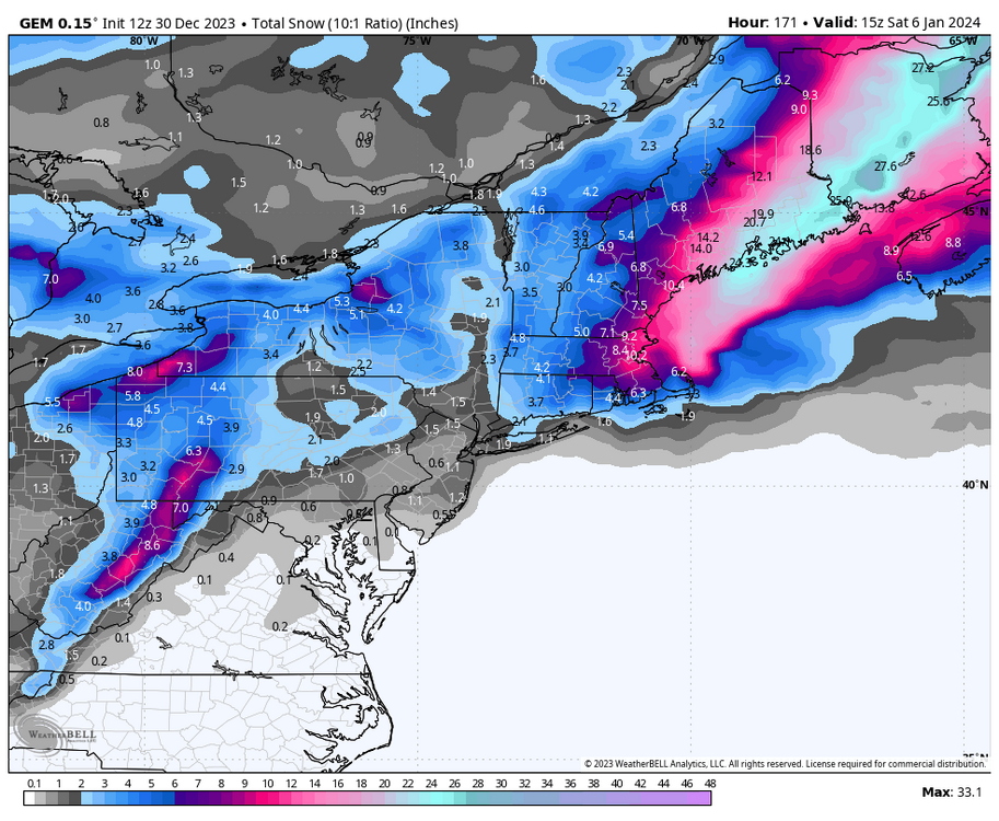
This isn’t a horrible look but it’s definitely not a slam dunk major snowstorm look either
-
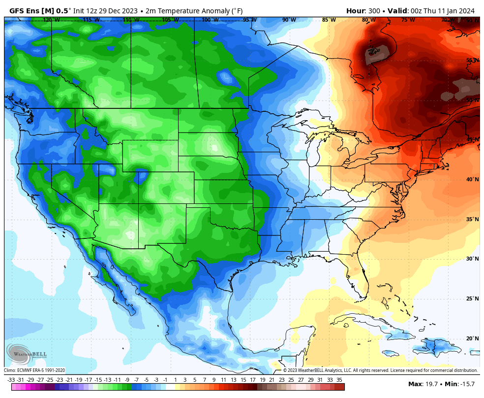
That’s some serious cold out west for the second week of January
-
This morning felt chilly at only 38 degrees
-

Jan Medium/Long Range Disco: Winter is coming
Allsnow replied to stormtracker's topic in Mid Atlantic
This would work
-
Haha. So true
-
-
E PA/NJ/DE Winter 2023-2024 OBS/Discussion
Allsnow replied to The Iceman's topic in Philadelphia Region
Boston? -
Crazy… we will never see that again in today’s climate
-
Yeah, tired of the 80 comparisons. We currently close to two years without a inch of snow
-
Bluewave handing out L’s to every forecaster on this forum
-
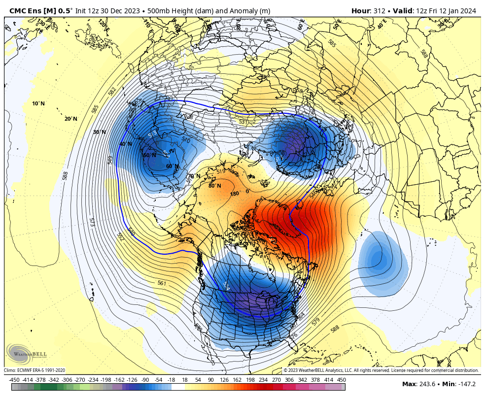
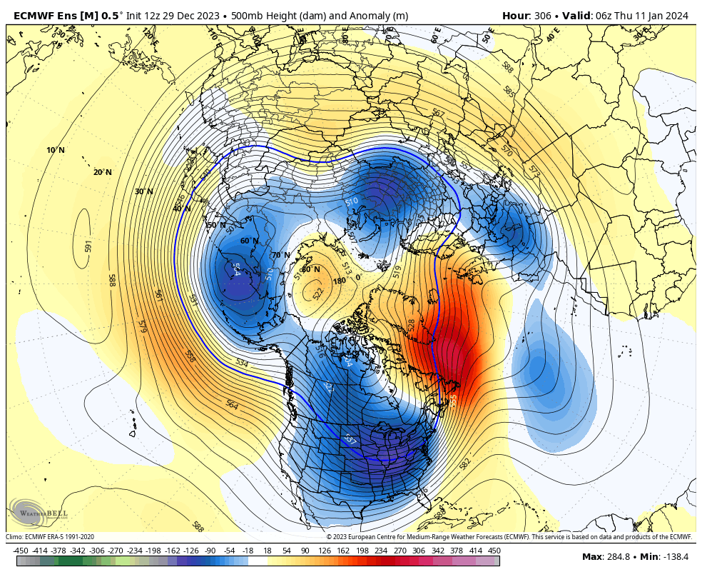
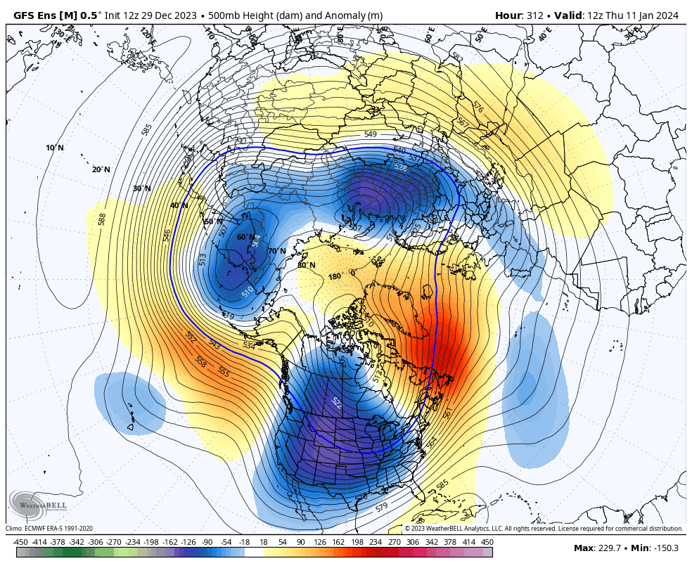
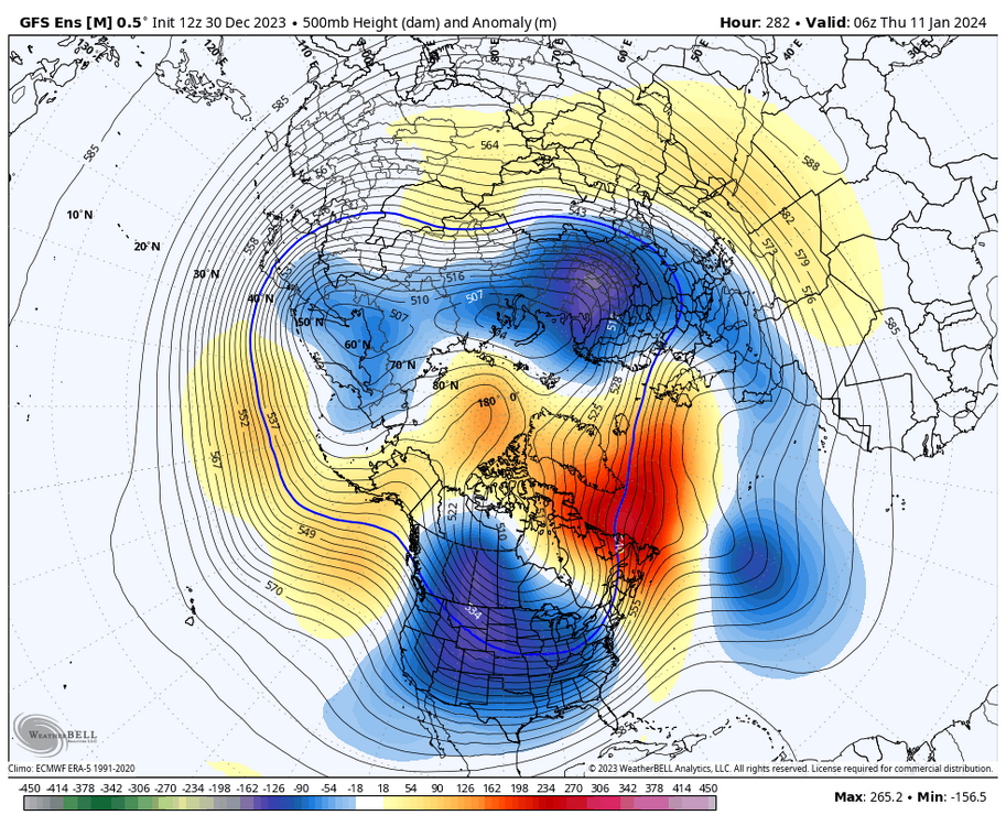
The wave was very weak in 8-1 passage plus the jet ext overpowered any type of response. Now the standing wave is gaining strength in p2 which isn’t good for the east. P3 is cold in Nino January but unfortunately latest olr maps have the p2 wave not moving
-
The mjo was very weak in 8/1 so we didn’t get a classic response. Now a standing wave is forming in p2 which is a Nina like response for January
-
Weeklies have punted that classic Nino look (Aleutian low/+pna) into February now. I think the typical Nino backloaded winter is in serious trouble. After p3 the phases are warm in the east for Nino January
-
Bluewave has been a step ahead every forecaster for years now
-
We cooked
-
Jan Medium/Long Range Disco: Winter is coming
Allsnow replied to stormtracker's topic in Mid Atlantic
@Heisy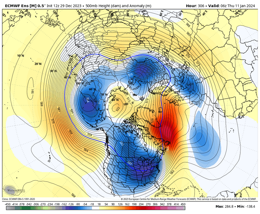
-
You said the same thing about this weeks torch
-
Gefs look ugly for the east as the southeast ridge links up with Nao domain.
-
Jan Medium/Long Range Disco: Winter is coming
Allsnow replied to stormtracker's topic in Mid Atlantic
Very Nina like which would keep the storm track over or west of us with cold/dry in between. I’m repeating myself but let’s up that ridge can slide east closer to mid month -
Perhaps something along the front as the cold comes east?
-
Jan Medium/Long Range Disco: Winter is coming
Allsnow replied to stormtracker's topic in Mid Atlantic
Gefs similar. Just happy not to see the trough further west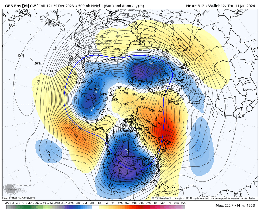
-
Gefs lock the cold in this run with -nao and -epo ridge. I’ll take that look and roll it forward in hopes p3 takes over