

donsutherland1
-
Posts
23,768 -
Joined
Content Type
Profiles
Blogs
Forums
American Weather
Media Demo
Store
Gallery
Everything posted by donsutherland1
-
I hope we can get some snow.
-
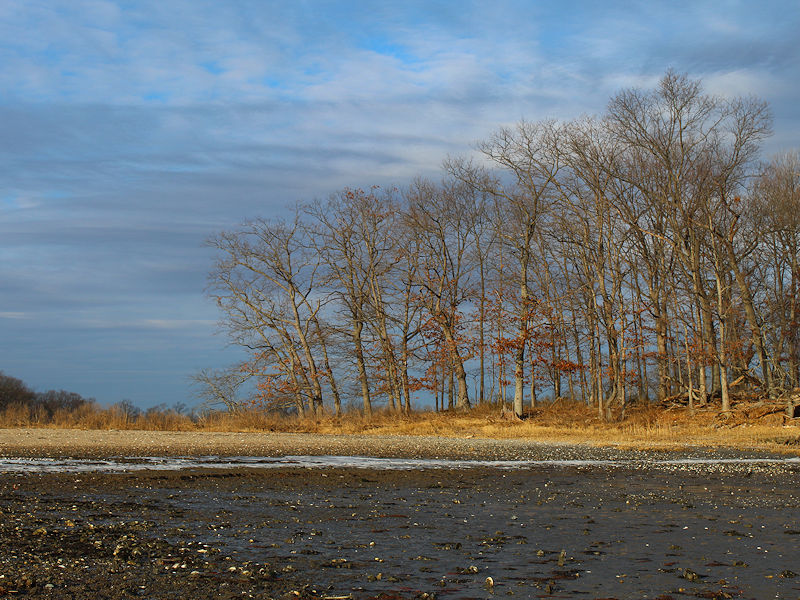
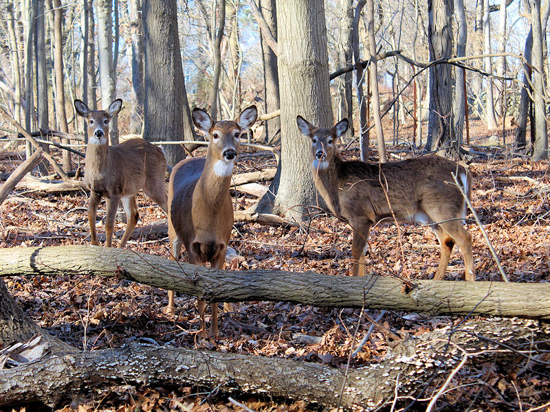
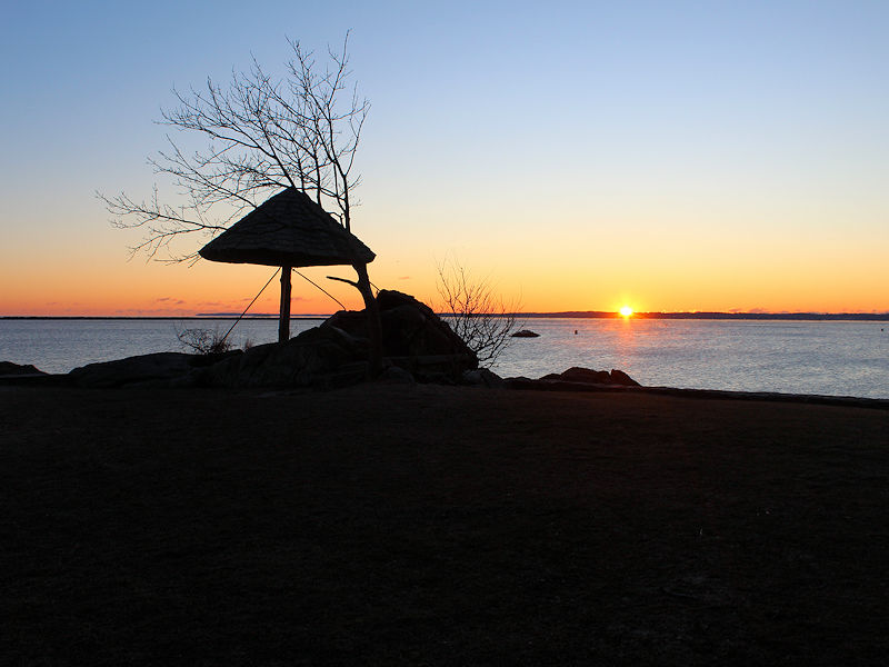
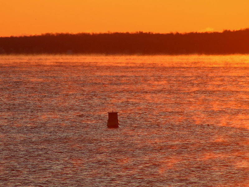
As milder air pressed northward into a rapidly retreating Arctic air mass, the sky was filled with high and mid-level clouds. The mercury slowly clawed its way back from the single digits, climbing through the teens, and into the 20s. Two photos.
-
I suspect that it will grow cooler for a time, but I doubt that there will be single digit cold again.
-
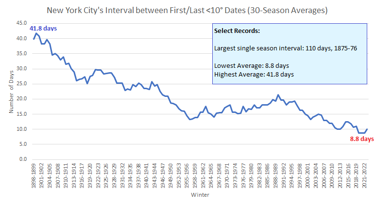
With single-digit days becoming increasingly uncommon in New York City, the average interval between the first and last such day during a season has declined. Winter 2022-23's interval of 43 days (assuming today will be the last such day this season) is the largest since Winter 2014-15 when the interval was 48 days.
-
The event of the season - 2 days of hell!
donsutherland1 replied to Go Kart Mozart's topic in New England
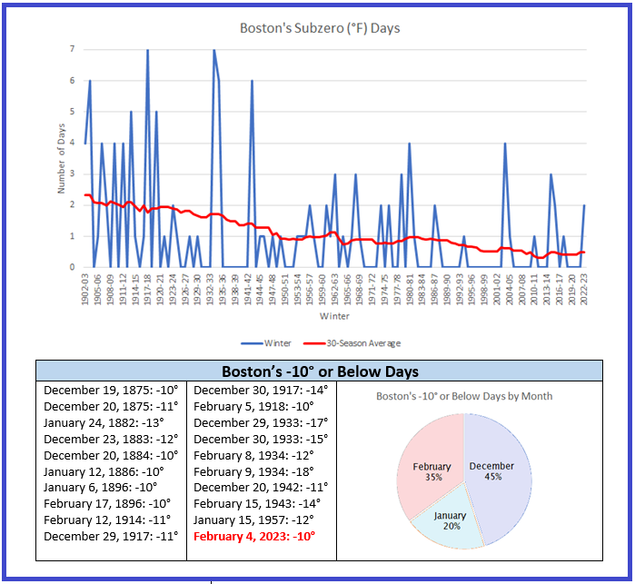
It was truly a once-in-a-generation or longer event in Boston. -
The event of the season - 2 days of hell!
donsutherland1 replied to Go Kart Mozart's topic in New England
Yes, that is true. Today was really impressive. -
The event of the season - 2 days of hell!
donsutherland1 replied to Go Kart Mozart's topic in New England
-
Yes. The full hourly data for the observed -28° wind chill: January 21, 1985 9 am: Temperature: -2° Winds: 29 mph Gusts: 37 mph
-
Morning thoughts… Near record and record cold readings will give way to a less harsh, but still cold afternoon. High temperatures will reach the middle and upper 20s in most of the region. Likely high temperatures around the region include: New York City (Central Park): 25° Newark: 26° Philadelphia: 30° It will turn much milder tomorrow. Normals: New York City: 30-Year: 40.3°; 15-Year: 40.5° Newark: 30-Year: 40.9°; 15-Year: 41.1° Philadelphia: 30-Year: 42.1°; 15-Year: 42.1°
-
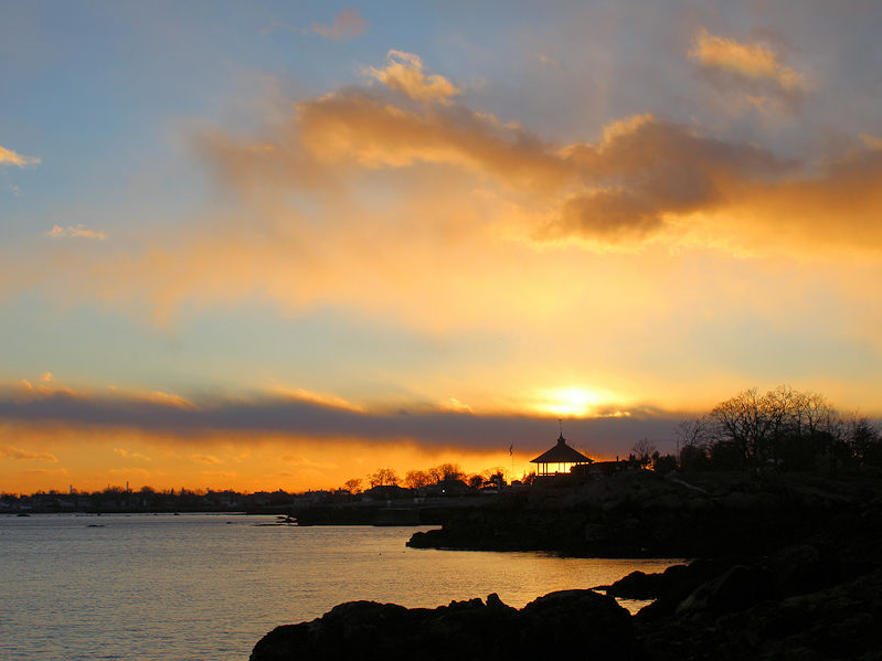
Sunrise:
-
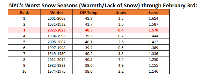
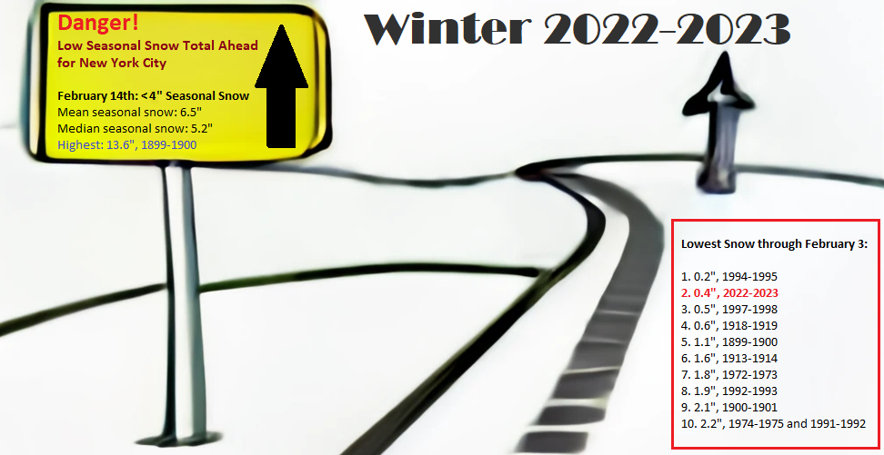
New York City's snow season futility rankings through February 3rd:
-
It’s probably the new calculation.
-
That’s probably based on the current wind chill chart.
-
The event of the season - 2 days of hell!
donsutherland1 replied to Go Kart Mozart's topic in New England
Worcester: -8° (old record: -7°, 1931, 1955, and 1971) -
The event of the season - 2 days of hell!
donsutherland1 replied to Go Kart Mozart's topic in New England
-
For JFK: -28, January 21, 1985
-
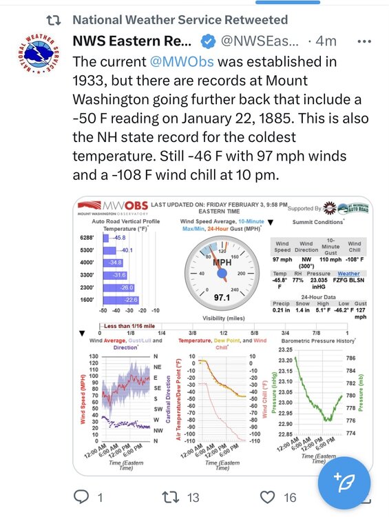
FYI, from the NWS:
-
Mount Washington’s low is now -46.
-
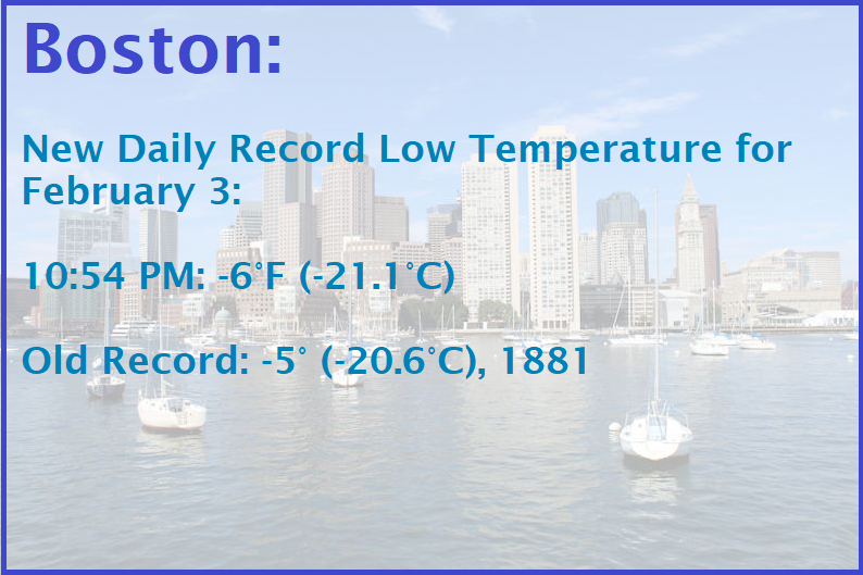
An Arctic air mass now covers the region. Blustery winds will continue to drill cold air into the region for much of the night. The weekend will start off on a bitterly cold note. Parts of the northern Mid-Atlantic and southern New England areas will see record cold readings. Despite ample sunshine, the mercury will rise only into the lower to middle 20s across much of the region. In southern New England, Boston will likely see its first subzero temperature since January 7, 2018 when the temperature reached -2°. The potential exists for Boston to see a -5° or below temperature. The last time that happened was February 14, 2016 when the thermometer fell to -9°. That would also be the coldest February temperature following a January with a mean temperature of 35° or above (January 2023 had a mean temperature of 37.8°). Select Record Lows for February 4th: Boston: -2°, 1886 Bridgeport: 5°, 1955 and 1996 Montreal: -20°, 1963 Mount Washington, NH: -35°, 1963 New Haven: 4°, 1963 and 2011 New York City-JFK: 9°, 1955 nd 1996 New York City-LGA: 10°, 1955, 1963, 1978 and 1996 Portland: -19°, 1971 Providence: -2°, 1918 White Plains: 4°, 1978 Through 6 pm, Mount Washington has had a low temperature of -45°. That crushes the daily record of -32°, which was set in 1963. As had been the case during the December Arctic shot in a winter of almost unbroken warmth, the current Arctic shot will be a fleeting one. Just a day after the height of the cold, the temperature will rocket toward normal levels and then above normal levels a day later. The potential exists for temperatures to run above to much above normal through mid-month. Both the CFSv2 and EPS weeklies show much above normal temperatures through the second week of February. The ENSO Region 1+2 anomaly was -0.2°C and the Region 3.4 anomaly was -0.6°C for the week centered around January 25. For the past six weeks, the ENSO Region 1+2 anomaly has averaged -0.32°C and the ENSO Region 3.4 anomaly has averaged -0.70°C. La Niña conditions are beginning to fade and they should evolve to neutral conditions during late winter or early spring. The SOI was +20.41 today. The preliminary Arctic Oscillation (AO) was -0.385 today. On February 1 the MJO was in Phase 3 at an amplitude of 1.663 (RMM). The January 31-adjusted amplitude was 1.829 (RMM).
-
Near sunset: 18°
-
If the warmer guidance showing little or no snowfall through mid-February verifies, that would put Winter 2022-2023 on a trajectory that has led to much below normal seasonal snowfall (less than 50% of the current seasonal normal figure) for New York City in the 8 prior cases that reached February 14th with less than 4" of snowfall.
-
We will go through a very warm period. Right now, it appears that the closing week to 10 days of the month could see a cooling trend. That's very far out in the future, so that outcome is far from assured. The current short but severe cold shot coupled with late month uncertainty suggests that a similar or even warmer outcome is far from assured. What could be reachable, but still not assured at this point in the month, is only the second January-February combination where both months had mean temperatures of 40° or above in NYC. 1998 is the only year when that happened. 1990 (39.7° in February), 2002 (39.9° in January), and 2020 (39.1° in January) came close.
-
I don't think there's a simple explanation. I suspect a combination of factors have contributed. Ongoing marine heatwaves distorted the pattern leading to, among other things, California's excessive precipitation during a La Niña, almost unrelenting push of Pacific air into North America, and tendency for expansive ridging in the western Atlantic to which the earlier blocking linked up. Long-term changes taking place in the Arctic have also led to an increased tendency for "stuck patterns." Stochastic factors at the synoptic level also contributed.
-
I agree with you. February should be cooler than January, perhaps by several degrees. There does seem to be some window of opportunity on the ensembles. Let’s hope it is realized.
-
Morning thoughts… Arctic air is surging into the region. Today will be windy and sharply colder. The temperature will fall through the 20s into the teens. Likely high temperatures around the region include: New York City (Central Park): 25° Newark: 26° Philadelphia: 30° After a very cold start to the weekend, temperatures will rebound strongly. Normals: New York City: 30-Year: 40.1°; 15-Year: 40.3° Newark: 30-Year: 40.7°; 15-Year: 41.0° Philadelphia: 30-Year: 42.0°; 15-Year: 42.0°


