

donsutherland1
-
Posts
24,194 -
Joined
Content Type
Profiles
Blogs
Forums
American Weather
Media Demo
Store
Gallery
Everything posted by donsutherland1
-
Some are now trying to recast Winter 2023-2024 as "one of the coldest on record" in the Northeastern U.S. In fact, Winter 2023-2024 edged out Winter 2001-2002 as the warmest on record in the Northeast. It was also among the least snowy ones on record. As a result, Boston reached 816 consecutive days without 4" daily snowfall today (old record: 711 days).
-
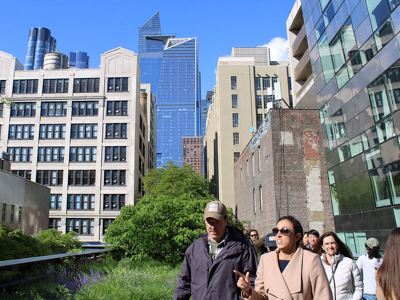
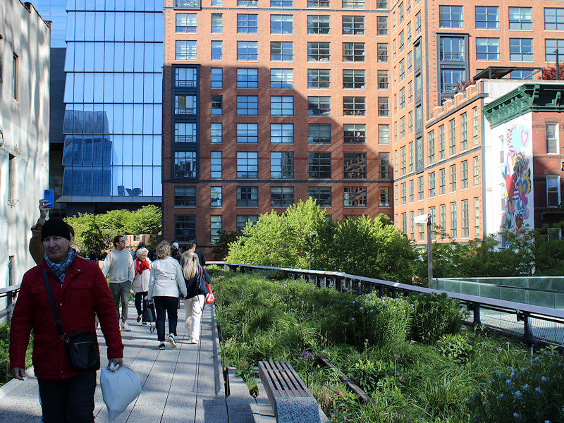
I will get more pictures in coming weeks.
-
A warming trend is underway. The warmth will crest with temperatures peaking in the lower and perhaps middle 80s during the middle of the week. Beyond that, temperatures will generally remain near or somewhat above normal through the remainder of May. The latest summer guidance continues to suggest a warmer to much warmer than normal summer lies ahead. The ENSO Region 1+2 anomaly was -1.1°C and the Region 3.4 anomaly was +0.2°C for the week centered around May 15. For the past six weeks, the ENSO Region 1+2 anomaly has averaged -0.25°C and the ENSO Region 3.4 anomaly has averaged +0.57°C. Neutral conditions are imminent. The SOI was +9.44 today. The preliminary Arctic Oscillation (AO) was -0.188 today. Based on sensitivity analysis applied to the latest guidance, there is an implied 78% probability that New York City will have a warmer than normal May (1991-2020 normal). May will likely finish with a mean temperature near 64.4° (1.2° above normal).
- 1,603 replies
-
- 2
-

-
- spring
- cool temps
- (and 3 more)
-
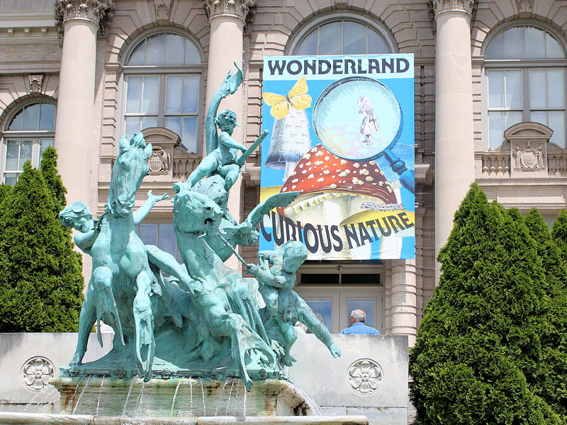
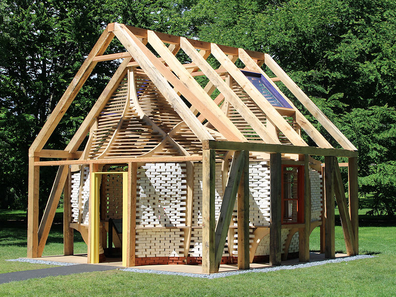
Some images related to the Alice in Wonderland theme: Note: The bricks are made from mushrooms


-
A warming trend is getting underway. The warmth will crest with temperatures peaking in the lower and perhaps middle 80s during the middle of the week. Beyond that, temperatures will generally remain near or somewhat above normal through the remainder of May. The latest summer guidance continues to suggest a warmer to much warmer than normal summer lies ahead. The ENSO Region 1+2 anomaly was -0.4°C and the Region 3.4 anomaly was +0.3°C for the week centered around May 8. For the past six weeks, the ENSO Region 1+2 anomaly has averaged -0.08°C and the ENSO Region 3.4 anomaly has averaged +0.73°C. Neutral conditions are developing. The SOI was +5.99 today. The preliminary Arctic Oscillation (AO) was -0.223 today. Based on sensitivity analysis applied to the latest guidance, there is an implied 76% probability that New York City will have a warmer than normal May (1991-2020 normal). May will likely finish with a mean temperature near 64.3° (1.1° above normal).
- 1,603 replies
-
- 1
-

-
- spring
- cool temps
- (and 3 more)
-
The Garden was established by the New York State Legislature in 1891. The best land available at the time was in the Bronx.
-
Tomorrow will be variably cloudy and pleasant. Temperatures will likely top out in the lower and perhaps middle 70s. Afterward, a warm week lies ahead. Although significant early-season heat is likely through at least the first three weeks of May, temperatures could reach the 80s on several days. Through May 18th, New York City has had a spring mean temperature of 53.9°. That makes Spring 2024 the 4th warmest spring on record through May 18th. Only 1945 (54.1°), 2010 (55.1°) and 2012 (54.8°) were warmer. The latest summer guidance continues to suggest a warmer to much warmer than normal summer lies ahead. The ENSO Region 1+2 anomaly was -0.4°C and the Region 3.4 anomaly was +0.3°C for the week centered around May 8. For the past six weeks, the ENSO Region 1+2 anomaly has averaged -0.08°C and the ENSO Region 3.4 anomaly has averaged +0.73°C. Neutral conditions are developing. The SOI was -1.67 today. The preliminary Arctic Oscillation (AO) was -0.223 today. Based on sensitivity analysis applied to the latest guidance, there is an implied 70% probability that New York City will have a warmer than normal May (1991-2020 normal). May will likely finish with a mean temperature near 64.0° (0.8° above normal).
-
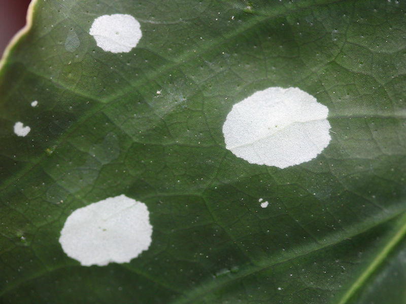
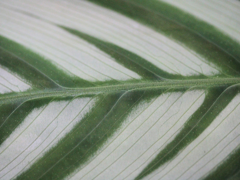
Leaf patterns at the New York Botanical Garden:

-
A partly to mostly cloudy weekend lies ahead. Sunshine will likely increase on Sunday. A few scattered showers are still possible during the weekend. Temperatures should reach the upper 60s to lower 70s tomorrow and lower to middle 70s across the region on Sunday. No significant early-season heat is likely through at least the first three weeks of May. However, it will likely turn warmer next week as sunshine returns. The ENSO Region 1+2 anomaly was -0.4°C and the Region 3.4 anomaly was +0.3°C for the week centered around May 8. For the past six weeks, the ENSO Region 1+2 anomaly has averaged -0.08°C and the ENSO Region 3.4 anomaly has averaged +0.73°C. Neutral conditions are now developing. The SOI was -1.67 today. The preliminary Arctic Oscillation (AO) was -0.023 today. Based on sensitivity analysis applied to the latest guidance, there is an implied 62% probability that New York City will have a warmer than normal May (1991-2020 normal). May will likely finish with a mean temperature near 63.7° (0.5° above normal).
- 1,603 replies
-
- 1
-
-
- spring
- cool temps
- (and 3 more)
-
I continue to suspect that we'll see a hot summer. More importantly, the guidance still suggests that a hot summer lies ahead. July through September could be the warmest relative to normal.
- 1,603 replies
-
- 1
-
-
- spring
- cool temps
- (and 3 more)
-
Partly to mostly cloudy conditions could persist through the weekend, although drier air could allow for an increase in sunshine during Sunday afternoon. A few showers are still possible during the weekend. Temperatures should reach the lower 70s across the region. No significant early-season heat is likely through at least the first three weeks of May. However, it will likely turn warmer next week as sunshine returns. The ENSO Region 1+2 anomaly was -0.4°C and the Region 3.4 anomaly was +0.3°C for the week centered around May 8. For the past six weeks, the ENSO Region 1+2 anomaly has averaged -0.08°C and the ENSO Region 3.4 anomaly has averaged +0.73°C. Neutral conditions are now developing. The SOI was -0.52 on May 13. The preliminary Arctic Oscillation (AO) was +0.507 today. Based on sensitivity analysis applied to the latest guidance, there is an implied 58% probability that New York City will have a warmer than normal May (1991-2020 normal). May will likely finish with a mean temperature near 63.5° (0.3° above normal).
-
The pattern following the breakdown of a strong El Niño can sometimes be quite active in the spring. 1983, 1998, and 2010 are some examples.
- 1,603 replies
-
- 1
-
-
- spring
- cool temps
- (and 3 more)
-
Showers will depart tomorrow and the clouds could begin to break during the afternoon. However, partly to mostly cloudy conditions could persist throught the weekend. Further, additional showers are possible during the weekend. In the wake of the system, readings will reach mainly the 60s through the weekend. No significant early-season heat is likely through at least the first three weeks of May. However, it could turn warmer next week. The ENSO Region 1+2 anomaly was -0.4°C and the Region 3.4 anomaly was +0.3°C for the week centered around May 8. For the past six weeks, the ENSO Region 1+2 anomaly has averaged -0.08°C and the ENSO Region 3.4 anomaly has averaged +0.73°C. Neutral conditions are now developing. The SOI was +14.42 on May 13. The preliminary Arctic Oscillation (AO) was +1.387 today. Based on sensitivity analysis applied to the latest guidance, there is an implied 52% probability that New York City will have a warmer than normal May (1991-2020 normal). May will likely finish with a mean temperature near 63.3° (0.1° above normal).
- 1,603 replies
-
- 1
-
-
- spring
- cool temps
- (and 3 more)
-
Occasional Thoughts on Climate Change
donsutherland1 replied to donsutherland1's topic in Climate Change
Yesterday, Fort Lauderdale had a minimum temperature of 85°. That set a new May record and tied the all-time mark. All three prior cases had occurred in August. The average minimum temperature in May has warmed dramatically from 70.1° during 1961-1990 to 73.2° during 1991-2020. Excessive ocean warmth has played an important role, with climate change having increased the frequency, magnitude, and duration of marine heatwaves.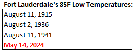
-
It is all but certain that map will fail spectacularly. Let’s see if JB embraces it, as he so often does with other maps showing cold extremes.
-
It is an interesting development. Unless we have a cool end to the month, I think things still favor a warmer than normal May. Maybe we’re getting to about as cool as the models will show.
-
A system will bring showers and periods of rain tomorrow into Thursday. A general 0.25"-0.75" rainfall appears likely. Additional showers are possible during the weekend. Afterward, much of the week will likely see temperatures in the upper 60s and lower 70s. No significant early-season heat is likely through at least the first three weeks of May. The ENSO Region 1+2 anomaly was -0.4°C and the Region 3.4 anomaly was +0.3°C for the week centered around May 8. For the past six weeks, the ENSO Region 1+2 anomaly has averaged -0.08°C and the ENSO Region 3.4 anomaly has averaged +0.73°C. Neutral conditions are now developing. The SOI was +6.30 on May 13. The preliminary Arctic Oscillation (AO) was +1.595 today. Based on sensitivity analysis applied to the latest guidance, there is an implied 53% probability that New York City will have a warmer than normal May (1991-2020 normal). May will likely finish with a mean temperature near 63.5° (0.3° above normal).
-
I don’t think so.
-
Tomorrow will be partly sunny and warm with widespread readings in the lower and middle 70s. Some showers are possible. A system will bring periods of rain on Wednesday into Thursday. A general 0.25"-0.75" rainfall appears likely. Afterward, much of the week will likely see temperatures in the 70s. No significant early-season heat is likely through at least the first three weeks of May. The ENSO Region 1+2 anomaly was -0.4°C and the Region 3.4 anomaly was +0.3°C for the week centered around May 8. For the past six weeks, the ENSO Region 1+2 anomaly has averaged -0.08°C and the ENSO Region 3.4 anomaly has averaged +0.73°C. Neutral conditions are now developing. The SOI was +6.30 today. The preliminary Arctic Oscillation (AO) was +1.268 today. Based on sensitivity analysis applied to the latest guidance, there is an implied 58% probability that New York City will have a warmer than normal May (1991-2020 normal). May will likely finish with a mean temperature near 63.8° (0.6° above normal).
- 1,603 replies
-
- 1
-
-
- spring
- cool temps
- (and 3 more)
-
It’s developing but I doubt that it has altered atmospheric patterns this early in its evolution.
-
It just turned positive in recent days. Wave lengths are also shorter.
- 1,603 replies
-
- 1
-
-
- spring
- cool temps
- (and 3 more)
-
Tomorrow will be partly to mostly sunny and milder with the temperature returning to the upper 60s across much of the area. Afterward, much of the week will likely see temperatures in the 70s. No significant early-season heat is likely through at least the first three weeks of May. The ENSO Region 1+2 anomaly was 0.8°C and the Region 3.4 anomaly was +0.5°C for the week centered around May 1. For the past six weeks, the ENSO Region 1+2 anomaly has averaged -0.08°C and the ENSO Region 3.4 anomaly has averaged +0.85°C. The ongoing basinwide El Niño event is fading. Neutral conditions could develop later in the spring. The SOI was -10.63 today. The preliminary Arctic Oscillation (AO) was +1.120 today. Based on sensitivity analysis applied to the latest guidance, there is an implied 56% probability that New York City will have a warmer than normal May (1991-2020 normal). May will likely finish with a mean temperature near 63.8° (0.6° above normal).
-
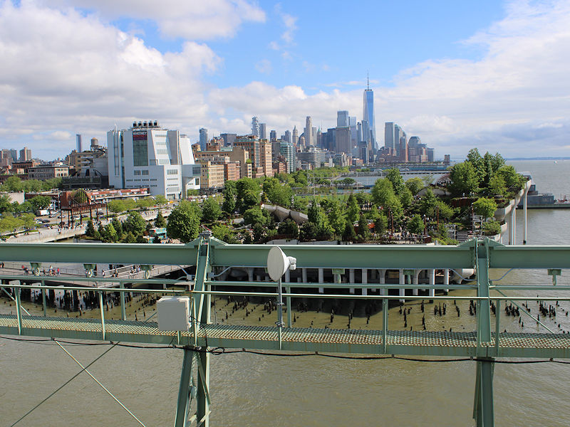
Clouds and rain finally gave way to sunshine in New York City making for a nice late afternoon and early evening.


- 1,603 replies
-
- 6
-
-
- spring
- cool temps
- (and 3 more)
-
Updated geomagnetic activity forecast: :Product: 3-Day Forecast :Issued: 2024 May 12 0030 UTC # Prepared by the U.S. Dept. of Commerce, NOAA, Space Weather Prediction Center # A. NOAA Geomagnetic Activity Observation and Forecast The greatest observed 3 hr Kp over the past 24 hours was 9 (NOAA Scale G5). The greatest expected 3 hr Kp for May 12-May 14 2024 is 9.00 (NOAA Scale G5). NOAA Kp index breakdown May 12-May 14 2024 May 12 May 13 May 14 00-03UT 7.67 (G4) 6.00 (G2) 4.67 (G1) 03-06UT 7.67 (G4) 6.67 (G3) 4.33 06-09UT 8.00 (G4) 6.67 (G3) 3.00 09-12UT 9.00 (G5) 5.67 (G2) 3.00 12-15UT 8.67 (G4) 4.67 (G1) 2.67 15-18UT 8.00 (G4) 3.67 2.67 18-21UT 7.00 (G3) 3.67 3.00 21-00UT 7.00 (G3) 4.00 3.33
- 1,603 replies
-
- 1
-
-
- spring
- cool temps
- (and 3 more)
-
Tomorrow will be mainly cloudy with some scattered showers and somewhat cooler readings. Highs should reach the upper 50s in the New York City area and upper 50s and lower 60s in the Philadelphia area. Much of next week will likely see temperatures in the 70s with no significant early-season heat likely. The ENSO Region 1+2 anomaly was 0.8°C and the Region 3.4 anomaly was +0.5°C for the week centered around May 1. For the past six weeks, the ENSO Region 1+2 anomaly has averaged -0.08°C and the ENSO Region 3.4 anomaly has averaged +0.85°C. The ongoing basinwide El Niño event is fading. Neutral conditions could develop later in the spring. The SOI was -10.25 today. The preliminary Arctic Oscillation (AO) was +0.545 today. Based on sensitivity analysis applied to the latest guidance, there is an implied 55% probability that New York City will have a warmer than normal May (1991-2020 normal). May will likely finish with a mean temperature near 63.8° (0.6° above normal).
- 1,603 replies
-
- 1
-
-
- spring
- cool temps
- (and 3 more)

