

frd
-
Posts
5,700 -
Joined
-
Last visited
Content Type
Profiles
Blogs
Forums
American Weather
Media Demo
Store
Gallery
Posts posted by frd
-
-
Just now, CAPE said:
Also from my post this morning- again at 12z there is an indication of a shortwave moving eastward in the southern stream under that Baffin block.. 'Big dog' potential for around the 18th maybe?? Possibly more than a squirrel anyway..


More than a squirrel sounds awesome in this new base state . Meanwhile Tip talking about 1977 in the NE forum
 . Bring it !
-
4 hours ago, CAPE said:
Pretty radical look at the end of the 6z GFS
Just checked out the latest AO forecast. Members going even more negative than yesterday. Consensus on - 4 SD AO. Some members take it to - 6 SD. Wow !!
-
 9
9
-
-
1 minute ago, CAPE said:
Pretty radical look at the end of the 6z GFS. TPV locked underneath the block and energy in the SW poised to come eastward. Anything from suppressed to a phase with NS wave(s) would be on the table. Well below avg temps for the central/eastern US as advertised.

A look where snow on snow could occur.
Ha, I can dream.
-
1
-
-
5 hours ago, brooklynwx99 said:
this wave breaking is a thing of beauty on the OP GFS
.thumb.gif.95f44b48fa9dd3850f67a9ac75e283fd.gif)
Pretty crazy look on long range guidance last night. GFS has big potential. Have not seen the GEFS but @CAPEposted the overnight Euro ensemble and it looks enticing. Nice wave breaking - wonder if we might get a clipper exploding on the VA capes near the 17 th to the 22 nd
-
 3
3
-
-
7 minutes ago, CAPE said:
Also phasing opportunities with a potential southern wave. Tracking waves and their timing and interactions, maybe more than usual.
Yep, I am excited for this time period.
-
1
-
-
23 minutes ago, CAPE said:
Looking ahead to mid month and beyond for storm opportunities, there is a strong signal for the 13-14th window, but as discussed the trough axis is still a bit too far west this period so the favored storm track is to our west. This is far enough out to keep an eye on though. As modeled the cold will be advancing eastward during/just beyond this period. Maybe a trailing wave scenario as the boundary moves eastward around MLK day.

Beyond that as modeled the h5 pattern progression should bring colder air to the east coast with an establishing NAO block and a TPV lobe located underneath. There is an indication of a southern stream shortwave moving eastward, in addition to NS vorticity associated with the southward displaced TPV. The NS probably wont be 'quiet' during this time with the TPV depicted to be that far south. There should finally be some cold though.

Looks like potential for a clipper. Been a long time. Also, a Manitoba Mauler would be acceptable as well. That vortex is almost South of Hudson Bay, interesting possibilities if this look comes true.
-
1
-
-
Increased likelihood of a deeper and longer duration - AO.
.thumb.png.777248539a565ac3affa9d5dc4aa4465.png)
-
11
-
 1
1
-
-
13 minutes ago, psuhoffman said:
The danger being if the system continues to weaken that will degrade from here.
good thread, and talking about the this very thing.
-
1
-
 2
2
-
-
14 minutes ago, Allsnow said:
eps couldn’t be any different then the gefs at day 10. Big battle out west going on for mid month
I thought last I read it was the EPS and GEPS versus the GEFS. Also, thought I read the GEFS was trending to the EPS in the long range.
Period of interest was near and after the 20th. I for one believe we must have the Pac on our side to get snow, versus anything else.
-
1
-
-
1 minute ago, CAPE said:
Good 'trends' on the 0z and now 6z guidance. Still a close call for I-95 and east, but now looking favorable for a mostly snow event just west of there. That surface HP is in a pretty good spot stays locked in.


Any thoughts on what happens after this event as we approach mid month ? Happy New Year too !
-
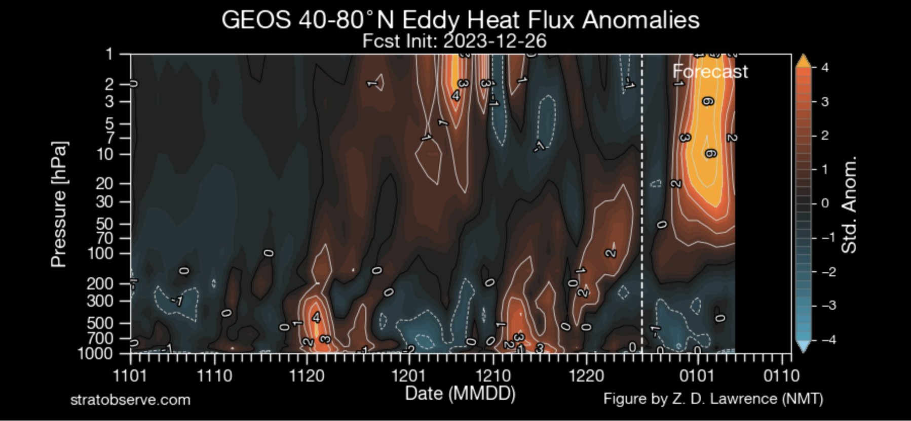
Rather impressive heat fluxes during the next 10 days.

-
4
-
-
Check this out
-NAO and then the SWWE
Long duration - AO and - NAO upcoming
.thumb.png.cdcc28a3152745b2a553b0f28d03adce.png)
-
4
-
-
I believe this raises the bar for cold and stormy weather here, while enhancing cold air intrusions after Jan 20 th.
Robust agreement here.
-
2
-
-
-
SSWE becoming more and more likely.
AO expected to dive soon, and then we await on the after effects of the warming. Too soon to know where the coldest anomalies are directed to.
.thumb.png.15ea27224d59bd017fb6514ee1aad07a.png)
-
4
-
-
21 minutes ago, CAPE said:
Much stronger signal for a gulf low tracking towards the east coast. Nice surface setup.


Your in top form @CAPE. Appreciate the updates. Not posting as much because I have suffered medical issues and surgery, but your posts cheer me up every morning.
I am really hopeful for snowfall in early Jan. Things looking better and better.
-
26
-
-
13 minutes ago, CAPE said:
The thing about a Nino is there is seemingly always another wave, and on an ensemble mean at range with disparity among the members, it is sometimes difficult to make a distinction between one wave and the next.
maybe this isnt the one-

and this one is. looks colder/snowier on the mean, with surface low placement further SE.

Might gamble and take a PTO day for Jan. 8th. The second disturbance sure looks promising at this range . Upstream looks better as well leading to the colder outcome.
-
10 hours ago, psuhoffman said:
When I think back on this hobby I don’t remember all the times looking at day 15 ensembles. I think about watching the snow creep north through VA thr afternoon before the blizzard of 96 started. I remember staying up all night in the weather station at PSU Hazleton the night of the January 2000 storm. Looking at WV the afternoon before and trying to harass any of the Mets who would listen that “something wasn’t right”. Realizing “it’s coming up”. Trust me I wish we got more of that and less of long range tea leaf reading.
That was a great memory. So much excitment. I remember Accu weather with a forecast of 6 to 8 inches for the beaches of southern NJ the day before. This might have been the storm the Canadian sniffed out that JB claimed his greatest victory to that point calling for a I 95 snowstorm when all others were a scrapper.
Watching that snow shield move North and forecasts changing was a big thrill. I also recall the winds after the storm blowing snow back into areas that were cleared. A great memory psu !
-
1
-
-
47 minutes ago, CAPE said:
Webb and the other east coast warminsta trolls will take their victory lap. Xmas torch!
Seems very typical in years past. I am sure he is celebrating. My Christmas day high temp has increased to 55 degrees, not too bad, however, still waiting on a white Christmas. By Friday we get back to normal temps.
-
1 minute ago, psuhoffman said:
If the nao tanks the first week of January all bets are off. I want to see another couple days of movement in this direction. I wasn’t expecting that until later. But if true the -pna wouldn’t matter.
-
1
-
-
Just now, psuhoffman said:
if you’re Webb
At least he is bullish on Feb, as you are, and believes we have very significant - NAO later in Jan and Feb.
-
1
-
-
22 minutes ago, CAPE said:
Looks toasty, quite perturbed and stretched. As advertised this configuration would seem to favor development of a more sustained -NAO mid month and beyond
-
16 minutes ago, CAPE said:
The advertised h5 pattern for around the 5th in particular looks quite favorable for a MA winter storm.
The weekend rule. Sure looks nice.
-
1
-
-
SSWE in Jan. has historical analogs as support.
.gif.28d1142f8fe060c6e1669b6e07a86917.gif)
.png.57e160cfa97d4f5e2aaa98b60e830c16.png)
.png.85255aacce9eb7b66914e34c396265d3.png)
.png.5e1d71a40808544989d212585b7db160.png)
Jan Medium/Long Range Disco: Winter is coming
in Mid Atlantic
Posted
I believe this happened several years back, what was a direct Arctic air mass modeled to drop SE from central Canada into the East ended up becoming a hybrid Blue Northern responsible for the devastating Texas power grid collapse. I hope your first potential scenario does not occur.