Rjay
-
Posts
28,400 -
Joined
-
Last visited
Content Type
Profiles
Blogs
Forums
American Weather
Media Demo
Store
Gallery
Everything posted by Rjay
-
I have so much to say but I'm just gonna zip it.
-
Hail in Hicksville according the the in-laws
-
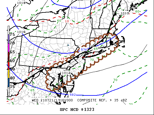
https://www.spc.noaa.gov/products/md/md1323.html
-
Sun July 11-Mon July 19 Pockets of FF/SVR and a modest heat wave
Rjay replied to wdrag's topic in New York City Metro
Great light show. Some heavy rain and many CGs.- 382 replies
-
- 3
-

-
- flash flooding
- severewx
- (and 1 more)
-
Sun July 11-Mon July 19 Pockets of FF/SVR and a modest heat wave
Rjay replied to wdrag's topic in New York City Metro
81/77 -
Sun July 11-Mon July 19 Pockets of FF/SVR and a modest heat wave
Rjay replied to wdrag's topic in New York City Metro
Wow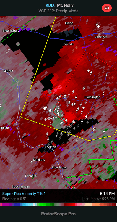
- 382 replies
-
- 4
-
-
- flash flooding
- severewx
- (and 1 more)
-
Sun July 11-Mon July 19 Pockets of FF/SVR and a modest heat wave
Rjay replied to wdrag's topic in New York City Metro
Legit hook- 382 replies
-
- 2
-
-
- flash flooding
- severewx
- (and 1 more)
-
Sun July 11-Mon July 19 Pockets of FF/SVR and a modest heat wave
Rjay replied to wdrag's topic in New York City Metro
- 382 replies
-
- 1
-
-
- flash flooding
- severewx
- (and 1 more)
-
Lol after all that has happened so far today, it's still somehow a bust.
-
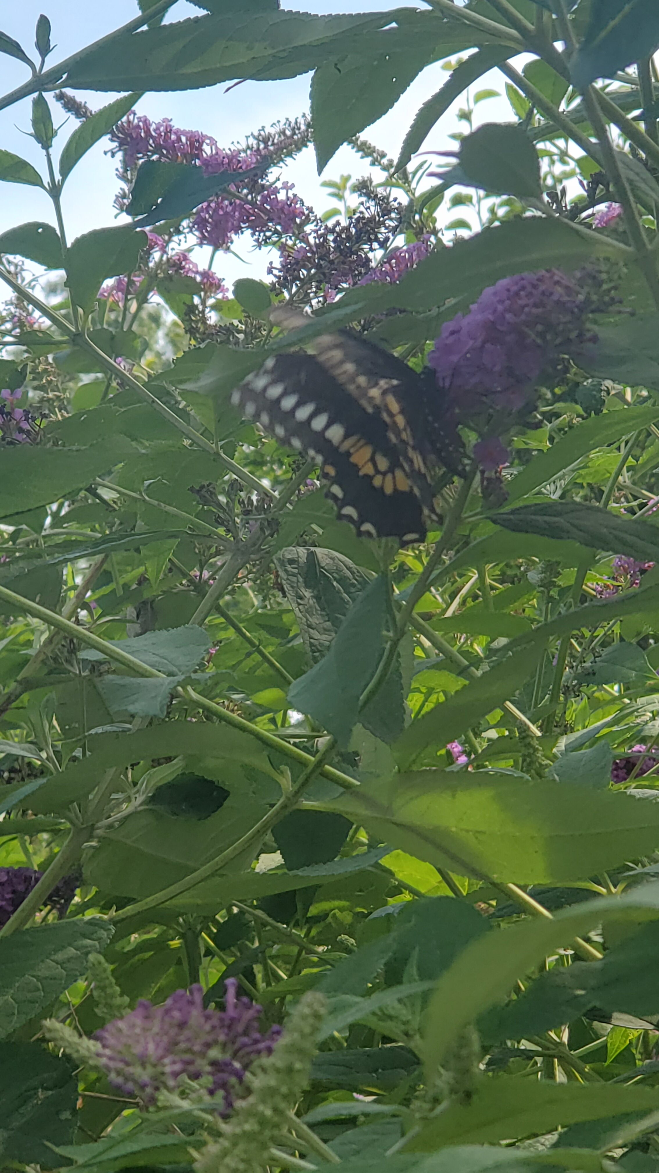
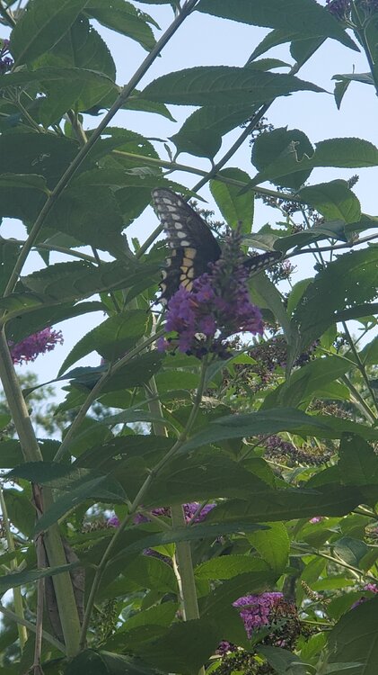
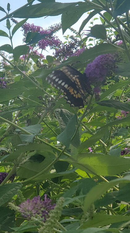
@donsutherland1 @forkyfork Black swallowtail? It was moving a lot so hard to get a good pic.


-
Sun July 11-Mon July 19 Pockets of FF/SVR and a modest heat wave
Rjay replied to wdrag's topic in New York City Metro
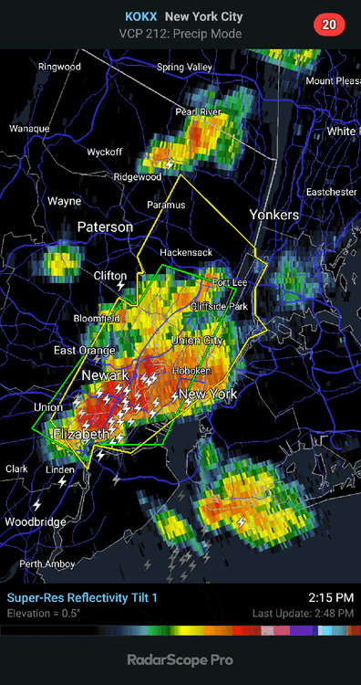
Storm looks legit. Expect at the very least some strong winds.- 382 replies
-
- 3
-
-
- flash flooding
- severewx
- (and 1 more)
-
Sun July 11-Mon July 19 Pockets of FF/SVR and a modest heat wave
Rjay replied to wdrag's topic in New York City Metro
Nothing interesting. -
Sun July 11-Mon July 19 Pockets of FF/SVR and a modest heat wave
Rjay replied to wdrag's topic in New York City Metro
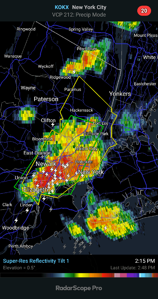
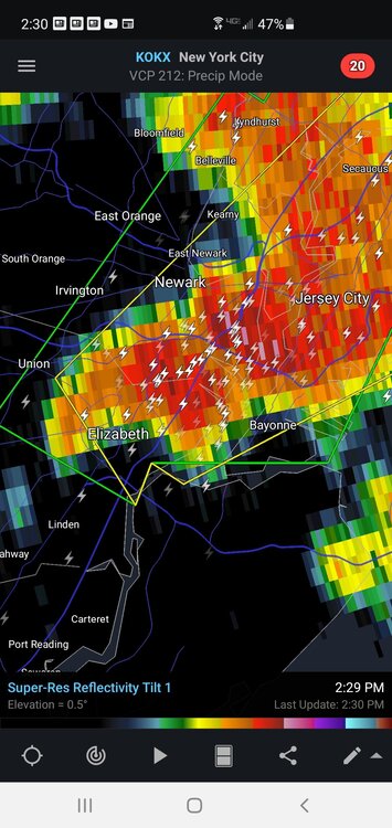
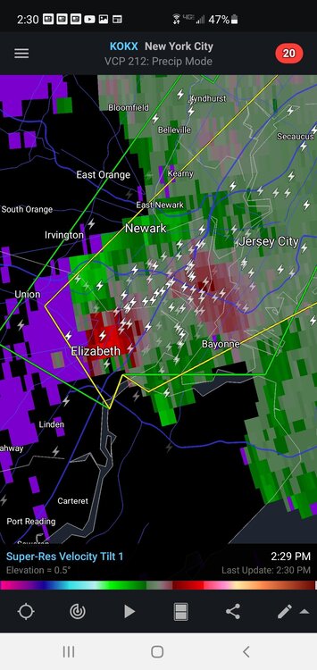
Tornado warning for SI now as well- 382 replies
-
- 2
-
-
- flash flooding
- severewx
- (and 1 more)
-
Sun July 11-Mon July 19 Pockets of FF/SVR and a modest heat wave
Rjay replied to wdrag's topic in New York City Metro
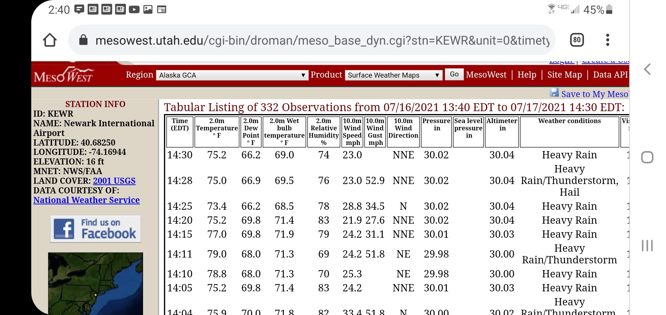
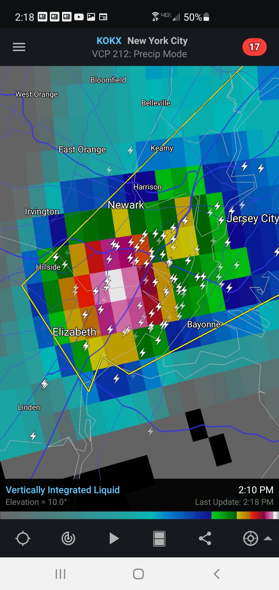
hail can throw this off a bit but there's definitely widespread flooding in the area.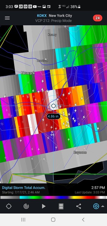
- 382 replies
-
- 1
-
-
- flash flooding
- severewx
- (and 1 more)
-
Sun July 11-Mon July 19 Pockets of FF/SVR and a modest heat wave
Rjay replied to wdrag's topic in New York City Metro
-
Sun July 11-Mon July 19 Pockets of FF/SVR and a modest heat wave
Rjay replied to wdrag's topic in New York City Metro
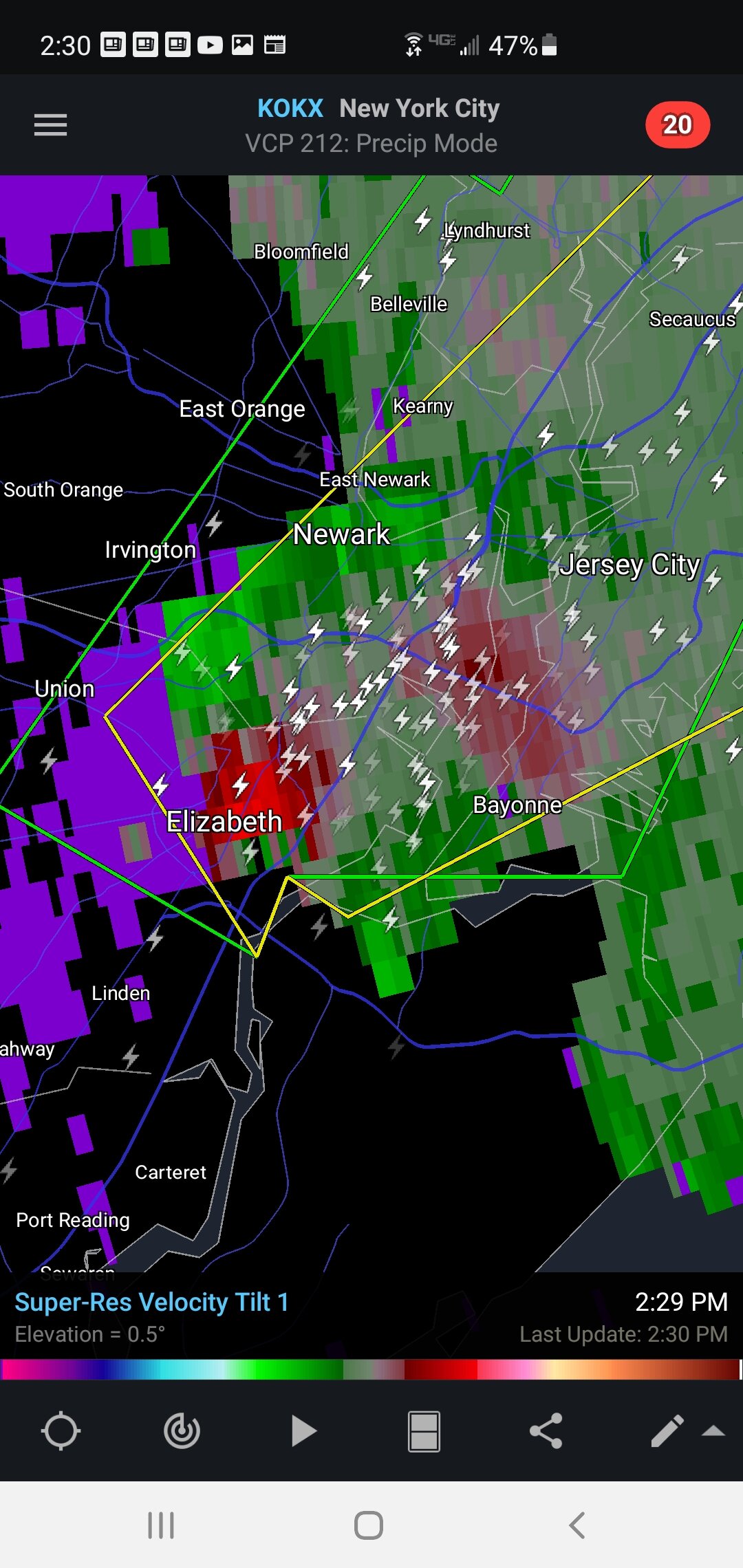
The main core is not in a big hurry to move. It's parked over the same areas.- 382 replies
-
- 1
-
-
- flash flooding
- severewx
- (and 1 more)
-
Sun July 11-Mon July 19 Pockets of FF/SVR and a modest heat wave
Rjay replied to wdrag's topic in New York City Metro
Get some video lol- 382 replies
-
- 1
-
-
- flash flooding
- severewx
- (and 1 more)
-
Sun July 11-Mon July 19 Pockets of FF/SVR and a modest heat wave
Rjay replied to wdrag's topic in New York City Metro
Yup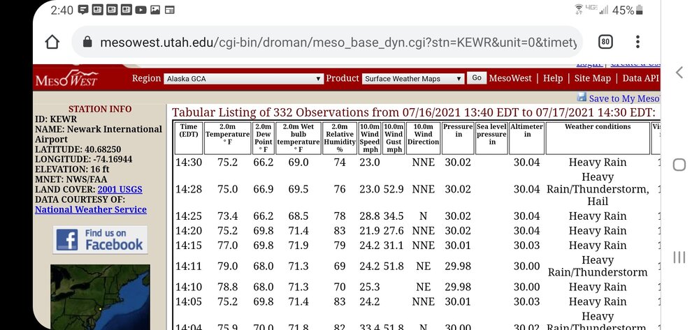
-
Sun July 11-Mon July 19 Pockets of FF/SVR and a modest heat wave
Rjay replied to wdrag's topic in New York City Metro
- 382 replies
-
- 1
-
-
- flash flooding
- severewx
- (and 1 more)
-
Sun July 11-Mon July 19 Pockets of FF/SVR and a modest heat wave
Rjay replied to wdrag's topic in New York City Metro
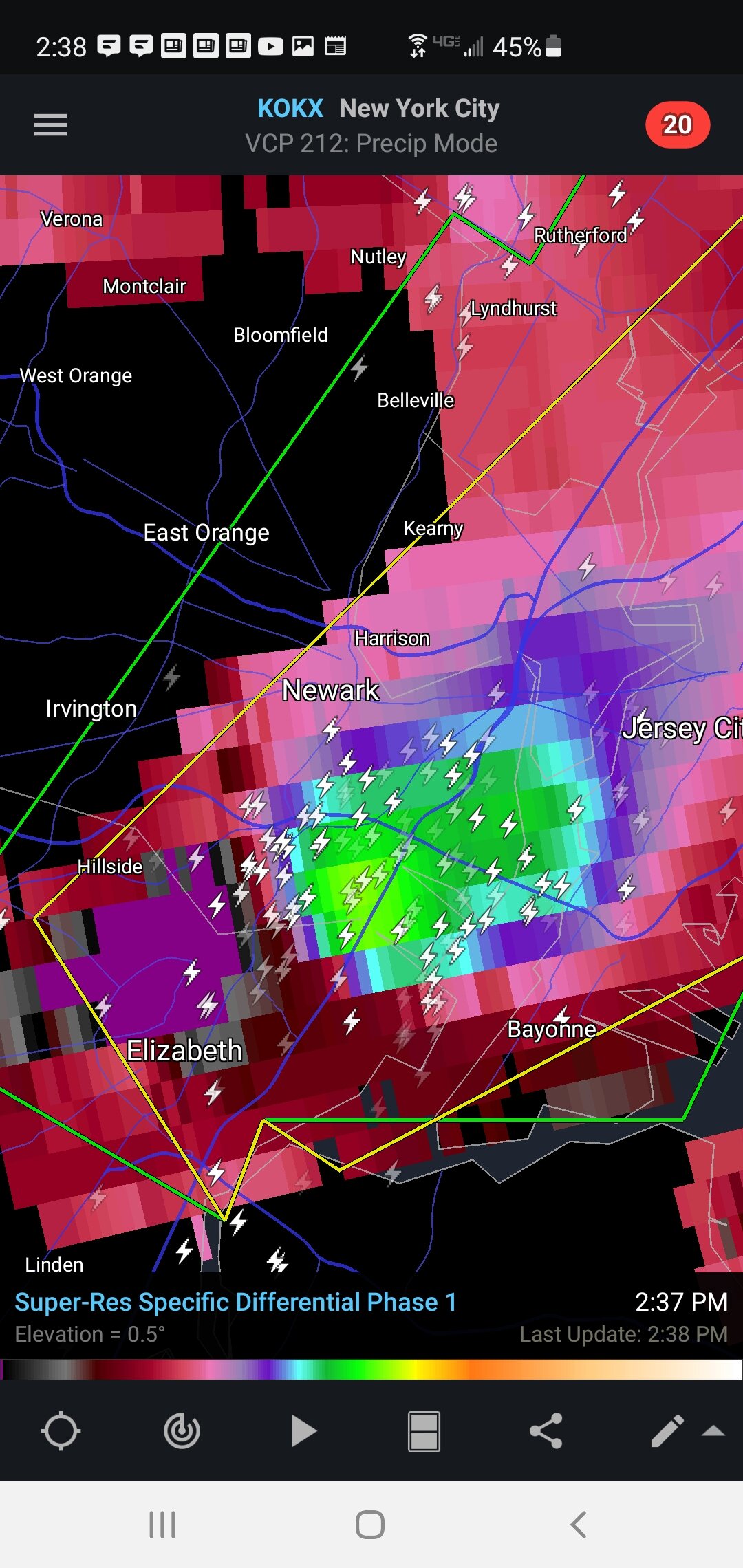
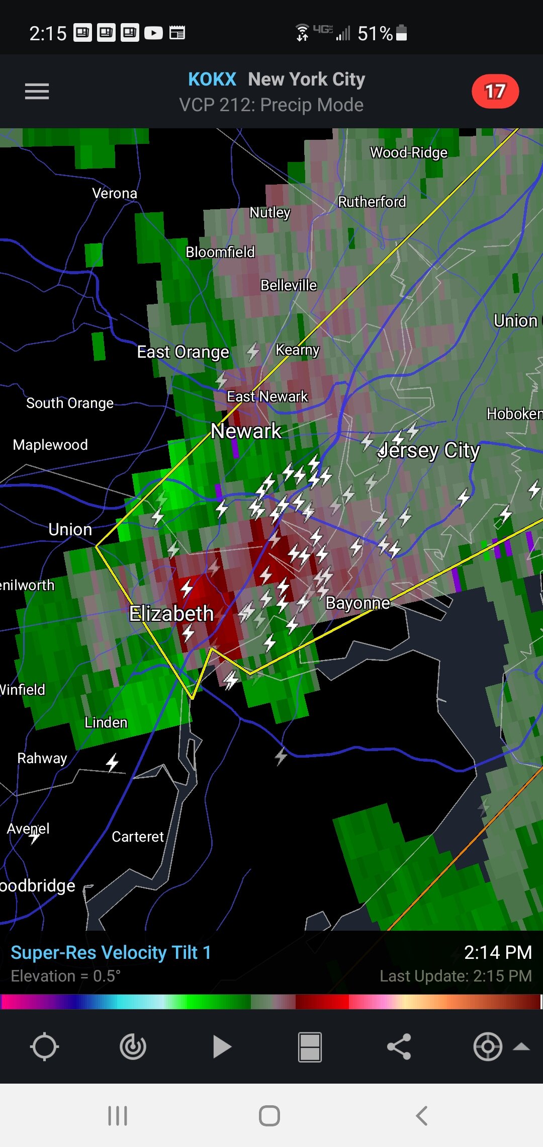
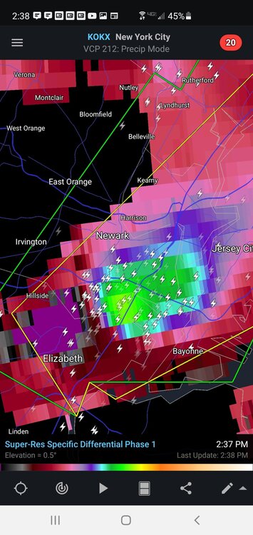
Wonder if the area between Elizabeth and Jersey City has hail covering the ground -
Sun July 11-Mon July 19 Pockets of FF/SVR and a modest heat wave
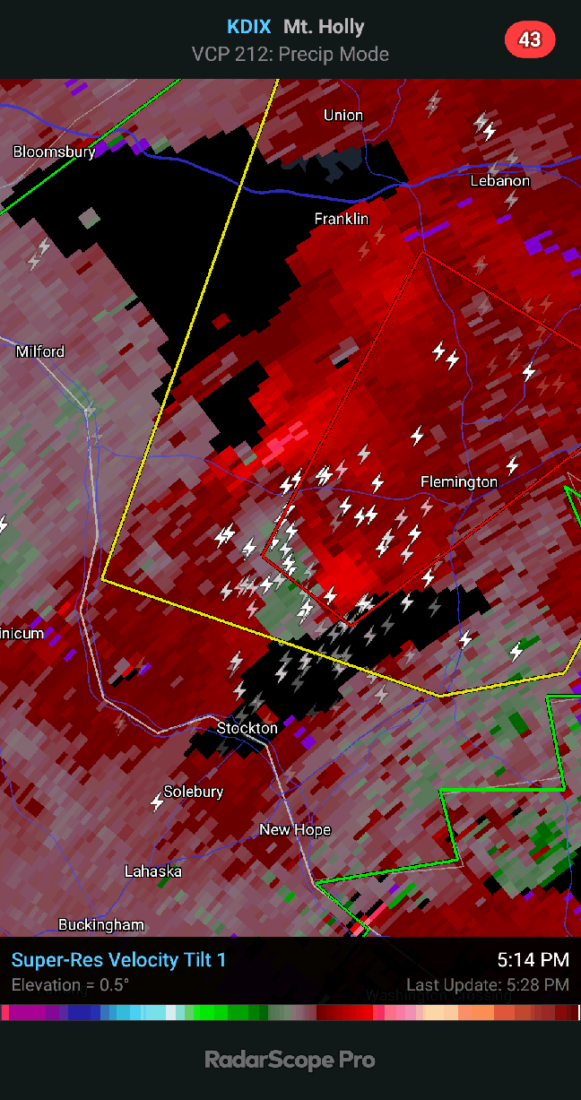
Rjay replied to wdrag's topic in New York City Metro
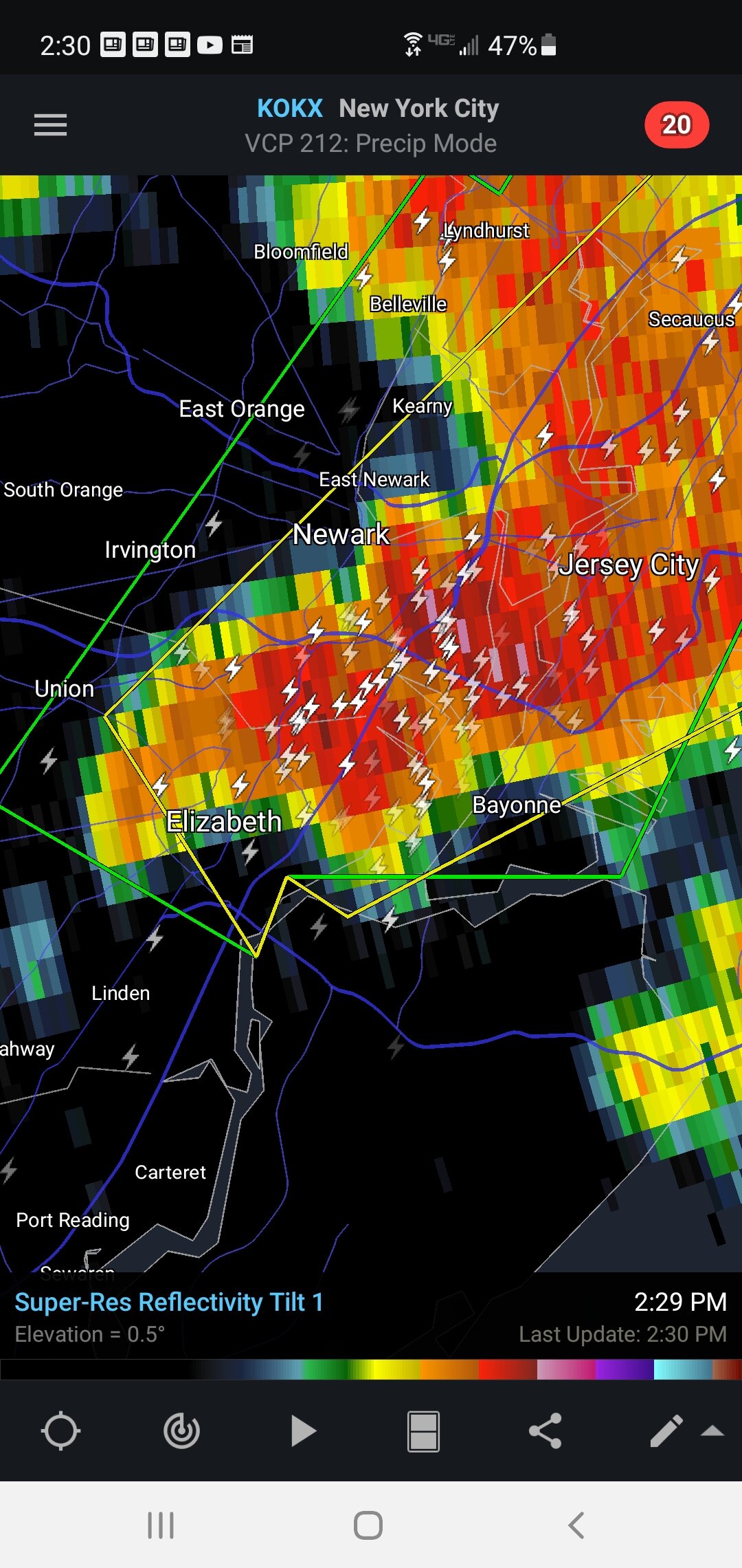
Wonder if that meso tightens up even more.- 382 replies
-
- 1
-
-
- flash flooding
- severewx
- (and 1 more)
-
Sun July 11-Mon July 19 Pockets of FF/SVR and a modest heat wave
Rjay replied to wdrag's topic in New York City Metro
-
Sun July 11-Mon July 19 Pockets of FF/SVR and a modest heat wave
Rjay replied to wdrag's topic in New York City Metro

- 382 replies
-
- 1
-
-
- flash flooding
- severewx
- (and 1 more)
-
Sun July 11-Mon July 19 Pockets of FF/SVR and a modest heat wave
Rjay replied to wdrag's topic in New York City Metro

-
Tracking The 3”+ Heavy Rainfall Events Since 2010
Rjay replied to bluewave's topic in New York City Metro
Def