Rjay
-
Posts
28,400 -
Joined
-
Last visited
Content Type
Profiles
Blogs
Forums
American Weather
Media Demo
Store
Gallery
Everything posted by Rjay
-
Just east of there but still lolz
-
22 minutes. French site has it but I hate that site lol.
- 1,603 replies
-
- 1
-

-
- hurricane gusts
- flooding rains
- (and 2 more)
-
Depends where it makes landfall.
-
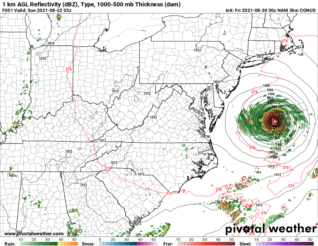
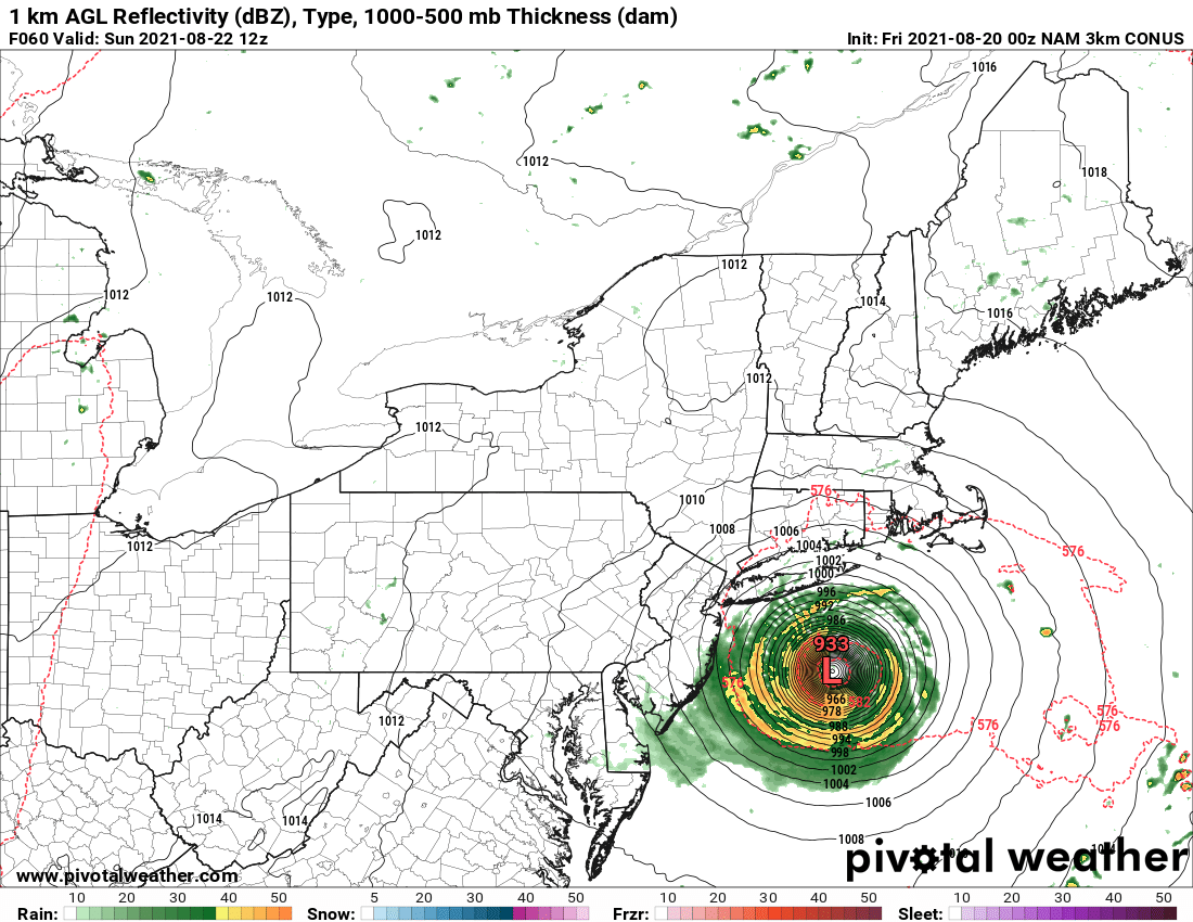
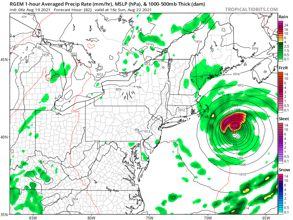
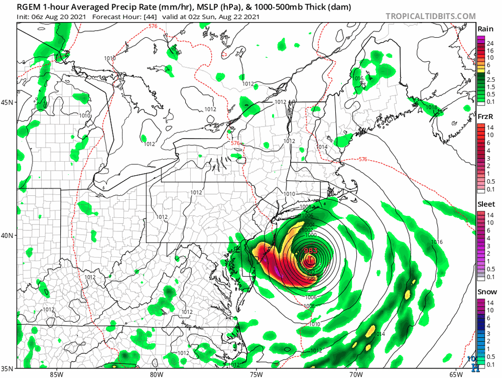
This was the rgem 24 hours ago and headed to the NE
-
The rgem has trended hundreds of miles west of the last few runs
- 1,603 replies
-
- 3
-

-
- hurricane gusts
- flooding rains
- (and 2 more)
-
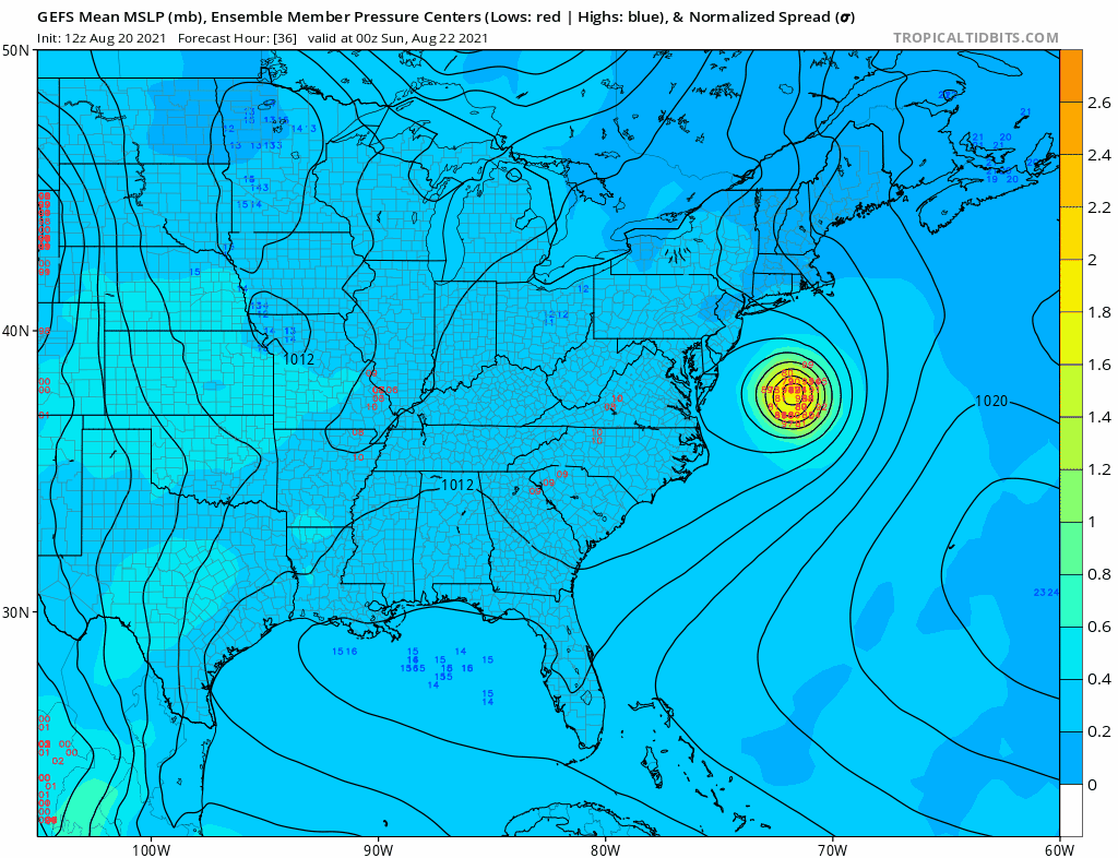
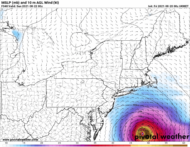
Ukie looks a bit east. Better maps in a minute.
.gif.3fdc7e8f41a4041a8a2e166c889f283d.gif)
-
"Hey, you never know"
-
At least it's weakening on approach to LI

-
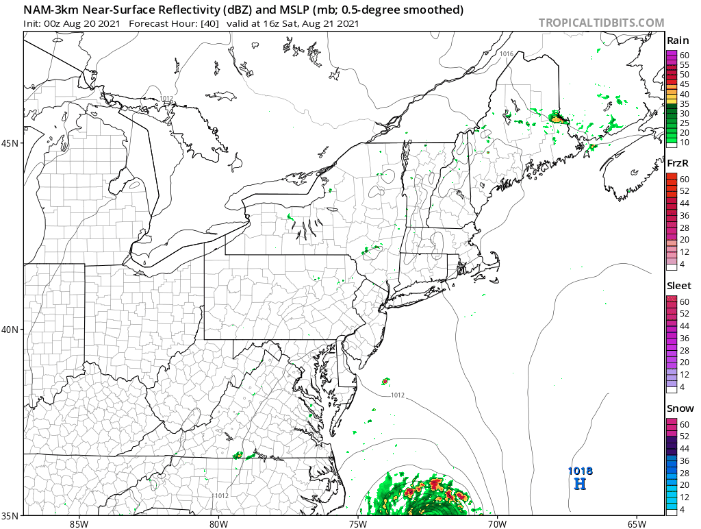
Noo. The 3k is too much fun.
.gif.9c90aa0f22b1eb15c59d459a64ecd83d.gif)
.gif.c5d6de549ff50ba93c415bbd77f4108c.gif)
.gif.68fe8e513fb05ae2c64b6f1ba3c8ce76.gif)
.gif.02442794bcc0de8cdb4a5a2e2338906f.gif)

.gif.8e81ec11d4276852018fcec3acd52151.gif)
.gif.cc1d5aeefca6506218ba66f818564cf4.gif)


.gif.44e4ce21139d4686152a0a6f03c98185.gif)