WxUSAF
-
Posts
29,086 -
Joined
-
Last visited
Content Type
Profiles
Blogs
Forums
American Weather
Media Demo
Store
Gallery
Everything posted by WxUSAF
-
Over 1”
-
We better get used to far NW getting crushed while we get scraps for this winter
-
Yeah rain shield seems much raggedier on the SE side than forecast. 0.35” here so far
-
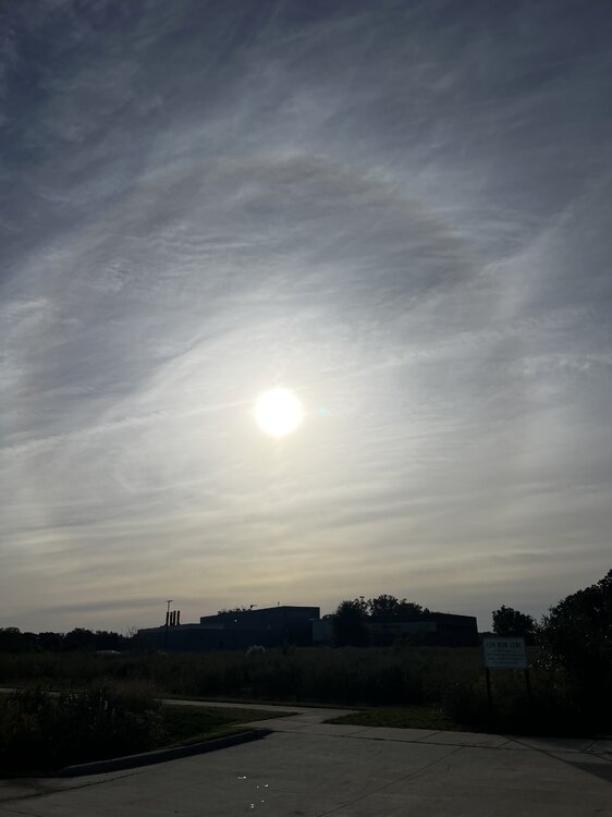
Got a nice 22 degree halo right now
- 264 replies
-
- 15
-

-
And it’s officially a Cat 3
-
I drafted Jayden Daniels as my fantasy QB, and I just grabbed Michael Penix on the waiver wire. So do I start the guy who has consistently disappointed in fantasy when he hasn’t been hurt or the guy playing against my favorite team?
-
110mph Cat 2 as of 5am. Close to a major
-
Definite first freeze potential D10-11 on several runs today for NW burbs and IAD
-
Yyyyyeeeeeeesssssssssss
-
Clean up in the winter merchandise aisle
-
DOGE-level inanity
-
Seems he already knows where the next 25 days are headed so hang it up folks. Winter 26-27 time of death: 10/7/2026
-
Bad news. Judah Cohen says that the slow rate of Siberian snowcover advance in the (*checks notes*) FIRST SIX DAYS OF OCTOBER implies a mild winter.
-
My sketchy PWS says 38. Most around the neighborhood are 41.
-
We need to switch the pattern to have rain on weekdays and gorgeous fall weather on weekends
-
Today is why October is the best (non-snow category)
-
Not surprising at this range, but the ensembles are much less enthusiastic with the depth of that trough.
-
Not sure they can win without him given how the defense looks so far.
-
Way out there but euro ai has had a number of runs recently that spin up a big storm in the D11-13 range and brings in cold air behind it. Probably would be first freeze chance for IAD and NW burbs if something like that happens.
-
Three neighborhood PWSs hit 41
-
Future Isaias could be a ‘cane in the Gulf of Idiotic Arrogance before giving us some remnant rain in about a week? @WxWatcher007
-
Yeah feels like Lamar, Henry, Zay, and 49 other guys. These next 2 games *should* be fairly easy but I’m skeptical they can win both. Or maybe either…
-
Ravens have about as many penalty yards as offensive yards
-
0.6” or so to start the month
-
So sorry to hear that @RickinBaltimore. My condolences to you and your family