
Cfa
-
Posts
4,693 -
Joined
-
Last visited
Content Type
Profiles
Blogs
Forums
American Weather
Media Demo
Store
Gallery
Everything posted by Cfa
-
Stayed in the 60’s all night. High of 84 yesterday.
-
Topped out at 71 at home. Low 70’s here in Cleveland as well.
-
42 and gross outside. Snowing in Massachusetts. Every time I think our climate sucks I look at New England and feel slightly better.
-
Getting smoked here near ISP. My PWS getting missed though.
-
Only made it to 60 here.
-
I was expecting a more dramatic drop, it still feels kind of warm in Port Jefferson Station at 65.
-
Winds out of the east, down to 75 now. So many people are dressed for June and have no idea what’s coming. Myself included.
-
Savoring this 84, hopefully it’s not a long wait to have this again.
-
80 in Riverhead and 60 in Flanders is a crazy gradient, that’s basically walking distance. 83 here.
-
80, with a heat index of 81. First 80 and first heat index of the year.
-
Fun for who? A BDCF tainting the first 80 kind of sucks.
-
Already at 76 here.
-
33.3 for a low here.
-
And if it were a day exported from mid-January it’d somehow manage to be “normal” or “expected” for late March by someone on here.
-
I couldn’t verify any frozen precip, but some of those drops hitting the windshield looked abnormally large.
-
That was wild. Heard the roar and then the floor started vibrating.
-
Temps were in the upper 40’s in the Hamptons this afternoon, went to Riverhead from there and the temp jumped about 10 degrees. 64/33 today. 60’s were very fleeting, however.
-
70/29 today. Wasn’t expecting either one.
-
Surprised there isn’t a wind advisory, some of these gusts are rather potent.
-
Canceled my RadarScope subscription until we get weather, and with Long Island being the most boring part of the region outside of tropical events, it’ll be quite awhile. 2012 was the best spring+summer combination that I can recall, but this is the first March in a while that hasn’t sucked.
-
Looks like the area Gabreski Airport area, which was the sight of a wildfire decades ago, the pines there are all miniature. Sunrise Highway looks closed according to Apple Maps.
-
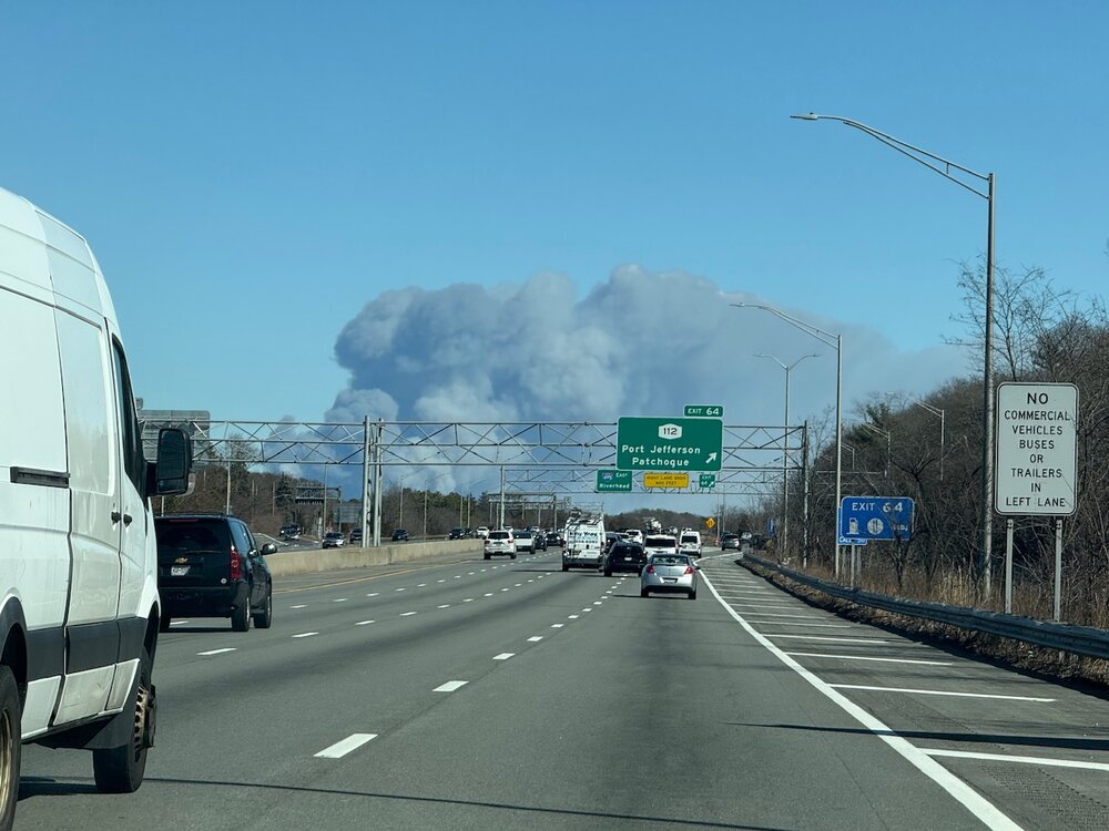
From Medford heading east. I saw it all the way from ISP, over 20 miles away.
-
Massive smoke plume near the LIE (mid 60’s), forest fire?
-
Made it to 63, now down to 52.


