

Lady Di
-
Posts
748 -
Joined
-
Last visited
Content Type
Profiles
Blogs
Forums
American Weather
Media Demo
Store
Gallery
Everything posted by Lady Di
-
44F here. Has been raining since late morning. Getting a little breezy too. PECO sent an email out today regarding preparedness. So, I charged the phone, and I hope I can get home in time to crank up the furnace to get the place warmed up in case a cow hits the transformer. Low says 26 tonight? Is that right? I also have some propane on hand that I can hook up my little buddy heater in the basement. My candle inventory is depleted from the holidays, I should order some more. Generator is down in the shed. Better not need that as I can't handle it and I have zero gas.
-
E PA/NJ/DE Winter 2023-2024 OBS/Discussion
Lady Di replied to The Iceman's topic in Philadelphia Region
Lots of storms every few days. Surely I'll cash in on 1. -
Even if we were to win, we're still sunk having to play again on a short week. Just get it over with! Too late to right the ship. I'm a little pissed.
-
Flurries now and 33. Barley a covering from earlier. I’ll take whatever flakes I can get.
-
Graupel down here @ 9:45. 29 degrees.
-
E PA/NJ/DE Winter 2023-2024 OBS/Discussion
Lady Di replied to The Iceman's topic in Philadelphia Region
Thought there was something that hit my head while out walking a minute ago. I'm at 40F. -
At my location and elevation going with rain and grupel. I’ll take whatever flakes I can get. Lol.
-
E PA/NJ/DE Winter 2023-2024 OBS/Discussion
Lady Di replied to The Iceman's topic in Philadelphia Region
Who is starting the storm thread? Nice to wake up to this threat. Happy tracking! -
E PA/NJ/DE Winter 2023-2024 OBS/Discussion
Lady Di replied to The Iceman's topic in Philadelphia Region
This is ridiculous! Have the humidifier turned off, the house is damp and drafty so still need to run the furnace once or twice a day to dry it out. Have the Christmas lights on 24/7 outside, and yes, I killed a couple flies! They were mostly dead anyway. Wishing you all Happy Holidays! Go Birds! -
Nada down here, but thanks for the pics.
-
Front door to river.
-
Not used to seeing this path right up the Delmarva instead of just off shore. My beach cottage is in the Upper Chesapeake area. I think it will be OK with 1-3 ft. Keep an eye on the Elk River for me. It's a pretty wide beach, I've seen water come up on it, but not a lot. The cottage is built up on concrete footers so should the water make it up to the 1st row of places, it will go under and not in.
-
Had a TOR warning about 6:10pm about the same time the power stayed out. I did go to the basement, and grateful it flew by pretty quickly. Driving rain and wind, then it calmed down to your normal thunderstorm. A good 45 minutes of thunder. No damage thankfully. Power was restored sometime during the night 2-3am I think. Windows are open waiting on the cold front.
-
Was just out for a walk, feeling that warm breeze. Something coming, hope it fizzles before it arrives at my location. Right next door, Lancaster Co, and south, Cecil have TOR watches up. I forgot to put my umbrella down at the river cottage (Elk-Cecil Co) uh oh. 80D-76DP-87%RH Gross.
-
Going to the ball park later. Odds of getting wet are about 99.9%
-
Congratulations on your red tag, and best wishes to you on obtaining a PhD. Never been to Laramie, but was in Casper WY way back in '83. Split levels are the worst in regard to ductwork layout to get the proper cfm for heating and cooling. On long hot stretch of days like this I've seen people use booster fans or shutting off some feed ducts to push the air where you need it. Or, yeah, give the thermocouples a try 86 Degrees with 70 dew point-just saw a little tiny blip of lighting around the Mason Dison line.
-
Incoming. It's here
-
My timing is impeccable having plans to go to NYC tomorrow, thru the weekend. Someone get that retrograding low pressure to get out to sea and send me from winds from the south! Seeing the worst of this was yesterday/today? Just asking since our activities do not include being inside. An outdoor concert tomorrow night and touring lower Manhattan on Saturday. Clock ticking on cancellation time(s) to get full refund. I think we aren't cancelling though. Thanks in advance for any advice.
-
Oh Newman! Seems things are about to get real. My front lawn has lots of brown spots too. The dust from the driveway is awful and I refuse to close my windows! I just throw a towel over the clean dishes until I put them away. I'm old and never remember a May where it didn't rain and be cold. 2023 new record. First time in recorded history.
-
53 w/rain. Had to turn the heat on!
-
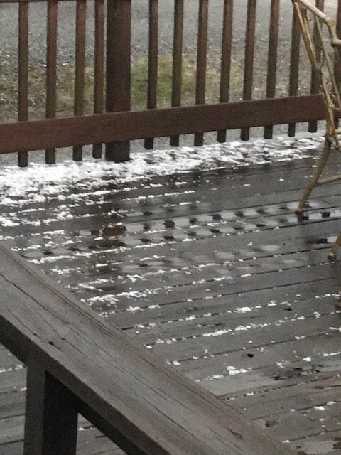
Crazy evening on Saturday. No tornado for me, thankfully. Just some hail
-
At least I was able to entertain myself by scrolling through the NE forum.
-
Congrats guys. I got nothing. Saw some pixie dust on the way in this morning. Pretty windy though. Currently at 25mph. Temp 36F. Gives a wind chill of 24F. Hope the power stays on.
-
-
E PA/NJ/DE Winter 2022-2023 OBS Thread
Lady Di replied to Ralph Wiggum's topic in Philadelphia Region
Y'all have been a barrel of fun this winter. Maybe next year. Can't say I miss shoveling.


