EasternLI
-
Posts
3,745 -
Joined
-
Last visited
Content Type
Profiles
Blogs
Forums
American Weather
Media Demo
Store
Gallery
Everything posted by EasternLI
-
Zero complaints on the 6z GEFS. Inching closer.
-
-
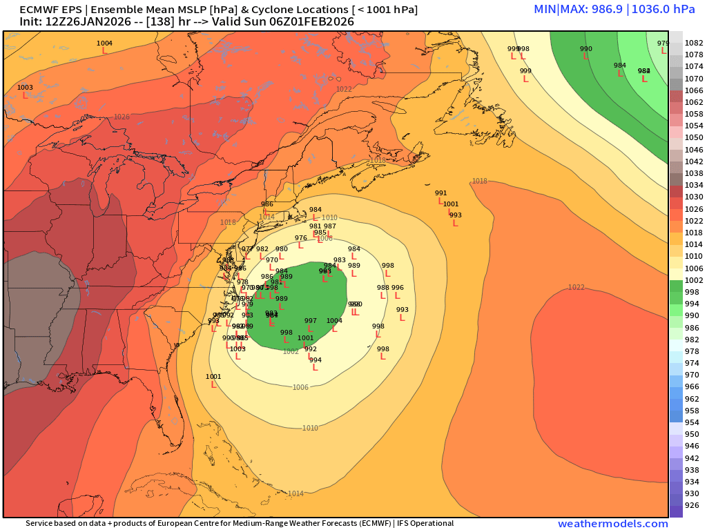
00z EPS spread is giving me the classic Hatteras to BM vibes.
-
-
-
-
I like the orientation. It's ever so slightly tilted in a way that would want to force neg tilt along the east coast naturally.
-
Just keep the looks like this showing up, for now..

-
Nice! Rjay threads are usually good luck too lol
-
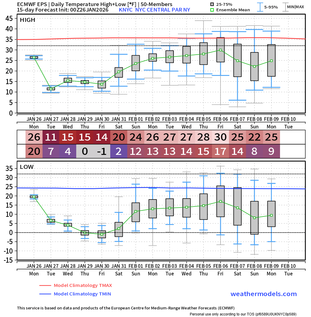
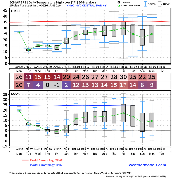
24" here on the season at this point which is pretty damn good for here. With future prospects too, this is a fun winter we have going on.
-
Snow is falling again here too lol I still have to dig this out
-
I don't know. Maybe @donsutherland1 or @bluewave
-
Burial if this thing goes off. What's out there now isn't going anywhere. Might have to fire up the snowpack thread this year.
-
Including the sleet, I end up with 11" from this. Which is in line with nearby obs. Crazy event.
-
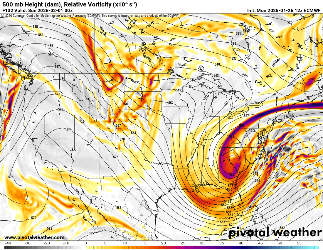
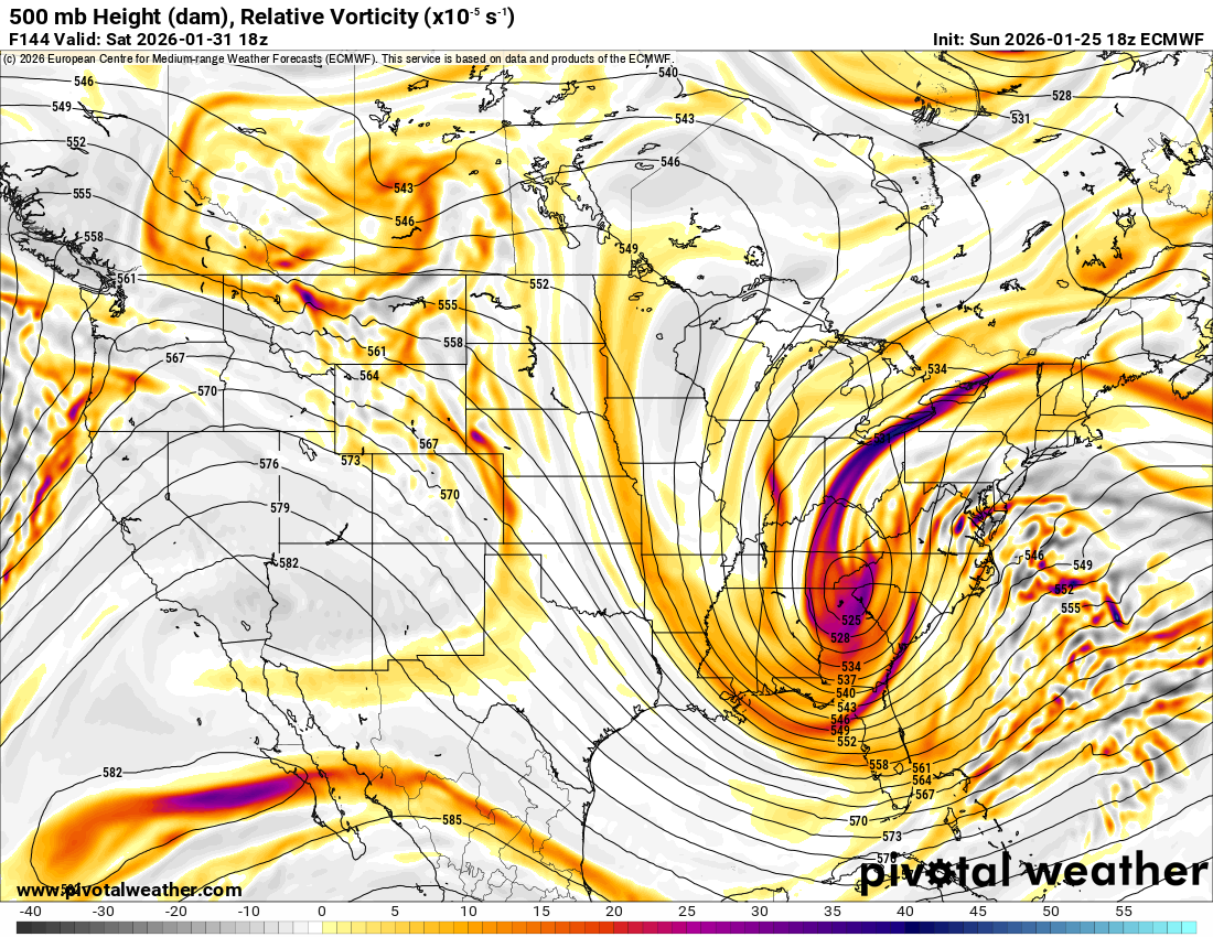
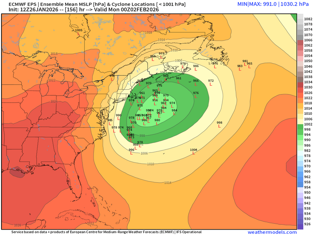
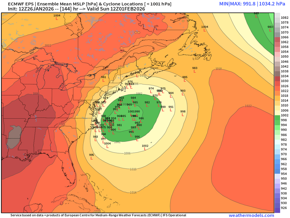
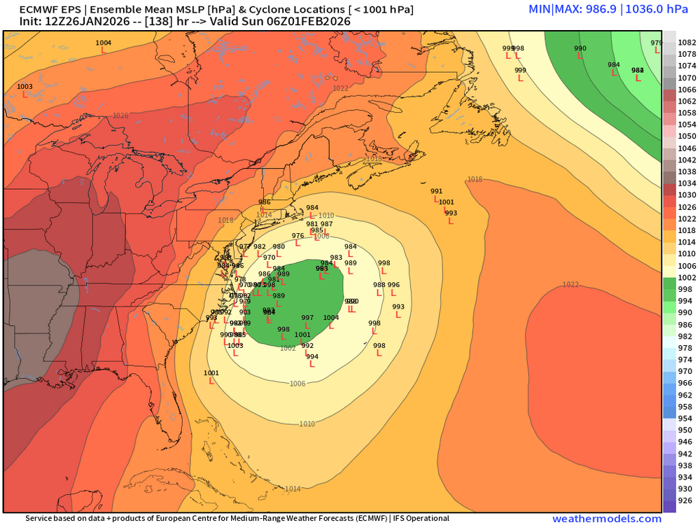
It's an actual legit phase 8 assist from the MJO we're getting this time IMHO. The first time, earlier this season, was not as far as I'm concerned. I've been liking ~Feb 1st quietly for a little while now for a big signal to show up and finally it does. I think that period fits in really well with a bit of lag time. Nice to see all models latching on to this idea more now. Even nicer to see the EPS with spread in direction of the BM. I think it's coming.
-
Well now you have this on the EPS too. Which kind of just jumped on the scene. That wasn't there on previous runs.
-
Not too shabby

-
Yeah not sure what that is out there. It's more like snow than pure sleet. Vis is pretty low. Still accumulating though close to 9" OTG now
-
Well this snow/sleet mix is still doing something I guess. 8.3 OTG now
-
Depends. How's it oriented? What else is going on with it? Amplitude? I think we're in a good place if we can prolong a -AO. It's already a good place. I'm not having a bad season. Around 22" after today is pretty good by this time of year here. You must be doing alright too?
-
Best part of this event is that we don't have to worry about it melting away in a day. Or even in a week. I'm pretty damn happy this thing wasn't suppressed.
-
Yup, and I think he's going to be right.
-
8" OTG now, so it's still accumulating. Snow/sleet mix continues.
-
Yeah I've had that same sleet/snow mix back and forth since it got here. Sometimes more sleet sometimes more snow
-
Increasingly -AO with a possible vortex split up above?... Sounds like a plan