Damage In Tolland
-
Posts
116,820 -
Joined
2 Followers


About Damage In Tolland

- Birthday 11/02/1972
Recent Profile Visitors


-

Augdewst 2026: Summer's Last Stand
Damage In Tolland replied to Prismshine Productions's topic in New England
Guess who whined their way to a Stein buster. Dendy!
-
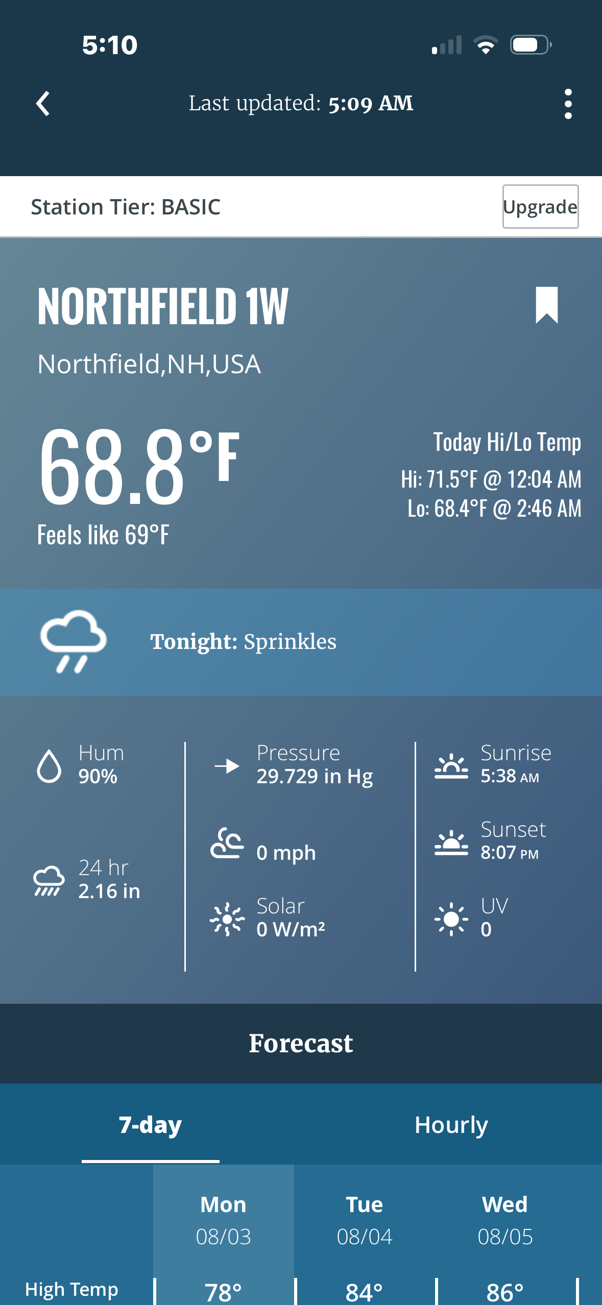
Why though? Out in the open , away from any tree drop. It’s the best spot that I’ve had it since I got my first Davis . I don’t have many options here living in the woods
-
Augdewst 2026: Summer's Last Stand
Damage In Tolland replied to Prismshine Productions's topic in New England
TFlizz getting a soaking shower already to kick the party off -
Augdewst 2026: Summer's Last Stand
Damage In Tolland replied to Prismshine Productions's topic in New England

-
For early Augdewst, this is solid https://imgur.com/a/LKPmfMD#o6bl5XP
-
Augdewst 2026: Summer's Last Stand
Damage In Tolland replied to Prismshine Productions's topic in New England
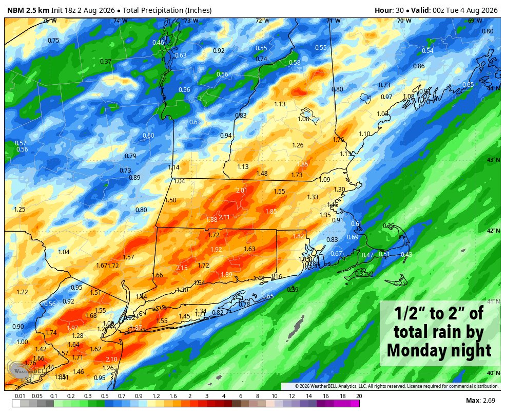
I can totally see a narrow zone or a few towns getting 3-5” but that would be combined with both the morning stuff and if anything fires in the afternoon -
Augdewst 2026: Summer's Last Stand
Damage In Tolland replied to Prismshine Productions's topic in New England
I am saying don’t see widespread big rain amounts / flooding etc . This isn’t that type of setup -
Augdewst 2026: Summer's Last Stand
Damage In Tolland replied to Prismshine Productions's topic in New England
Not seeing that. Everyone will rain but only a very narrow area will get anything of bigger significance. There will be a small zone that trains .. but it’s nothing widespread -
Augdewst 2026: Summer's Last Stand
Damage In Tolland replied to Prismshine Productions's topic in New England
Folks is cocked . Tomorrow is one of those have/ have nots days. Most turns get a downpour or two and a few that train get 2” and that’s it. Very meh setup with no sun -
Augdewst 2026: Summer's Last Stand
Damage In Tolland replied to Prismshine Productions's topic in New England
Midweek on looks like Tip’s Bermuda Blues pattern he gets so hot over. Maybe a pm shower each day. Another day tomorrow of downpours with little/no thunder. Will we see a tstorm ever again ? -
Augdewst 2026: Summer's Last Stand
Damage In Tolland replied to Prismshine Productions's topic in New England
I’d be willing to bet dews stay in the 60’s Tuesday . That front really doesn’t move all the way through cleanly -
Augdewst 2026: Summer's Last Stand
Damage In Tolland replied to Prismshine Productions's topic in New England
Probably lost control of a chainsaw -
Augdewst 2026: Summer's Last Stand
Damage In Tolland replied to Prismshine Productions's topic in New England
Yikes on those feet -
Augdewst 2026: Summer's Last Stand
Damage In Tolland replied to Prismshine Productions's topic in New England
Dews being picked up -
Augdewst 2026: Summer's Last Stand
Damage In Tolland replied to Prismshine Productions's topic in New England
Some summers they do do start early . Some years they stop as fall arrives. And others all hell breaks loose