wxmanmitch
-
Posts
2,096 -
Joined
-
Last visited
Content Type
Profiles
Blogs
Forums
American Weather
Media Demo
Store
Gallery
Everything posted by wxmanmitch
-
That 131.0" was for the 2020 calendar year. My 2019-20 snowfall total is in my signature.
-
My 2020 weather stats: Total precipitation: 58.32" Total Snowfall: 131.0" Average Temperature: 43.6° F Lowest Temperature: -7.9° F on 2/15 Highest Temperature: 84.8° F on 7/19 I'm amazed at how high my precipitation total is given that Bennington just over the hill about 12 miles away had only 36.94" and Pittsfield, MA about 30 miles to my SSW had 37.41". This total is from a Stratus rain gauge and not from my Davis VP2 tipping bucket gauge.
-
2.0" of icy crap-o-rama here with 0.93 liquid equivalent. 0.2" of ice accretion after the 2" of snow and sleet. I also had about 0.2" of ice accretion two nights ago, so there was 0.4" total glaze. Fortunately only some twigs and small branches came down and no power issues. Glad to see a decent little 5-8" event for the north country since they largely missed out on the big storm two weeks ago.
-
I sure do! I "measured" 45 inches in that event, but have since changed my measuring protocols to be consistent with CoCoRaHS methodology since I was clearing the board too much. I probably had somewhere in the 36-40" range. I clear the board once every 24 hours now.
-
23.0" with 2.11" of liquid the final here. I was surprised there was that much liquid in the snow given how cold the storm was. Maybe I'll core it again tomorrow to confirm that liquid equivalency...
-
Yup, and Okemo too. Seeing some reports of around 36" up around Ludlow, VT.
-
Wow! Looks like 18" or so here. Haven't gone out to measure yet. That death band wound up about 20-30 miles further north than modeled. Amazing storm.
-
I literally have goosebumps right now after seeing the RDPS (RGEM) and the radar. Death band incoming and I may very well be very close to or under the pivot point. It's already pounding snow, although flakes are small to medium. 9.4° F.
-

December 5-6, 2020 Storm Observations and Nowcast
wxmanmitch replied to Baroclinic Zone's topic in New England
4.0" final here. Wind is absolutely howling just above the surface with the occasional gust mixing down. Snow is blowing around all over the place making measuring difficult. 25.5° F. -
December 5-6, 2020 Storm Observations and Nowcast
wxmanmitch replied to Baroclinic Zone's topic in New England
3.2" of snow with 0.28" LE here. Light snow ongoing with dropping temps now at 29.7° F. Grateful to at least get something even though I missed out on the QPF bomb... -
Dec 5/6th major coastal/ west Atlantic cyclogenesis ...?
wxmanmitch replied to Typhoon Tip's topic in New England
I'm likely watching this one from afar or from the edges anyway barring a TB12 Super Bowl LI type comeback. RGEM offers a bit of hope that I at least get something. It can happen. I remember the 3/7-8/18 nor'easter that was modeled to go slightly east and I wound up getting 3'+ from a sick deform band that sat up over me for several hours and dumped... -
4.0" overnight for a 4.6" two day total. Road was plowed and I have just enough to snow blow the driveway even though it'll melt soon.
-
While not always the case, I've noticed the same thing. Stability tends to increase at night so that would favor a more stratiform type of upslope as opposed to a cellular (unstable) or streamer (neutral stability) upslope so there is definitely merit to this observation. The streamers can nail a particular location if you manage to get one over you for a while.
-
Only 0.6" on my snow board from rounds 1 and 2, so it's safe to say the upslope has been a disappointment down here so far. This stuff is hard to measure with some "drifts" to 2-3" around the house. Awaiting to see what the clipper brings us for round 3 overnight... I haven't been able to get the deeper moisture profiles needed to get a more robust upslope snowstorm this far south. It's one of those deals where you can clearly see the silhouette of the sun or moon through the clouds. The bigger events tend to produce a thicker cloud cover where the sun or moon aren't visible.
-
Classic stratiform type upslope snowfall ongoing with fat, fluffy flakes. Still rather wet since it's 32.6° F, but the ground is white once again. Under a WWA for 4-8" through Tuesday.
-
Hi...Justin, I remember that original screen name. Glad to see you back on the forums. We overlapped a bit at Plymouth...I graduated with a BS in '07, MS in '10. You're in a good spot for snow up there in the heart of CAD country. Any idea what the annual averages are like at your location? I've since relocated to a decent snow spot high up in the Green Mountains of far southern Vermont. I get a nice mix of snow from coastal storms, southwesterly flow overrunners, and upslope on NW flow. Look forward to your observations this winter.
-
The percentage of error is definitely more significant the heavier the rain gets, not necessarily the more rain that falls for the event in question. The worst errors seem to occur during thunderstorms. Prior to calibrating my Davis tipper, it was over reporting by an average of 25-30%. It's pretty much spot on for the light rain events, so for instance if my Stratus gets 0.14" my Davis is usually 0.14", unless it all fell in < 5 minutes or something.
-
3.66" in my Stratus rain gauge, 3.95" in my Davis VP2. I've noticed my Davis tends to over report rain during heavy events, but is very close to the Stratus for the lighter events. Is this normal? Anyway, drought cancel here. Rivers and streams are flowing vigorously again. Not that there was much of a drought to begin with here...
-
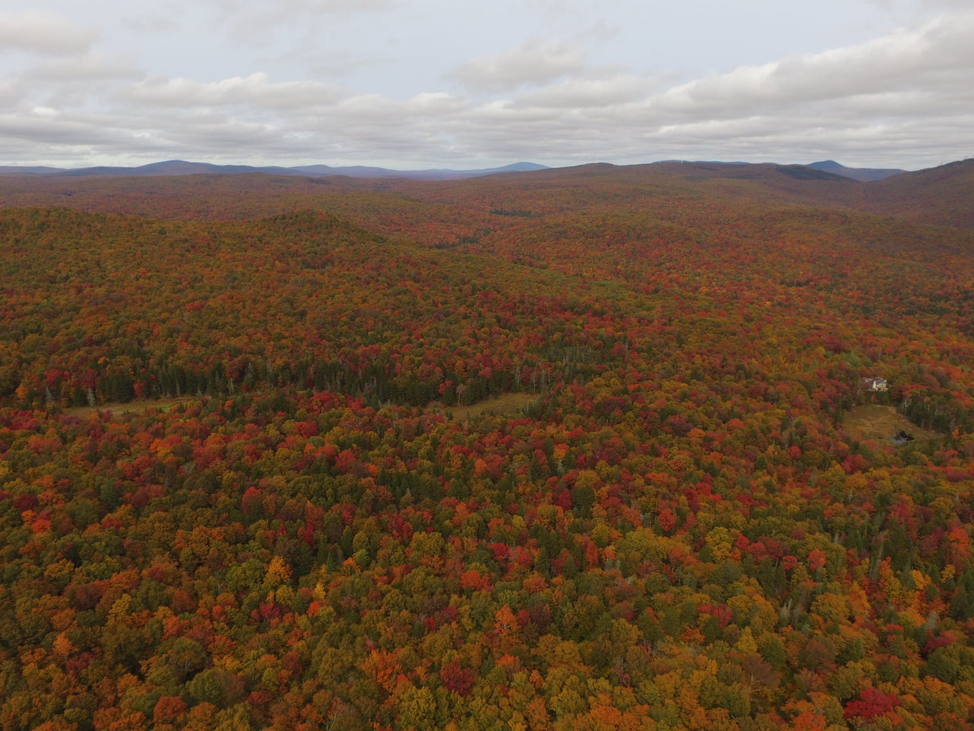
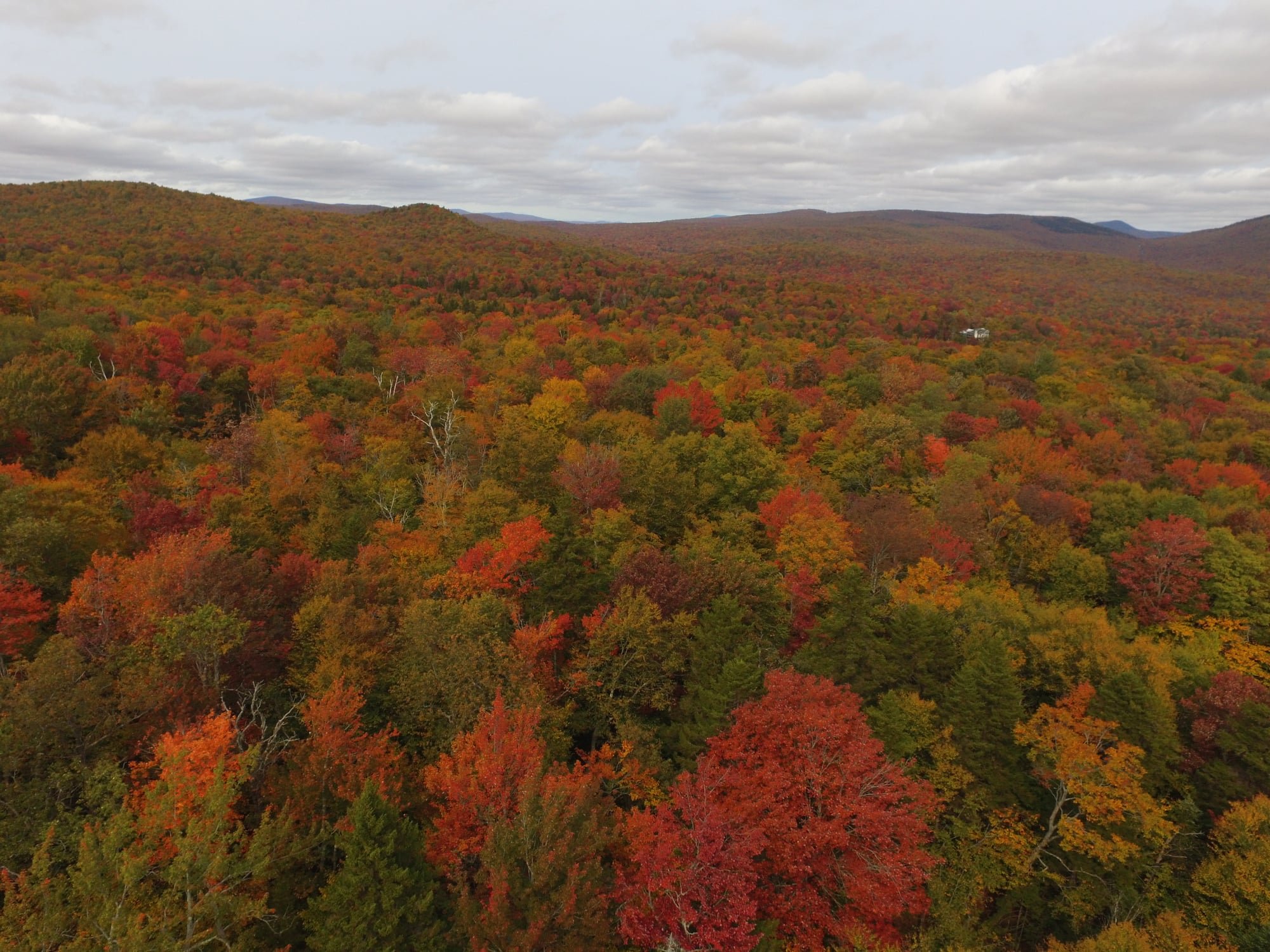
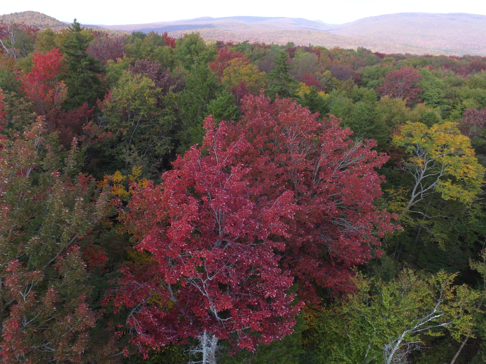
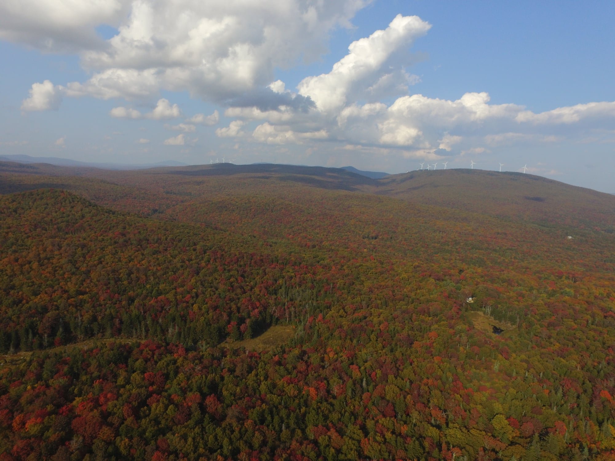
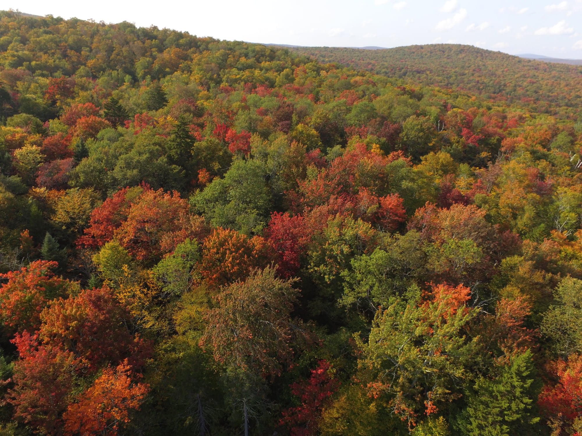
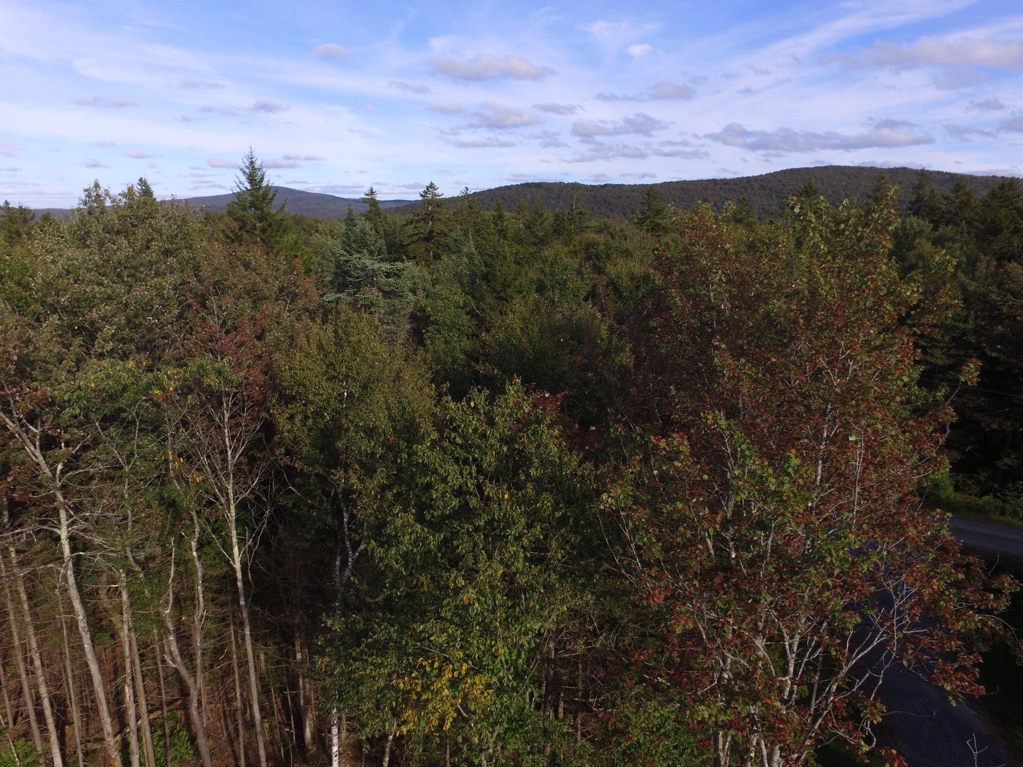
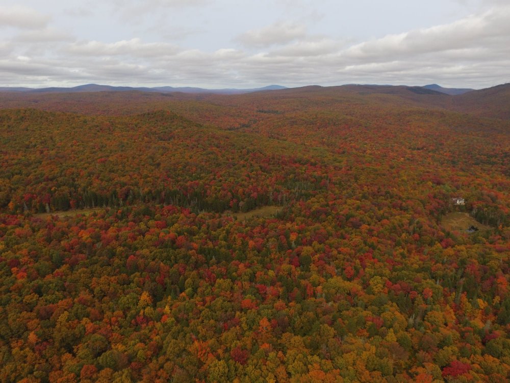
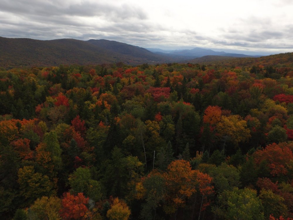
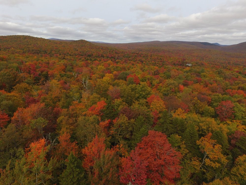
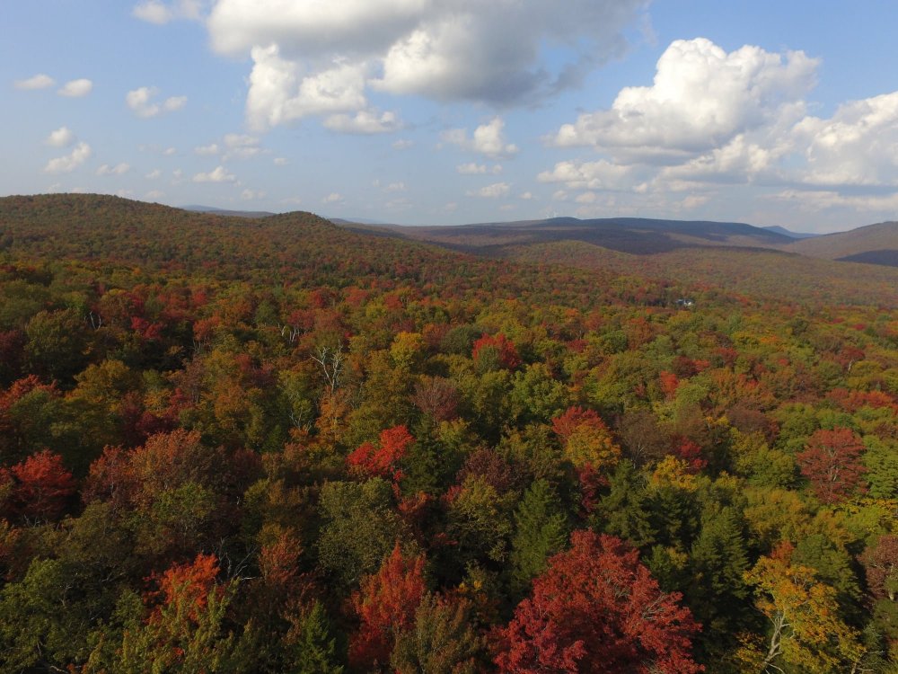
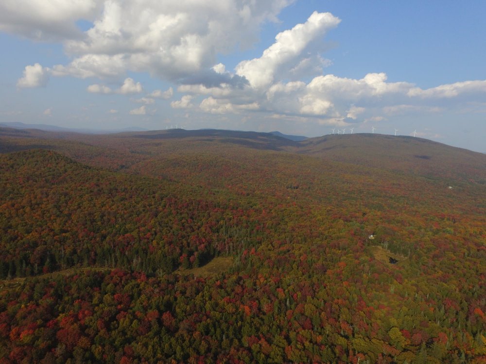
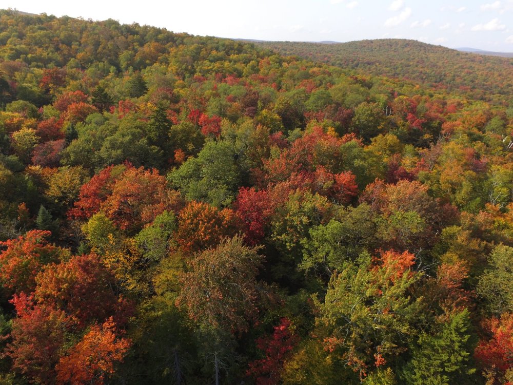
There's a reason why Vermont is world renowned for fall foliage and this is it! Just a few of the drone shots I got yesterday above my house.
-
I'd say I'm just about there. The sudden explosion in colors over the past few days has been nothing short of incredible to witness. The red maples are putting on quite a show again this year. There's such a great abundance of them around these parts, especially in the 2,000-2,500' zone.

-
I didn't see a 2020 Fall Foliage thread, so I figured I'd get one started since the leaves are beginning to turn here in the highlands of southern Vermont. The red maples are beginning to turn a bit read and the sugar maples have a hint of orange, so it's coming. I've been largely spared from the drought here, but I did have a bruce spanworm (a close relative to the invasive winter moth that's invaded coastal New England) infestation that did a number on the ash trees and did some minor damage to other species. Fortunately, I don't think the damage to the maples was significant enough to detrimentally effect the fall color and ash trees only make up a small component of the forests around here so I think the foliage should at least be decent in S VT.
-
May 8-9 mid-spring rain, snow, cold, wind obs
wxmanmitch replied to CT Valley Snowman's topic in New England
Typically 850 to 900 mb, but I've seen blocked or slightly blocked flow occur if there's more of a northerly component to the wind in the low levels or weaker westerly flow without much evidence of an inversion. The stronger the cross barrier component of the wind and, of course, the lower the stability, the higher the Froude number will be. Looking back on it in more detail, there was likely some synoptic forcing mechanism that was enhanced by upslope behind those totals as opposed to just pure upslope. Many of these backside events are wrap around comma heads with NW flow, but the maxes with this one seemed a bit further west than usual. Shaftsbury, VT (10.5") and Cambridge, NY (12") are not typically spots that jackpot in these setups. Usually it's a bit to the east near the crest of the spine. How much of this was the result of synoptics vs. upslope is difficult to pin down and would make for a good case study subject. I measured 7.5-8" in Woodford at 10 AM, so the 8.5" report from 7:30 AM is legit. Even the east side of Bennington at 900' had 6-7". I finished with 5.0", but the Deerfield Valley towns just to my east had less than an inch. Very sharp gradients that were not as dependent on elevation as I would've anticipated. -
May 8-9 mid-spring rain, snow, cold, wind obs
wxmanmitch replied to CT Valley Snowman's topic in New England
I'll head up to Woodford in a little to see if that 8.5" is legit, but I think it is. Likely some blocked upslope going on the west side of the Taconics and Greens that led to those 8-9" totals. -
May 8-9 mid-spring rain, snow, cold, wind obs
wxmanmitch replied to CT Valley Snowman's topic in New England
5.0" looks to be the final here as the sun comes out. Tough to measure due to the winds blowing around dry, fluffy nature of the snow. It's wet at the bottom. Depths ranged from 4.5" to 5.5". Had a low temperature of 22.6° F at 8 AM with a midnight "high" of 29.2° F. I wonder if I verify a subfreezing high today? It'll be close since that May sun is intense. Although May snow is not uncommon here (I had 3.3" last year on the 14th of the month), this type of snow is. It's like midwinter. -
March 12/13/14 Blizzard/Winter Storm/WWA etc
wxmanmitch replied to Bostonseminole's topic in New England
+SN, 23° F. 11" of upslope, 7" from the storm yesterday.