

Jackstraw
-
Posts
2,410 -
Joined
-
Last visited
Content Type
Profiles
Blogs
Forums
American Weather
Media Demo
Store
Gallery
Everything posted by Jackstraw
-

Winter 2019-20 Medium/Long Range Discussion
Jackstraw replied to Hoosier's topic in Lakes/Ohio Valley
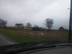
My big sugar maples just dropped 5 inches of leaves the last 2 days if I slant stick it. If the NAM verifies in the short term and then a refresh midweek it'll look like a foot lol. Btw, is depth to measured off the dirt or whatever is above the dirt. If it's above I'll stop mowing the end of August so I can feel good about a 2 inch misery snow -
Yeah and that sucks. Granted early cold but with no snow I hate cold dry crap even if it was in September lol. Like Stebo said, we need this trough a little more west to get some moisture pumped into this anomalous pattern. I just hate cold and dry Tibet'n steppe crap anytime of year.
-
Winter 2019-20 Medium/Long Range Discussion
Jackstraw replied to Hoosier's topic in Lakes/Ohio Valley
Yeah I was surprised to see this much discussion on a GFS run this far out. Think the Halloween event triggered some irrational thinking like if you had a first date with the head cheerleader in high school and she teased you into thinking the second date was going to be THE date lol. Regardless I bought a bottle of my winter single barrel a little early this year just in case. -
Winter 2019-20 Medium/Long Range Discussion
Jackstraw replied to Hoosier's topic in Lakes/Ohio Valley
You mean like 5 years ago the GFS would spit out a 10 day clown map of 2 feet from St. Louis to Detroit or the last couple years a 3 day clown map of 36 inches from Dallas to Toledo. I swear the last couple years all of the models have been terrible. The local forecast offices need to get off the model teet and get back to some good old fashioned forecasting. Don't bash me I'm just sayin'. Reliance on technology can be a crutch when there's a bug in the system. Youtube, Tesla, sleeping drivers. Just sayin' -
I've never been able to tweet embed. True story
-
Spent about 15 years in Fl. Experienced some good ones. Some I chased some didn't have to. Elena (72 hours of hell), Andrew (West coast still a monster), Katrina (scariest cat 1/2 ever), Ivan (was prepared and actually enjoyed it) to name a few. I'm of the opinion know where you live. Canes come with the territory down there so deal with it and prepare yourself. For most of Fl. it's not that hard to evacuate 20 or 30 miles inland (if you have to go that far) if you live within 5 miles of the coast and then hunker down. If you live in Fl. and your evac plan is Georgia move back up north lol. Pinellas county (St. Pete, Clearwater, Largo area where I lived) is just a disaster waiting to happen however because there's just nowhere to go. Water on 3 sides, an average above sea level of about 15-20 feet, 4 bridges and a highway paralleling the coast north the only way out for about 1 million people to evacuate. It's been like 100 years since that area was slammed with a big dog and it will happen again. IMO that area is a powder keg during cane season.
-
Pretty crazy stuff from the KILM Disco.... This will likely be the storm of a lifetime for portions of the Carolina coast, and that`s saying a lot given the impacts we`ve seen from Hurricanes Diana, Hugo, Fran, Bonnie, Floyd, and Matthew. I can`t emphasize enough the potential for unbelievable damage from wind, storm surge, and inland flooding with this storm.
-
Well Ryan said google it lol. https://en.wikipedia.org/wiki/List_of_Arabian_Peninsula_tropical_cyclones That would be an amazing sight especially just after landfall. I wonder if there is plant/animal(not necessarily multi cell) life in the area that lays dormant until such an event happens.
-
-
-
The August 21, 2017 Great American Eclipse
Jackstraw replied to ice1972's topic in Weather Forecasting and Discussion
We packed a tent and coolers and headed out Saturday morning with an idea but no plan. I had been watching the forecast and far western KY kept improving. Finally chose to go "somewhere" East of the Shawnee National Forest in IL across the river in KY for a few reasons. It was fairly close for us to drive, 300 or 400 miles. The forecast was giving us a better than 80% chance of no clouds. There's really nothing in that area but hills, farm land and little KY towns pretty spaced apart . There's only a couple of places to cross the Ohio to get into that area and they're about 50 miles apart. So I figured fairly remote, if the clouds role in to the NW in the center of the Carbondale madness, the 2 bridges are going to bottleneck the crazies trying to make a mad dash to find the sun, then that area would be a perfect place to enjoy it and not have the crowds or madness. Military strategy, we had a good defense in that area lol. Question was where to camp? Not knowing the area very well and unbeknownst to me, my girl got on FB and started searching for some folks in that area. Lo and behold she started up a conversation with a wonderful couple who had a big plot of wooded land right in the general area we were targeting.. After she spoke with them on the phone and turned on her charm they said we could camp there under the condition it was just us. They were really concerned about their property and the hype of the tons of people flowing into the Carbondale Hopkinsville corridor. We assured them it was just us and we would gladly pay and take care of their property like it was our own. Still hesitant they wouldn't tell us exactly where it was at, they just said call when we cross the Ohio. When my girl told me I said hey, we either got a place to camp or we're gonna be on one of those real life mystery crime documentary's! So we headed out and along the way we planned our escape for after the eclipse kind of making notes for escape routes if we got stuck in traffic. Regardless it all worked out great when we got down there, the folks were awesomely gracious and we all hit it off and had a blast. Come to find out they wanted to experience it in a similar manner as we did. Alone and reflective with someone you care about. I had targeted the area south of Morganfield KY and thats where we ended up. about 5 miles from the center line. The trip back wasn't bad. It really paid off taking some time to plan escape routes. We didn't spend more than 10 miles on any road with an "I" in front on the way back. Hardest parts of the trip home were the Ohio and Wabash river crossings, definitely bottle necked at both. But as soon as we crossed we hit the secondary's and the thirdendary's and even fourthendaiy's lol. Think storm chasing experience helped, the escape plans, plus two of us sharing the navigating and driving was a plus. It truly was an awe inspiring experience, well worth the minor headaches here and there on the road. I really can't add much more than what other's have already said about the actual event other than as awesome as it was, it was truly humbling at the same time. Really put's you in your place in this vast universe. Oh, and during totality , seeing it in person the pure 3 dimensional view really stood out. Pictures and video cannot reproduce that. Amazing! Besides the Eclipse we really did meet some great new friends and hope to spend some time with them again soon and repay their hospitality. Truly wonderful and memorable all around. -
I'm supposed to drive up to Norwalk Ohio leaving North Central In. at 4am Monday. I usually take 69 and cut over on 30 then back North. Any guesses on if the roads will be passable if this thing pans out?


