snowlover2
-
Posts
2,731 -
Joined
-
Last visited
Content Type
Profiles
Blogs
Forums
American Weather
Media Demo
Store
Gallery
Everything posted by snowlover2
-
Ohio now has a stay at home order officially. Doesn't actually change anything that we've been doing for the last week and a half but it goes into effect tomorrow night at midnight through April 6.
-
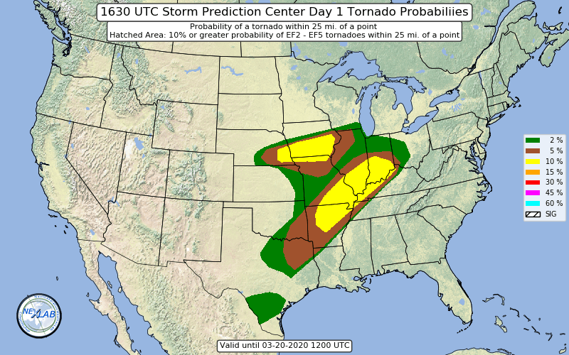
10% tornado area expanded across the S IA area otherwise no other real changes on new day 1.
-
Same thing announced for Ohio. Delivery, carryout and drive thru still available.
-
Same for Ohio.
-
Just like Dayton on Memorial day but we obviously were much luckier on the death total.
-
You should look at the 0z GGEM.