

weatherwiz
-
Posts
81,132 -
Joined
-
Last visited
Content Type
Profiles
Blogs
Forums
American Weather
Media Demo
Store
Gallery
Everything posted by weatherwiz
-
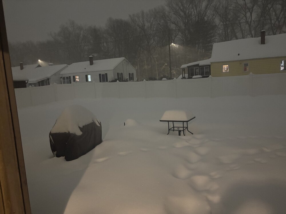
 forgot to clear my table off...got side tracked Oh well. Have to head to bed soon but probably do one final measurement. It's gotten pretty breezy here so snow is definitely drifting. I am actually wondering if I cleared, would I even get an accurate accumulation with the way the snow is blowing. Oh well...it is what it is
 -
I can't even remember the guidelines anymore...I feel like this is the first snow event in forever where it's accumulated for something longer than 4 hours lol
-
That I didn't do. I was going to do 6 (which is now).
-
Measurement #3 7:30 PM: 11.5" !!!!! 1:30 PM measurement: 4.8" 4:30 PM measurement: 8.8"
-
Doing 3 hour measurements because I feel like it so next one is at 7:30. I am betting I am closing in on a foot.
-
This is amazing
-
Really coming down out there...almost looks like its breezy because the snow is almost sideways but the trees aren't moving
-
Might actually be the heaviest snow of the day here
-
NE MA is going to jack for sure. That's where the 20"+ totals will be coming. Someone def gets 2' there...probably several reports
-
8.8" 4" in 3 hours
-
About 20 minutes from doing measurement #2 curious to see where I'll be at...been ripping very good but been going back and forth between good snowgrowth and much lesser...don't think it's ever been stellar here
-
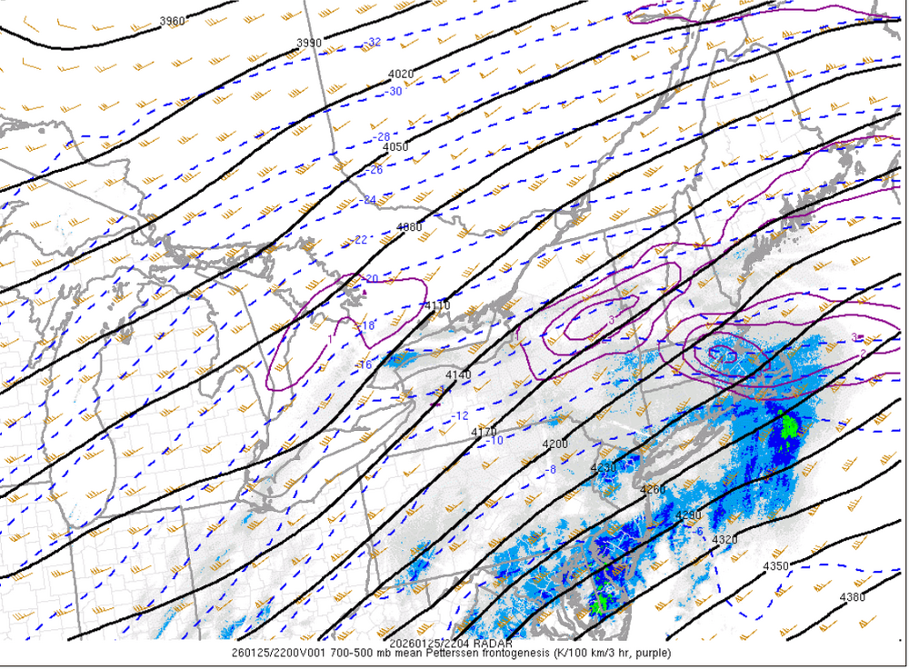
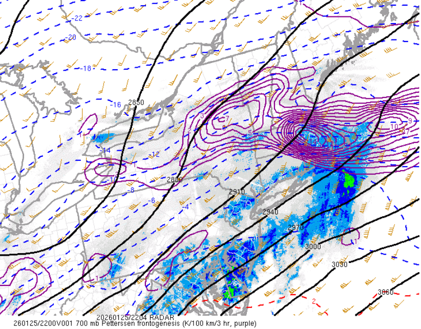
might be getting a little bit of subsidence going on
-
The heaviest rates probably start tapering off (west first) in about 3-4 hours.
-
If there are any thundersnow reports we'd probably see them in the next hour
-
Over/under Average snow totals or Pats points?
-
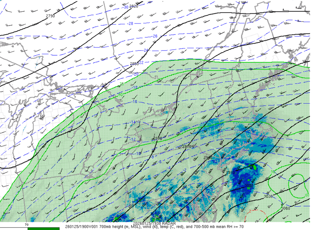
I'm always curious where the dry slot is and checked out 700mb not long ago and thought the same lol
-
snowgrowth picking back up here and visibility going down.
-
Frontogenesis and omega should be increasing (well if we want to be technical omega values decreasing) over the next few hours so we should probably see some much more uniform snowgrowth I would think.
-
Anyone else just love staring at the radar with the big blue MCD circling the region
-
Frist measurement 1:35 PM EST: 3.8"
-
Sucking a little exhaust right now but at least still coming down good...just some reduced flake size from earlier
-
Probably going to take first measurement around 1. Can't wait for it to rip even more. Any thunder reports yet?
-
who was saying that?
-
ripping here...going to be accumulating at a rapid pace for the next several hours
-
It was around 3-4"


