weatherwiz
-
Posts
81,132 -
Joined
-
Last visited
Content Type
Profiles
Blogs
Forums
American Weather
Media Demo
Store
Gallery
Everything posted by weatherwiz
-

Friday February 6 FROPA / WINDEX small event
weatherwiz replied to HoarfrostHubb's topic in New England
Definitely interesting up around BOS on the NAM. Agreed...I'm thinking most should see 1-2" but where you get those localized bands I could legit see some spots picking up 3-5". -
Friday February 6 FROPA / WINDEX small event
weatherwiz replied to HoarfrostHubb's topic in New England
It's going to be very localized but there is going to be a very narrow area which I think pulls off 3-5" within eastern CT...maybe more into SE CT -
Friday February 6 FROPA / WINDEX small event
weatherwiz replied to HoarfrostHubb's topic in New England
The 12z HRRR has that feature too -
Based on what was going around on social media I don't know where the idea came really of a "torch" or whatever you want to call it upcoming. I mean we were clearly going to moderate from what we've been experiencing. This is when anomaly maps get tossed around and are used and interpreted incorrectly. We are still in peak climo in terms of temperatures...orange and red shadings on anomaly maps don't necessarily indicate or mean warm...we can still be above average and its still relatively cold or chilly or whatever. The only areas where its clear there will be a significant warmup is within the central Plains. Even those temp anomaly maps from BAM or sham or whoever...+12 to +15 in the upper-Midwest this time of year is still chilly
-
Makes my life easier. I was creating stuff using the ENSS-ONI, ONI, and RONI...now I can just eliminate the ONI
-
Yup. Sounds like the ONI will continue being maintained but the RONI will be the go to now.
-
@40/70 Benchmark Even a better page dedicated to the RONI and much easier to view the data https://www.cpc.ncep.noaa.gov/products/analysis_monitoring/enso/roni/#latest-data
-
Wagons in on that 13-15 period. Time to throw in the chips and hope for another biggie
-
Time is starting to run thin though, especially with not much - if anything in the pipe line in terms of anything big except that mid-month period but there is disagreement on how legit it is. Obviously we can get snow and big storms into March but it becomes much more difficult to do (outside of NNE). But once we hit that time change...bring on the warmer weather.
-
Going to enjoy what's left of winter and continue enjoying and admiring the scenery outside, but in another 4-5 weeks...I will be full on ready for warmer weather and looking for that first stretch of 60's.
-
Oh wow didn't realize this but the RONI is going to be the official monitoring and prediction of ENSO for the CPC https://www.weather.gov/media/notification/pdf_2026/pns26-05_Relative_ONI.pdf
-
Euro doesn't look too bad for Friday night and Saturday. Not looking in at zoomed in but looks like maybe even a bit of an inverted trough into parts of RI/eastern CT? Probably be a good 2-3" region wide I'd think
-
Just caught the post after the reply. Thanks for the clarification, this actually makes much more sense. So ultimately, we *could* (if a storm signal remains) end up seeing guidance transition from the coastal look depiction to something more along the lines of an overrunning signal (or dare I say...cutter)? Would not be the first time we've seen this happen
-
hmmm I thought opposite when looking at the teleconnections. Rise in the NAO with a declining PNA All of this during a period which looked to be active with shortwaves progressing within the flow across the country. I know the OP shows a storm but not necessarily basing my thoughts on the OP...but seeing the OP with a storm kind of backs up the potential?
-
Our best chance upcoming is going to be that mid February time frame. I don't have much confidence moving into the second half of the month...there's been increasing signals with a flip on the PAC side and introducing more trough amplification into the West and we know what that mans for us. A bit of vitality showing up with respect to pattern evolution second half of the month...that look makes me nervous because it could be signaling the hemisphere is making strides towards the seasonal transition. Not saying winter is over or snow threats are done because slight tweaks in the evolution opens a window. So for now I don't have much in the way of expectations and proceeding with lower confidence moving forward.
-
Agreed. These things don't just come in quiet. I think there will be snow showers and squalls around all weekend, perhaps not widespread but there is definitely some moisture around. Orographically areas likely favored
-
could be potential for some decent OES across the Cape Sunday/Monday
-
The period around mid February is quite intriguing I think, at least in terms of the evolution of teleconnections which I know Tip has touched upon. But during that period the NAO is forecast to become less negative over time with the PNA becoming more neutral. Will be very active in the shortwave department. Obviously how everything evolves is a different story but that is a period to 100% watch
-
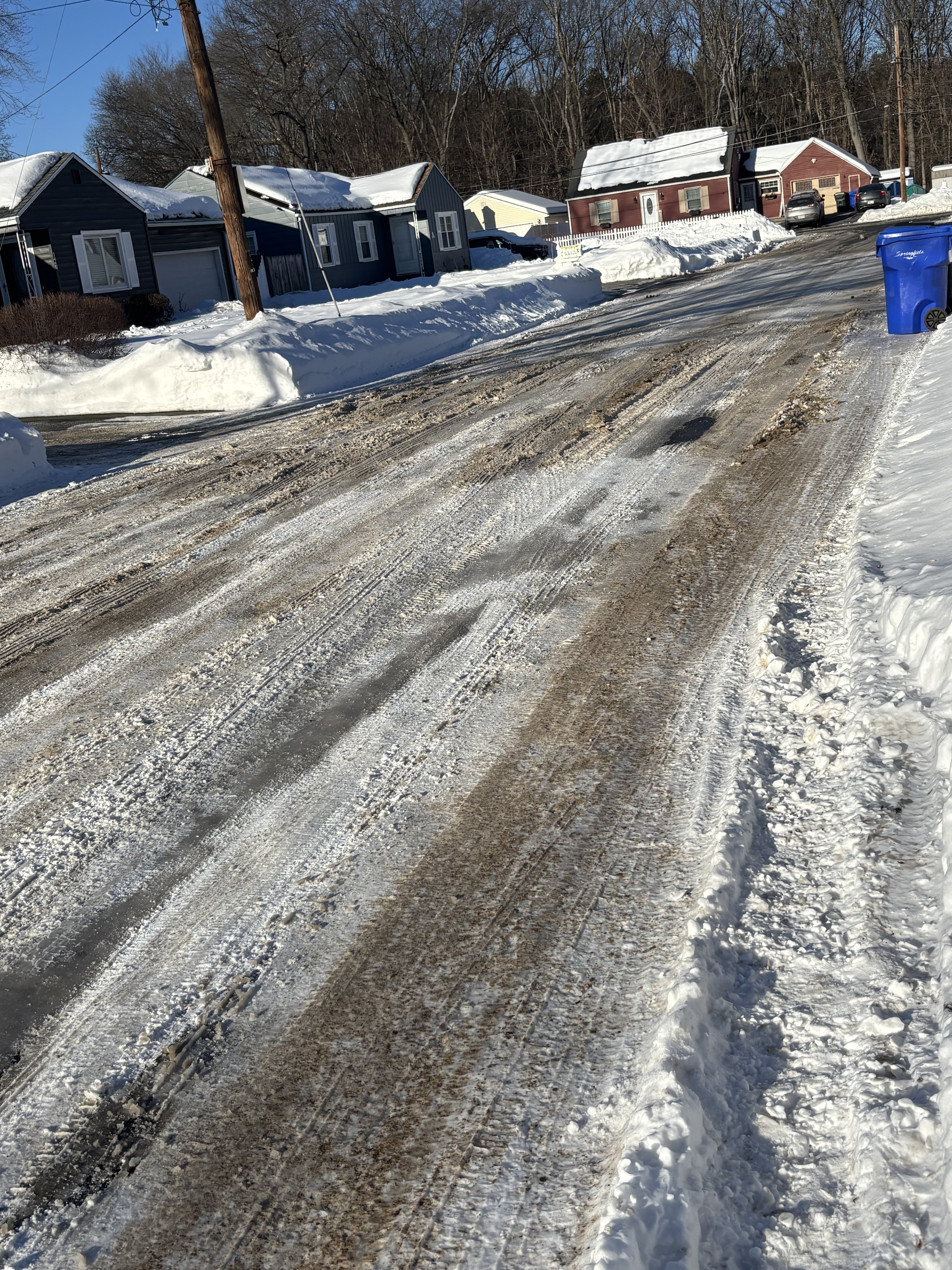
That road doesn't usually see any sun until like later March or April lol. Went out yesterday and was glad the roads that do get sun were in pretty great shape.
-
That explains it. TBH I've been trying to avoid looking at the temp/dewpoint because it just makes it worse. Not looking forward to this upcoming weekend. I might watch the SB from the inside of a fire place
-

-
Despite the temperatures and abundance of sun today I am impressed by the lack of snowmelt. The road here is still a complete disaster too
-
Hopefully it breaks down
-
It might only be early February and we may still have several weeks of winter to go, however, that doesn't change the fact winter is getting into its back half which means spring is approaching and pretty soon severe weather season. While its usually not until late May or early June when we start getting some real severe threats May 1 is a great proxy to use because we can sometimes sneak in some early season events and it gives time to switch the mind into convective forecast mode and start sniffing out guidance for potential threats. Just like professional athletes need a pre-season to prepare for the season and shake off the off-season rust, this threat offers the same thing...a good place to talk convection and shake off the rust. With this said, we'll open the countdown at 88 days Its coming and coming quickly
-
It will certainly change. I really wish we could get a good 2-3 year period of ENSO neutral conditions. I think that would go along way of stabilizing things for a bit