-
Posts
80,252 -
Joined
-
Last visited
Content Type
Profiles
Blogs
Forums
American Weather
Media Demo
Store
Gallery
Everything posted by weatherwiz
-

May 2024 Discussion - Welcome to Severe Season!!!!
weatherwiz replied to weatherwiz's topic in New England
too bad you can't load more than one product at once. It's brutal how slow it can be to populate or whatever on nws -

May 2024 Discussion - Welcome to Severe Season!!!!
weatherwiz replied to weatherwiz's topic in New England
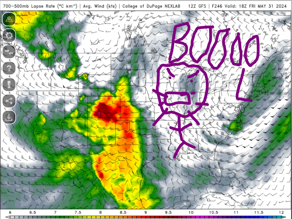
This is what I DON'T WANT TO SEE. This is what kills getting EMLs up this way. UGHHHHHHHHHHHHHHHHHHHHHHHHHHHHHHHHHHHHHHHHHHHHHHHHHHHHHHH -

May 2024 Discussion - Welcome to Severe Season!!!!
weatherwiz replied to weatherwiz's topic in New England
Some good support for a hot day tomorrow -

May 2024 Discussion - Welcome to Severe Season!!!!
weatherwiz replied to weatherwiz's topic in New England
And now there is no looking back until November -

May 2024 Discussion - Welcome to Severe Season!!!!
weatherwiz replied to weatherwiz's topic in New England
Actually much of Kansas looks like nada. -

May 2024 Discussion - Welcome to Severe Season!!!!
weatherwiz replied to weatherwiz's topic in New England
Thursday looks decent for convection along/ahead of the front at least. Certainly would be room for some locally strong-to-severe thunderstorms. -

May 2024 Discussion - Welcome to Severe Season!!!!
weatherwiz replied to weatherwiz's topic in New England
It's just basically waiting for some severe wx setups at this point. Hopefully we get active in 2 weeks -

May 2024 Discussion - Welcome to Severe Season!!!!
weatherwiz replied to weatherwiz's topic in New England
Windsor Locks too (though might be considered Windsor). -

May 2024 Discussion - Welcome to Severe Season!!!!
weatherwiz replied to weatherwiz's topic in New England
Have to look online, but I wonder what ERSST vs maps would show (though I'm not sure how up-to-date that data is available for). IIRC, that version has one of the best resolutions. -

May 2024 Discussion - Welcome to Severe Season!!!!
weatherwiz replied to weatherwiz's topic in New England
This 2 days of nice weather and two days of crap stuff has gotten annoying. Hopefully next week we turn the page. Not totally dry though...want one to two FROPAs a week with convective chances. -

May 2024 Discussion - Welcome to Severe Season!!!!
weatherwiz replied to weatherwiz's topic in New England
I am not so sure on the AI aspect. Do I think AI has value and will provide great value moving forward? I believe this, however, I think AI is leading to more harm than good in the forecasting business right now and I think that ultimately, AI is going to be the downfall society. Everyone is so fixated in wanting computer and robots to basically operate our lives that eventually nobody is going to know how to do anything - there will be no such thing as having fundamental skills anymore. With this google AI modeling crap, the article that was floating around on that, it essentially stated the model had zero clue how it was deriving it's output. Too make it simple, it knows 10 x 10 = 100, but it doesn't know why that is. The only great part of that model (IMO) was the fact that it processed data substantially faster, however, it did not use physics or calculus (if I understood correctly). The premise of AI from my gathering anyways is it just finds patterns and understands patterns and goes from there. But at least with weather, pattern recognition is only a very small piece of the puzzle - too small to make definitive calculations and "forecasts" just because some robotic, computer mind, ciphered through 500,000 different patterns and "recognized" one as a match. -

May 2024 Discussion - Welcome to Severe Season!!!!
weatherwiz replied to weatherwiz's topic in New England
I'm trying to remember back a few days ago, but the GFS may have been onto the idea, just not as aggressive as the NAM. IIRC, the NAM was the more aggressive with the development of llvl circulations and were further north with them. The GFS was a bit weaker and south (which I think was similar to the Euro). You have to wonder if even 15-20 years ago would an event have performed as such, with the atmosphere holding so much more moisture now and all...these type of setups may be bound to produce more rain. We're looking at PWAT anomalies which are like +1.5SD right now. -

May 2024 Discussion - Welcome to Severe Season!!!!
weatherwiz replied to weatherwiz's topic in New England
Agreed, that's why I wasn't so high on this a few days ago. It was difficult to find overwhelming support with the NAM sort of alone. I suppose you could throw the long-range HRRR in there but I don't really count that since there aren't many products available on the HRRR to provide enough insight. -

May 2024 Discussion - Welcome to Severe Season!!!!
weatherwiz replied to weatherwiz's topic in New England
Just got the living room A/C installed since a friend came up. Have to buy a new unit for the bedroom though -

May 2024 Discussion - Welcome to Severe Season!!!!
weatherwiz replied to weatherwiz's topic in New England
Nice little zone of fronto on the NAM with decent inflow. 3km has some pretty hefty 12-hr totals -

May 2024 Discussion - Welcome to Severe Season!!!!
weatherwiz replied to weatherwiz's topic in New England
Off to a fairly active start this year (seems like it anyways). See if we can continue that for another month or so before the Plains season typically begins to level down a bit. -

May 2024 Discussion - Welcome to Severe Season!!!!
weatherwiz replied to weatherwiz's topic in New England
You can tell there is definitely some sort of potential pattern change towards the end of the month. Doesn't necessarily mean there will be a direct impact or correlation to our region, but there is an upward/increasing trend to at least start building heat into the southern states. I loved how in your earlier posts you outlined 850 temperatures. Often times, we focus too much on the H5 look and (focusing on summer months here) and we presume that no major ridge in the East signal means no heat - that isn't true. I feel like many of our bigger heat patterns (especially the more active ones with convection) occur when we have a strong ridge in the lower-levels with less ridging in the mid-levels and more of a trough signal. This helps to transport the airmass from the Southwest or southern Plains into our region and increases the likelihood of this airmass keeping it's integrity - and we see this by advection of EML plumes. -

May 2024 Discussion - Welcome to Severe Season!!!!
weatherwiz replied to weatherwiz's topic in New England
Just need this to become consistent -

May 2024 Discussion - Welcome to Severe Season!!!!
weatherwiz replied to weatherwiz's topic in New England
Another fantastic days. At least down this way, the nice days have been stellar but the awful days have been totally crap. Doesn't seem like we've had many in the middle days. -

May 2024 Discussion - Welcome to Severe Season!!!!
weatherwiz replied to weatherwiz's topic in New England
Agreed, just replied the NAM might be a bit out to lunch I think. Don't really see support for it's scenario. We'll see showers for sure but don't think we'll see widespread heavy rain. -

May 2024 Discussion - Welcome to Severe Season!!!!
weatherwiz replied to weatherwiz's topic in New England
The NAM also looks like it is on its own island (with the HRRR). It's the most aggressive with closing off through H5 and north with the lows while Euro/GFS aren't as aggressive and south overall. The differences between the NAM/rest of guidance leads me to think NAM is out to lunch. -

May 2024 Discussion - Welcome to Severe Season!!!!
weatherwiz replied to weatherwiz's topic in New England
But who the hell knows. disastrous model consensus for tomorrow. Thank God this isn't a winter event. -

May 2024 Discussion - Welcome to Severe Season!!!!
weatherwiz replied to weatherwiz's topic in New England
Looks like at least southern sections get grazed with some heavy rain tomorrow night. -

May 2024 Discussion - Welcome to Severe Season!!!!
weatherwiz replied to weatherwiz's topic in New England
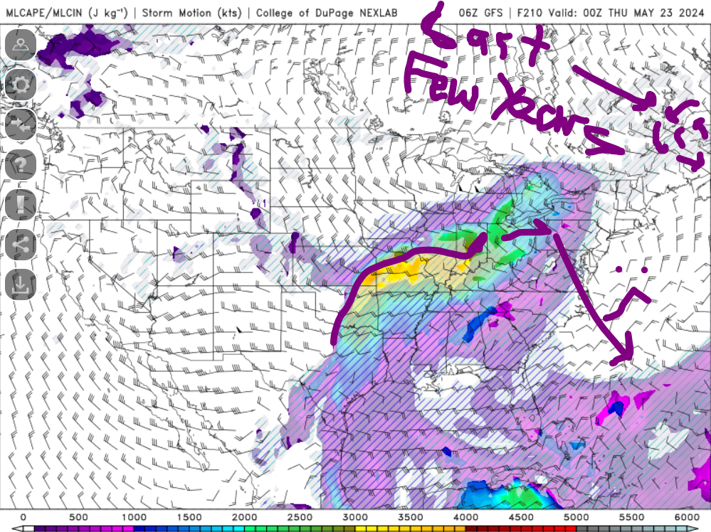
This is going to sound stupid but it's an observation. Every May and June I like to just go to the GFS MLCAPE and run it through 384-HR and see if it has any big CAPE into our region. The last few years would be super frustrating in that all big CAPE would get shunted south and east from the Ohio Valley into the mid-Atlantic. One big difference I see between now and the last few years is no low pressure signal northeast of Maine which shunted all the good south. I'm going to take that as a positive and hope it means that late May or early June we can get some good severe threats. -

May 2024 Discussion - Welcome to Severe Season!!!!
weatherwiz replied to weatherwiz's topic in New England
This site may have what you're looking for. https://mesonet.agron.iastate.edu/plotting/auto/?q=76 I wish it was easier to flip through all the charts.


