weatherwiz
-
Posts
79,820 -
Joined
-
Last visited
Content Type
Profiles
Blogs
Forums
American Weather
Media Demo
Store
Gallery
Everything posted by weatherwiz
-

May 2024 Discussion - Welcome to Severe Season!!!!
weatherwiz replied to weatherwiz's topic in New England
I am under red echos but nothing happening... -
May 2024 Discussion - Welcome to Severe Season!!!!
weatherwiz replied to weatherwiz's topic in New England
super eerie here. may head to the basement -
May 2024 Discussion - Welcome to Severe Season!!!!
weatherwiz replied to weatherwiz's topic in New England
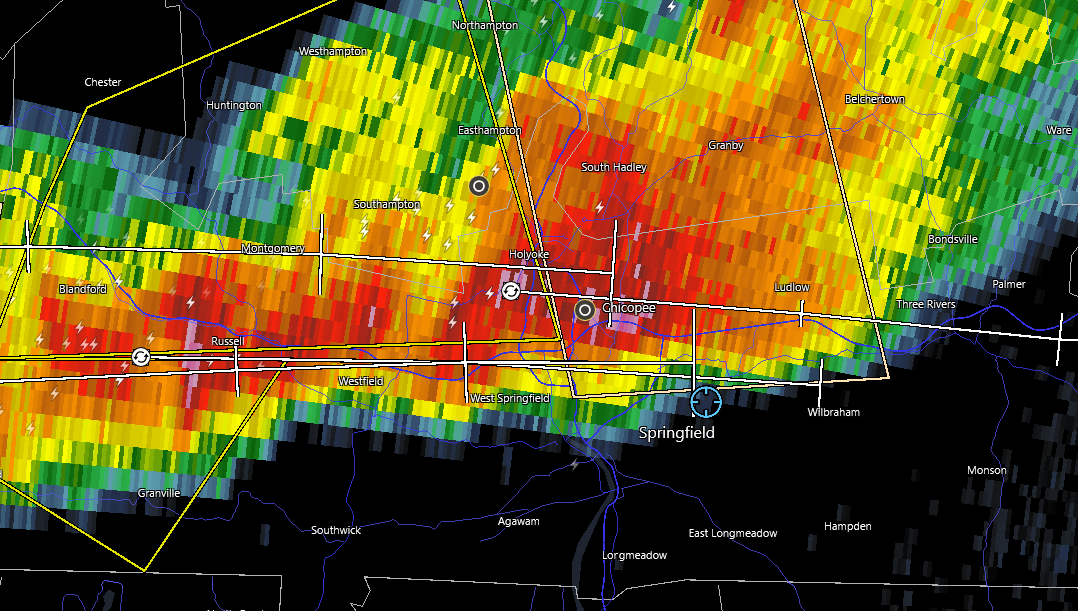
1.5'' hail marker over Westfield -
May 2024 Discussion - Welcome to Severe Season!!!!
weatherwiz replied to weatherwiz's topic in New England
let's go baby!!
-
May 2024 Discussion - Welcome to Severe Season!!!!
weatherwiz replied to weatherwiz's topic in New England
quite a bit of thunder here. crazy...blue sky looking east and off to the west is the clouds with the storms. -
May 2024 Discussion - Welcome to Severe Season!!!!
weatherwiz replied to weatherwiz's topic in New England
Just erupted into blue sky in Springfield with severe to my west. GOING TO BE POUNDED!!!!!! -
May 2024 Discussion - Welcome to Severe Season!!!!
weatherwiz replied to weatherwiz's topic in New England
decent rotation over Blanford -
May 2024 Discussion - Welcome to Severe Season!!!!
weatherwiz replied to weatherwiz's topic in New England
rotation over Otis -
May 2024 Discussion - Welcome to Severe Season!!!!
weatherwiz replied to weatherwiz's topic in New England
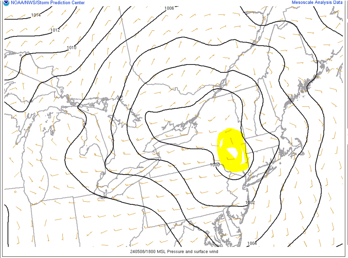
this may be the culprit
-
May 2024 Discussion - Welcome to Severe Season!!!!
weatherwiz replied to weatherwiz's topic in New England
rapid sky brightening here. it's like one of those dim lights where you slowly turn the knob to adjust the brightness and in this case its brightness up -
May 2024 Discussion - Welcome to Severe Season!!!!
weatherwiz replied to weatherwiz's topic in New England
Nice instability/thermal axis for any storms to ride up along. -
May 2024 Discussion - Welcome to Severe Season!!!!
weatherwiz replied to weatherwiz's topic in New England
The HRRR is intriguing. It has been pretty consistent. Satellite trends and mesoanalysis show WF progression. I'm still a little concerned about the degree of dry air, but we're not looking at widespread storms here. Looking at the potential for a few, mainly a tiny cluster and if updrafts can become mature enough there's plenty to tap into. -
May 2024 Discussion - Welcome to Severe Season!!!!
weatherwiz replied to weatherwiz's topic in New England
Normally I would just toss NAM temperatures but this is probably a scenario the NAM will coop well. We aren't going to probably mix well and be stuck with a onshore flow. Despite it being quite chilly aloft, if we were able to mix and get some Sun it would still be several-plus degrees warmer (probably to about what the GFS has). -
May 2024 Discussion - Welcome to Severe Season!!!!
weatherwiz replied to weatherwiz's topic in New England
Quite the difference in guidance with precip for tomorrow and especially tomorrow night. The 3km has a decent precip shield moving through overnight while its counterpart is like what precip lol. -
May 2024 Discussion - Welcome to Severe Season!!!!
weatherwiz replied to weatherwiz's topic in New England
That is definitely something I noticed as well. Happened on 5/31/98. Had multiple rounds of strong morning convection which I think cleared out by 9 or 10 AM and an hour or two later it was wall-to-wall Sun and temps pushing 90. Likely a product of an advecting EML in these setups. The stout inversion helps to eliminate the RH field, we get rapid clearing, and the inversion with the EML prevents CU from forming until we're able to bring in the forcing. Pretty awesome how it all works really. -
May 2024 Discussion - Welcome to Severe Season!!!!
weatherwiz replied to weatherwiz's topic in New England
ahh yes I have come across some info that the lake boundaries can act as an enhancer. I think there is a similar connection across western NY. I recall reading some studies which analyzed several tornadoes which eerily had nearly identical tracks. Also one big difference between MI and our area today is I believe they got into the warm sector whereas we won't. Also a bit early in the season here so the SE sfc flow (while aiding in the SRH) provides us with muck off the water. If we had this same setup in even another 3 weeks it probably would have been interesting. -
May 2024 Discussion - Welcome to Severe Season!!!!
weatherwiz replied to weatherwiz's topic in New England
That's super sad. That area of Michigan is rather wild. I don't know much about there climo but what is it that makes southwestern Michigan kind of a hot spot for these larger tornadoes? Is it just because of where they're positioned they tend to end up in a favorable overlap of high cape/shear with great forcing or is there some local terrain induced influences at play? -
May 2024 Discussion - Welcome to Severe Season!!!!
weatherwiz replied to weatherwiz's topic in New England
Some friends of mine from school were renting out a house in Newtown and a tree limb punctured a hole in the roof and they weren't able to stay there until it was repaired. Luckily there landlord had a friend who did that sort of work. His friend told him there were weeks long backlog of orders to remove trees from yards. In fact, he said it was so bad businesses we're turning people away lol. Lots of people in that industry got rich from that event. People were being quoted $15,000+ just to remove a single tree lol -
May 2024 Discussion - Welcome to Severe Season!!!!
weatherwiz replied to weatherwiz's topic in New England
That's when you put up signs, "free wood if you have a chainsaw" -
May 2024 Discussion - Welcome to Severe Season!!!!
weatherwiz replied to weatherwiz's topic in New England
wow I just realized the 3km (6z run) was wayyyy off with the timing of this morning stuff. But I guess it at least caught on to it. IIRC correctly it wasn't as enthused with this AM stuff. -
May 2024 Discussion - Welcome to Severe Season!!!!
weatherwiz replied to weatherwiz's topic in New England
It's been wild for sure, not just the amount of rain but with some of the rainfall rates observed. -
May 2024 Discussion - Welcome to Severe Season!!!!
weatherwiz replied to weatherwiz's topic in New England
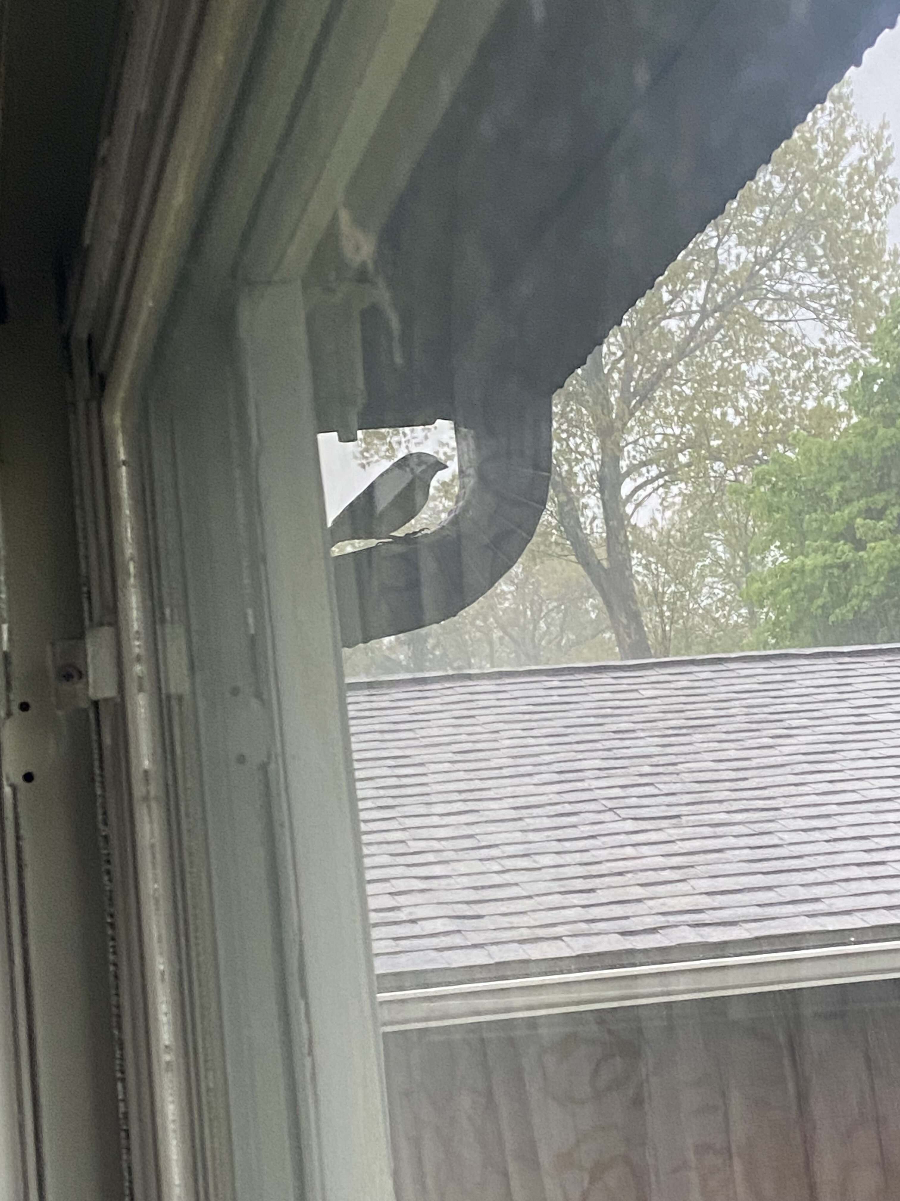
Bird taking shelter.
-
May 2024 Discussion - Welcome to Severe Season!!!!
weatherwiz replied to weatherwiz's topic in New England
It's pretty wild how dark the sky is. Looks like something you would see in a severe thunderstorm. -
May 2024 Discussion - Welcome to Severe Season!!!!
weatherwiz replied to weatherwiz's topic in New England
Crazy stuff around Kalamazoo, MI last night. Heartbreaking -
May 2024 Discussion - Welcome to Severe Season!!!!
weatherwiz replied to weatherwiz's topic in New England
It's an overall decent setup but I didn't like how much dry air arrives in the wake of this morning stuff. Though it does look like there is some moistening later this afternoon. Also looked like a bit of a cap around 600-400mb. There is two round potential today...this morning stuff and then potential for a few strong storms to develop later this afternoon.