weatherwiz
-
Posts
81,158 -
Joined
-
Last visited
Content Type
Profiles
Blogs
Forums
American Weather
Media Demo
Store
Gallery
Everything posted by weatherwiz
-
Wow...definitely ended up much more humid than I was expecting. I for sure thought we were going to see dews down into the mid 60's and highs generally mid 80's.
-
That time will be here before we know it
-
75% of the school day will be done by the time we get there. Also, don't schools do 1/2 on Wednesday's or is that not a thing anymore?
-
Those winds were like 60+ mph though and the ground was wet as were the tires/brakes. Brakes may not have been working very well.
-
80/71 at OXC so far. Hopefully they're managing the extreme heat in Waterbury well.
-
Couldn't have stated it any better It all is in good fun and quite frankly what else is there to really discuss? On the other hand though, I'm sure there are some who lurk and might be interested in learning more about weather and forecasting and I can't even imagine what's going through their minds lol.
-
I've grown to really hate the terms "above-average" and "below-average", at least pertaining to temperatures. First off, those terms means zilch to the general public and most probably don't even care. If location x has a climo high of 89 and it turns out to only get to 84...sure that is below-average but its still very warm. Look at like Montana or the Dakota's during their peak winter climo...departures could be like +30 and it doesn't change the fact that it is still cold lol.
-
I am so sick and tired of being tickled, teased, and tortured with these fake EML plumes. Done with summer...time to waive the white flag. All good things must come to and end. Ready for fall and winter and stupid 10:1 or Kuchera snow maps (depending on what is showing the most snow) for 220 hours out.
-
Ehh all that stuff about how bugs don’t bite or bees don’t sting unless provoked is total BS. I think I’ve been stung 5 times by bees. Every time except one I was doing nothing but minding my own business. The exception was during lunch at high school I was playing frisbee outside and it went into the bushes and when I reached in I got attacked by white faced hornets and was stung 6 or 7 times. Outside of that, I’ve always gotten stung doing nothing. I’ve never been stung swatting them away or swatting and running
-
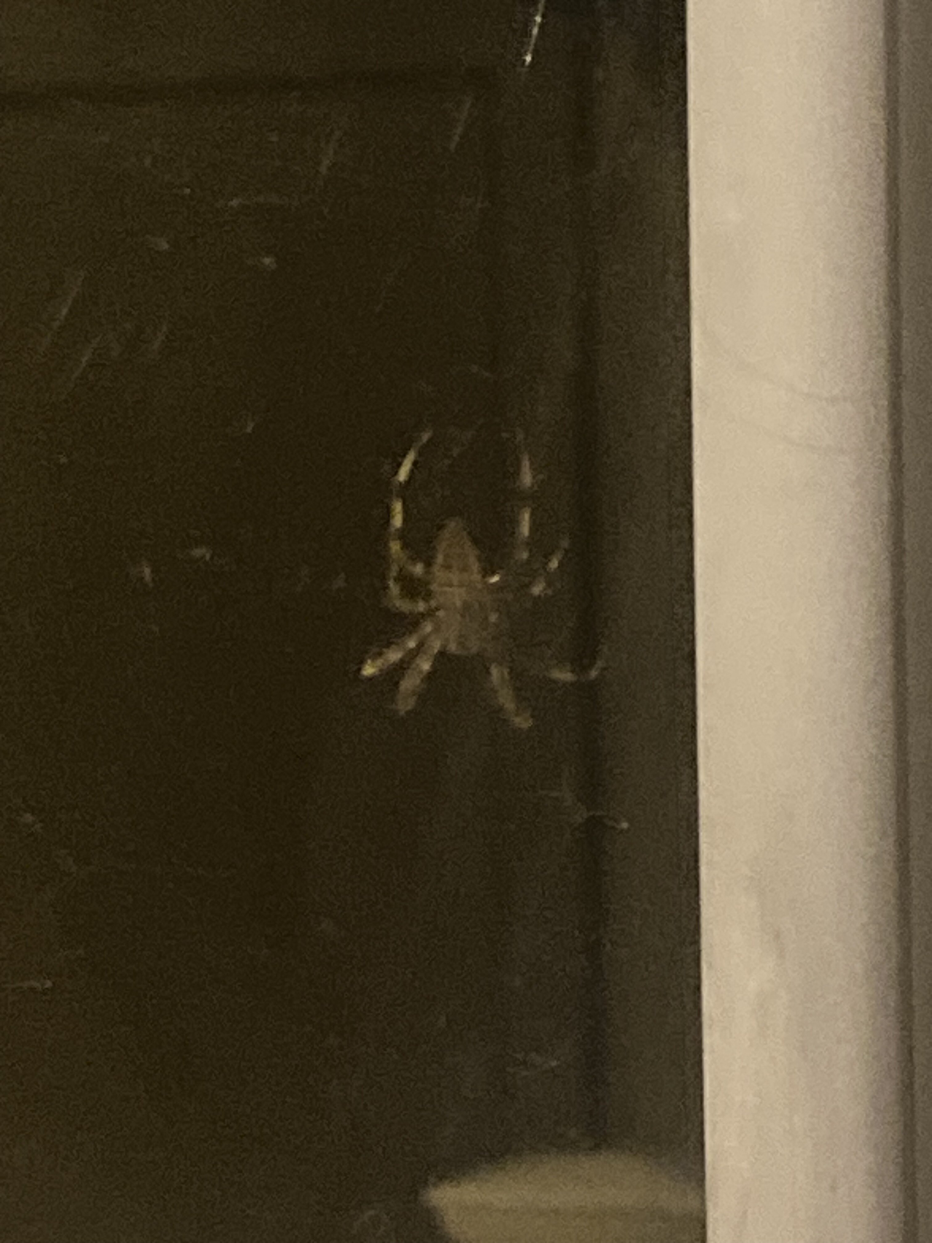
It’s outside but even if inside…that would be way too big for me to go near.
-
Ahhh crap
-
Bingo...exactly what my girlfriend has said when we discuss this stuff. She says its one of the most challenging things to not only prove but convince a jury on.
-
It's ridiculous. My girlfriend came across a story a few months back where someone is suing one of the candy companies (or trying too) because the candy didn't look exactly like the candy on the box or something. This is where we're at as a society...
-
Unfortunately, I think a large part of it is due to the fact that everyone is afraid of being sued and public backlash when incidents happen.
-
They probably looked at some stupid freaking iPhone app or asked their piece of garbage google AI. That's all everything is nowadays, stupid bullshit apps and rubbing AI like its an Aladdin lamp and the genie pops out, tells them an answer, and they just roll with it. Its sickening.
-
This is absolutely the most absurd thing I ever heard. I just don't get it. You have people in these positions who are responsible for making decisions and supposedly are supposed to be highly educated and yet make decisions which fire ants even laugh at. There is absolutely zero basis for this type of call. Whoever made the final call on this and whoever was involved in leading to this call all need to be fired. What a total freaking joke.
-
What makes this more absurd is its not even going to be super hot or humid tomorrow. I mean if the threshold for cancelling school because of temps in the 80's and dewpoints in the 60's school may as well not start until October 1 and end in May. It was Waterbury school...that district is very odd anyways but someone clearly is getting fed bad info.
-
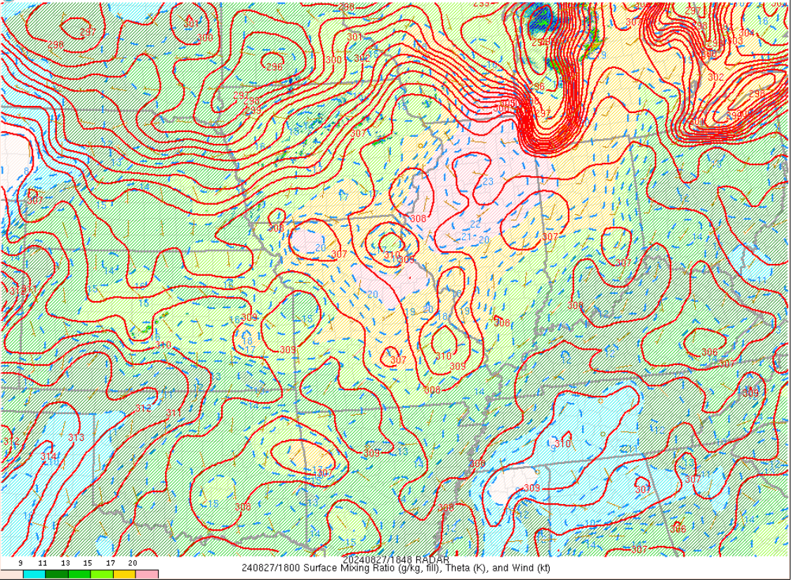
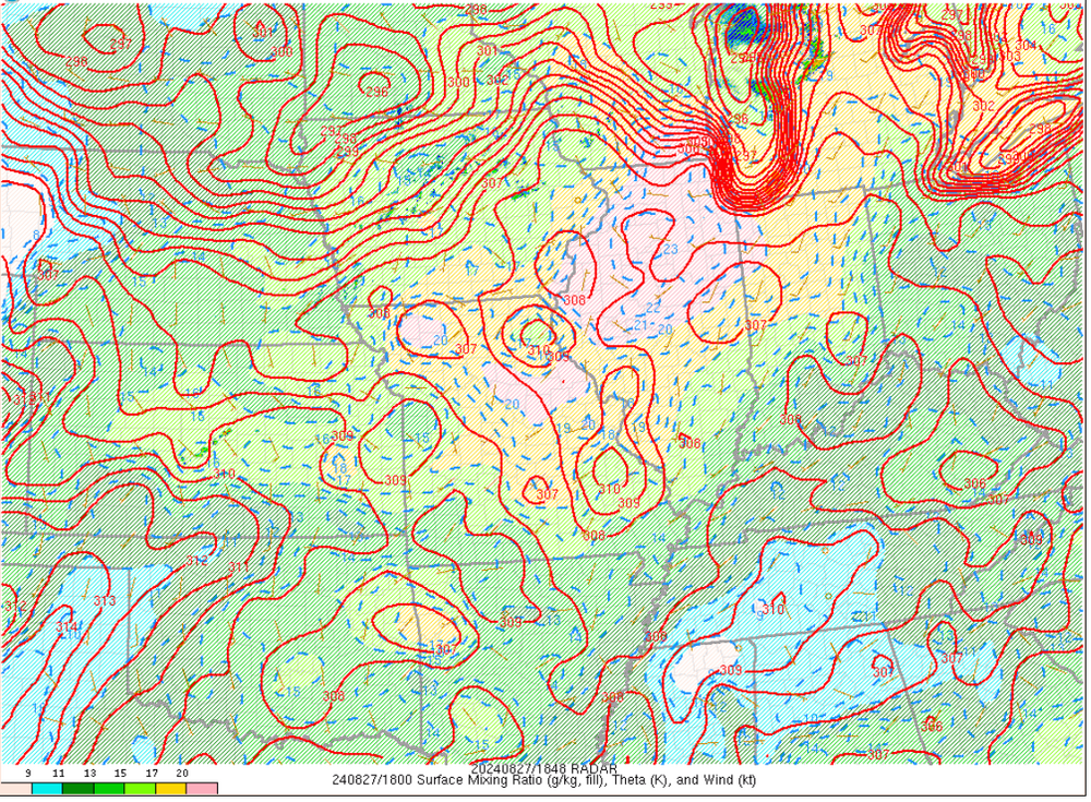
pretty insane theta-e across those parts and check out the mixing ratio.
-
that will be updated I think...there is no way anywhere in CT is sniffing HI of 100...let alone even 90 (except maybe the shoreline sniffs 90).
-
The sfc front though comes through pretty early...looks like by mid-morning. One of the reasons why the severe weather threat has been shunted even farther southwest. If anything, dews are going to be dropping through the morning. Hell, even the 850 front or boundary looks to come through early
-
It will be in the mid 80's and dews mid 60's lol. Did they not check for updates on the weather in the last couple days?
-
Just saw some schools in CT are having an early dismissal and cancelling after school activity due to expected "extreme heat" tomorrow. Extreme heat...
-
Looks like a decent little winter weather event for Glacier National Park/some of the surrounding mountains in Montana tomorrow.
-
Sunday could definitely be up in the air. If we get lucky, the FROPA occurs overnight and most of the rain/thunderstorm activity is evening/overnight with the front pushing off the coast Sunday morning, yielding improving conditions as the day progresses. However, there is potential the front gets hung up or stalls and that would yield a very shitty Sunday.
-
Many in Connecticut will always despise him for using Hartford as a means to get the new stadium in Foxboro. There are a ton of people in Connecticut who hate the Patriots because of this and stopped rooting for the team.