weatherwiz
-
Posts
79,820 -
Joined
-
Last visited
Content Type
Profiles
Blogs
Forums
American Weather
Media Demo
Store
Gallery
Everything posted by weatherwiz
-
My nose is in the shop
-
ughhh Albany's radar is down. Can't find any status messages either.
-
Should get a few storms to chase today! Kind of intrigued by Sunday, though timing looks meh
-
Yes…got exactly what we were hoping for today
-
Went back up to Lee. Saw some lightning and had thunder! Rain was insane. Got to the Mass Pike and in Blanford now awaiting the heavy rain again
-
Yup haha should have stayed
-
Re-positioned to Canaan, CT
-
Should see a line of rain and storms get into far western CT. Nothing will be crazy today
-
Actually it’s only 50 minutes away
-
leaving now. Lee only just over an hour away
-
Thinking of going to Lee and then making a move from there. A little worried Albany may be too far north...especially since we'd prefer Troy since its a bit more open. May see some storms get into western Mass later on
-
Is this a true story?
-
Thinking of going to Troy, NY (or just east). Been there before...very open and a direct route into southern VT. Tough call where to go but certainly somewhere in eastern NY. North may be better just due to proximity to better forcing/dynamics but south may be more unstable.
-
yikes
-
I think there will be a few decent storms up this way tomorrow...just going to have to get lucky and hope we pick the right spot
-
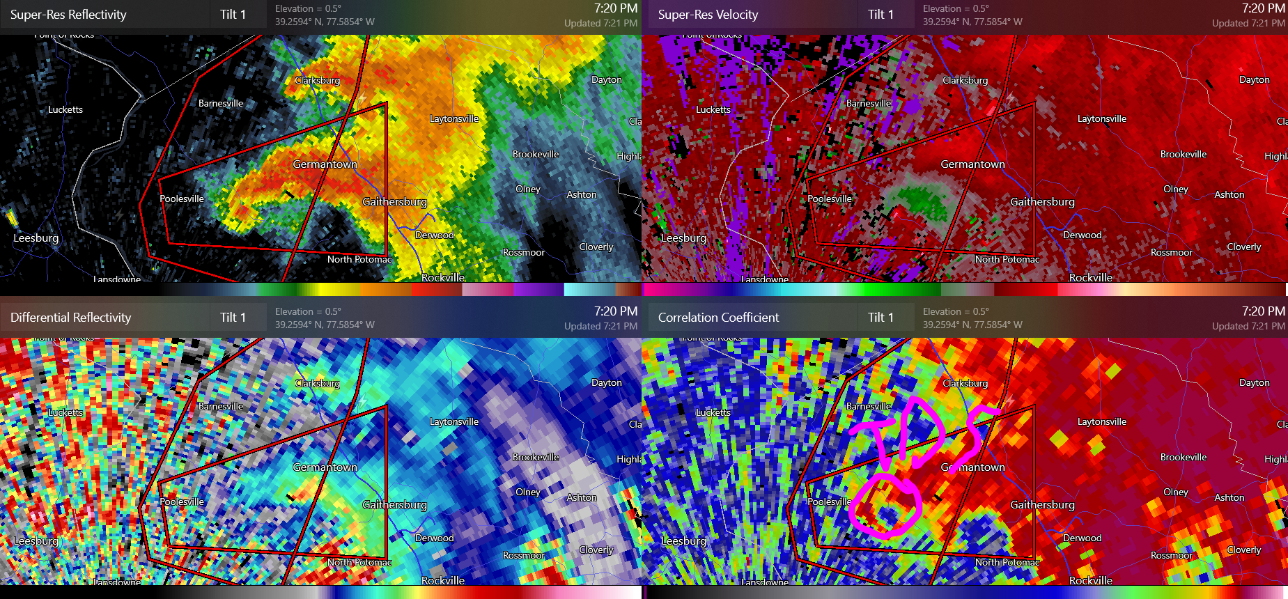
If this holds its headed towards Gaithersburg where population is ~68,000
-
Very good overlap of shear/instability along the warm front and likely some terrain enhancement. Sometimes with these warm fronts even a blind nut can find a squirrel
-
-
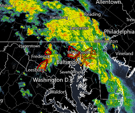
that one west of BWI is pretty wild
-
A circle of tornado warnings around Baltimore
-
was going to go to SE NH today too damn
-
Looks like another year my friend and I will get zilch to chase. We've been doing the last week of May and first week of June since 2009 but starting last year we moved it to the first two weeks of June. Hoping for at least some thunder tomorrow. May have stuff over the weekend. At this point just looking for storms, severe isn't happening.
-
fair trade off
-
This is ridiculous. With climate change these critters are going to become a problem. Pretty soon we'll be housing back widows, tarantulas, brown recluses, and those massive Australian dinner plate sized spiders. What does climate change have to do with this? Well these spiders that get brought here will be able to live in our ever warming climate. It's going to get ugly with these bugs.
-
targeting Albany area for Thursday