weatherwiz
-
Posts
79,820 -
Joined
-
Last visited
Content Type
Profiles
Blogs
Forums
American Weather
Media Demo
Store
Gallery
Everything posted by weatherwiz
-
I thought we would at least see a confirmed tornado or two as well. But I think the premise of everything worked. We were really only going to see several cells that really had potential. That initial stuff west of Vermont I think went up a bit too early and it prevented better heating. I remember seeing mesoanalysis only showing like 1000…maybe 1500 MLCAPE at the time. If there had been 1500-2000 it would have been different. But we all know/knew what the lack of EML meant in this setup. I always find these setups intriguing though because sometimes they will produce and sometimes they won’t. And that’s what really drives my interests in Convective weather because what really is that differentiator?
-
I think today went pretty exactly as expected.
-
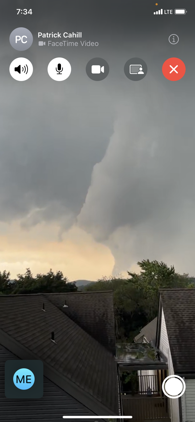
FaceTiming with a friend in Danbury and got this

-
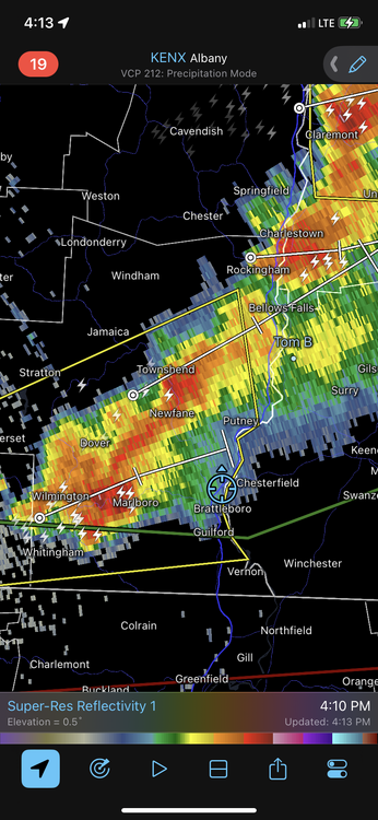
Back home in Springfield. After the storm passed in Brattleboro, I elected to go south and try and get to BDL for the cell coming into Connecticut. I debated on following that storm across southern New Hampshire, but not familiar with the road network and I always prefer to be at a spot setup ahead of storms rather than following them. Unfortunately, I was not going to make that cell into Hartford and as soon as I pull into my driveway it gets the TOR. Second day in a row the strongest rotation is over West Hartford lol. Fun storm though...had a barrage of CGs and loud thunder and three seconds of hail. I was thinking of going to Chesterfield and I saw there was a 1.50'' hail report.
-
Might head back towards bdl
-
Only lasted like 3 seconds ughh
-
Hail!!!!!!!
-
Just had a massive CG in front of me but camera was off because I changed spots
-
Lots of thunder
-
Made it here we’ll see what happens
-
Going to chesterfield
-
Yeah this MLCIN is kind of a killer right now. And back to socked in with clouds here. This could end up being better off to the south lmao
-
After this stuff pushes east I wonder if I should head back south in the event stuff blossoms over MA/N CT
-
I’m feeling good about my spot!!! Sun is peaking out too in Walpole, ahead of the exploding supercells
-
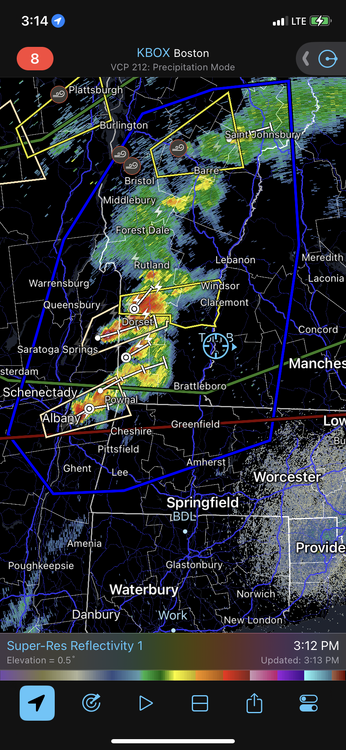
Just made it to Walpole, storms really firing. Think I’ll just stay put here. Good viewing spots around here
-
LET'S GO!!! making the move to New Hampshire shortly.
-
I'm really watching those dewpoints because they will certainly factor into development today. Lots of stations into the lower 70's for dews. I still think there may be some dewpoint pooling later and we see dews in the 74-76 range. If those dews can get into S NH and any discrete cell can get going...yikes.
-
High-end severe is certainly difficult to obtain here, especially on a widespread scale. It's so difficult to advect an EML into our region and it's even more difficult to time it with an advancing shortwave/front.
-
I would go up 91
-
I still think we'll see 2 or 3 very nasty cells, its just a matter of where they occur and whether anyone going out can get lucky enough to catch em
-
yeah right. Now sure I want to go that far north though but we'll see how things are starting to look.
-
The hi-res models are all over the place though for today and I'll say...not a huge fan of how the HRRR has been trending.
-
I was a little shocked to see the enhanced expanded south some given the trends through the day yesterday and 0z guidance. But all the ingredients are there so I can see why it was expanded.
-
maybe some stuff later in the evening/overnight but nothing outside of showers and maybe some thunder
-
Thank you! If I end up that way I will head there.