weatherwiz
-
Posts
81,150 -
Joined
-
Last visited
Content Type
Profiles
Blogs
Forums
American Weather
Media Demo
Store
Gallery
Everything posted by weatherwiz
-
It can either be pretty amazing or complete an utter crap. But yeah its generally a useless month and its exacerbated by the fact that everyone has spring fever by now and fed up with it. You know nicer times are right around the corner but the corner seems millions of miles away lol.
-
April is the new November
-
Greens could get smoked Friday night into Saturday
-
clouds breaking quickly, finally into some sun.
-
Big fluffy flakes now
-
Heavy snow shower here. Went from nothing falling to coming down pretty good...squall like. Ground coating up
-
Can't wait until we get this more consistently.
-
You're better off wearing a sign that says, "kick me"
-
Not a winter jacket...just a light zip up
-
Only need one jacket outside today
-
Do you wish you still lived near Little Rock @H2Otown_WX
-
Little Rock going to be rocking later
-
Several at least
-
56 knots at IND!!!
-
OMG
-
well it stopped now...had some pinging against the window but it stopped.
-
Nuts
-
sleet falling here
-
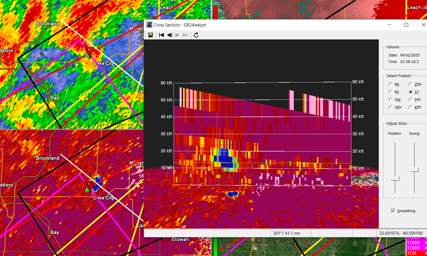
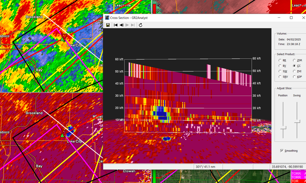
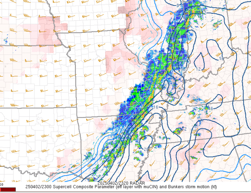
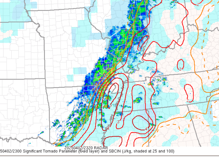
Crazy supercells getting going. Not good for western Kentucky and Tennessee.
-
-
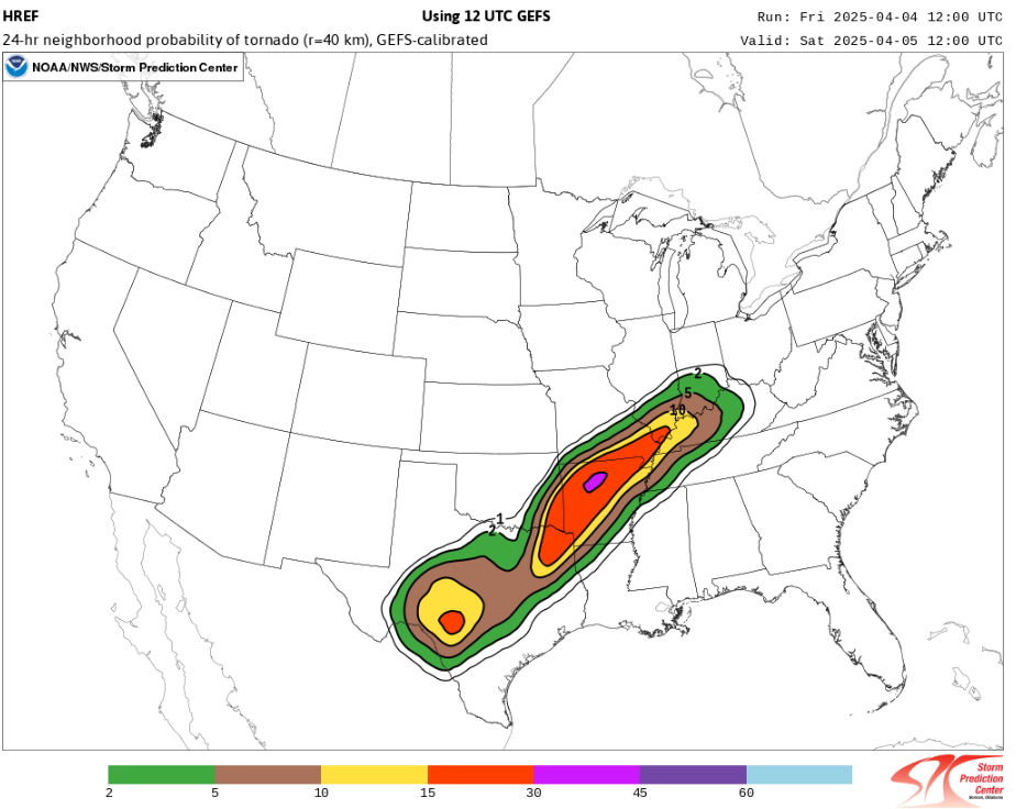
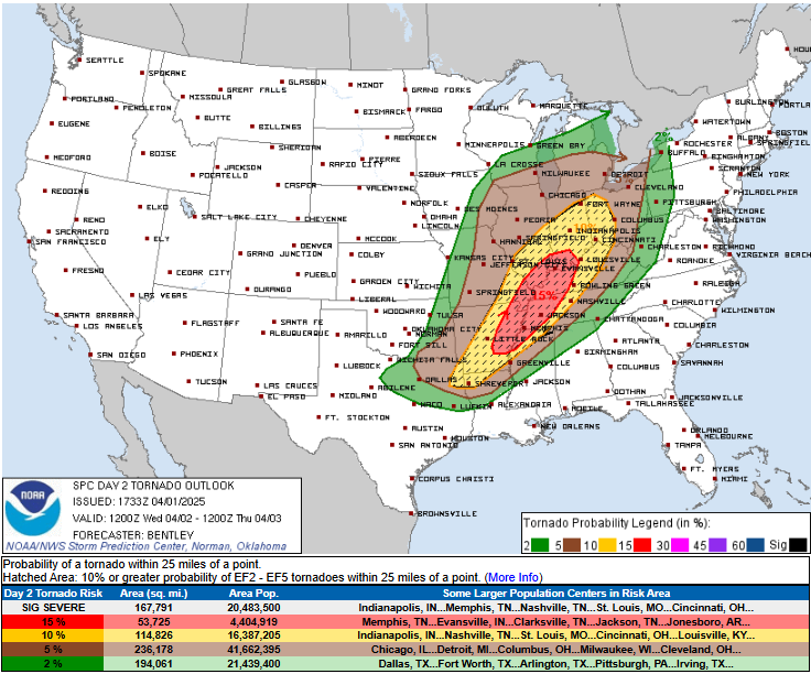
I can’t believe the rainfall totals being spit out by guidance. A widespread 8-12”. Given how much convection will be involved I bet there will be some locations that pull of 20”.
-
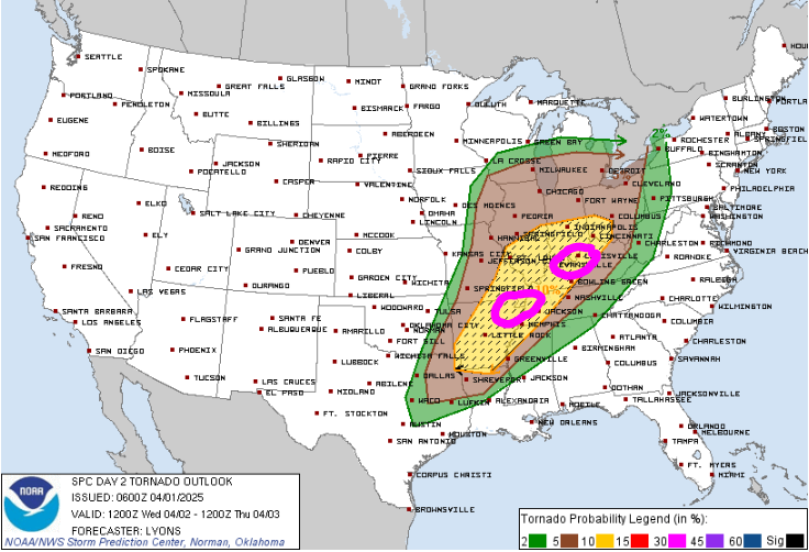
Wow PDS Flood Watch for parts of KY/TN/AR/MS. I don't ever recall seeing a PDS Flood Watch...?
-
Saturday is going to struggle to warm sector. Don't think anyone in New England warm sectors. Sunday most should warm sector but it may take some a while.
-
A little off but not bad
-
Yeah this is looking ugly within western Kentucky. I would not be surprised if there were spots that saw 15-20" of rain.