
weatherwiz
-
Posts
81,965 -
Joined
-
Last visited
Content Type
Profiles
Blogs
Forums
American Weather
Media Demo
Store
Gallery
Everything posted by weatherwiz
-
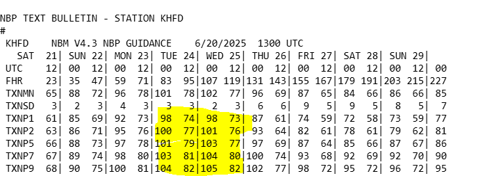
What I think also gives this more support is the NBM doesn't look to be overmixed wither...still has upper 60's to lower 70's dewpoints. The NBM tends to be lower with dews. I guess though if we end up seeing dews more 72-73 versus say 68-71 then we may be more 99ish versus 101-102ish.
-
Here are the percentiles. This is a pretty damn good signal for highs to get into the 100's in the hottest spots. Not sure how much this applies to our area but in these anomalous heat patterns...those 70th-90th percentiles usually work out. This has with some of those big heat events within the West anyways...again not sure if that can be applied here.
-
I'm waiting for some trees/limbs to start snapping.
-
Brutal. The 3km pretty much nailed the whole evolution in the midwest the day prior while the HRRR was awful...I thought maybe that was a good omen for yesterday...nope. The pre-frontal really screwed us yesterday and not having the steep lapse rates as advertised. Maybe if we did have the steep lapse rates that stuff with the pre-frontal would have been more intense.
-
These gusts are insane. Have to be gusting 40-45
-
Clouds quickly leaving here...getting into strong sun now!
-
ahhh...I thought that looked extremely odd when I saw that. I didn't catch there was an error.
-
I was shocked seeing this
-
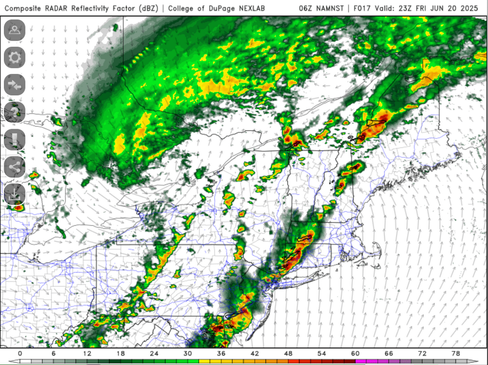
Could be a wild evening and early overnight that way, probably a 1-2 hour window for some big TORs too.
-
It actually kind of sucks. Figured I'd work outside and wear shorts today but its cloudy and cool. Put on a little light jacket and may have to switch to long pants.
-
3km has some violence later today
-
so the HRRR screws up in the midwest but then it ended up being spot on for here (talking about how yesterdays runs didn't show much). SCREW YOU HRRR
-
eh screw it...just going to go home. nothing else looks like it is popping and the stuff going on is coming down
-
Not a bad idea, but traffic may be miserable getting there lol
-
Probably going to go hang in North Branford for a bit in the field next to police station. It's a nice open spot. But that still may be just a bit too much into marine influence. Maybe I'll do Wallingford.
-
Yeah 6.5 C/KM is respectable. Of course steep lapse rates aren't a requirement for severe weather, they are when you're talking about the potential for widespread and high end severe weather but you can still get severe with weak lapse rates, its just more very localized and typically not high end.
-
Yeah we see stuff pop more easily but the trade off is weaker activity. This is why pre-frontal troughs hurt us more often than not...once we get the convective temp reached we start popping too early. This is one reason why those EMLs are so important. they keep a lid on things until the strongest forcing can arrive
-
probably producing hail west of Bristol
-
ughhh I think it has ticked east a bit...maybe be along the NY/CT border. well at least we'll start seeing more pop
-
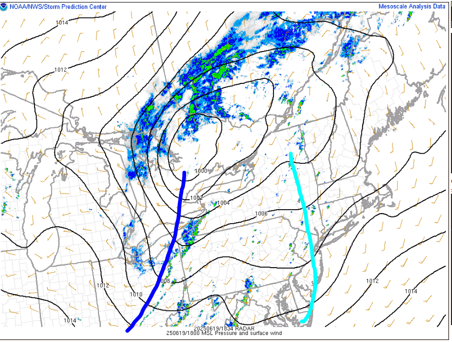
poor mlvl lapse rates and the forcing still too far west. I'm wondering if maybe the pre-frontal trough can stay a bit stationary if that can allow for a bit of a boost in a few hours but it probsly shunts east
-
It's headed towards Springfield and I'm in Branford
-
right on cue
-
ifthat sucker can strengthen that may become a supercell
-
I'd watch that cell headed towards NW CT
-
Curious to see what happens between 3-6 PM. The forcing is still pretty west and even seems a few hours slower than what was modeled. But dynamics are increasing a bit and we're backing the sfc winds somewhat, at least locally. The pre-frontal trough is pretty east though...once that goes through maybe we can keep enough instability for some scattered stuff with the front early in the evening