weatherwiz
-
Posts
81,342 -
Joined
-
Last visited
Content Type
Profiles
Blogs
Forums
American Weather
Media Demo
Store
Gallery
Everything posted by weatherwiz
-
 May see a decent line of storms move through Saturday evening...probably some decent wind potential. maybe even a TOR
 -
depends on the hot dog
-
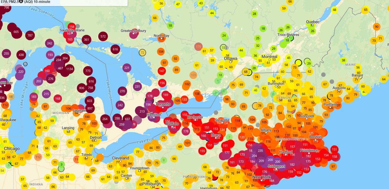
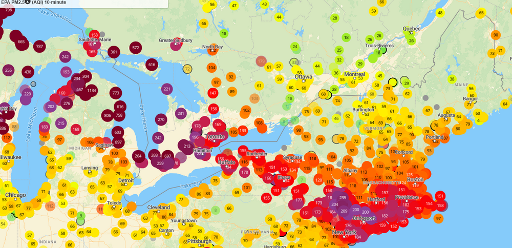
Insane AQI back over the Great Lakes. Can't imaging what values tomorrow will be down this way.
-
need charmin today
-
Just went outside to grill hot dogs for lunch and wow the smell is insane. Combination of smoke and ass.
-
wonder if any spots come close to dense smoke advisory tomorrow
-
Was it 2002 when we had the wild smoke from the fires around Montreal(?). That was nuts
-
So dark I may have to put a light on. Its super spooky out...makes me want to go out, carve a pumpkin and sit it on my desk
-
I do recall something
-
yeah and those values are absolutely nuts. Off the scale that pivotal has lol
-
If I remember correctly too, some of the research on wildfires and influences on severe weather events is also based on the source of the wildfires (i.e. what is burning). Different burn sources are going to release different particulates into the air. And I think there is a big difference between what is burnt/released from Canadian fires versus what is burned and released within the western U.S.
-
Be curious to see where we end up with for temperatures today. I don't think statistical guidance (MOS/NBM) factor in smoke so you almost have to guess how much to take off them for temps. Almost may have to subtract something like 7-12F
-
Really wondered what would have happened if we didn't have the influences of the smoke yesterday.
-
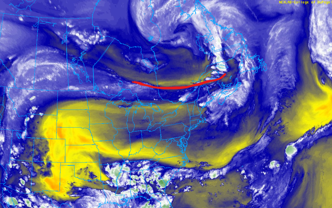
Tomorrow looks like it will be very bad for smoke...even worse than today
-
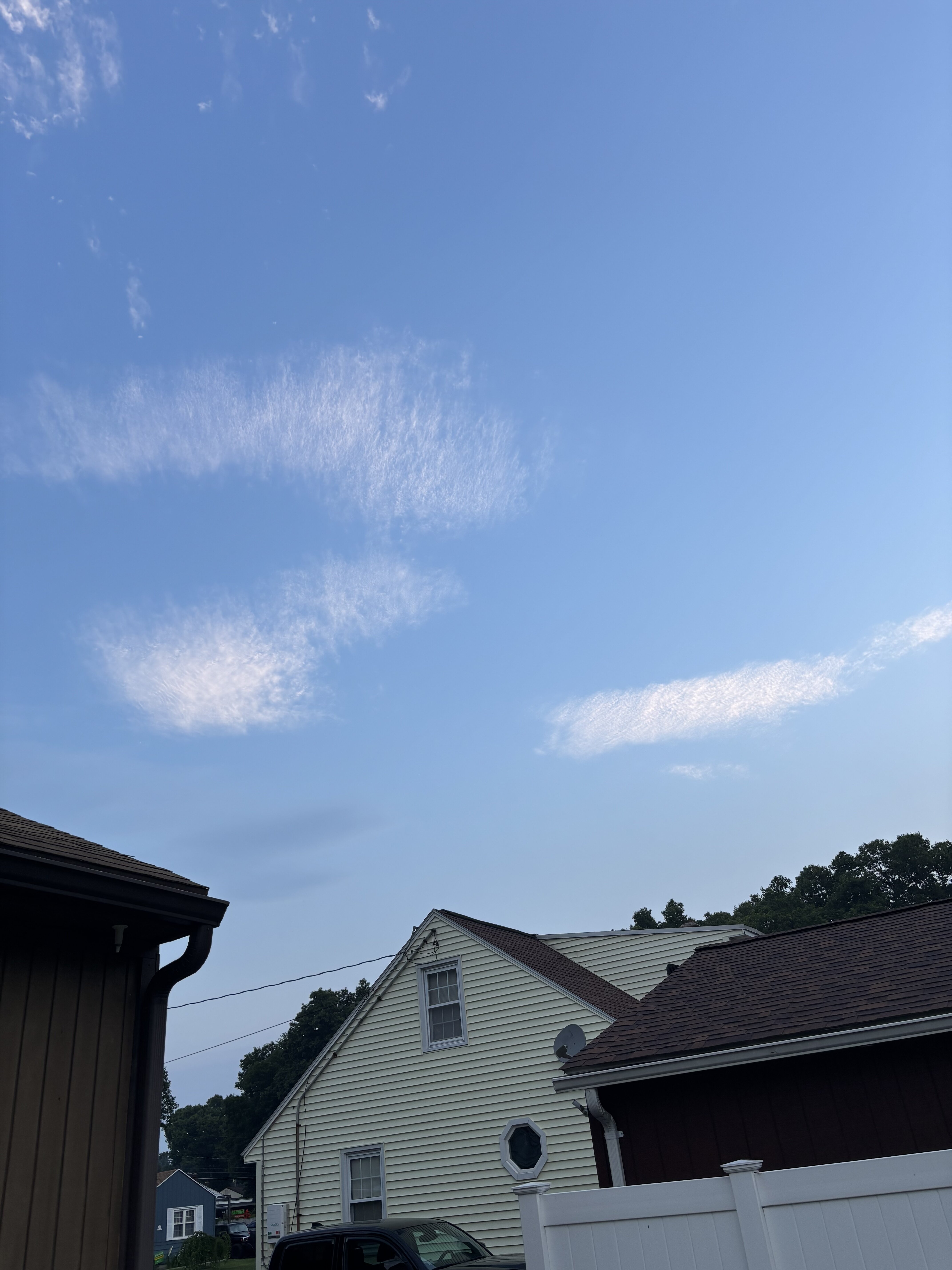
Took a snap around 5:45 before the smoke starting moving in

-
13 hail reports >= 1.25" last night. That's pretty damn impressive for the region
-
Friend of mine saw some trees down about 4 miles north of Bellows Falls on 91
-
might be what to watch for upstate NY/VT in the next 3-5 hours
-
I'd watch the 10:00 PM - 1:00 AM window. If the HRRR is right with that evolving cluster there may be some significant wind damage (assuming storms can root surface-based). That's some insane DCAPE values Very high derecho composite parameter too. Suggestive of increased potential anything becoming organized may develop an organized cold pool, enhancing wind potential.
-
The main show was always supposed to be after 7-8 PM lol. Anything before then was tied into the potential for discrete supercells. That obviously didn't happen because of the cloud debris/smoke and just too much capping to over come. But you have the front and shortwave moving into the environment. Things are going to take off
-
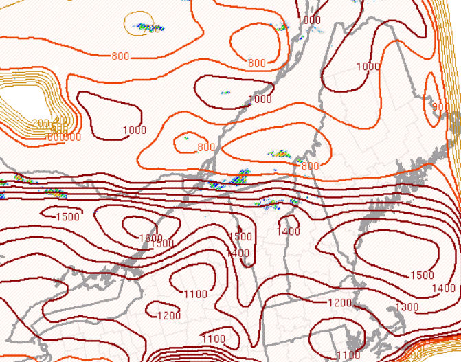
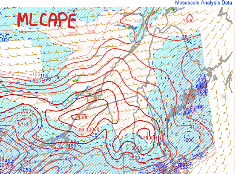
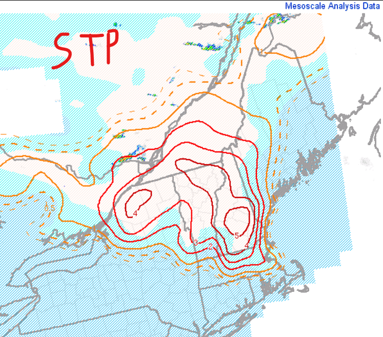
Front/trough continue advancing south EML shunting south so cap up north so that will help weakening the capping MLCIN all but eroded with values >3000 J/KG Getting activity going...I would think things really begin taking off in the next couple hours. Don't see STP values like this here very often and these may be amongst the highest that would exist in a database if such one existed

-
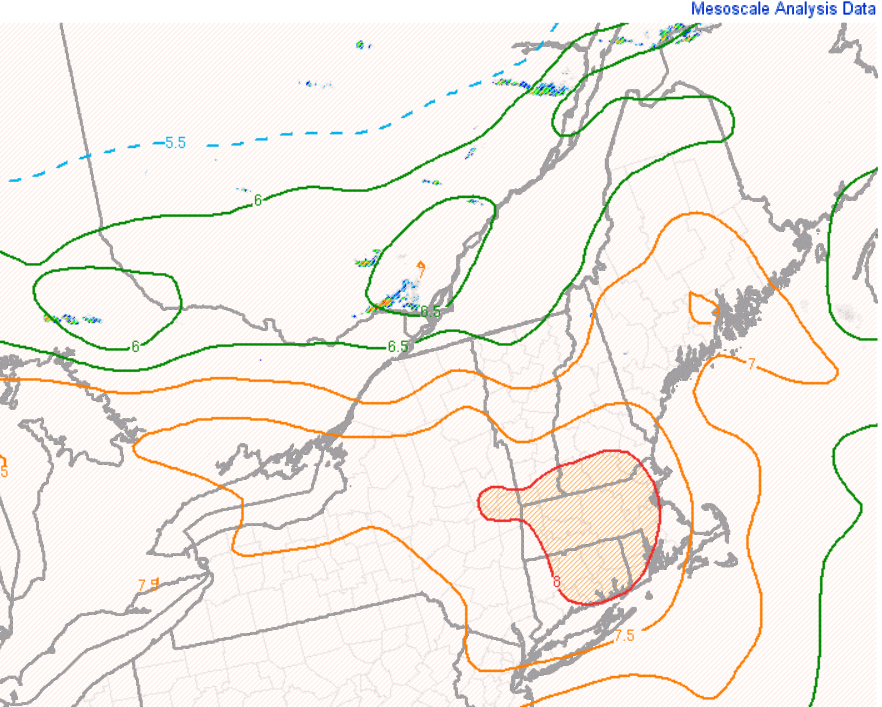
This is probably going to be the area of focus. Mesoanalysis (using the RAP) erodes SBCIN and MLCAPE in this region over the next 2-4 hours
-
18z NAM gone wild in upstate NY. That hodographs is nuts. About as perfect of winds turning with height as you'll see lol...maybe would want just a tad more southerly component to sfc wind. But over 4000 J of MLCAPE in this kinematic environment
-
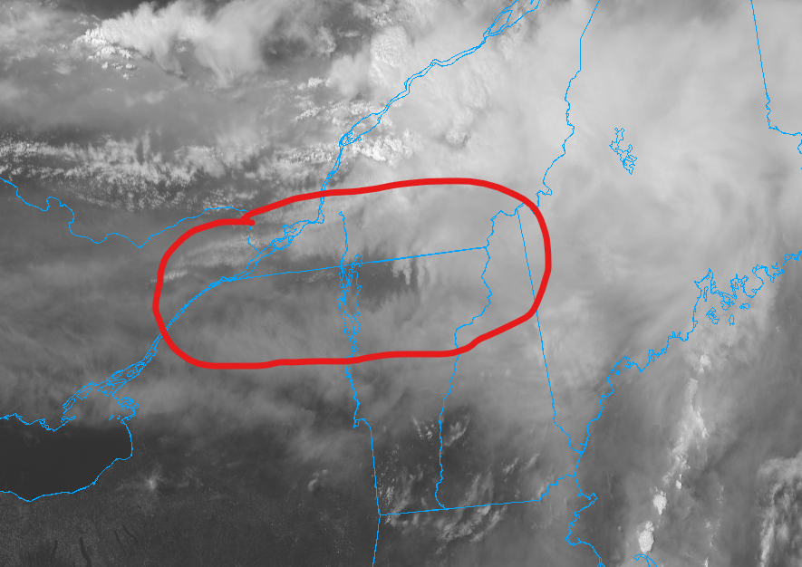
whoops... Not the first time a part of Maine has been in 10% tor, first time for 10% hatched. But this is the farthest north for 10%. @Winter Wizard I think posted a map a page or two back showing the data from Iowa St
-
@CoastalWx post earlier about watching southwest of where SPC has is looking good. Hourly runs of the HRRR are beginning to get a bit more aggressive with activity back across upstate NY, northern VT, and norther NH. Stuff may even get closer to central VT/NH. May see a southward expansion of the enhanced at 20z