Here's the deal.
2005 was an epic, historically rare meteorological event. Windspeed and I were actually hanging out at a hurricane conference in Florida in May of that year discussing the abnormally low wind shear, excessively hot sea surface temperatures and a satellite image of the Atlantic basin on May 17, 2005 that looked more like a satellite for mid-late July. We knew it would be crazy, and coming off the ravaging of the 2004 hurricane season, the anticipation was higher than you can imagine. I actually remember Windspeed telling me, "Mike, I think we may eventually see a Hurricane "Mitch" type storm with 180 mph winds in the Gulf of Mexico in the next few years...maybe even this year with those crazy SSTs." The fact that Hurricanes Katrina and in particular Rita then rivaled Mitch in the Gulf just 3/4 months later was unimaginable. I also remember us discussing the likelihood of a major hurricane in July, since conditions already seemed so prime. Little did we expect two hurricanes of Category 4 and 5 intensity ravaging the Western Caribbean, Mexico, Cuba and Florida by July 20th.
Almost 30 named storms? Four Category 5 storms? Give me a break. I was 17 years old. I might see that again if I'm an old man with a huge head of white hair. 2005 was an epic season not seen since 1933. That type of year is almost unbelievable. The chances of it happening even during hyperactive seasons is unlikely.
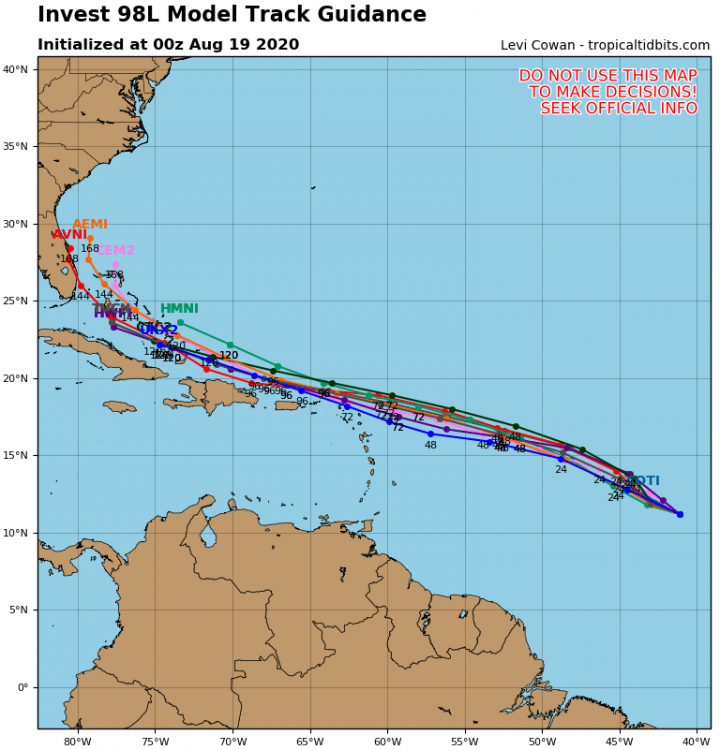
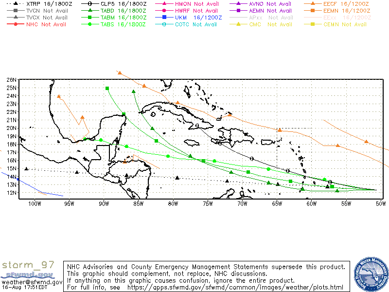
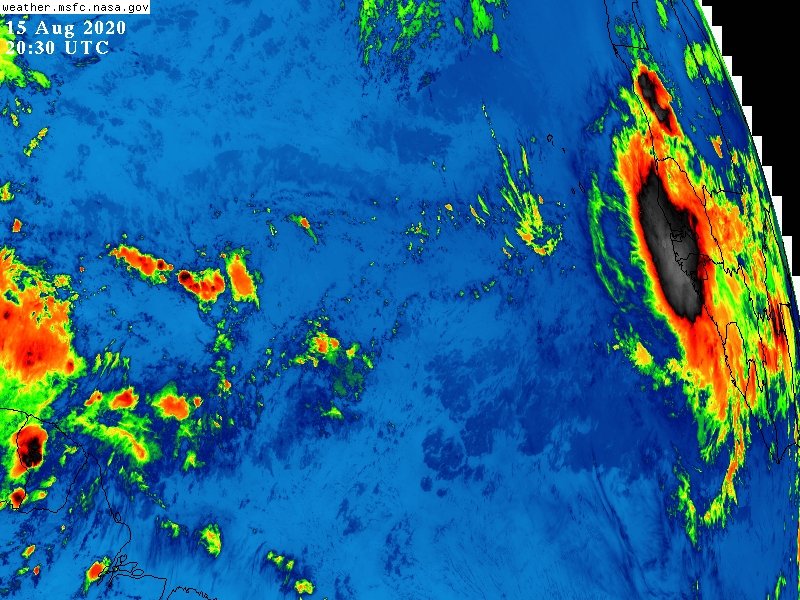
1. This has been, and looks to be, a very-severe record breaking hurricane season. This is backed up by the fact that we have outpaced the records of 2005 for number of named storms, have extremely high oceanic heat content anomalies, forecasts of very lower-than-normal wind shear during the heart of the season, above average rainfall over Africa, and a likely extremely favorable MJO push from late August through mid-September. Add to this what appears to be a possible troublesome pattern for U.S. landfalls including having already seen the landfalls of two potent hurricanes and three tropical storms, this season is ringing alarm bells. Indeed, I believe this is the first time Dr. Klotzbach has forecast the Greek Alphabet since we used it back in 2005.
Even if we didn't name two or three weak and short lived storms (Bertha, Dolly and Edouard), we would still be tracking the "G" storm, which would put us at roughly the level 2005 had at this point. So while it's not "2005" just the fact that it's rivaling 2005 in the number of named storms is disturbing because of how active that means things are.
2. Intense Julys aren't always harbingers of active seasons, but they often are. 1996 had two July hurricanes (Bertha and Cesar, one a major hurricane). 2008 had two July hurricanes (Bertha and Dolly, one a major hurricane). Those years ended up very destructive with infamous storms like Hurricane Fran and Hurricanes Gustav, Ike and Paloma. However, 2005 was different. In July, we had two major hurricanes, both were 130 kt+ Cat 4/5 storms, and one hit the U.S. as a major hurricane. The historical significance of Hurricane Dennis cannot be underscored enough. Dennis was the first major hurricane to strike the U.S. before August since Audrey in 1957, 48 years prior. That's almost five decades, half a century. Not only that, but the last time a July hurricane struck America as a major Cat 3+ was a 1916 Gulf Coast storm 89 years before. Before that, it was the 1909 Velasco hurricane, 96 years before.
That should show how rare an event a July major hurricane landfall in the United States is. If you average out the four major hurricanes that hit the U.S. before August in the last Century,
1909, 1916, 1957, 2005
The mean and median of those years are 32 and 41 years, respectively. That means, on average, those events happen once every 30 or 40 years. Three times in the 20th Century, once (so far) in the 21st. Dennis was a rare event, and it made 2005's July much more severe than 2020. However, just the fact that we had two hurricanes make U.S. landfall before mid-August is quite intense, and I actually think Hurricane Hanna was an impressive storm. 973 mb, well defined eye, and a fierce battering for the Texas coastline. Isaias was also no puppydog.
The bottom line:
No two hurricane seasons are exactly the same, and 2005 was a rare event. However, that doesn't downplay the amount of pre-August activity we've had so far, and the indications that 2020 will be a very active peak season.