Ralph Wiggum
-
Posts
17,384 -
Joined
-
Last visited
Content Type
Profiles
Blogs
Forums
American Weather
Media Demo
Store
Gallery
Everything posted by Ralph Wiggum
-

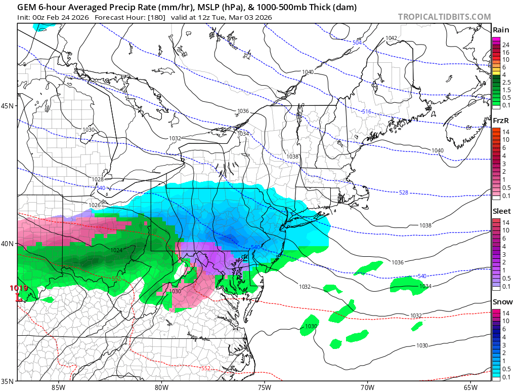
E PA/NJ/DE Winter 2025-26 Obs/Discussion
Ralph Wiggum replied to LVblizzard's topic in Philadelphia Region
March 2-3 window still looks interesting: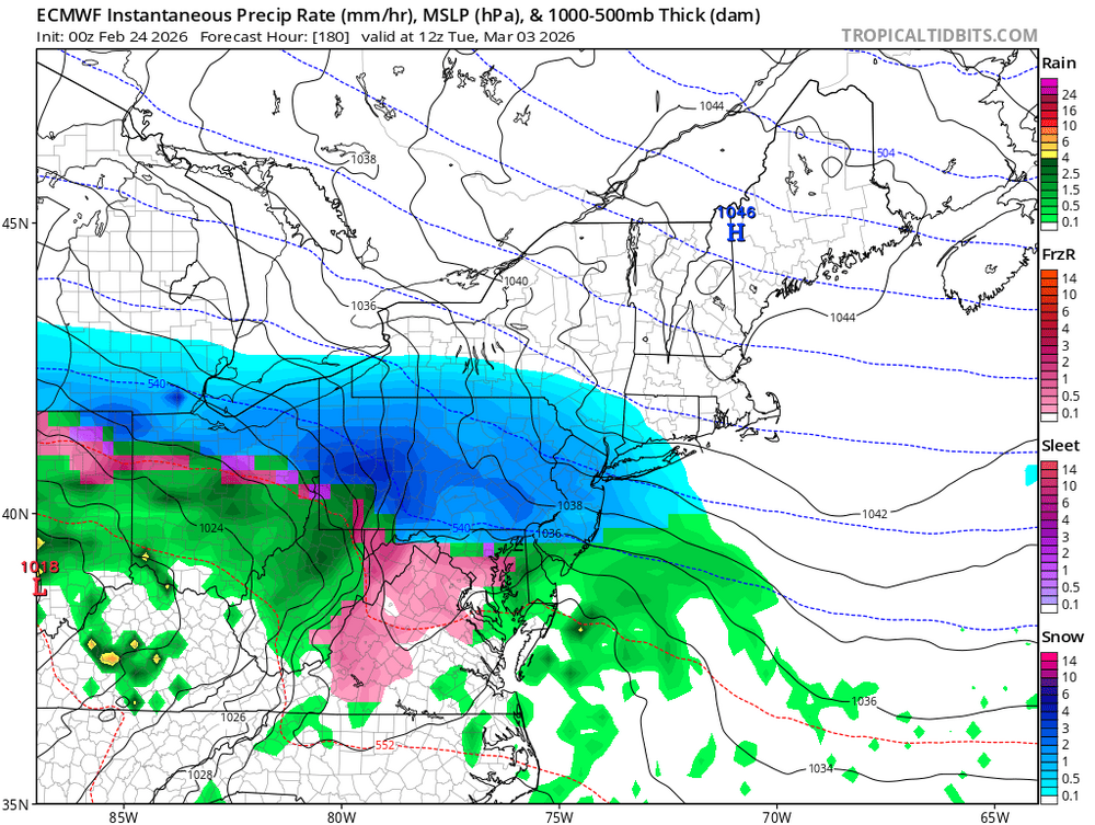
-
Blizzard of 2026 Storm Thread/OBS
Ralph Wiggum replied to Mikeymac5306's topic in Philadelphia Region
Who would have thought the Blizzard of 78 wouldnt just be surpassed but SMASHED!?! -
Blizzard of 2026 Storm Thread/OBS
Ralph Wiggum replied to Mikeymac5306's topic in Philadelphia Region
Something is amiss with the trained spotter report for Warminster. Mid morning the Warminster spotter showed 13.5"......but with the final total is showing 13.2"? How do we lose accumulation? Just as a side note, there was a wild gradient across parts of Bucks County....Western Warminster was 13.5"....2 miles east in Ivyland I reported 18"....another 2.5 miles East in Richboro they reported 22". Thats an 8-9" difference in under 5 miles. Crazy stuff. -
E PA/NJ/DE Winter 2025-26 Obs/Discussion
Ralph Wiggum replied to LVblizzard's topic in Philadelphia Region
I will not turn my nose to a c-2" Wed AM followed by a 1-3" refresh Friday AM. Then we look to the March 2-3 window. -
E PA/NJ/DE Winter 2025-26 Obs/Discussion
Ralph Wiggum replied to LVblizzard's topic in Philadelphia Region
Narrow stripe of 3-5" NE MD, N DE, S/CENT NJ. -
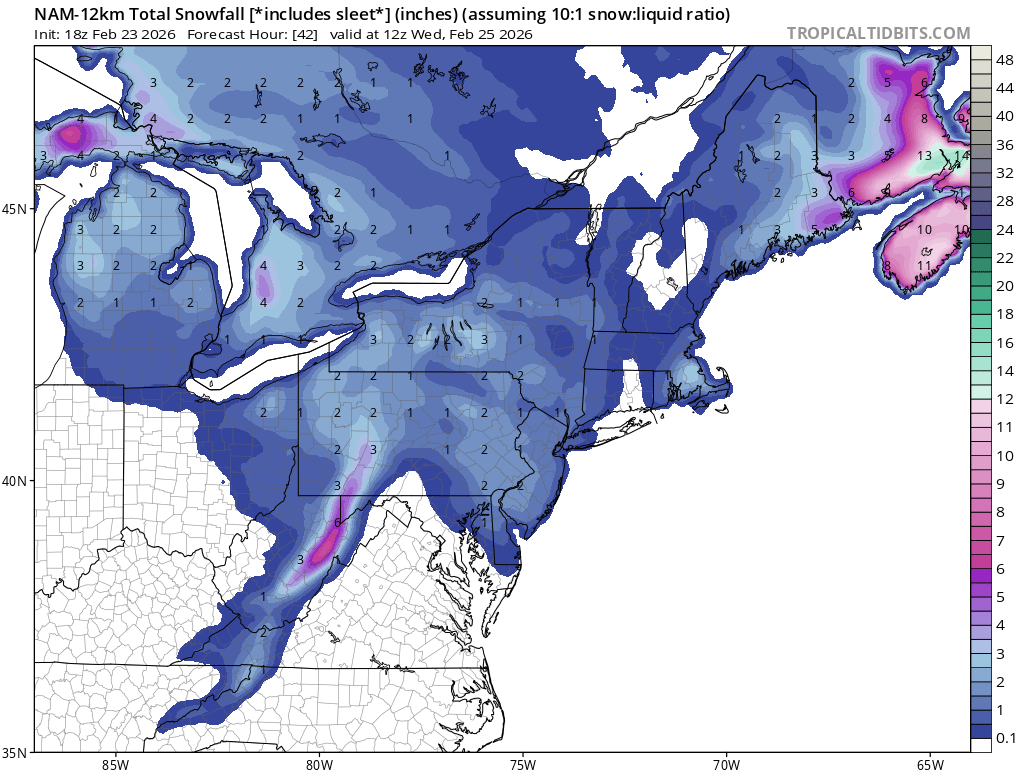
E PA/NJ/DE Winter 2025-26 Obs/Discussion
Ralph Wiggum replied to LVblizzard's topic in Philadelphia Region
12k NAM trend for Wednesday morning. Says most of SE PA picks up a c-2":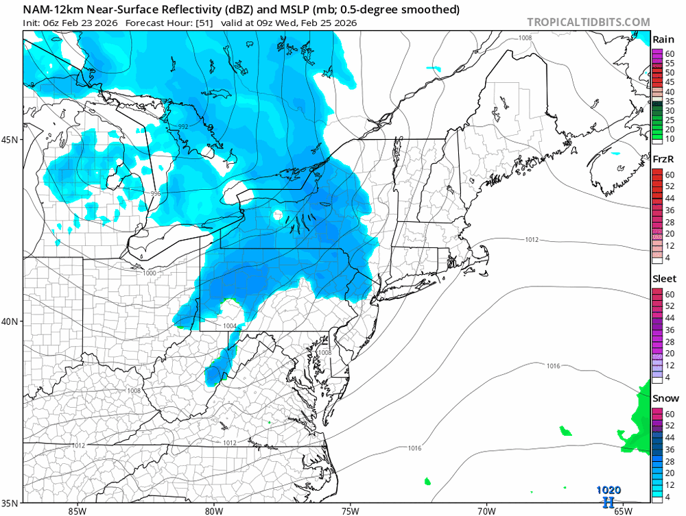
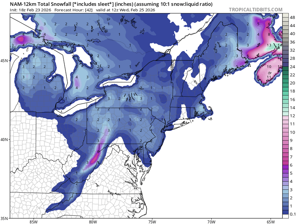
-
E PA/NJ/DE Winter 2025-26 Obs/Discussion
Ralph Wiggum replied to LVblizzard's topic in Philadelphia Region
50" on the season. A+ winter. We had it all but a major ice storm/fzra. But I am fine with that. Plenty of snow from Dec-March, epic cold, HECS. And we are still tracking. -
Blizzard of 2026 Storm Thread/OBS
Ralph Wiggum replied to Mikeymac5306's topic in Philadelphia Region
50" on the dot for the season. Snow started up again. -
Blizzard of 2026 Storm Thread/OBS
Ralph Wiggum replied to Mikeymac5306's topic in Philadelphia Region
Picked up another 1.5" since 730am. We are at 18" total for this one. 2 miles up the road in Richboro trained spotter measured 22". Wow. -
E PA/NJ/DE Winter 2025-26 Obs/Discussion
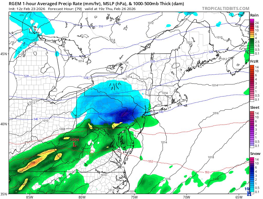
Ralph Wiggum replied to LVblizzard's topic in Philadelphia Region
Hello RGEM:
-
Blizzard of 2026 Storm Thread/OBS
Ralph Wiggum replied to Mikeymac5306's topic in Philadelphia Region
@The Iceman I am seeing 24.2" in Freehold officially attm. Im sure its bound to change tho. We can split the beer -
E PA/NJ/DE Winter 2025-26 Obs/Discussion
Ralph Wiggum replied to LVblizzard's topic in Philadelphia Region
Yep I will take a refresh any day. The winter that keeps on giving. -
E PA/NJ/DE Winter 2025-26 Obs/Discussion
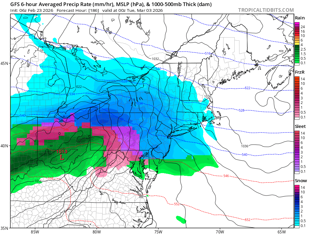
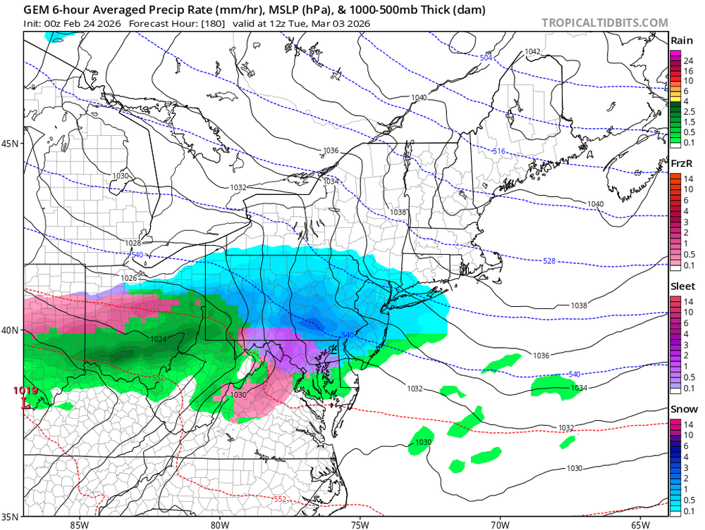
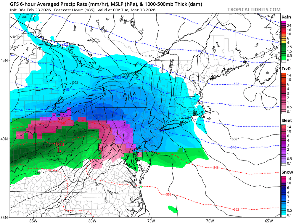
Ralph Wiggum replied to LVblizzard's topic in Philadelphia Region
GFS is a hefty thump to mix for March 2 window: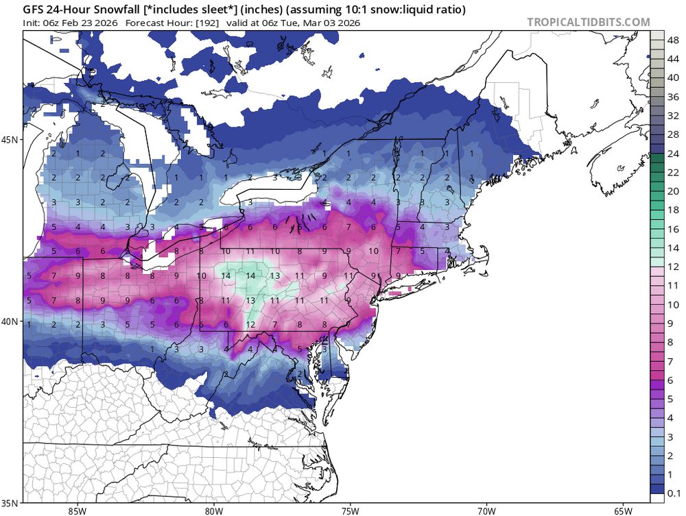
-
E PA/NJ/DE Winter 2025-26 Obs/Discussion
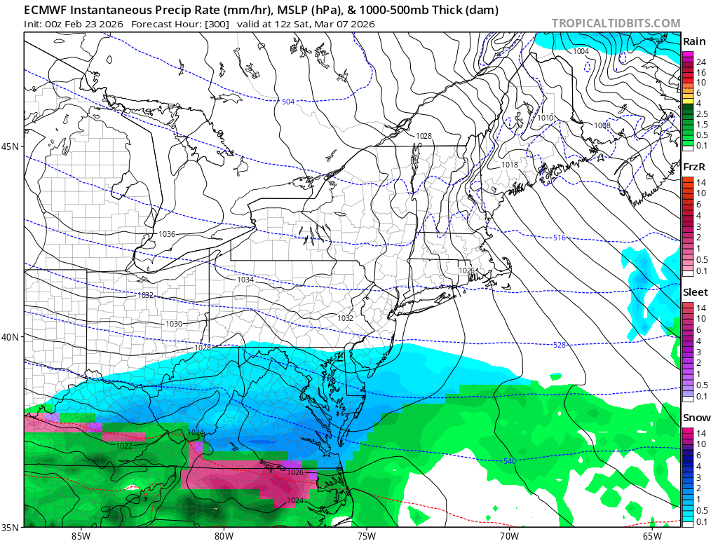
Ralph Wiggum replied to LVblizzard's topic in Philadelphia Region
Euro disapproved of the March 2-3 window but like the March 7 window instead:
-
E PA/NJ/DE Winter 2025-26 Obs/Discussion
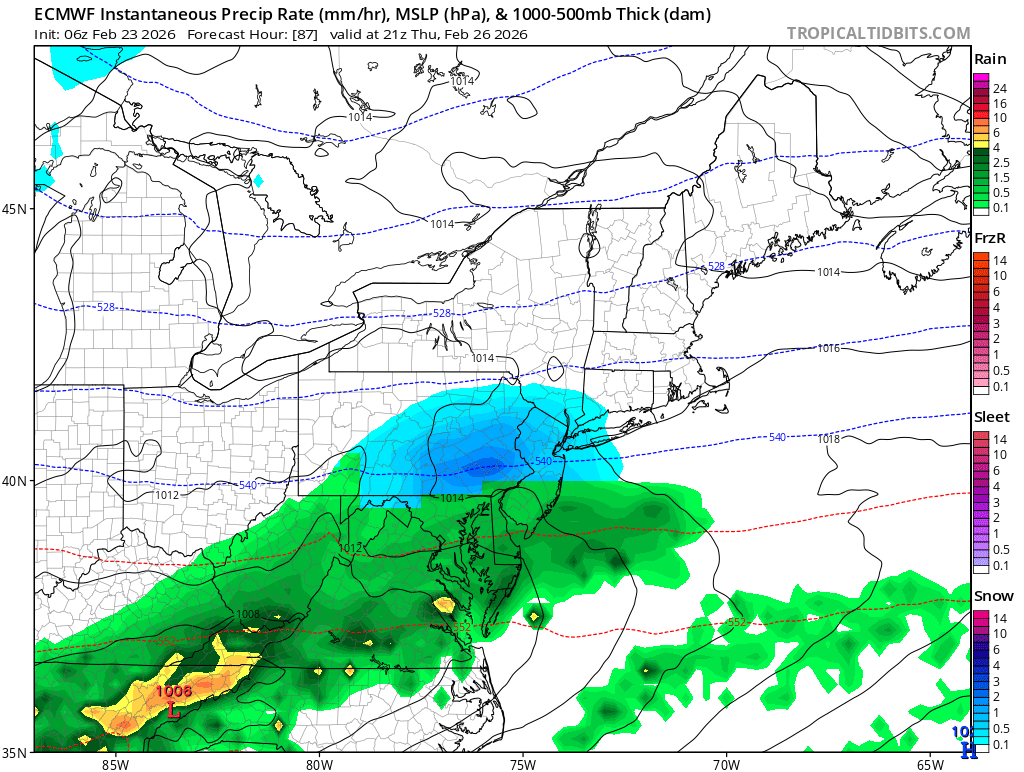
Ralph Wiggum replied to LVblizzard's topic in Philadelphia Region
Here are the GFS and Euro from 6z for Thirsday night: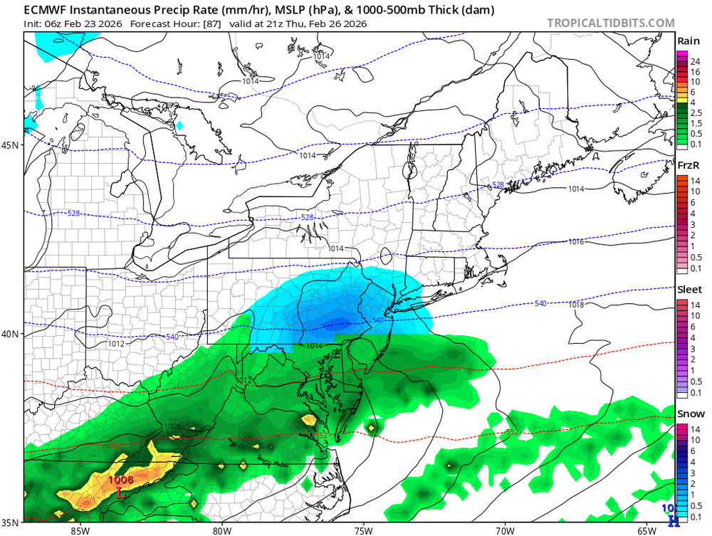
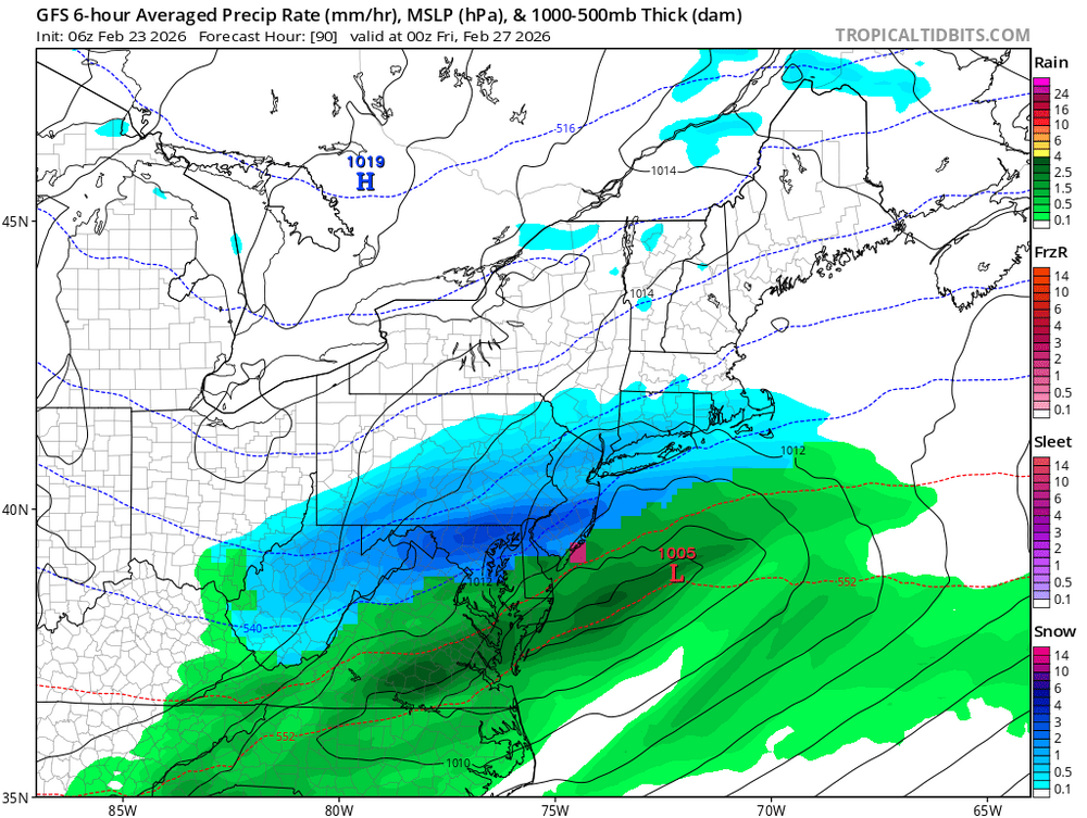
-
E PA/NJ/DE Winter 2025-26 Obs/Discussion
Ralph Wiggum replied to LVblizzard's topic in Philadelphia Region
Absolutely, I dont 'expect' 3 events in that time frame. I was just happy to see it seasonal and not 70. Too early for that. -
Blizzard of 2026 Storm Thread/OBS
Ralph Wiggum replied to Mikeymac5306's topic in Philadelphia Region
Liking the backbuilding on the radar. Moderate snow here and looks like a few more hours to go. -
Blizzard of 2026 Storm Thread/OBS
Ralph Wiggum replied to Mikeymac5306's topic in Philadelphia Region
14.5" total attm. 29F. Breezy and snowing still. -
E PA/NJ/DE Winter 2025-26 Obs/Discussion
Ralph Wiggum replied to LVblizzard's topic in Philadelphia Region
Euro AI says no 70s first week of March. Rather, it has 3 separate winter events in that 7 day stretch. -
Blizzard of 2026 Storm Thread/OBS
Ralph Wiggum replied to Mikeymac5306's topic in Philadelphia Region
Death band passed thru here. Did a better measurement on the board out in the field. That was a fun little walk. 9" and blowing around still so the measurement from earlier I lazily took from the deck was wildly inaccurate, sorry for that. Looks like another deathband refiring right along i95 and pressing NW again. Just wow! -
Blizzard of 2026 Storm Thread/OBS
Ralph Wiggum replied to Mikeymac5306's topic in Philadelphia Region
27F here and heavy snow. Lots of blowing powder. -
Blizzard of 2026 Storm Thread/OBS
Ralph Wiggum replied to Mikeymac5306's topic in Philadelphia Region
Sustained tropical storm force winds at Barnegat Light at 39 gusting to 64. Nice night for a beach walk. -
E PA/NJ/DE Winter 2025-26 Obs/Discussion
Ralph Wiggum replied to LVblizzard's topic in Philadelphia Region
GFS has another winter storm in about 3.5 days -
Blizzard of 2026 Storm Thread/OBS
Ralph Wiggum replied to Mikeymac5306's topic in Philadelphia Region
Carnage out there right now. Between the wind howling and this death band delivering, just insane rates. -
Blizzard of 2026 Storm Thread/OBS
Ralph Wiggum replied to Mikeymac5306's topic in Philadelphia Region
Go with the trained spotter for now will get a better read in the AM.