Ralph Wiggum
-
Posts
17,383 -
Joined
-
Last visited
Content Type
Profiles
Blogs
Forums
American Weather
Media Demo
Store
Gallery
Everything posted by Ralph Wiggum
-
2 extremely trustworthy models at range.
-

January 25-26 Winter Storm Potential
Ralph Wiggum replied to Ralph Wiggum's topic in Philadelphia Region
Not just this but ive been watching it develop off of SC, then off of NC (this was when we were looking golden), and now develops at the mouth of the Chesapeake Bay down near VA Beach. If this is the case, ie develop it farther N and W, then we need the low to go East from there. Keep an where 12z develops the 2ndary...more east is better here. -
What time does the morning euro come out?
-
January 25-26 Winter Storm Potential
Ralph Wiggum replied to Ralph Wiggum's topic in Philadelphia Region
AI euro drops about 11" before ending as a mix. -
January 25-26 Winter Storm Potential
Ralph Wiggum replied to Ralph Wiggum's topic in Philadelphia Region
6z gefs is a thing of beauty. Minimal mixing. Seems things have settled down since the pac data was ingested last night.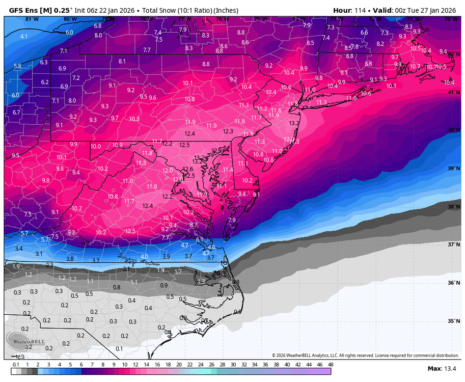
-
January 25-26 Winter Storm Potential
Ralph Wiggum replied to Ralph Wiggum's topic in Philadelphia Region
6z rgem had 4-6" snow before plowing the mix line due N and turning to sleet -
January 25-26 Winter Storm Potential
Ralph Wiggum replied to Ralph Wiggum's topic in Philadelphia Region
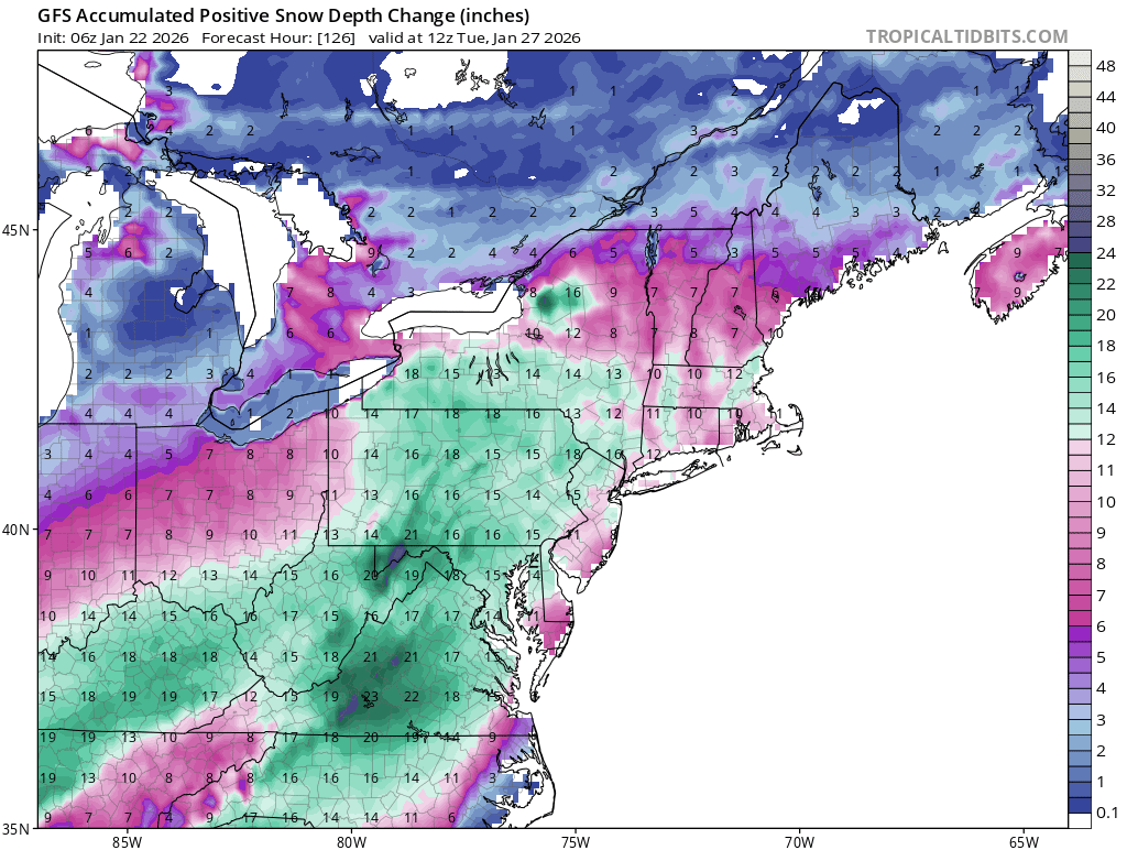
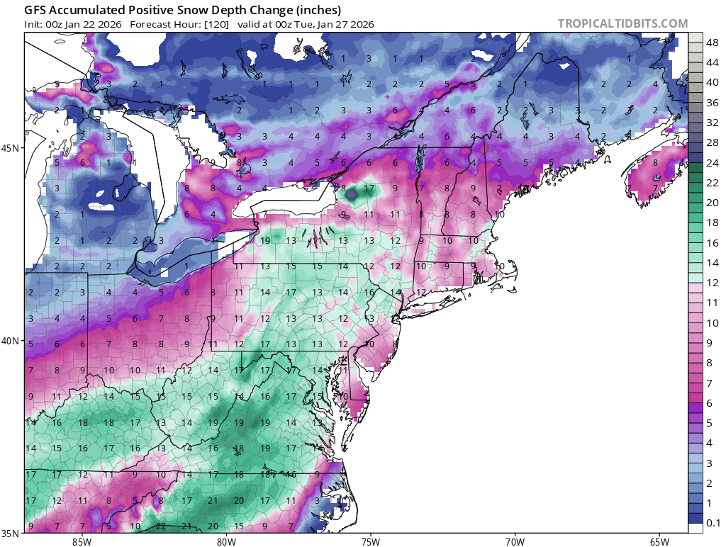
6z GFS upped the ante:
-
CMC does not have the dropsonde data.
-
January 25-26 Winter Storm Potential
Ralph Wiggum replied to Ralph Wiggum's topic in Philadelphia Region

-
I thought you were out?
-
Then no I cannot confirm lol. Timestamp is different 12.23.25
-
Check date on that 12.23.25
-
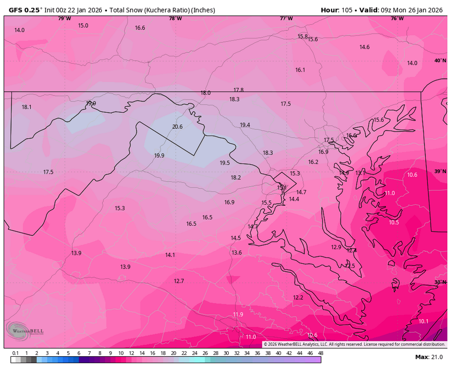
Can.you please post the kuchera on that with a slightly more NE view?
-
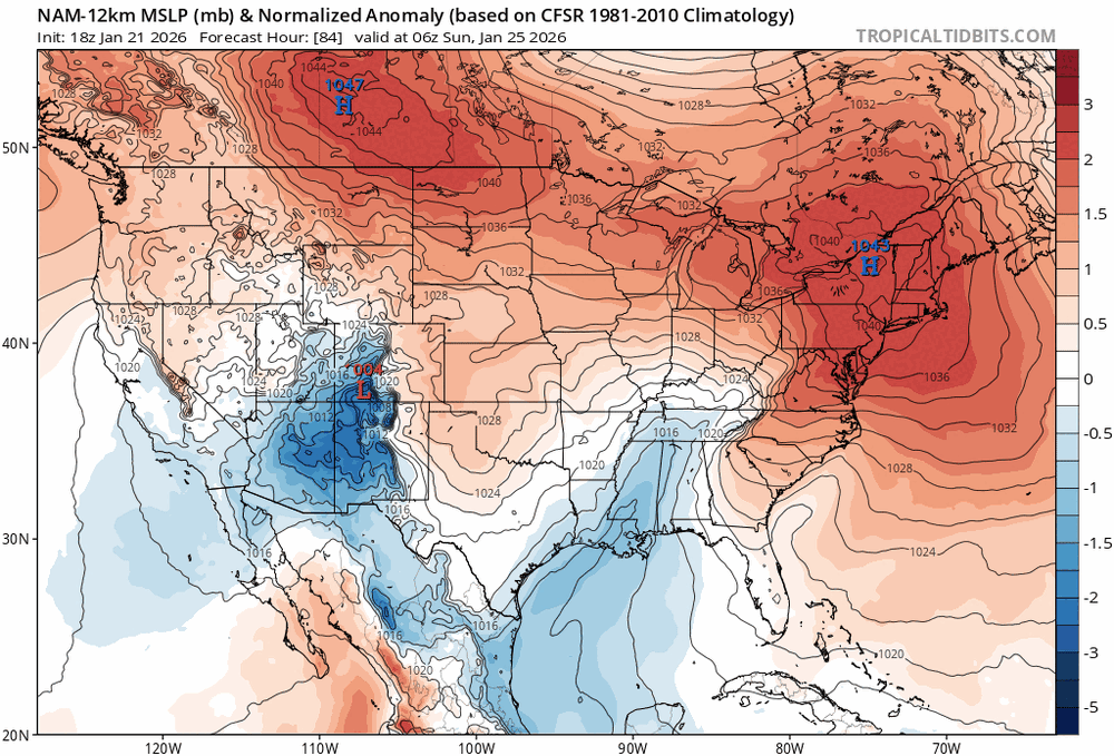
Off topic, but since everyone is hanging in here, icon is sending a clipper into the flow midweek with this weekend storm acting as a 50/50 and the flow jammed up.
-
Is that a capture on the icon between 114 and 120?
-
Exactly. It seems the bleeding has stopped thus far at 0z.
-
?? We are about to get plastered with a thump of snow right after 84
-
Imma leave this right here (0z vs 18z...stronger banana high and puts that TV low right in its place)
-
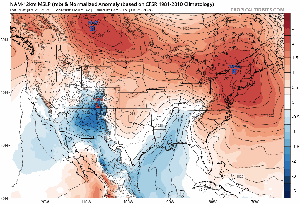
From 75 to 84 the hp in NY doesnt move an inch
-
Confluence is displaced a little N this run with higher heights. Not sure we r going to love this. Initial thump will be nice.
-
I was just contemplating the same and yes, farther east. May make for a shorter duration system but will limit the heights rising and mix threat
-
You are correct. GFS and Euro will have it.
-
Can't help but think back to Jan 25, 2000 and the papers that were written after that surprise. Models and mets together were focusing on the wrong sw feature all the way up til 36 hrs prior. Maybe we are victims of something similar here. Not sure what surprise would be in store. Just thought it was funny we sitting here not sure what we are hoping for, same date 26 years later, same dilemma.
-
Watch the models decide to bury the sw out in baja at 0z now.
-
January 24-26: Miracle or Mirage JV/Banter Thread!
Ralph Wiggum replied to SnowenOutThere's topic in Mid Atlantic
We need to unleash balloons from Hawaii and Guam to get the data. Seemed to work for China where they sent weather balloons to the US to sample sparse data areas for their weather reports a few years ago