CT Rain
-
Posts
26,253 -
Joined
-
Last visited
Content Type
Profiles
Blogs
Forums
American Weather
Media Demo
Store
Gallery
Everything posted by CT Rain
-
Same here. Was in Charleston in 2017 and heading to Dallas this time. Can't wait.
-
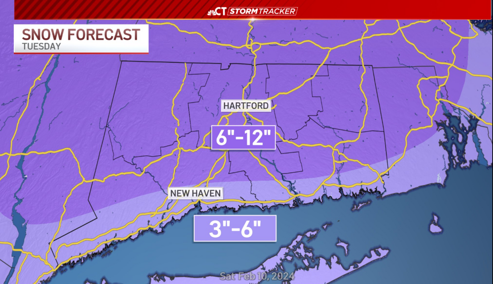
 It's amazing how quickly things tend to decrease once you get east of Guilford. My parents had 7.5" in Guilford only 2 miles from the Sound.
 -
We take everything about this map
-
BDL had 7.1" as of 18z.
-
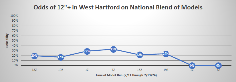
I thought this was an interesting way to visualize this forecasting cluster.
-
Just about 1" of liquid here so 15.7" in West Hartford comes to about 16:1. Love a good deform band!
-
15.2" in West Hartford here at the station. Nuts.
-
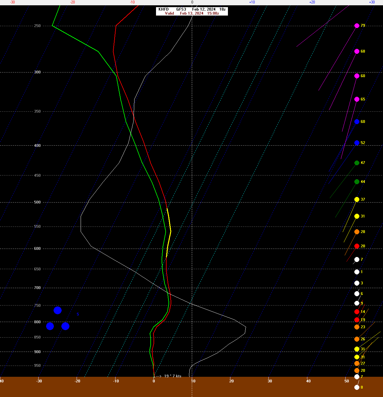
GFS is south a bit but still good for the south coast. Seems like a bit of an outlier at the moment.
-
The problem is half the ensemble members are time lagged so you're getting 50% of that mean coming from 12z runs and 50% from 00z runs. When there's a dramatic shift the utility of the HREF is definitely more limited.
-
Yup... HRRR looks worse. Blahh.
-
Not much of a change from 12z to 18z on the EPS
-
They should do well. 8 or 10 for most?
-
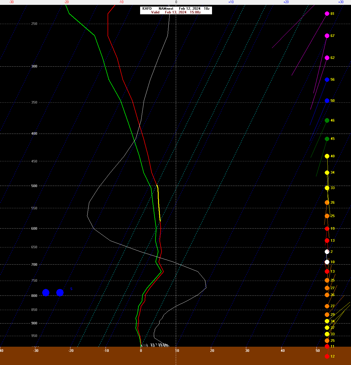
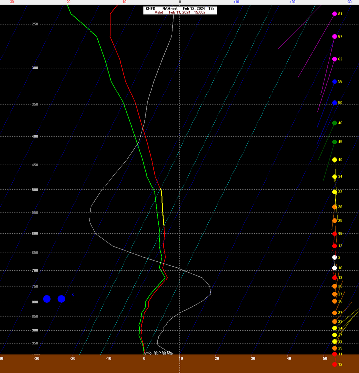
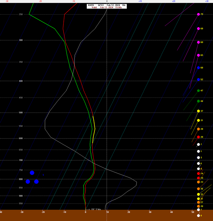
FWIW - the 18z GFS, 18z NAM (12km and 3km) still show excellent snow growth for BDL/HFD. Even on the QPF gradient the efficient dendritic growth could help.
-
A bit of a bump. At least the trend has stopped.
-
Even looking at the 19z/20z HRRR there's a great banding/snow growth signal through most of CT up through boston.
-
GFS isn't a total disaster
-
I think it still looks pretty good for you guys and most of S CT
-
Good lord. What a disaster.
-
Here's our first call. Only thing I don't like about the 18z GFS is that it brought the 700mb low a bit farther north. Have to watch that south of the Pike I think.
-
2m temps are a bit warm on the Euro for valley/shore at the onset. Kevin would be fine of course.
-
Yeah a partial phase would send this pretty far north. Definitely don't want any more of that south of the Pike.
-
What a strange way to live your life. Just posting on a weather board trying to troll people about snow. Imagine having the time to be so lame? Anyways the GFS looks great. That confluence to the north is going a long way here in making this event an actual event.
-
Did you even look at anything or are you just trolling?
-
I like how the h5 low closes off a bit as it moves offshore. A couple days ago it seemed like the thing was sort of shearing out and dampening some.