Chrisrotary12
-
Posts
7,430 -
Joined
-
Last visited
Content Type
Profiles
Blogs
Forums
American Weather
Media Demo
Store
Gallery
Everything posted by Chrisrotary12
-
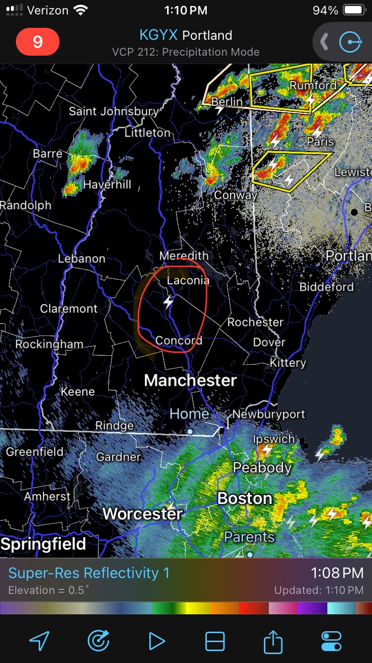
Wiz’s NW flow due to a large storm to our northeast is back.
-
May 2024 Discussion - Welcome to Severe Season!!!!
Chrisrotary12 replied to weatherwiz's topic in New England
Steined again. Also, this can’t be real right?
-
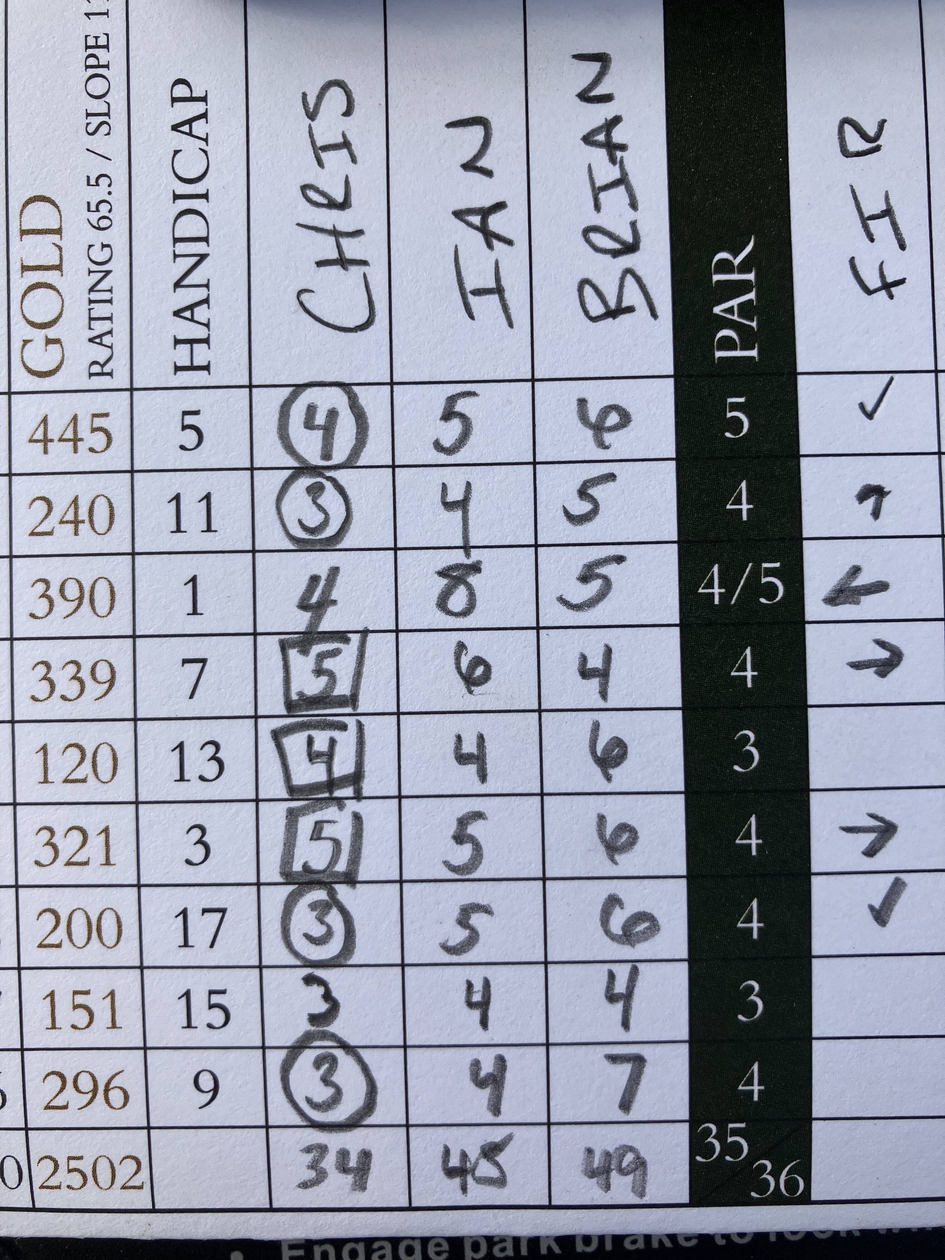
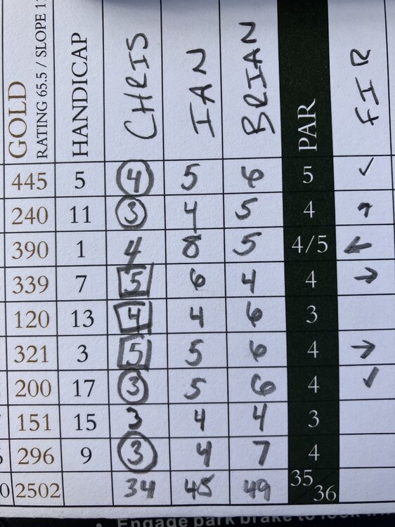
Played in my second New Hampshire Golf Association event this past Sunday. Partner event at Keene Country Club. 1st 6 holes: fourball 2nd 6 holes: modified alternate shot 3rd 6 holes: scramble Partner & I: -1, +5, -5 = -1 and a T-11. (alternate shot is hard)
-
That course is a joke. -20 in a major is a shame.
-
May 2024 Discussion - Welcome to Severe Season!!!!
Chrisrotary12 replied to weatherwiz's topic in New England
Probably should have installed last weekend. On this weekends to do list. -
May 2024 Discussion - Welcome to Severe Season!!!!
Chrisrotary12 replied to weatherwiz's topic in New England
The SNH thunderstorm screw zone strikes again!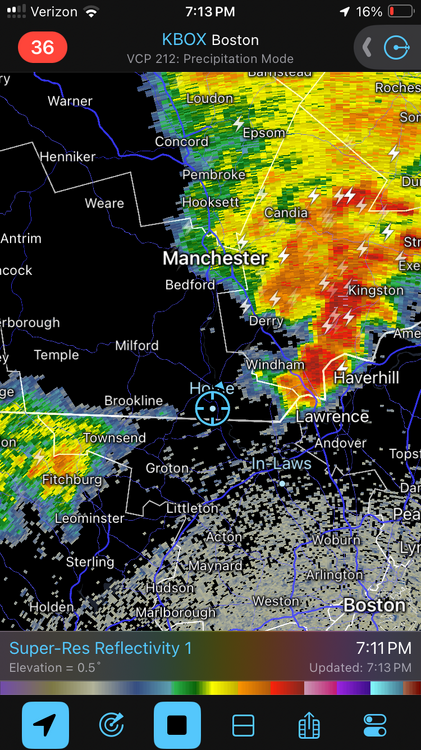
-
Missed this, but have tournament winner bets on: Scheffler (thug life), Koepka, Fitzpatrick, Thomas, Reed, MacIntyre, S. Kim, Murray.
-
Anyone ever played Keene Country Club? Playing there this coming Sunday for a NHGA event. 55 two man teams. 6-6-6 format (fourball, alternate shot, scramble).
-
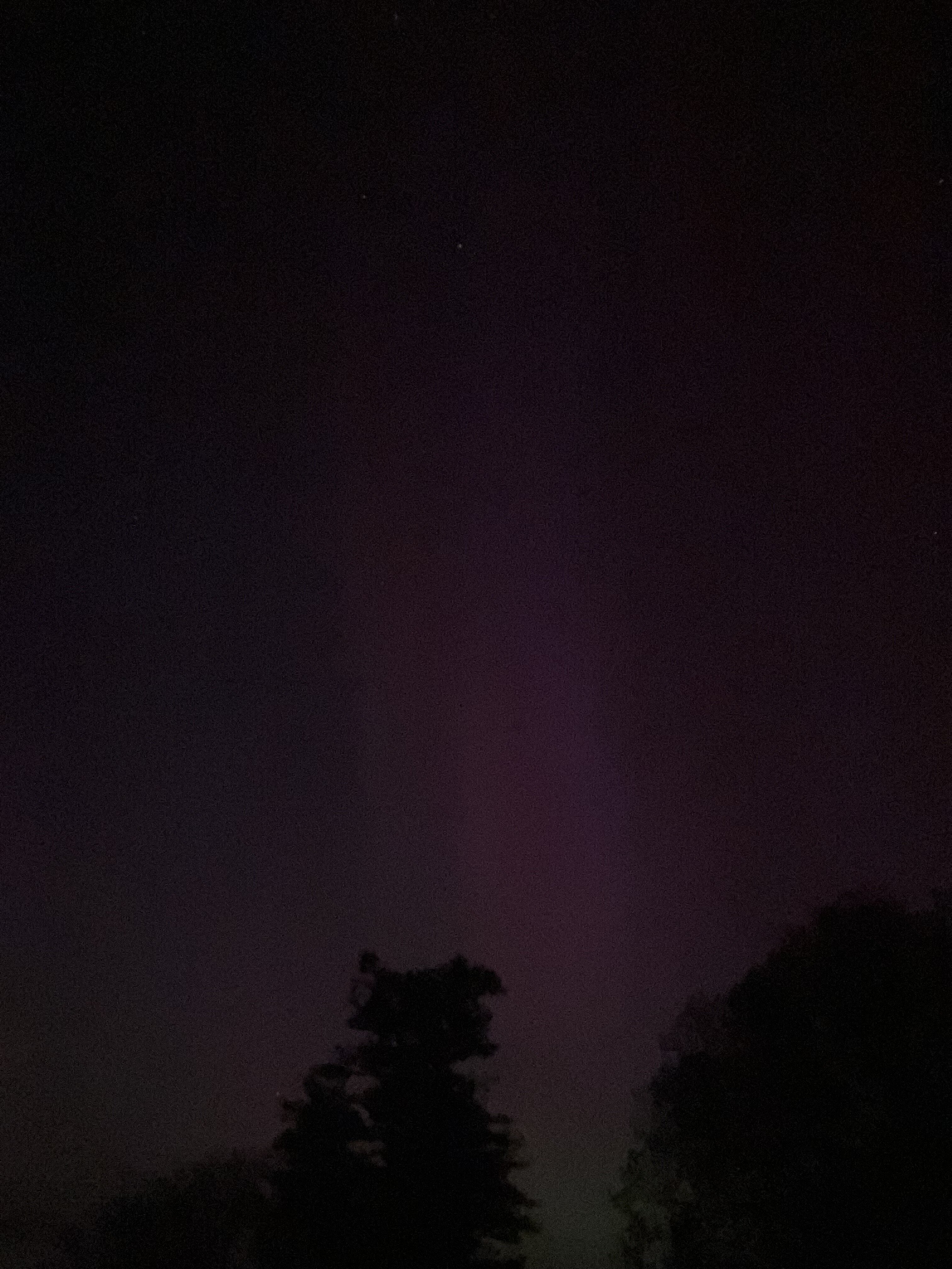
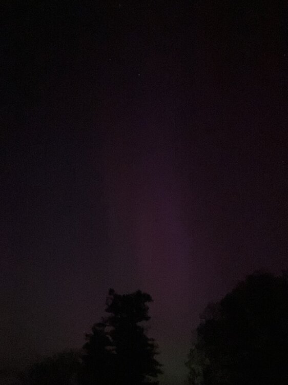
Best picture I got. Probably same pillar Will snapped as timing was similar. To naked eye it was s hazy white.
-
Very clear here and it shuts off.
-
Kp index down to 5
-
Can see faintly here.
-
Might be in trouble. Clouds filling in? https://weather.cod.edu/satrad/?parms=local-Vermont-07-24-1-100-1&checked=map&colorbar=undefined
-
Clouds can go F themselves
-
Going to drive up route 3 a bit. Maybe stop at Merrimack Outlets (solid northeast view).
-
How we doing on cloud cover?
-
Namibia getting in on the action.
-
Overhead? Low on horizon? Or 45 degrees? Lol
-
Like do those of us in a city have a chance even with light pollution?
-
Here’s an LOL 9 holes I just had.
-
May 2024 Discussion - Welcome to Severe Season!!!!
Chrisrotary12 replied to weatherwiz's topic in New England
Brilliant sunshine right now. -
We aurora tonight?
-
Playing Nashua Country Club today in a New Hampshire Golf Association event. https://nhga.bluegolf.com/bluegolf/nhga24/event/nhga2426/index.htm
-
April 2024 Disco- SNE’s favorite month
Chrisrotary12 replied to HoarfrostHubb's topic in New England
I don’t pay attention anymore lol -
April 2024 Disco- SNE’s favorite month
Chrisrotary12 replied to HoarfrostHubb's topic in New England
5a thunderstorm wasn’t on my bingo card