

WeatherNC
-
Posts
3,564 -
Joined
Content Type
Profiles
Blogs
Forums
American Weather
Media Demo
Store
Gallery
Everything posted by WeatherNC
-
Verbatim that hooks inside 40/70, dabenchmark 40/70 is grammar school for DCA - BOS with a bombing cyclone in the mid latitudes. Occlusion in southern NE (Long Island Sound) is high school
-
Pretty classic look for the MA crew at day 4, I would be prepping the clearing equipment 95 north of Richmond to NYC, particularly areas east of the Interstate. While we (SE) like Central FL or even GA, this is textbook with near term correction for your areas. Inside the benchmark with occlusion still on the table. Chase watch hoisted.
-
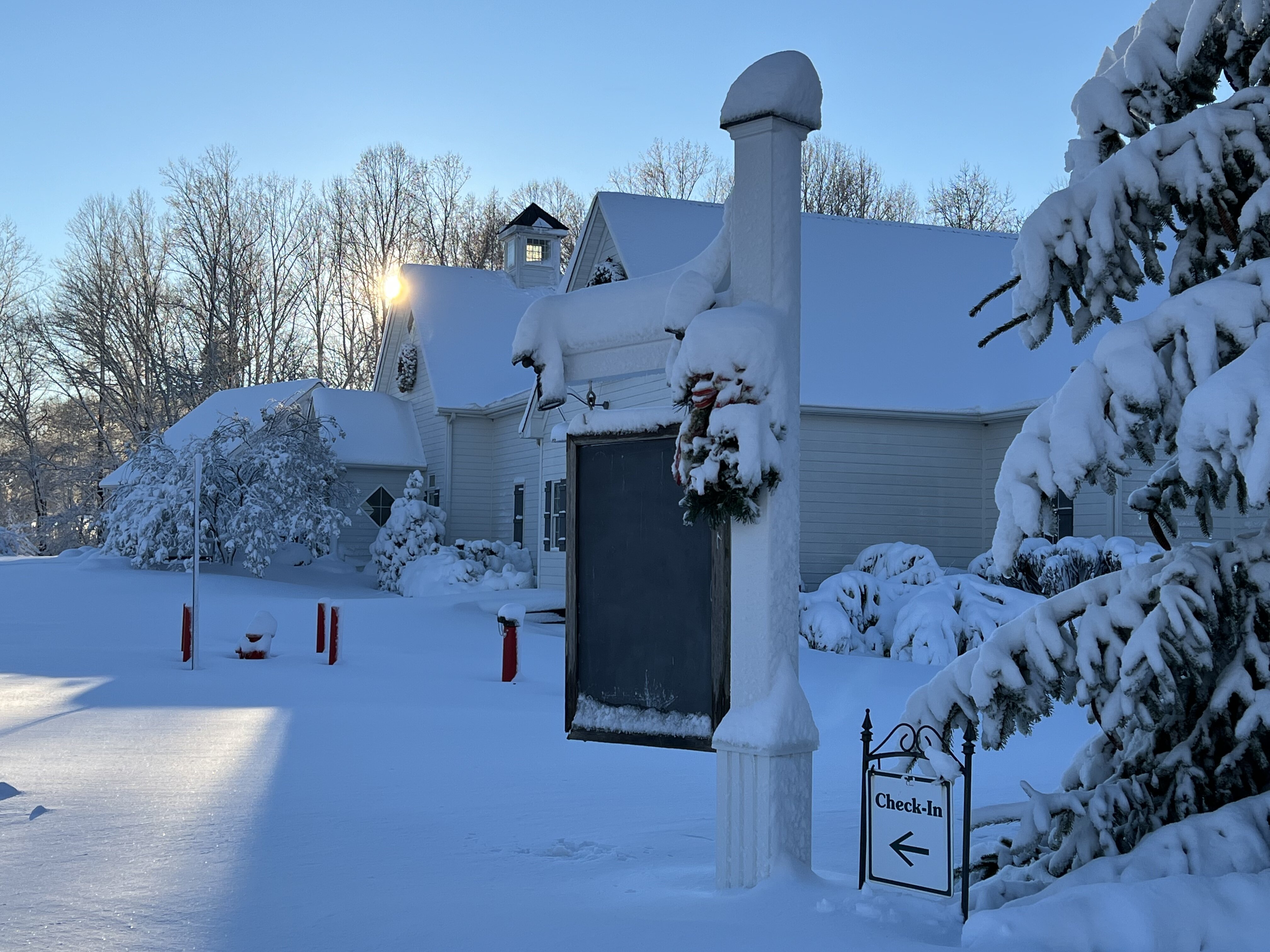
Does this count as a lollipop? Code on a hydrant is 18” above grade center cap.

-
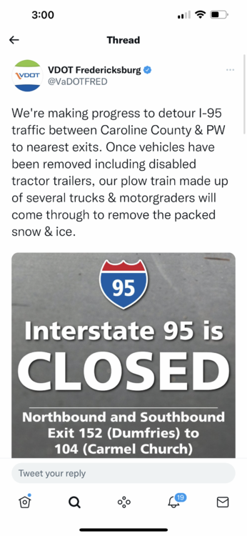
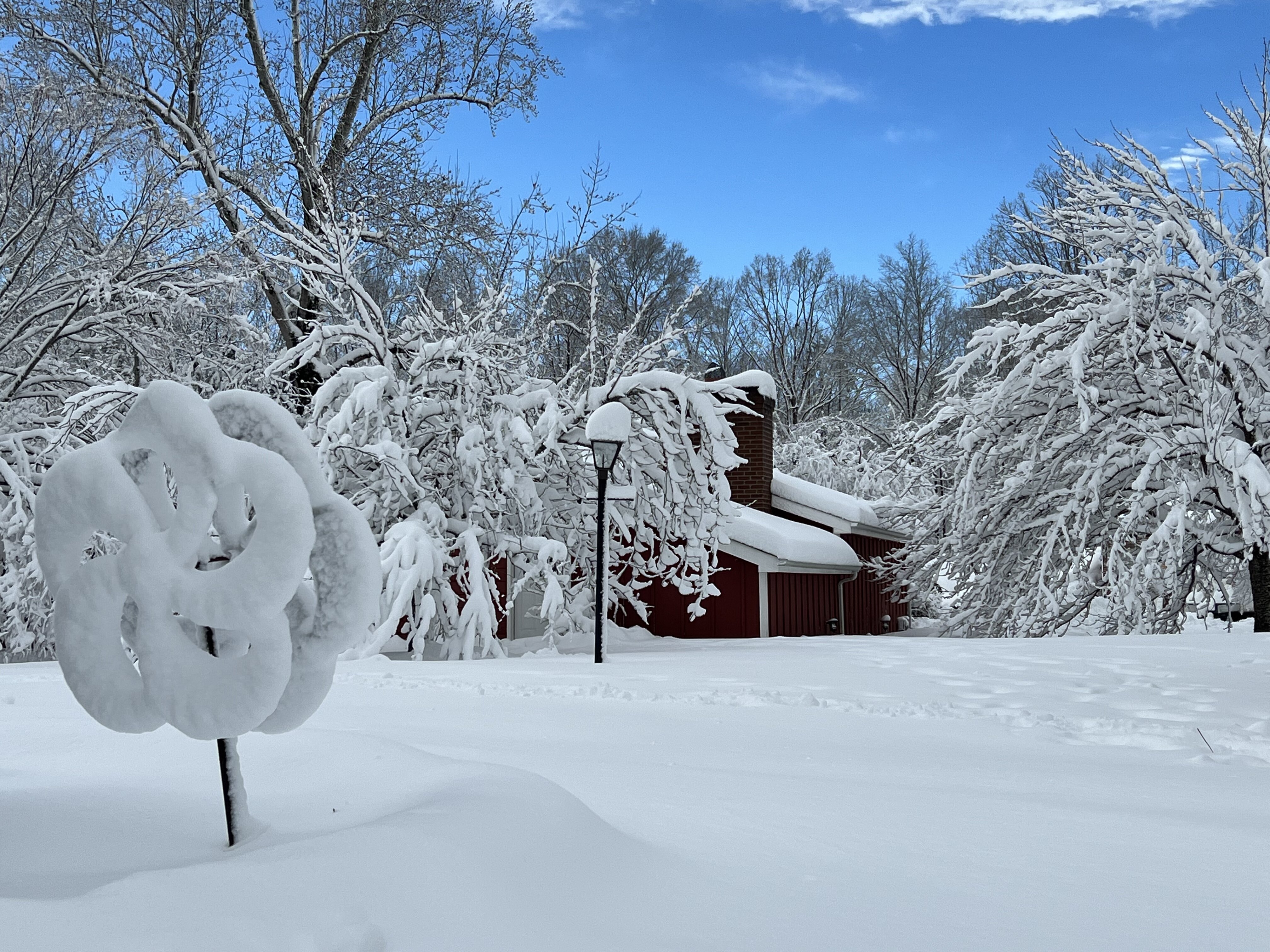
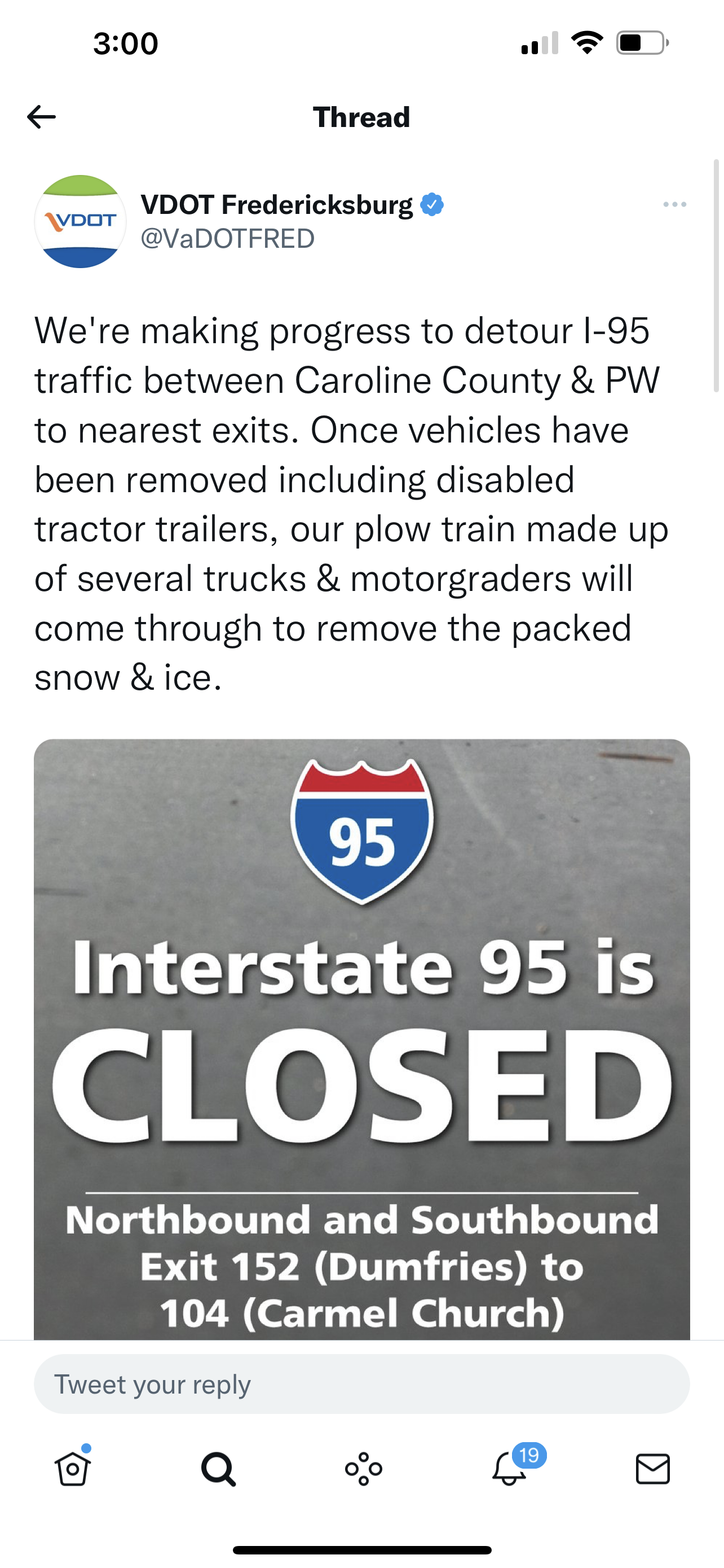
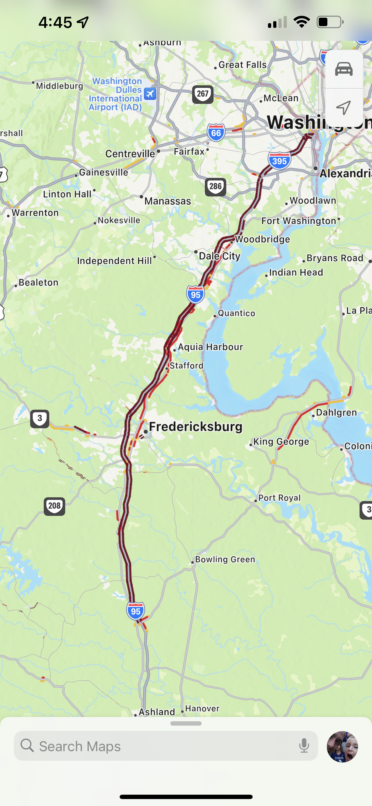
Ended up being a 27hr chase gate to gate from Greenville NC, required application of knowledge learned both in the mid Atlantic over the past 10-15 years punching some of the larger events on record and new things learned out in the PAC NW over the past two years, specifically wheel chains which I purchased for required areas out there and used on the rear for our drive down 1 to Ladysmith, we left about 430pm yesterday. VA law notes tire studs, chain info seems to be prohibited per law unless conditions warrant them in season but still unsure. And that’s with a 4x4 truck, it was rough. 9am 12pm 3pm ~14” with >1.5” liquid equivalent, heavy and wet with the pivot main deform supporting improved ratios after 11am

-
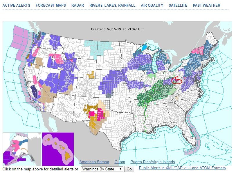
SNOW SQUALL WARNING NWS CHARLESTON WV 351 PM EST SUN FEB 10 2019
-
FYP...
-
Drove from Boone to Greenville today, coverage was total to around Zebulon. Takes a rare bird to lay down that areal extent in NC, even areas to the east saw cover yesterday before it melted. 40 north, solid A.
-
In Wilkesboro, about to make the final call of Blowing Rock or Sparta, I don’t want to enitely discount the RGEM and NAM for 2” of QPF with little mixing around Sparta.
-
30" around Lake James this run on pivotal.
-
Leaving for Blowing Rock in the am, considered going further south to Black Mountain but am really worried about pingers cutting back on totals. Also considered Spruce Pine but the roads may be sketch coming back on Tuesday especially if there is a lot of sleet.
-
He lives in Wake Forest vs SE Wake County, with the advances in computer simulations over the past 5-10 years, local hasn't changed.
-
Agreed, primary go to when the NAM looks off, difference usually verifies somewhere in the middle.
-
How is that a SN & IP best guess, unless I forgot to read Skew-T's that's SN, likely heavy.
-
Pivotal is 29" from Morganton to Lenoir to Hickory, 28" in Blowing Rock. As things stand now, Blowing Rock is where I will be Saturday afternoon - Tuesday. I like the elevation (wind potential), eastern side of the escarpment, 321 should be plowed with a backdoor through Boone and 421 if needed. Not ready to commit further south than there at the moment, SW VA appears to be safely out of play. Slower timing will allow ingest of the 12z run on Saturday for any last minute adjustments as I am on the road.
-
Still 48hrs out, but starting to look at Spruce Pine vs Sparta.
-
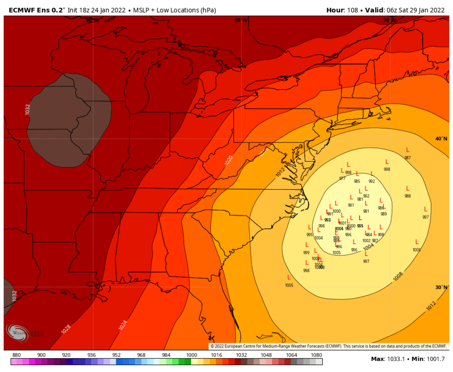
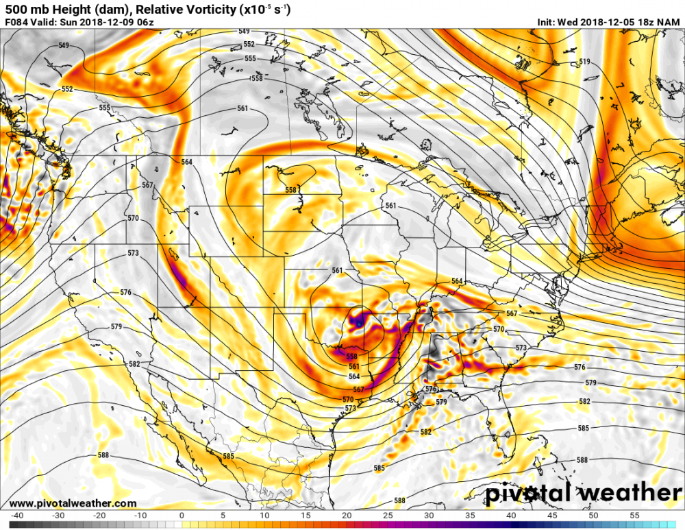
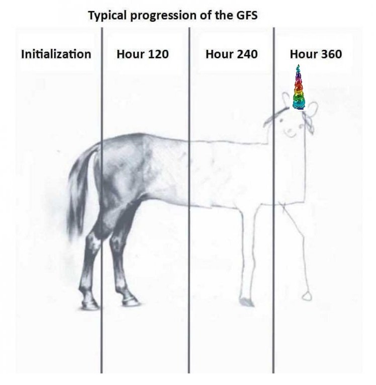
18z GFS appears to have suffered an anomaly after 108hrs.
-
18z NAM vs GFS @84hrs, outside of the NAMs useful range I know, but the preferred H5 look is a no brainier.
.thumb.png.7efa6386967e0113e77b516da90bb0ca.png)
-
Cut back on QPF by about a half inch in most of NC compared to 12z, SC still on par with widespread >2" amounts.
-
Somewhere along a line from Charlottesville to Asheville, I am currently looking at the area around Sparta. Still have to Friday to hammer down specifics. I did order a new snow shovel on Amazon, professional grade.
-
Snow output is a fool’s errand at this early stage, regardless of the model. The Euro does show 2-3” liquid equivalent in the same general vicinity which is significant.
-
Really just noise at this range, still a monster winter storm.
-
Snow packed chicken?
-
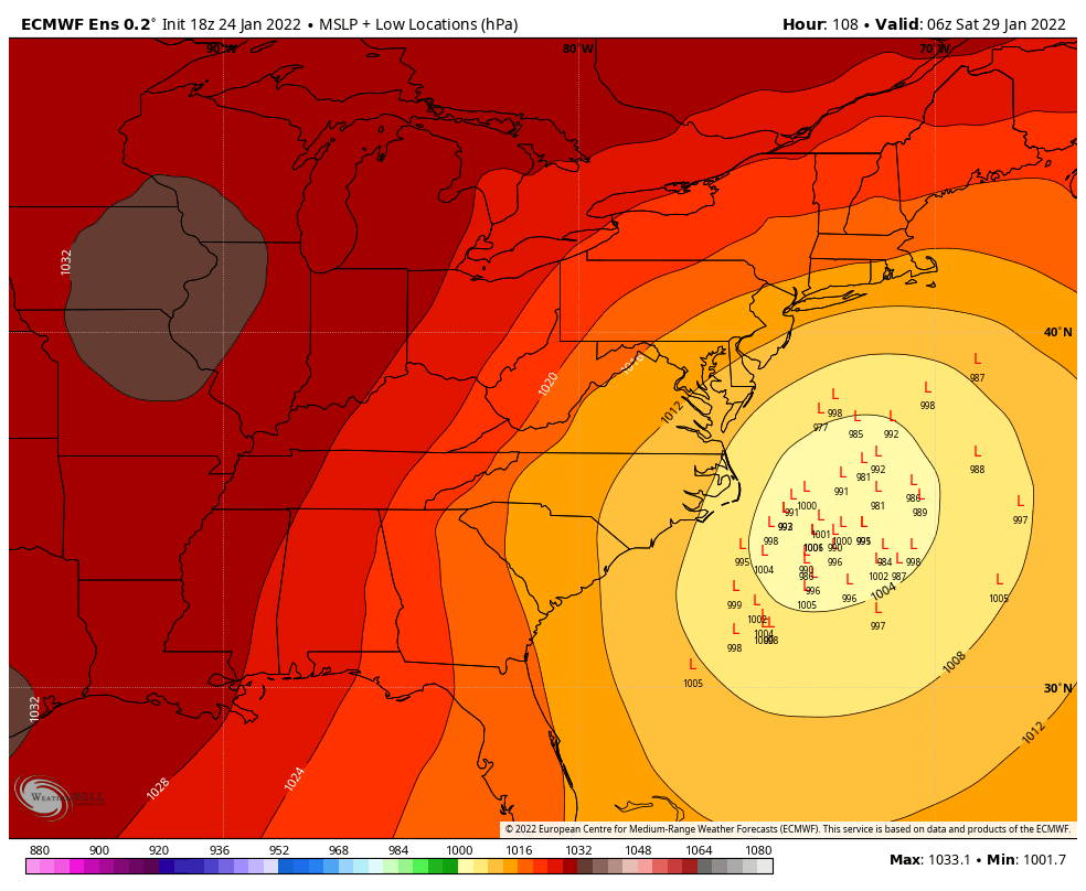
3 paragraph essay with the long term... .LONG TERM /TUESDAY NIGHT THROUGH SUNDAY/... As of 420 PM Sunday... Given the complexity of the forecast flow aloft across the CONUS this week, there not surprisingly remains amplitude and timing differences with individual shortwave perturbations embedded within that flow. While the GFS remains a deep outlier with respect to 500 mb heights over the cntl Appalachians/middle Atlantic at 00Z-12Z Wed, it has trended toward an otherwise relatively good model consensus during that time; and the associated QPF signal east of the Appalachians in recent days is consequently absent, or very light. As such, no measurable precipitation will be forecast in cntl NC at this time, with instead a chance of sprinkles over the Piedmont Tue night, and again over the ne Piedmont and nrn Coastal Plain with diurnal heating Wed, related to the passage of a secondary shortwave trough and associated similarly strong height falls and mid level Fgen. As previously noted, any very light resulting precipitation during either time would be liquid based on forecast (wet bulb) thermal profiles. It will otherwise be colder through the end of the week, as the trough aloft and cP high pressure migrate ewd across the srn Appalachians and sern US - coldest Thu, when highs will be in the 40s and lows solidly in the 20s. A reinforcing cold front, and leading edge of a fresh, stronger cP high, will then move swd through VA/NC late Fri-Fri night, setting the stage for the arrival of a srn stream system, or two, next weekend. The ewd progression of the parent, significant closed low forecast to migrate through split flow across the ern N Pacific, to near srn CA by the end of the week, has slowed in recent model cycles - perhaps not surprisingly given that such closed lows often take longer to eject ewd than what the models would suggest. As such, the arrival of resultant precipitation in cntl NC will likely be slower than previously indicated, particularly so given the presence of the aforementioned cP high and dryness extending from the upr Midwest, ewd and then swd in damming fashion east of the Appalachians. While forecast details remain uncertain, pattern recognition with a favorably positioned, cold high, and significant cyclogenesis from the GOM to the sern and middle Atlantic coast, favors wintry precipitation over the middle Atlantic states, including particularly the climatologically-favored areas of cntl NC. Given the time range and uncertainty, forecast p-types of only rain and snow will be included at this time. However, there would most likely be some degree of broader mixed p-type transition zones given that the parent trough aloft is forecast to remain west of the Appalachians through the weekend, with probable mid level warming across portions of the Carolinas. &&
-
mm / d
-
Source: https://ruc.noaa.gov/hfip/tcgen/2018/2018120212/


.png.4fb4b00005e6a8c7a24ddf0c78eda3dc.png)