

wncsnow
-
Posts
8,824 -
Joined
-
Last visited
Content Type
Profiles
Blogs
Forums
American Weather
Media Demo
Store
Gallery
Everything posted by wncsnow
-
I don't see it. After we have gotten a good thump maybe. We have east winds right now=good.
-
Heavy overcast here ceiling looks like its lowering.
-
Foothills weather folks still think the leeside could get 3 inches they are seeing more dry air and dont trust the models. Not sure what they are "seeing" dont think they do balloon launches.
-

January 30th- Feb 1st ULL and coastal storm obs
wncsnow replied to JoshM's topic in Southeastern States
-
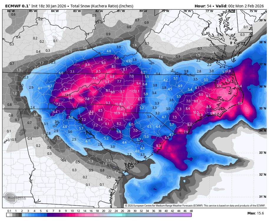
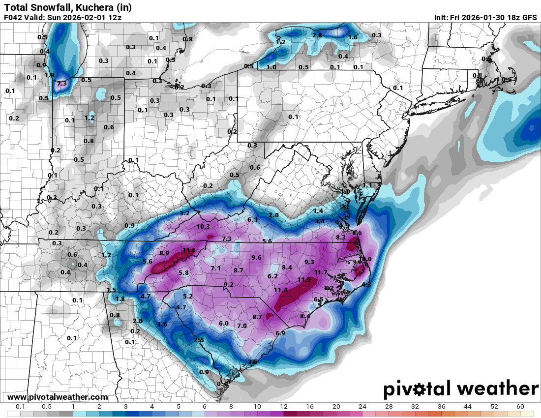
Euro looks great still. Solid 6-9 for everyone even leeside. Its been steady for a couple days. Hard to bet against it.
-
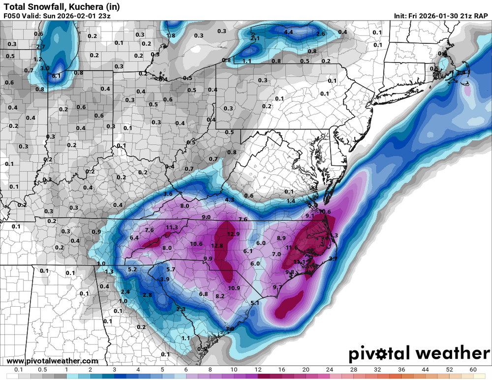
New RAP
-
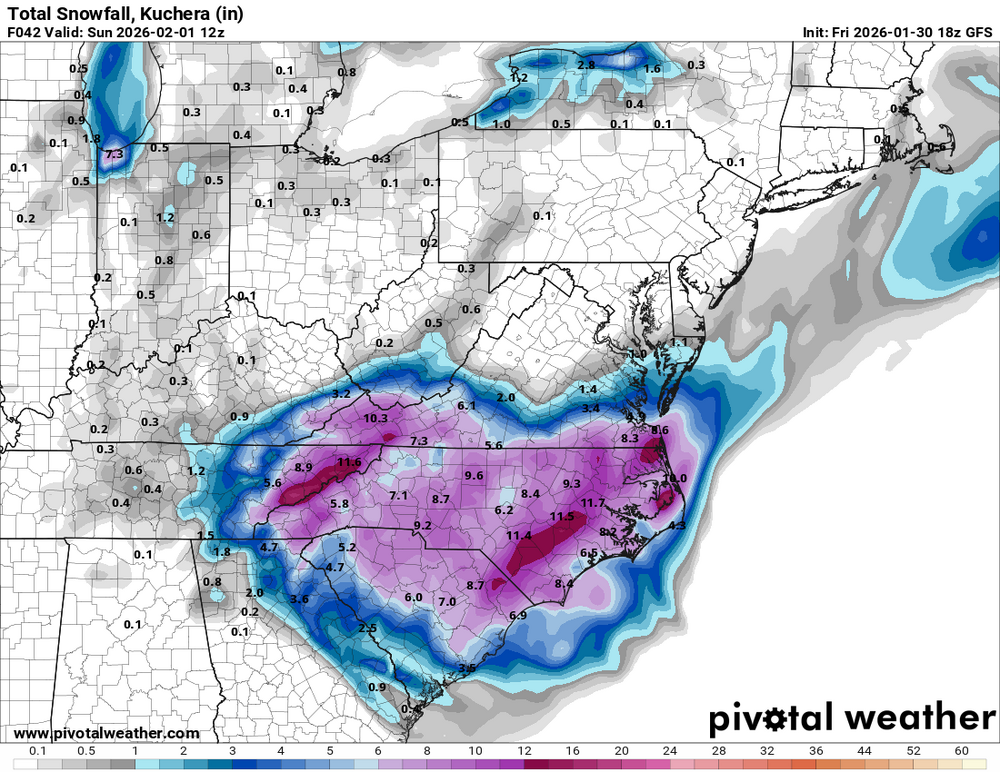
GFS still looking good
-
Its possible we have a little less but I honestly think its overdone with the flow being from the SE then turning E and NE. I think 4-6 is a safe bet.
-
.thumb.png.82d6a1aaa2897695ec67f6031d37d4ab.png)
-
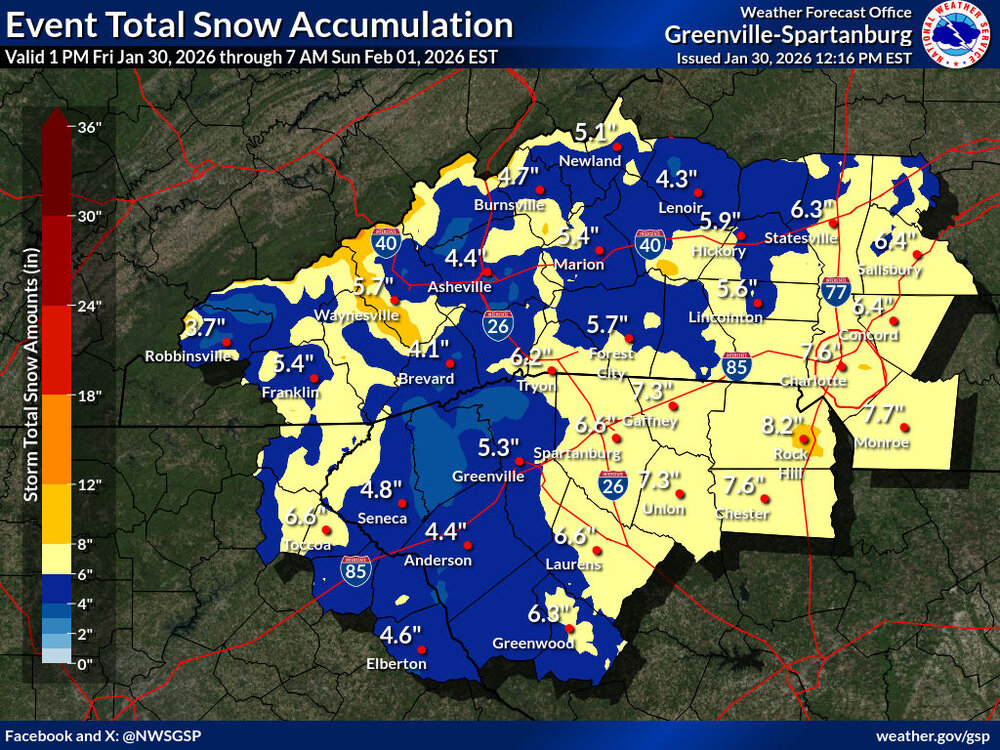
Still has me under 6 inches with that annoying leeside area but I think its overstating it.
.thumb.png.8357329a5aedc4c79a9e22ee568a5785.png)
-
The “I bring the mojo” Jan 30-Feb 1 potential winter storm
wncsnow replied to lilj4425's topic in Southeastern States
Honestly they both suck outside 24 hours. I would say inside 24 hours the HRRR is much better -
Its quite interesting noticing the same precip maximums as the meso low snow that forms in 2003. Obviously that was more of a strong clipper but this could have the same footprint but with more widespread totals. I could see someone getting 12-15" out of this in a small area.
.gif.4b28339dad4d3455a823708f58d1faf0.gif)
-
Milky sun in Asheville
-
The “I bring the mojo” Jan 30-Feb 1 potential winter storm
wncsnow replied to lilj4425's topic in Southeastern States
You're right its bigger -
The “I bring the mojo” Jan 30-Feb 1 potential winter storm
wncsnow replied to lilj4425's topic in Southeastern States
HRRR precip showing a huge dry slot.thumb.png.c775cb0dc0e068d055f419bc2b98f1cd.png)
-
Best HRRR run so far
-
The “I bring the mojo” Jan 30-Feb 1 potential winter storm
wncsnow replied to lilj4425's topic in Southeastern States
Slower and west is the theme still good for western carolinas -
I think we are good as long as the ULL tracks where its progged to and the meso low delivers. Father NE towards the Triad has the best shot of dry air IMO.
-
It's a bit concerning they give the NAM that much weight
-
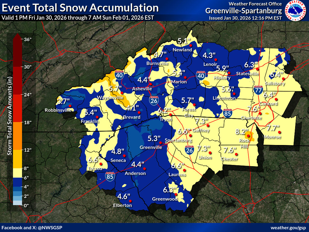
GSP lowered totals a bit, I do think they are playing catch up a little with the lower overnight trends vs the higher trends today. I expect them to bump it back up later.
-
SREF juiced up for us too. Could be a big NAM run coming.
-
Best rates look like tomorrow morning through lunchtime. Love a good daytime snow!
-
lovely Euro run. Someone near @strongwxncis getting 10+ out of this
-
Another short range gets juicier!
.thumb.png.a8e55e4b48ccd4950a3c5e76df163bb5.png)


.png.cf10fa0317a42ea0d9fea92901978c88.png)
.png.c675c26f9d9d7365cc832ae4822f0e90.png)

.png.de2fe346adff46c0f8b013d6de9e3951.png)


.png.01c0b6bac48053381eb71d44f8b04c5e.png)


.png.b7769f6980f6b32ad3a351da8fb89db1.png)