wncsnow
-
Posts
8,824 -
Joined
-
Last visited
Content Type
Profiles
Blogs
Forums
American Weather
Media Demo
Store
Gallery
Everything posted by wncsnow
-
Love the pics guys! I'm over 3 inches and snowing steadily
-
We got around 2 inches here and coming down steadily
-
Flakes here too. Off to get some sleep
-
Nice. We should see flurries soon surely.
-
Yeah we need to overperform early before the wind switch or we're cooked with 2 inches or less.
-
Checked one last time- Nada. Moon is mostly obscured at least..
-
Still visible moon here. Dry air.
-
Thanks same to you. Just checked outside again and still no flurries and a faint moon. Probably 1 or 2 am before we get precip.
-
Still see the moon here despite good echoes...
-
Usually a good sign for me
-
Echoes are getting stronger overhead. Still nothing though.
-

The “I bring the mojo” Jan 30-Feb 1 potential winter storm
wncsnow replied to lilj4425's topic in Southeastern States
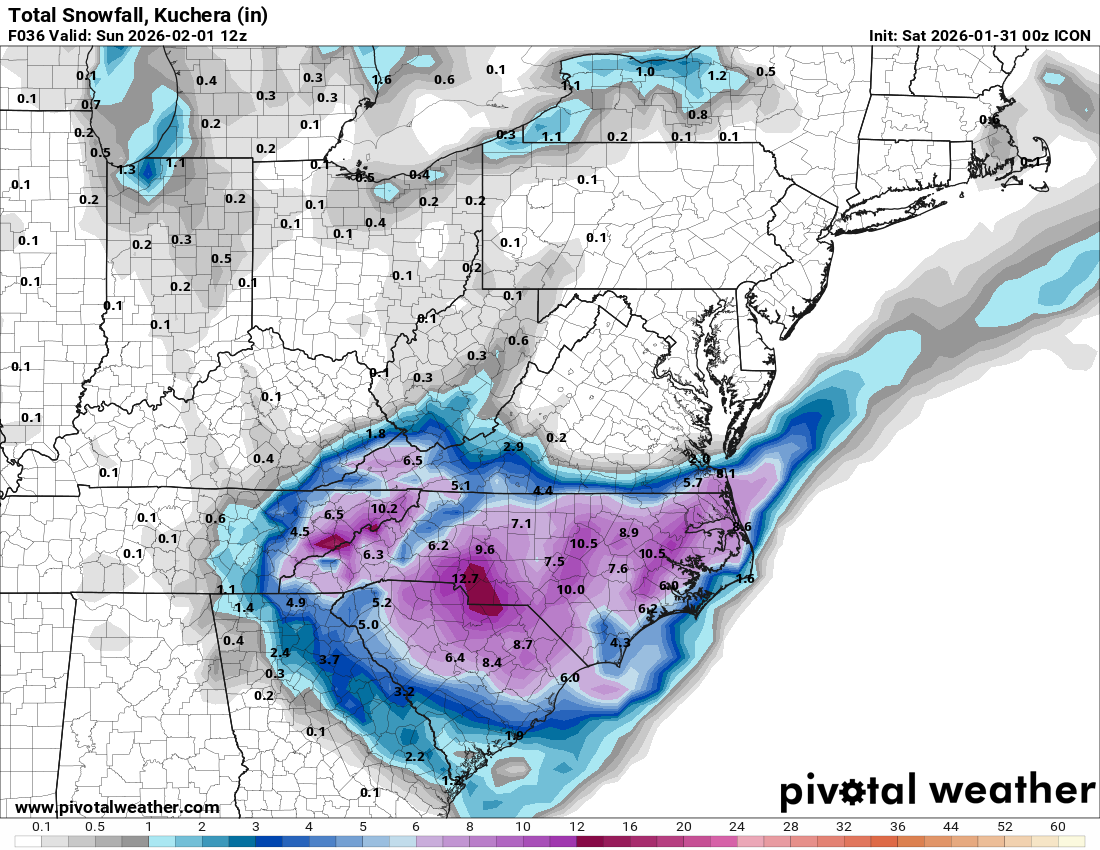
ICON
-
The “I bring the mojo” Jan 30-Feb 1 potential winter storm
wncsnow replied to lilj4425's topic in Southeastern States
Idk man, the leeside downsloping is showing up stronger some reason tonight. Most models are down to 3-5. I will gladly take that but less than 3 will be a disappointment. -
The “I bring the mojo” Jan 30-Feb 1 potential winter storm
wncsnow replied to lilj4425's topic in Southeastern States
This thread will be remembered.. gotta good feeling about that -
The “I bring the mojo” Jan 30-Feb 1 potential winter storm
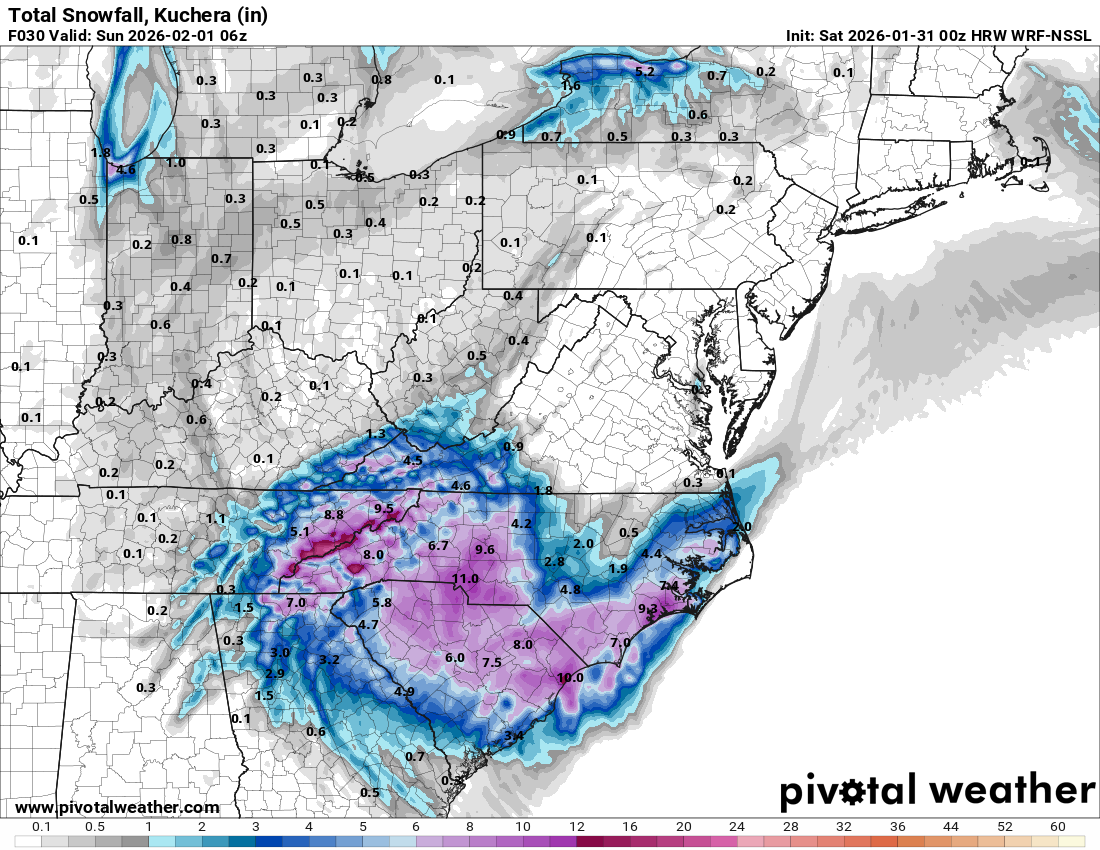
wncsnow replied to lilj4425's topic in Southeastern States
HRW WRF NSSL
-
The “I bring the mojo” Jan 30-Feb 1 potential winter storm
wncsnow replied to lilj4425's topic in Southeastern States
HRW WRF ARW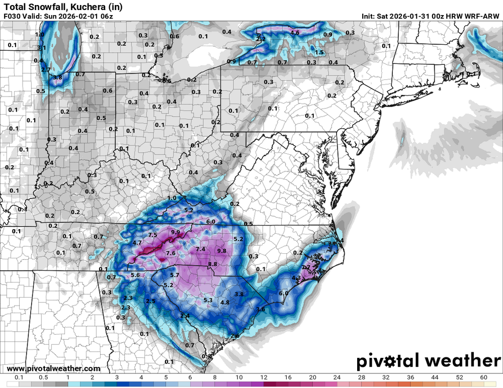
-
The “I bring the mojo” Jan 30-Feb 1 potential winter storm
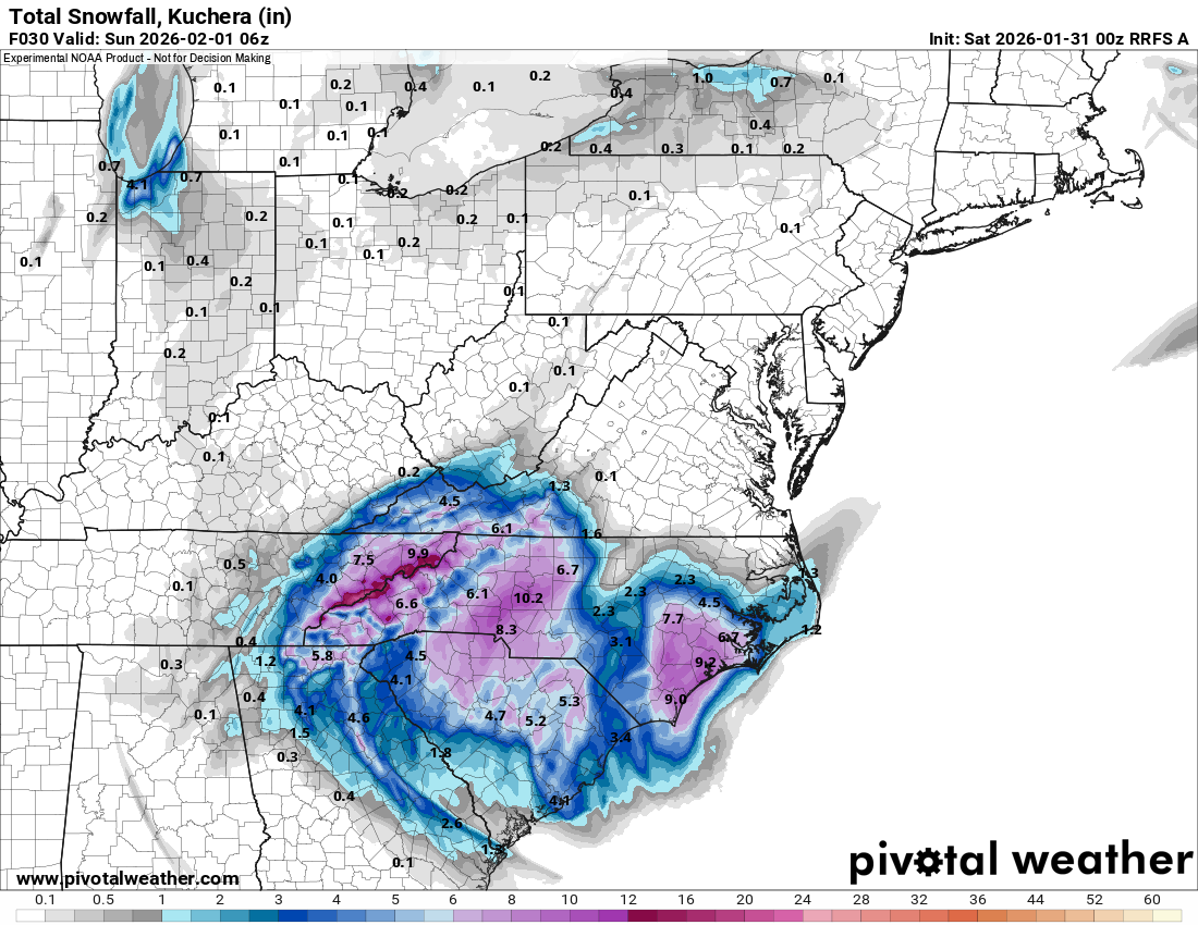
wncsnow replied to lilj4425's topic in Southeastern States
RRFS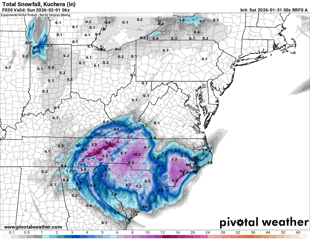
-
Leeside dry slot is getting worse too so you might have company in here
-
NAM 3K has a bigger leeside dry screw zone.. its increasing on a lot of models. Barely 3 inches here.
-
NAM 3K looking good
-
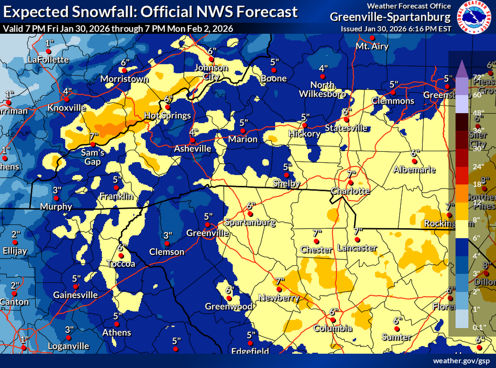
I'm setting my baseline expectations at 4 inches. That would be the most since 2022 and the 2nd most since 2018.
-
Just monitoring trends. HRRR doesn't start accumulating the snow here until 6 am.
-
HRRR keeps delaying the onset here..
-
Must be worried about dry air
-
NWS lowered again for most of us