Tatamy
-
Posts
2,583 -
Joined
-
Last visited
Content Type
Profiles
Blogs
Forums
American Weather
Media Demo
Store
Gallery
Everything posted by Tatamy
-

Snowfall NYC subforum Jan 6 and OBS if needed
Tatamy replied to wdrag's topic in New York City Metro
Steady light snow with 0.25” new. -
Snowfall NYC subforum Jan 6 and OBS if needed
Tatamy replied to wdrag's topic in New York City Metro
I think you had some existing snow cover from during the week. The area near Gouldsboro / Moscow had a couple of inches on the 2nd from some lake effect streamers that moved through (If that’s your area) and it looks like you received a coating up there today. That area is up at about 1800 feet so that always helps. -
Snowfall NYC subforum Jan 6 and OBS if needed
Tatamy replied to wdrag's topic in New York City Metro
I checked the traffic cams up in the Stroudsburg / MPO area and it looks like nothing more than flurries currently. -
Snowfall NYC subforum Jan 6 and OBS if needed
Tatamy replied to wdrag's topic in New York City Metro
Steady light snow with visibility at about 3/4 mile. Visibility’s to my west in the Allentown area are about the same. 24F. Roads and sidewalks quickly covered. -
Snowfall NYC subforum Jan 6 and OBS if needed
Tatamy replied to wdrag's topic in New York City Metro
Flurries here. 25F -
Snowfall NYC subforum Jan 6 and OBS if needed
Tatamy replied to wdrag's topic in New York City Metro
Light snow is reaching the ground now almost to the west side of Allentown. -
Snowfall NYC subforum Jan 6 and OBS if needed
Tatamy replied to wdrag's topic in New York City Metro
Blooming radar is nice however much of what is seen over PA currently to the north and east of Harrisburg is virga. -
Snowfall NYC subforum Jan 6 and OBS if needed
Tatamy replied to wdrag's topic in New York City Metro
RGEM is also south. -
Snowfall NYC subforum Jan 6 and OBS if needed
Tatamy replied to wdrag's topic in New York City Metro
I am waiting for the 0z runs where the models tighten the screws on the weenies regarding this event. That seems to be the pattern for the past two nights…lol -
Snowfall NYC subforum Jan 6 and OBS if needed
Tatamy replied to wdrag's topic in New York City Metro
It’s done. Confluence FTW. -
January 3, 2025 Light Snow Event Observations
Tatamy replied to ChescoWx's topic in Philadelphia Region
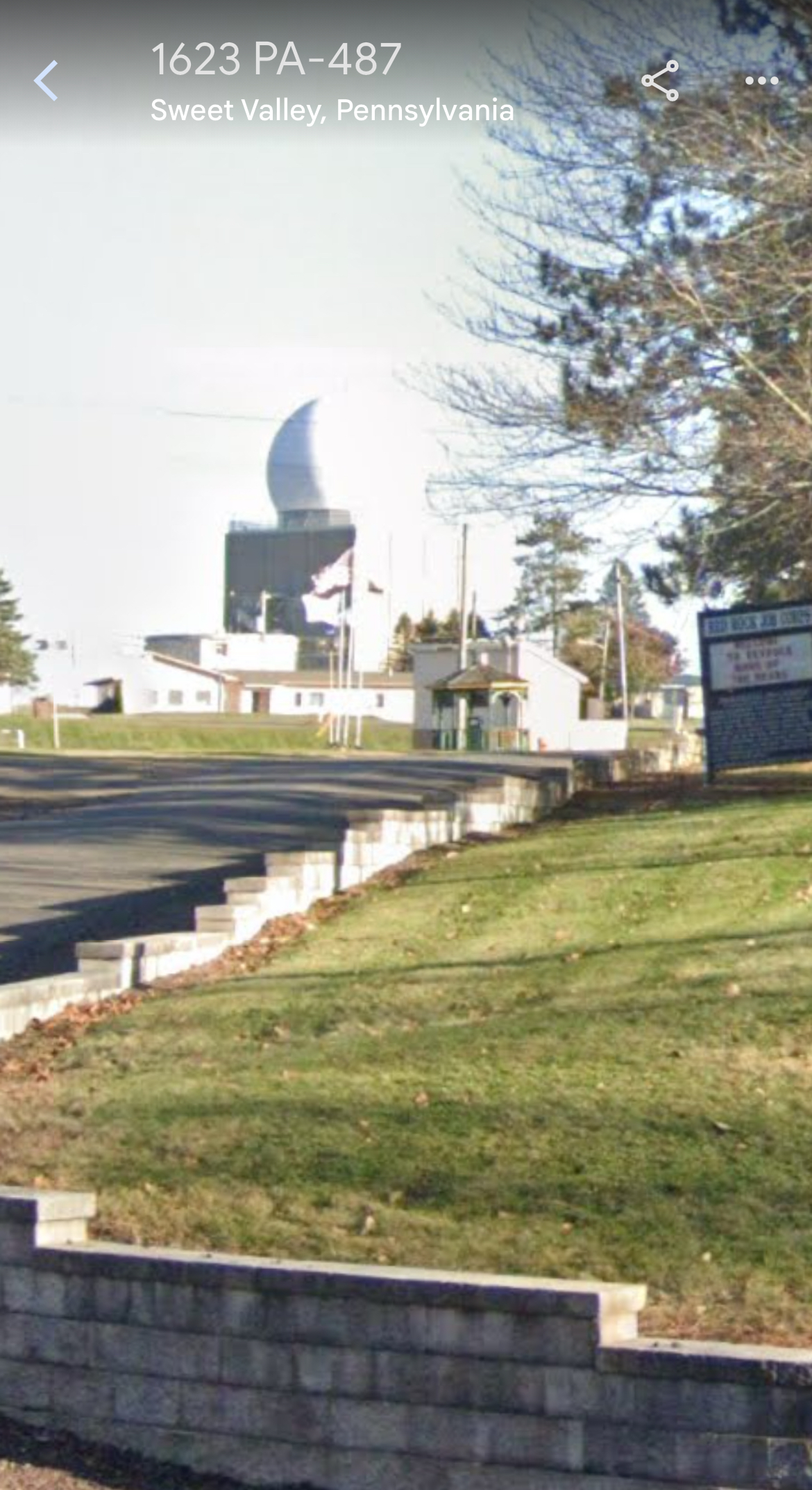
There is a radar site up in that area in Ricketts Glen State Park. It’s called the Benton FAA radar site and it’s on a mountain top north of Berwick. It’s a fascinating story about how this was once a military site and was subsequently transferred to the FAA. I knew nothing about it until one day I drove past it and thought it looked very much like a Doppler site (It’s not). It’s been upgraded and is now classified as a CARSR radar site and supposedly has weather data processing capabilities.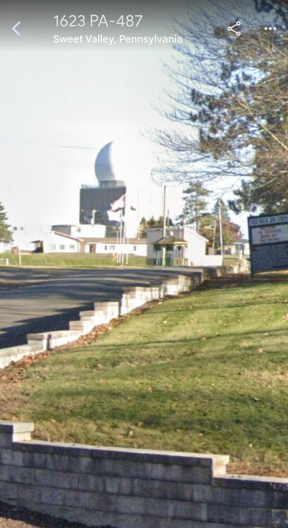
-
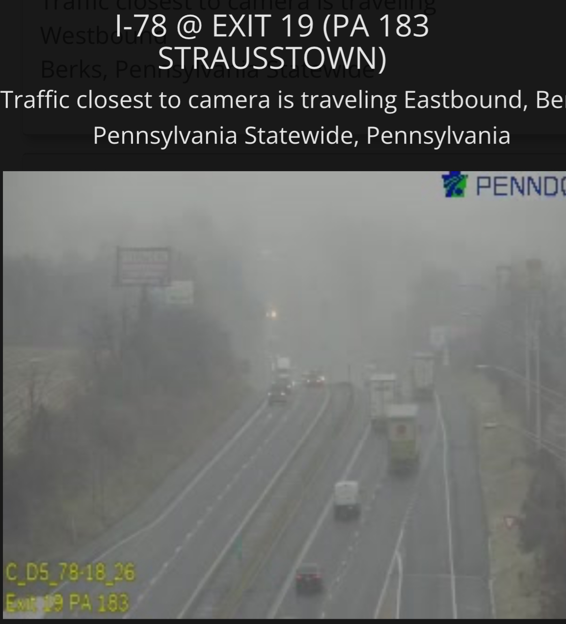
January 3, 2025 Light Snow Event Observations
Tatamy replied to ChescoWx's topic in Philadelphia Region
This is the current view at Strausstown along I78.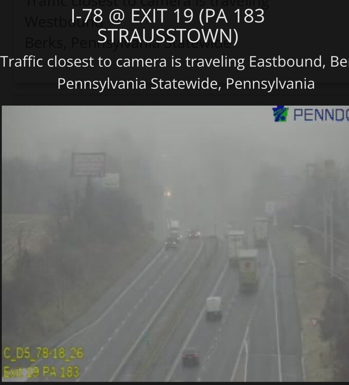
-
January 3, 2025 Light Snow Event Observations
Tatamy replied to ChescoWx's topic in Philadelphia Region
Light snow and flurries here. I checked out the Penndot cams along I78 and it’s coming down hard there west of Hamburg. -
Starting to see some very light snow and flurries with the weak disturbance moving SE across PA. Not expecting more than a dusting here if that into this evening.
-
Snowfall NYC subforum Jan 6 and OBS if needed
Tatamy replied to wdrag's topic in New York City Metro
lol - Icon gives me 7” (10:1) on 18z. This is starting to remind of the system that produced the I78 death band last year. The gradient was such that you could find a 4” accumulation difference on opposite ends of a town just south of me. Either way there will be a big time gradient with it. -
Snowfall NYC subforum Jan 6 and OBS if needed
Tatamy replied to wdrag's topic in New York City Metro
What is it that the EPS is seeing at 18z that the 18z GEFS is not? There’s something in the data stream that it’s parsing out that the other models aren’t (yet?). I get the part with the confluence however there seems to be more to it. -
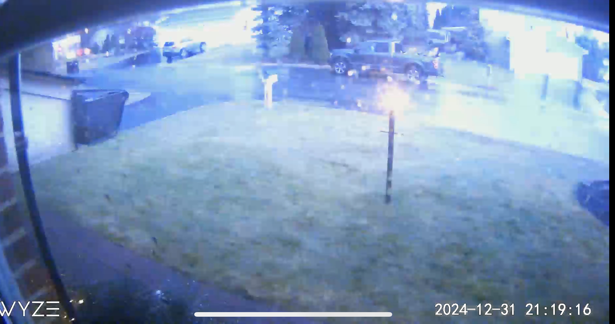
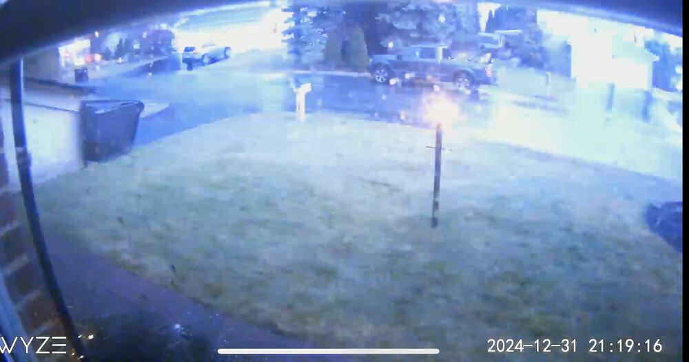
I have measured 127 lightning strikes in the past three hours on my Tempest.
-
Loud booming thunder here for New Years Eve
-
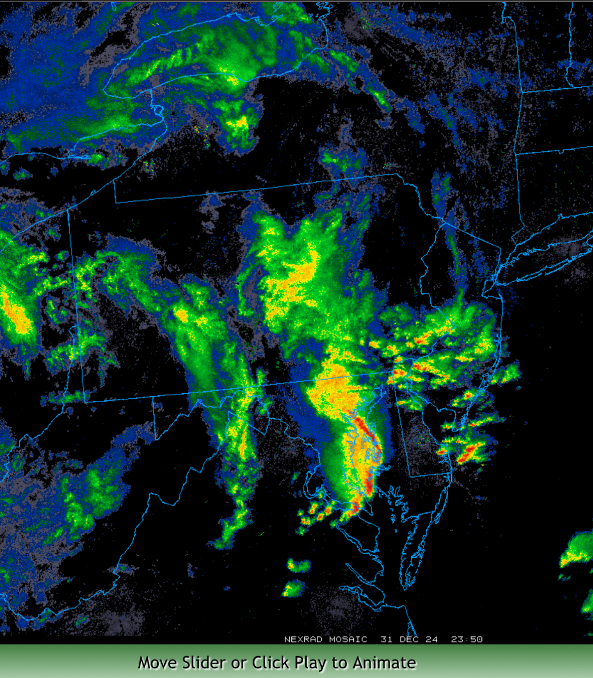
Going back to tonight’s system there’s a really interesting look to the radar right now to my south in the Philly area. The echos look to be convective in nature as they race off to the north ahead of the main band of rain. Big time squall line moving onto the eastern shore. Partly cloudy here with some stars visible.

-
Snowfall NYC subforum Jan 6 and OBS if needed
Tatamy replied to wdrag's topic in New York City Metro
Add in 78 and 79 -
Snowfall NYC subforum Jan 6 and OBS if needed
Tatamy replied to wdrag's topic in New York City Metro
06Z/31 EC illustrates your point very well. -
70s and 80s here on LI. I honestly felt that the climate would only produce 6”+ storms maybe 2-3 times per decade.
-
I was not expecting that. I actually had been looking forward to several days of warmer weather to close out the end of the year however it starting to look like I will be disappointed. I even put my snowblower away today figuring I would not need it for a least a week to 10 days or so.
-
Mt Holly in their evening AFD noted their concern about the possibility of a coastal developing on Wednesday and Wednesday night bringing snow to parts of the Poconos.
-
18Z GFS really outdid itself for Happy Hour tonight.