powderfreak
-
Posts
83,833 -
Joined
-
Last visited
Content Type
Profiles
Blogs
Forums
American Weather
Media Demo
Store
Gallery
Everything posted by powderfreak
-
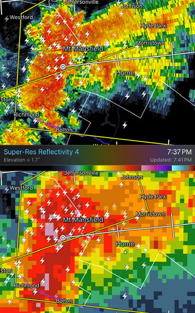
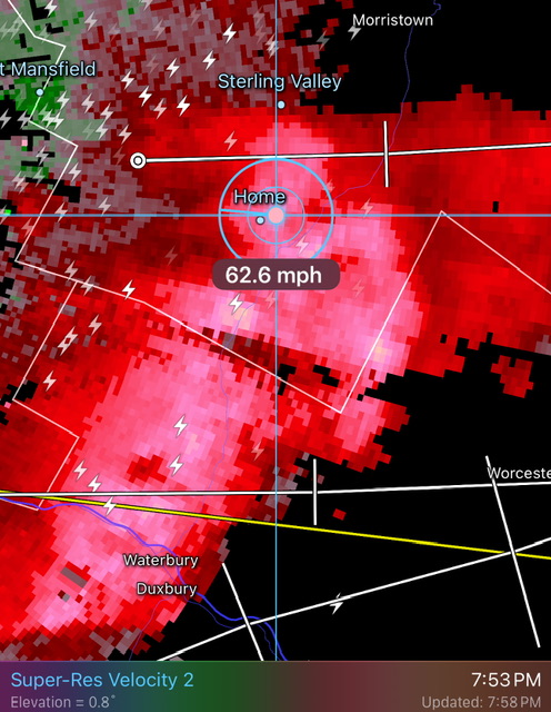
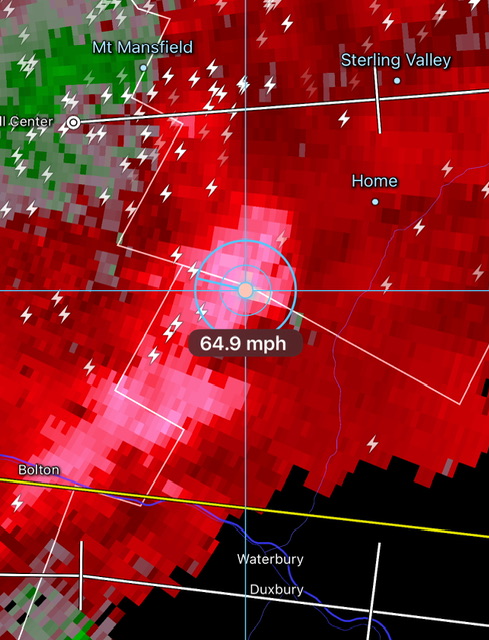
 Decent wind velocities.
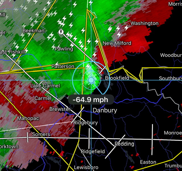
-
76/54 Dried out nicely this afternoon. Open the windows up.
-
ICON has like a foot for NYC, ha.
-
I’d feel fairly confident in 1”+ for your location… but yeah, I guess like winter if folks are looking for jackpots those will be narrow. Someone gets 1.5”, they’ll say they were Steined because somewhere else saw 4.5” and flash flooding.
-
There’s a higher chance of something going wrong for rain in summer than snow in winter?
-
88/65 Dews are running 5-7F lower up here today. It’s still very hot and humid but definitely a little bit of relief felt with a breeze today.
-
That’s so brutal in an urban setting. Man, if you don’t have A/C…
-
Yeah, you’d think if the state’s HI record was 115F, the post would want to focus on all the sites above that level in this image… not the one showing an erroneous 133F. Numerous sites above that 115F level but they lose the viewer by elevating the highest outlier.
-
Just had a quick shower leave 0.04” and then the sun quickly returned… and oh my god it feels like a real life sauna out there. I’m imagining a PWS with like 80F dews right now after that small amount of moisture. Your skin just turns immediately damp.
-
Sorry for the snark, it just feels like the same discussion about comparing dew points of a PWS in a wooded area. The data is real, the dew is 75F on DIT’s yard when it’s 68F at the open airport field. Both are real but for different reasons. Humans have altered the landscape too, it’s hard to separate out what degree of warming may be from pavement, vs emissions vs other anthropological reasons. I guess you could remove all sites that are within 30 miles of a given population number… then compare all the sites in rural areas to see what happens in the means?
-
But that’s where the airports usually are where temperature records are often taken, no? Just playing devils advocate.
-
Oh yeah, but I’m just saying where people live those temperatures are real to them. Heat islands are absolutely a thing but those temperatures are what are being felt too by millions and millions of people.
-
You mean how do we monitor surface temperatures as if there weren’t 7 billion humans building stuff all over the world?
-
Yeah good call. This morning especially felt cooler than I would’ve guessed going into Day 2. Those multiple rounds that moved through last night seemed much more developed than any model had, even short term.
-
I’m a little bummed from those MOS numbers a couple days ago… wanted to pop mid-90s up here. Been 90-91F.
-
Yeah RadarScope does HI. I’m not a fan when I see those.
-
Heavy rain, continuous thunder. Just constant booming, driving the dog into an anxious mess. A couple solid nearby cracks, deafening. Strobe lightning in this tropical air mass. This rainfall is intense, too.
-
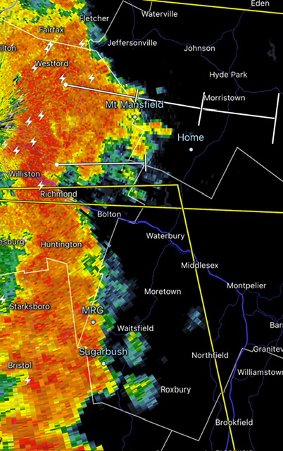
Decent regional line.
-
Round two.
-
We are absolutely buried in knotweed all along the West Branch up here. I don’t notice it in any of the larger feeders or flashier drainages like Notchbrook or Sterling Valley. It’s the West Branch here that flows through a lot of agriculture acres, golf course, draining fert and manure along the way in the larger valley (relative size around here).
-
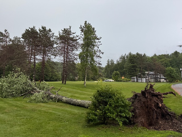
Ha, that wasn’t enough to flip the tables. I’m usually pretty reserved with obs, but that felt legit. Probably 40-50mph at max. Likely low to mid 40s… I think 50+ would’ve done more of these trees in our in the open. And 40-45mph here would fit with the 2-3k feet velocity scans of 55-65mph. But that was a solid downburst… whole trees swaying and bending for about 30 seconds in a whiteout. 30 seconds of mayhem.
-
Damage. Lots of sirens. That was fun.
-
Holy shit. Intense straightline winds. Wow. Branches down. Still have power though. That was whiteout straight-line wind damage that fanned out on the east slope and into the valley.
-
Some big wind coming your way… probably right on the county line at Lawn Rangers and that area on the high spot of RT 100. Just came over the spine and accelerated ESE.
-
It is loud coming over the mountain. Rain skirting a bit north so far, but it’s not going to miss.