nj2va
-
Posts
15,346 -
Joined
-
Last visited
Content Type
Profiles
Blogs
Forums
American Weather
Media Demo
Store
Gallery
Everything posted by nj2va
-

The Jan 31 Potential: Stormtracker Failure or 'Tracker Trouncing
nj2va replied to stormtracker's topic in Mid Atlantic
What does this mean? -
oooooooof
-
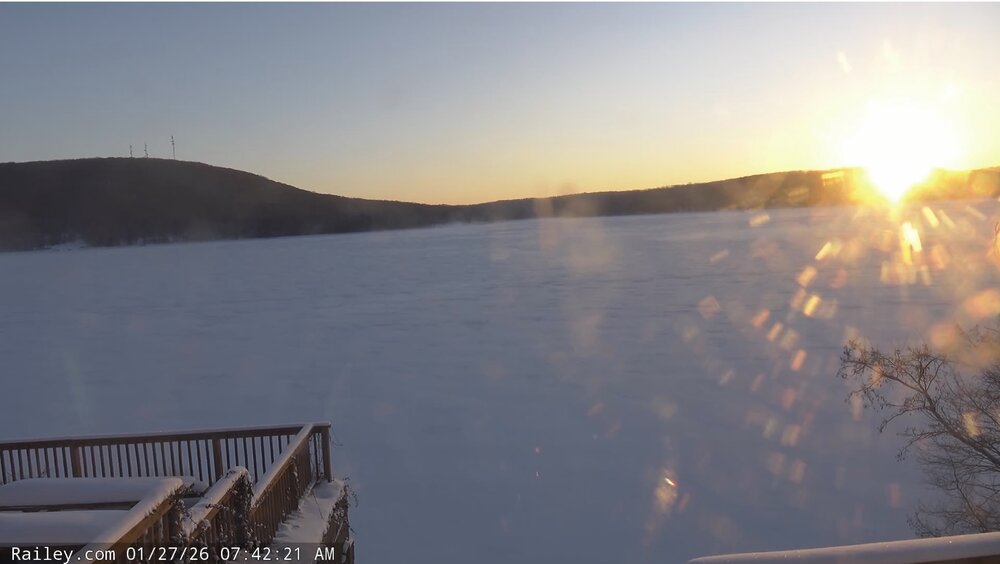
Captured this screenshot of the sun rising over Deep Creek Lake this morning from Railey Realty’s website. Low of -3 there.
-
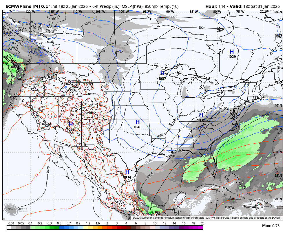
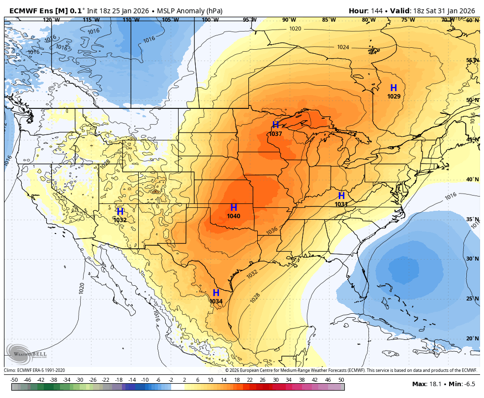
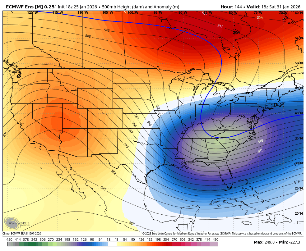
We are relying on some very intricate interactions and phasing of streams. Tiny adjustments make a big difference. At least there’s something to track 2 days after getting an area wide storm.
-
It’s usually a pile on…all it takes is one ‘zomg dunzo goner ugh another miss what else is new geez it never snows”.
-
I honestly don’t know where Reading is (I don’t mean that snarnikly), but there’s a good chunk of this forum in eastern areas (beaches, etc) that are very much in the game.
-
I’d say half of side roads around me haven’t even had a plow come through yet.
-
Yeah, the CCB would be where higher ratios would come into play.
-
Wisp reporting 19" storm total - with another 2-4" of upslope today.
-
Oops, forgot about them.
-
Did the Patriots play any hard teams this year except the Bills? lol
-
This. Sure NAM thermals were good (had the changeover too aggressive by a bit) but it failed miserably elsewhere. It was a joke.
-
This is going to be among a favorite of mine on my top lists. Thanks for all of your analysis!
-
Oh yeah not surprised - but such a joke. They don’t even stick a ruler in the ground…they stare out the window and take a wild guess I bet.
-
8.4” storm total, that was a lot of fun today. Beats out similar 8” storms that were all snow.
-
WTF is that DCA measurement? That is absurdly low
-
It was close with thermals but terrible with QPF.
-
January 24-26: Miracle or Mirage JV/Banter Thread!
nj2va replied to SnowenOutThere's topic in Mid Atlantic
Man of few words lol -
NAM QPF is a M’fing joke.
-
What are they caused by? That’s super cool.
-
I’d think we need that ridge out west taller.
-
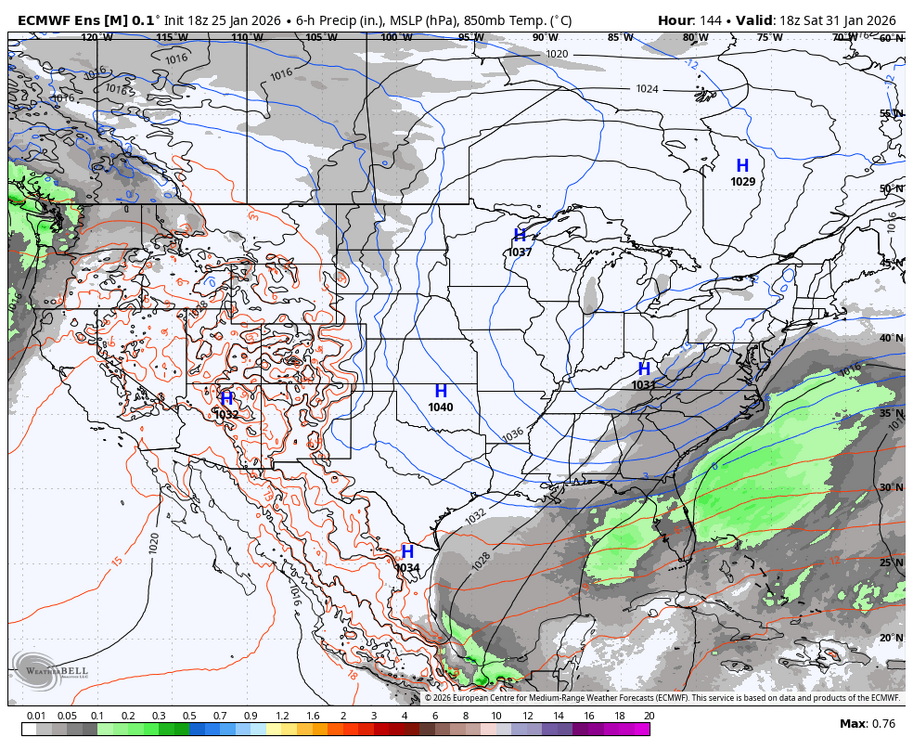
EPS at the end of the run. Seems progressive/offshore but I’ll let smarter people comment.


-
I’ve lived here for about 18 years and I don’t remember a storm quite like this - between the snow, heavy sleet, and now freezing rain with temps in the teens/20s. Very neat.
-
That’s textbook
-
What flavor icing are you going with?