GoAPPS
-
Posts
163 -
Joined
-
Last visited
Content Type
Profiles
Blogs
Forums
American Weather
Media Demo
Store
Gallery
Everything posted by GoAPPS
-

2025 Spring/Summer Mountain Thread
GoAPPS replied to Maggie Valley Steve's topic in Southeastern States
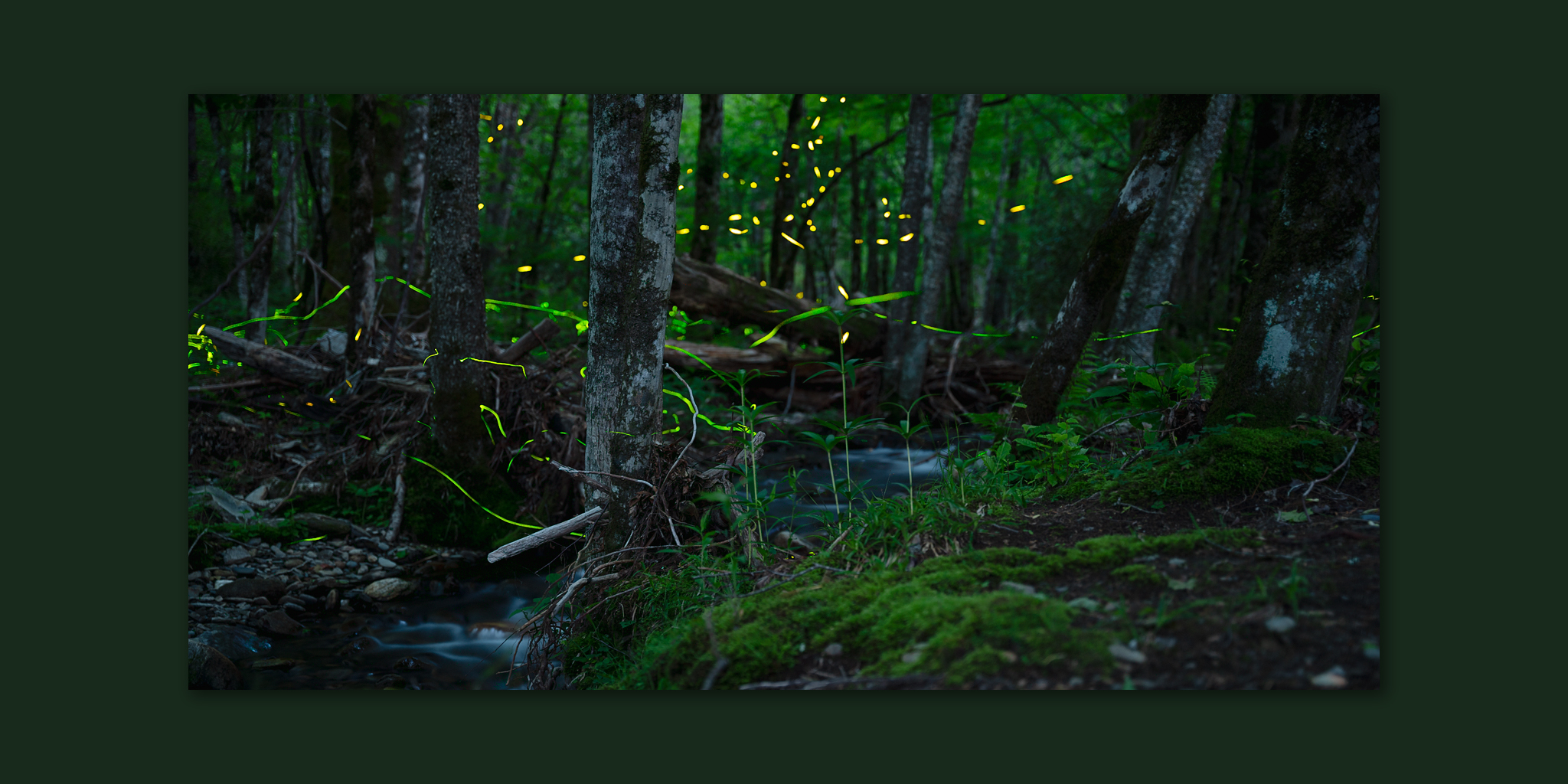
I've been heading out into the woods over the past couple of weeks to photograph the blue ghost and synchronous fireflies!
-
2025 Spring/Summer Mountain Thread
GoAPPS replied to Maggie Valley Steve's topic in Southeastern States
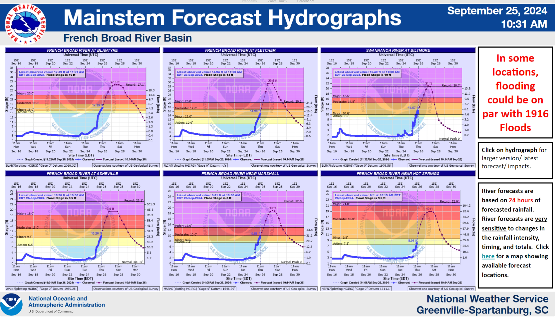
Six months ago... This raccoon was one of three who were trapped on an island in the middle of the Helene floodwaters in the River Arts District of Asheville. One by one they worked up the courage to swim for the shore. This one stopped halfway across and rested on a metal pole that was sticking out of the water. This heartbreaking moment reminds me that it wasn't just people who lost everything. I left shortly after taking this picture, because I was worried my presence would stress the raccoon more than it already was. I hope it survived.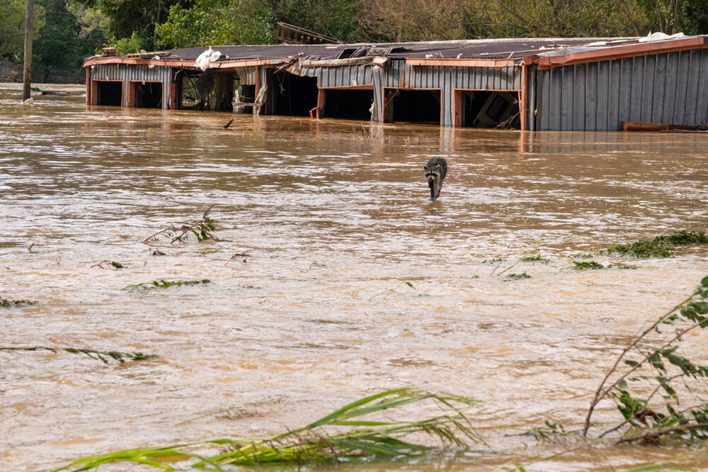
-
2025 Spring/Summer Mountain Thread
GoAPPS replied to Maggie Valley Steve's topic in Southeastern States
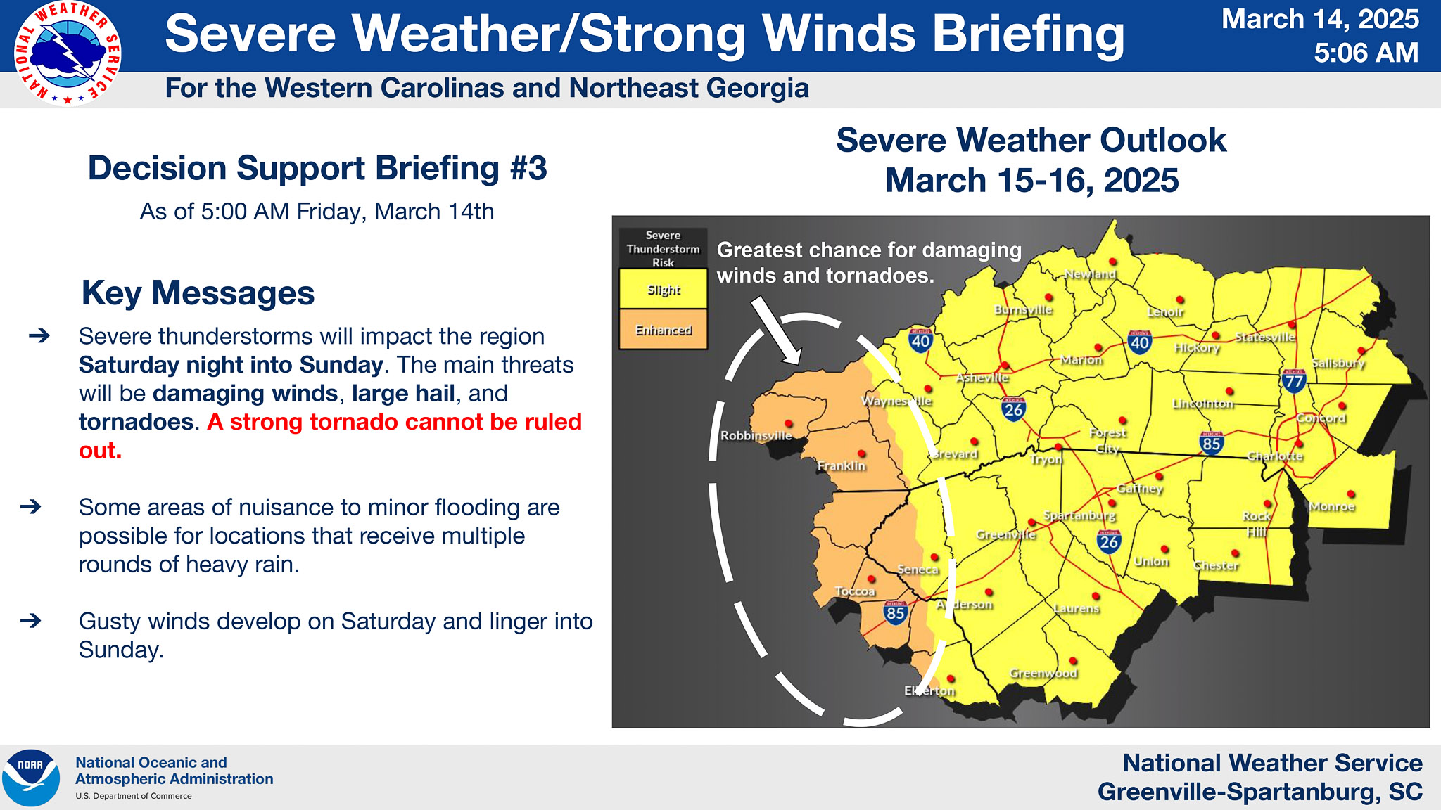
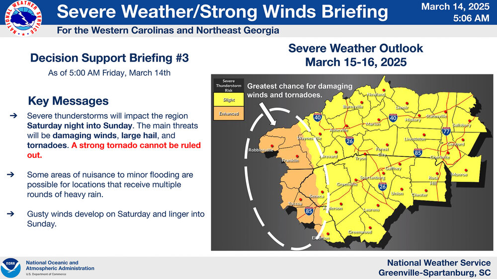
Look out, Western Upstate and Southwest NC.
-
-
Could the upper level snow be undermodeled based on how cold the air will be?
-
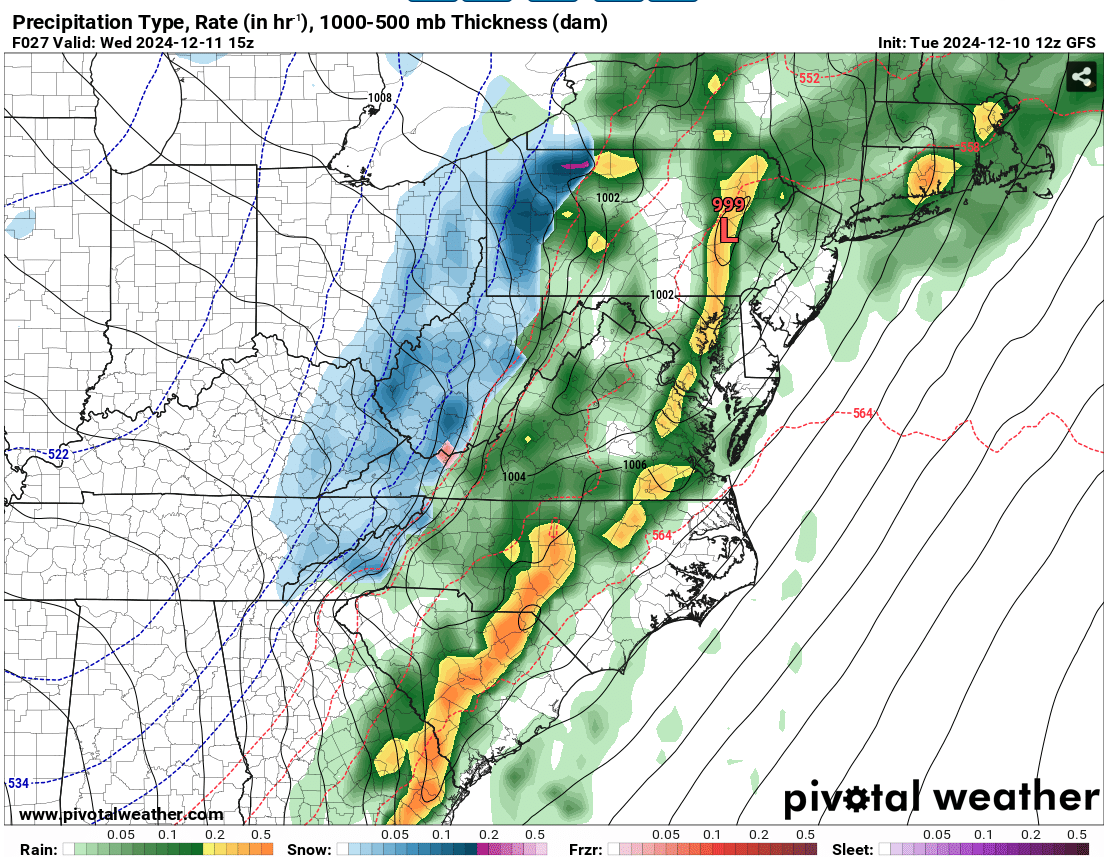
Light snow in Asheville.
-
I feel this as an Asheville resident. Pretty sure Wilmington has more total snow than us so far this year. People think it snows here a lot (because mountains), but they don’t know about the Asheville Snow Hole.
-
Idk, 32 inches in Goldsboro is a little sus.
-

-
Regardless of precipitation, we'll be in the ice box next week.
-
The Asheville snow hole was well modeled. I had hoped it was overdone, but it kept showing up run after run across all the models. Currently sleeting in West Asheville.
-
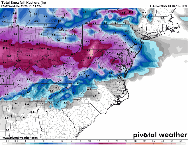
GFS total snowfall trend from Saturday's 18z run to today's 12z run.
-
Light snow in Asheville.
-
Some of the models keep insisting on a brief period of snow in the mountains tomorrow morning.

-
NC Mountains are basically bare, partly because of Helene and partly because of seasonal norms.
-
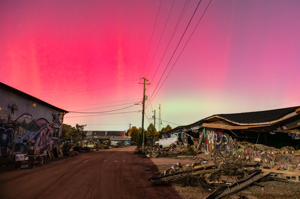
Hey, everybody. First time posting since Helene. I'm personally fine, but I lost my photography studio space that was in the River Arts District of Asheville. I don't know if this is allowed, but I have an online gallery store with photos from the Mountains, including some bittersweet images of the aurora over the River Arts District post-Helene. Additionally, if anyone is looking for handmade gifts this Christmas, Explore Asheville has put together a great list of local artists you can support.
-
Questions for the meteorologists: 1) If Helene comes ashore as a major hurricane versus a weaker system, how would its intensity affect how quickly or sharply it might curve NNW? What is the mechanism? 2) With an upper-level low positioned to the northwest of the storm as it makes landfall, how might the hurricane’s intensity impact its interaction with that low? Could a stronger storm create more resistance to the low's influence, or would it actually get steered more sharply?
-
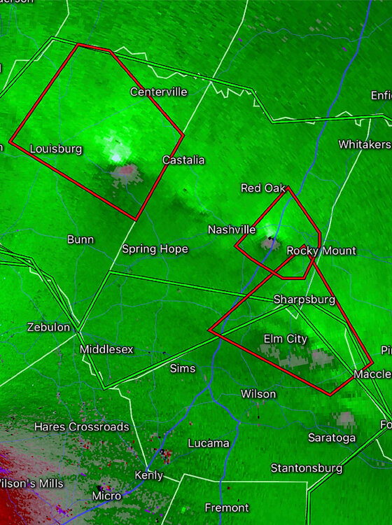
Several tornado warnings currently active in NE North Carolina.
-
-
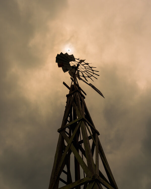
Let's see 'em! Here's mine from South Texas.

-
I went to the climatologically best place to see the eclipse without clouds (South Texas) and saw... clouds. Oh well, at least I got one good shot out of it.
-
2023-2024 Fall/Winter Mountain Thread
GoAPPS replied to The Alchemist's topic in Southeastern States
This picture would make a great magazine cover. -
2023-2024 Fall/Winter Mountain Thread
GoAPPS replied to The Alchemist's topic in Southeastern States
What is this depicting? -
2023-2024 Fall/Winter Mountain Thread
GoAPPS replied to The Alchemist's topic in Southeastern States
If it's snowing this hard in Asheville, I can only imagine what's going on further west and higher up.