GoAPPS
-
Posts
165 -
Joined
-
Last visited
Content Type
Profiles
Blogs
Forums
American Weather
Media Demo
Store
Gallery
Everything posted by GoAPPS
-
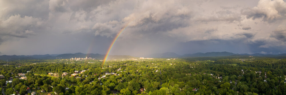
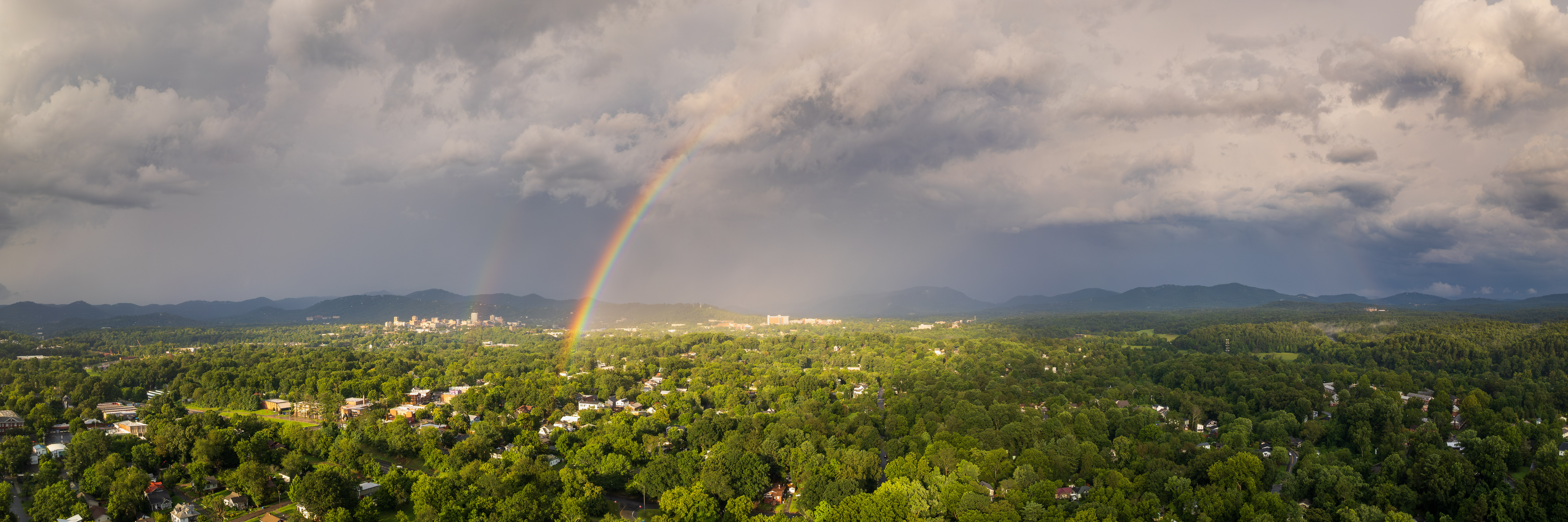
And here's a rainbow that appeared for a few minutes after the storm passed. Both shots were from my DJI Air2S drone.
-
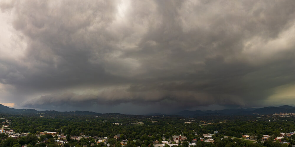
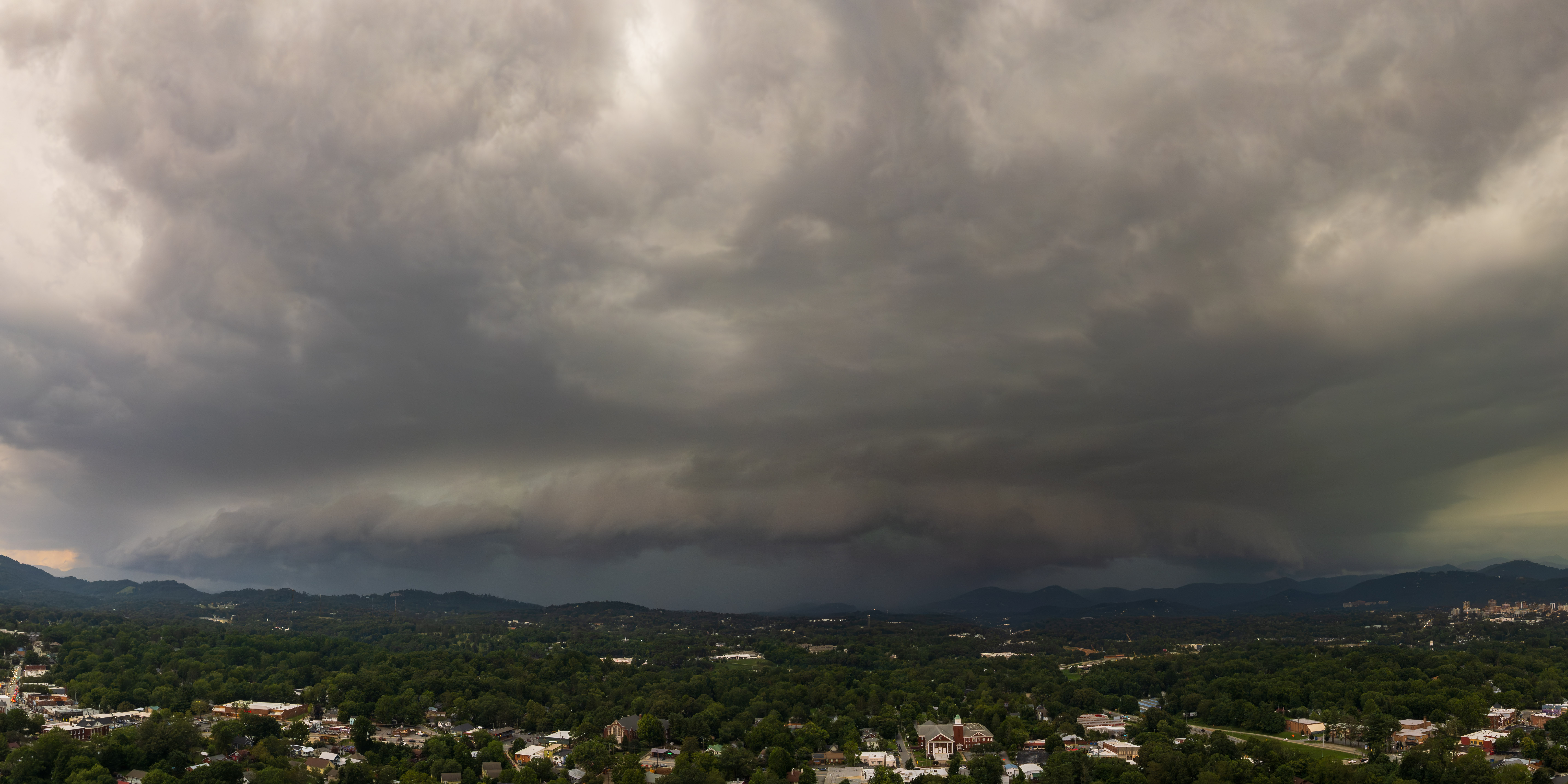
Late to the party, but here's a drone shot of the storm that hit Asheville.
-
Snowing in Asheville now. 34°.
-
As Met pointed showed above, the GFS and now several short-range models are showing a deformation zone forming as the trough goes neutral and the cyclone begins occluding, wrapping moisture back into the colder air mass on the northwest side of the system. The window is very narrow, so odds are low, but it could surprise some folks with a burst of snow.
-
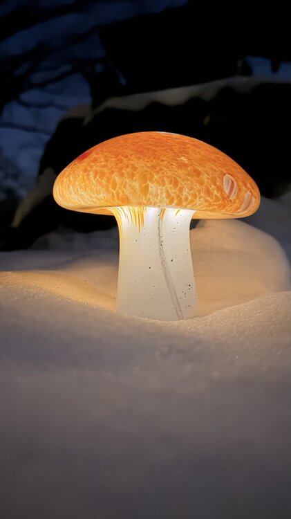
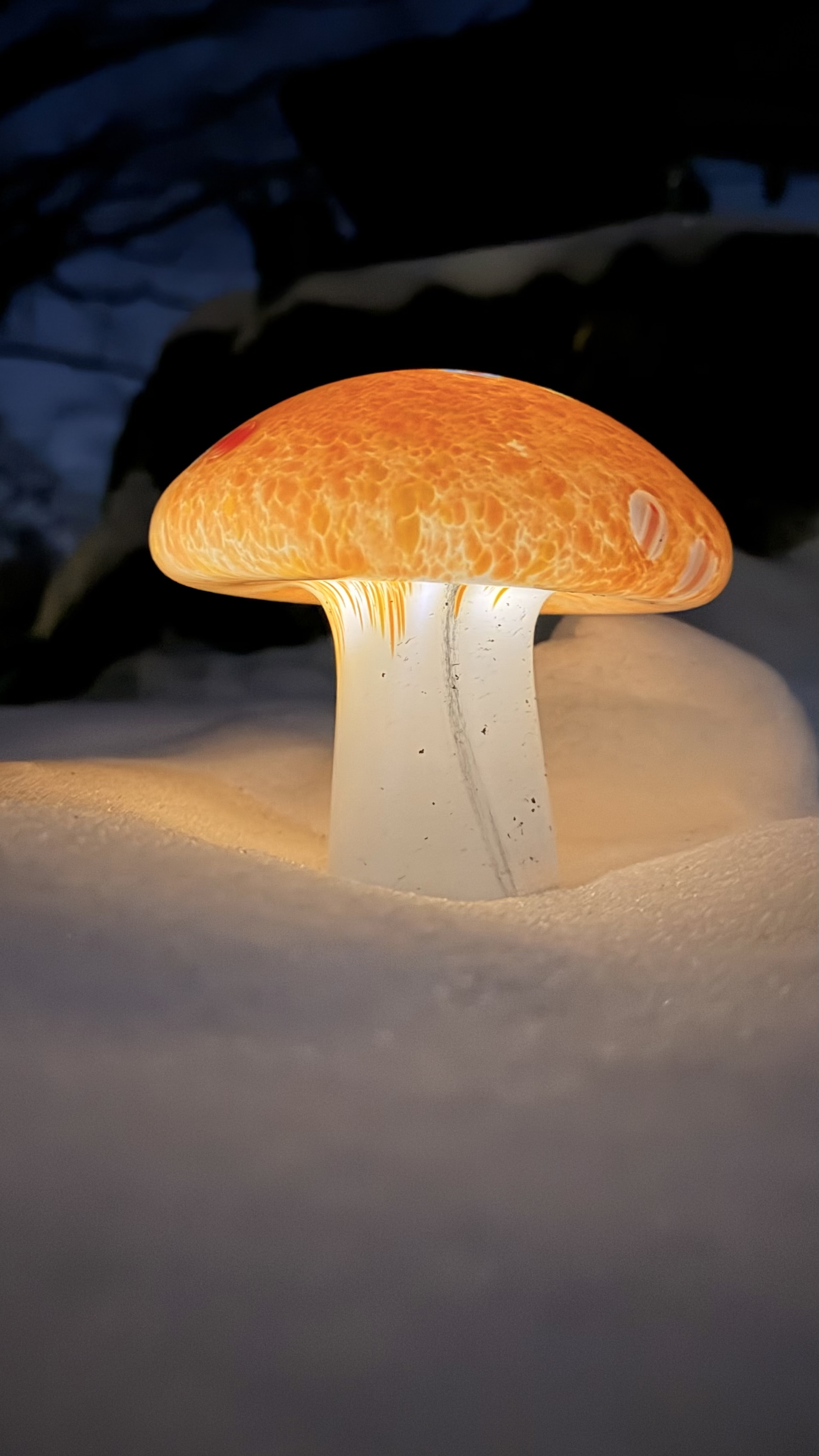
The Costco mushroom yard lights look great in the snow!
-
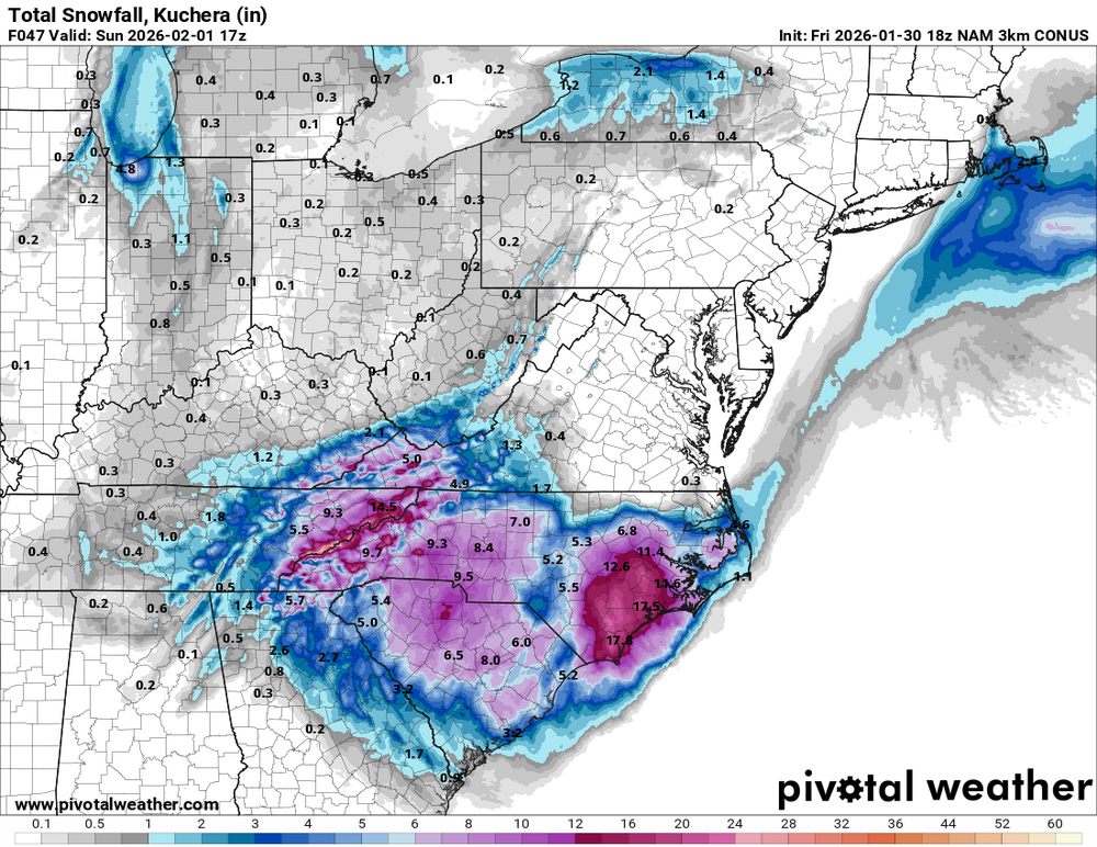
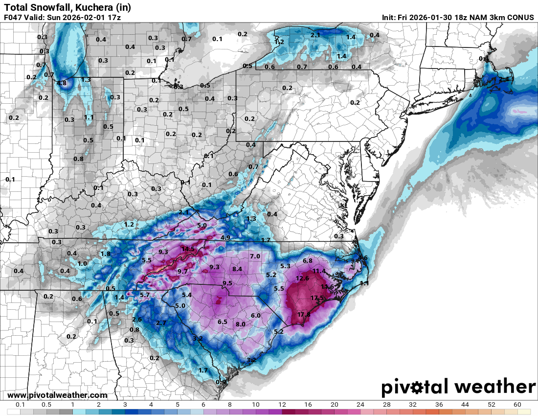
It's only through 1 p.m. tomorrow. Here's through 1 p.m. Sunday. Also adds a good thumping of NWFS for the mountains.
-
Latest GSP Forecast Discussion has some interesting tidbits. By Saturday, guidance digs the potent upper low in the vicinity of the Upstate as it evolves into a negative tilt and instigates subsequent surface cyclogenesis along a coastal baroclinic zone. The upper low will be anomalously deep with H5 heights in the bottom 1st percentile to near all time record low for the southeast. This will be an unusually cold snow event for the western Carolinas and northeast Georgia with very cold temperatures in place as the snow occurs. Some members of guidance depict temperatures in the low 20s to teens during peak snowfall rates on Saturday and even the warmer solutions keep temperatures at 30 degrees or lower. Furthermore, forecast soundings indicate incredibly cold profiles with a deep dendritic growth zone and plenty of forcing in part from strong DPVA with the upper low. This will result in rare SLRs ranging from 15:1 to 20:1. Surprisingly, guidance is in very good agreement with SLRs with only small differences between the 10th and 90th percentiles. Thus, it won`t take much liquid QPF to realize several inches of snow. The very cold temperatures will also increase impacts to travel with snow sticking very efficiently to roads.
-
That's a good bet, but I'd wait until Friday morning before making a final decision.
-
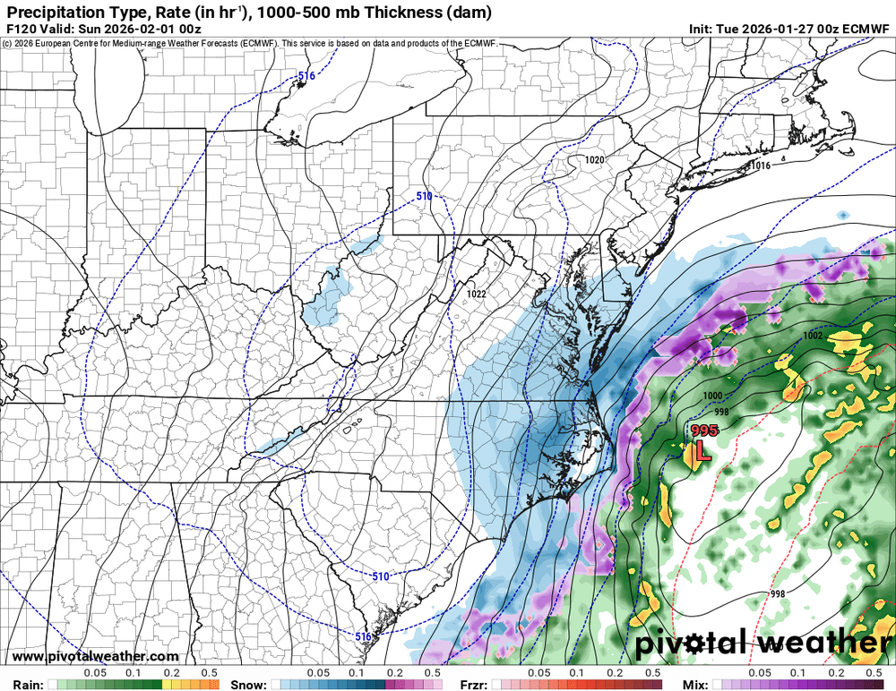
Timing is everything with this weekend's system. The Euro phases the upper low later and farther east, leaving the mountains with cold air aloft but limited divergence and moisture. The GFS phases earlier, allowing stronger upper-level divergence to overlap deeper moisture and throw precip back into the Appalachians.
.thumb.png.f17dd585b2d225e04aa7a57040fc60cd.png)
-
Up to 33 degrees in West Asheville with only a light glaze.
-
I’m guessing those lower totals in the southwest mountains are from the Euro amping the system so much that it changes over to just plain rain? Not complaining, if we’re not gonna get any snow, I’d rather it just be rain.
-
Any thoughts on an undermodeled CAD leading to the surface low tracking further south than modeled?
-
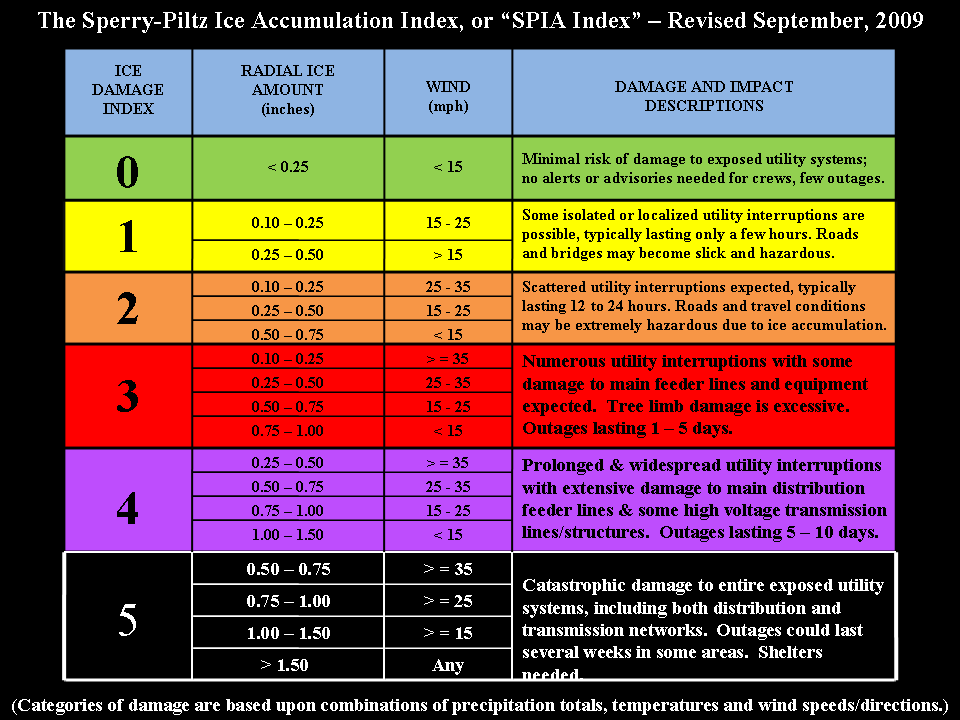
That wind could bump us from a 2 to a 4 or even worse.
-
We better pray that doesn't verify.
-
I really hope this is snow and not ice, not just because ice sucks, but also because Asheville and the surrounding area could really use a break from infrastructure-wreaking storms.
-
I'm really hoping these suppressed solutions don't pan out, though it would be hilarious if Wilmington got more snow than Asheville for the second year in a row. Last year it was 2.6" for Wilmington and 1.9" for Asheville.
-
Next Tuesday is looking tantalizingly close.
-

Major Hurricane Melissa - 892mb - 185mph Jamaica landfall
GoAPPS replied to GaWx's topic in Tropical Headquarters
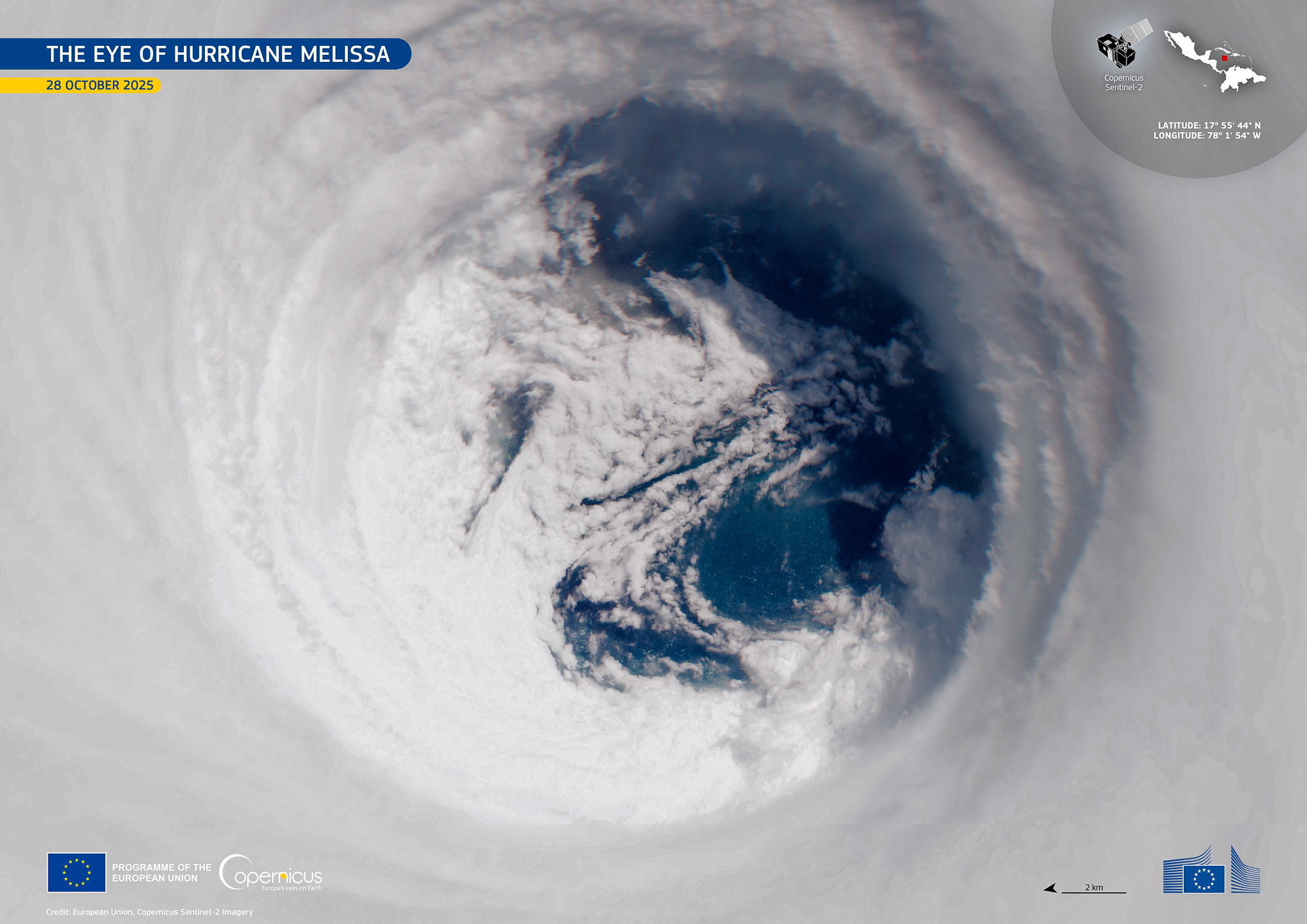
View of Melissa’s eye at peak intensity. Credit: European Union, Copernicus Sentinel-2 satellite.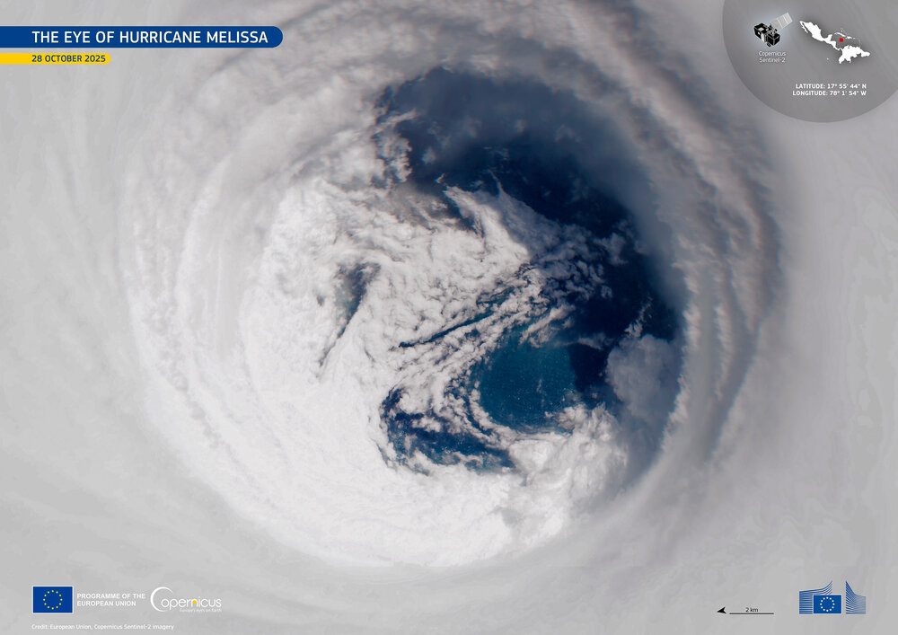
-
Major Hurricane Melissa - 892mb - 185mph Jamaica landfall
GoAPPS replied to GaWx's topic in Tropical Headquarters
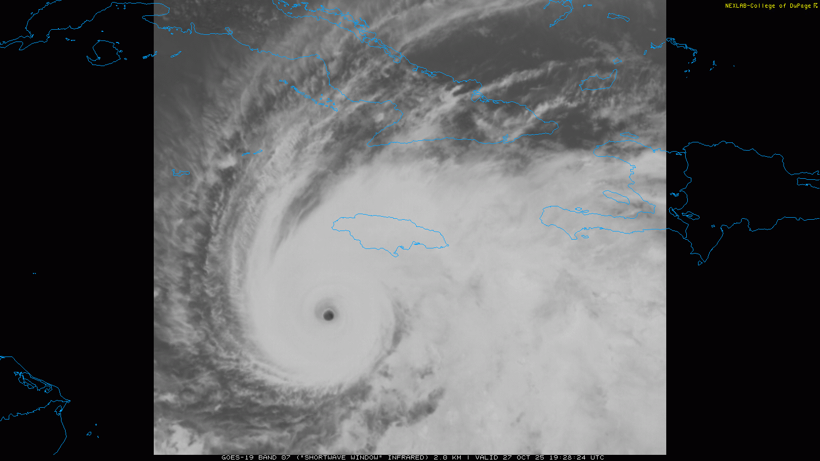
Look at the size of the stadium effect on shortwave IR.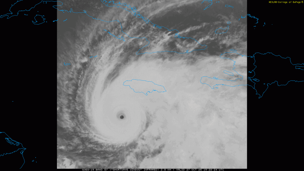
-
I hope this isn't a dumb question, but is there a website similar to Tropical Tidbits or Pivotal Weather where I can see graphical representations of Google AI model products?
-
Just to illustrate the difficulty of this forecast, here are the 500mb height anomalies from the 0z Euro, Euro AI, and GFS. They clearly show that 94L's eventual track is hugely dependent on the speed and placement of both 94L and Humberto when they have their Fujiwhara interaction. Three scenarios are showing up. In the GFS solution, Humberto throws 94L into the South Carolina coast, and it quickly moves inland. Scenario 2, shown by the Euro, has Humberto partially capturing 94L, causing it to stall right on the S.C. coast but eventually releasing it. Again, 94L strikes the S.C. coast, but a bit further south and weaker. The Euro AI has a weaker and faster Humberto, which interacts earlier with 94L and causes that same stalling further out to sea. When 94L eventually gets free, it heads out to sea instead of west.
.thumb.png.26f6716d7fd11b22a141f970a35cbb3b.png)
.thumb.png.5d46deccf01139e8cda6ff44e390a2e0.png)
.thumb.png.7a8af89f9bdc1c412d6cd65b135f6525.png)
-
Current runs of the GFS and Euro show the western tropical system hitting South Carolina.
-
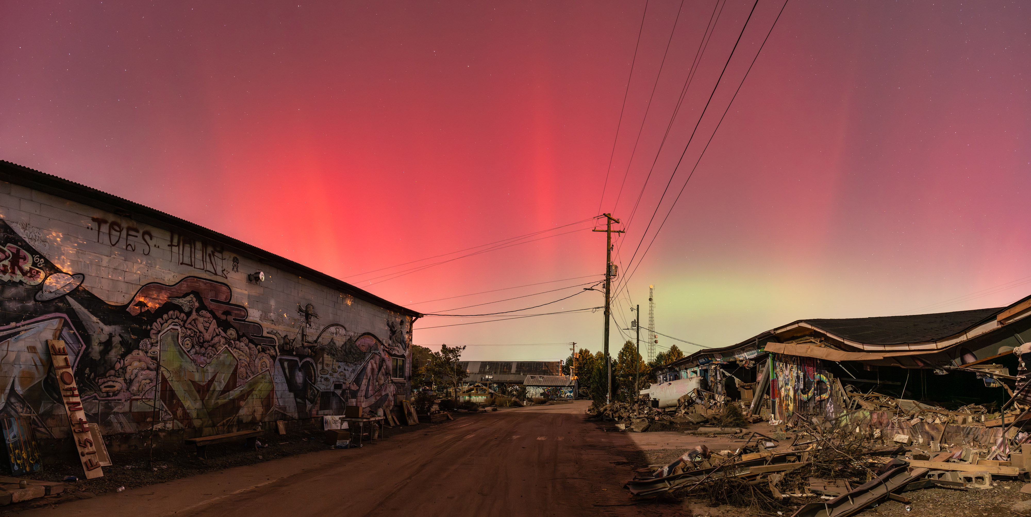
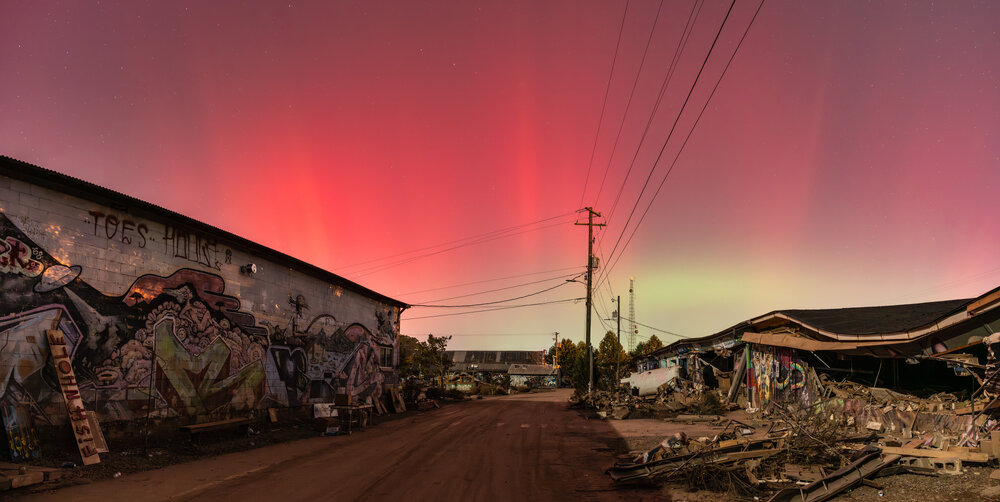
(Oct. 10) A rare solar storm brought the aurora very far south. I took this photo from the desolation of Foundy Street in the River Arts District.
-
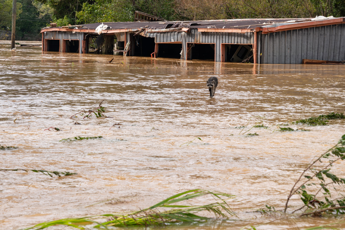
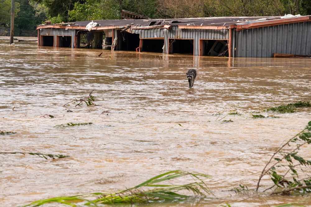
(Sept. 28, the day after the storm) A raccoon perches atop a metal post in the floodwaters. I walked away after taking this photo, as the raccoon was stressed enough. I hope it survived.
-
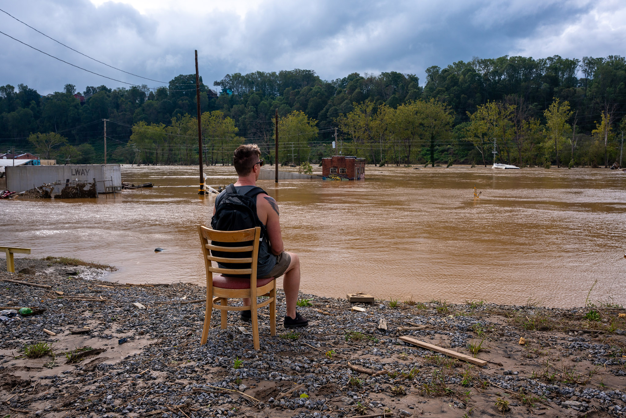
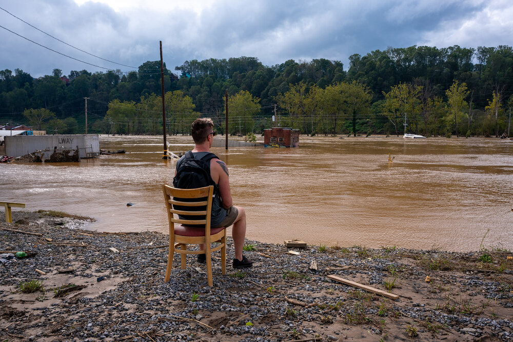
(Sept. 28, the day after the storm) My brother found a chair that had washed down the river the previous day and sat in it for a moment looking out over the River Arts District in Asheville.



.png.b342977ca471a322d61332d123effc23.png)


.png.0c19218a50e4def1337f5c0db7e86e32.png)
.png.a65ac6935f8c7e5c09206d12331581f7.png)
.png.a21307c57a9661862a22fa45df0f253e.png)