NorthShoreWx
-
Posts
5,510 -
Joined
-
Last visited
Content Type
Profiles
Blogs
Forums
American Weather
Media Demo
Store
Gallery
Everything posted by NorthShoreWx
-
I'd also like to see the original wording of the query, just to further my understanding of how the bot responds.
-
I was remote for a lot of years before it was fashionable going back to 2006. Not commuting was great, but I actually enjoyed traveling and seeing human beings in an office during that time. These days I'm a self-employed team of 1 (mostly) and all the back office functions are conducted at home, but that isn't really "remote". Low here was 27.9⁰. The 4 hours around 28 or 29⁰ wasn't quite a hard freeze. Maybe there was farther from the sound.
-
28.9⁰ here now. It's been below freezing since 7pm, but flatlined at 29⁰ for the past 2 hours. Stations just to my south are running 26 - 27⁰ and stations just to my north are running 31 - 34 (with a few higher). Just north of that is a lot of relatively warm water.
-
Overnight rainfall here only 0.06". Most of the precip was to our S and SW.
-
Seems that way, at least in the boundary, but it might stay dry. Anything very light would probably be liquid.
-
KBOX too.
-
Nice follow up stat: today on 11-11 we tied for our 11th earliest snowfall. I'd play that number. Unless you want to be a downer and bump it up to 8th because of the ties. 10 18 2015 10 27 2016 10 29 2000 10 29 2011 10 30 2020 11 2 2002 11 7 2012 11 8 2010 11 8 2019 11 11 1996 11 11 2025 11 12 2013 11 13 1997 11 13 2003 11 13 2004 11 15 2018 11 18 2008 11 20 2017 11 22 2006 11 22 2024 11 23 2005 11 26 2014 11 26 2021 11 28 2023 11 29 1995 11 29 1999 12 2 2007 12 5 2009 12 11 2022 12 17 2001 12 23 1998
-
I did a little data mining of my snowfall records. Over the past 30 winters (31 if you count through today), our average date of first snowfall (measurable or otherwise) is November 17. Our average date of the last snowfall is March 31. I've got a little PTSD from rehashing 2011-12 and a couple of others. Here are the details (assuming it pastes legibly): Winter First Snowfall Amount First Measurable Amount Last Snowfall Amount Last Measurable Amount 1995-1996 11/29/1995 4.0 11/29/1995 4.0 4/10/1996 7.0 4/10/1996 7.0 1996-1997 11/11/1996 T 11/28/1996 0.1 4/19/1997 T 4/9/1997 0.5 1997-1998 11/13/1997 T 12/10/1997 0.5 4/10/1998 T 3/22/1998 1.6 1998-1999 12/23/1998 0.7 12/23/1998 0.7 4/11/1999 T 3/15/1999 7.1 1999-2000 11/29/1999 T 12/22/1999 0.1 4/11/2000 T 4/9/2000 0.9 2000-2001 10/29/2000 T 12/8/2000 0.4 4/18/2001 T 3/26/2001 2.0 2001-2002 12/17/2001 T 1/7/2002 2.8 4/6/2002 T 3/18/2002 0.2 2002-2003 11/2/2002 T 11/27/2002 1.2 4/8/2003 T 4/7/2003 6.2 2003-2004 11/13/2003 T 12/5/2003 7.5 3/19/2004 3.6 3/19/2004 3.6 2004-2005 11/13/2004 0.2 11/13/2004 0.2 3/24/2005 1.6 3/24/2005 1.6 2005-2006 11/23/2005 T 11/24/2005 1.0 4/8/2006 T 3/2/2006 4.0 2006-2007 11/22/2006 T 1/19/2007 0.6 4/6/2007 T 3/16/2007 4.8 2007-2008 12/2/2007 0.9 12/2/2007 0.9 3/1/2008 0.6 3/1/2008 0.6 2008-2009 11/18/2008 T 12/6/2008 0.7 4/8/2009 T 3/2/2009 8.9 2009-2010 12/5/2009 T 12/9/2009 1.2 3/4/2010 0.2 3/4/2010 0.2 2010-2011 11/8/2010 T 12/13/2010 0.3 4/1/2011 T 3/24/2011 2.0 2011-2012 10/29/2011 T 1/21/2012 4.0 2/12/2012 0.1 2/12/2012 0.1 2012-2013 11/7/2012 2.0 11/7/2012 2.0 3/25/2013 T 3/21/2013 0.5 2013-2014 11/12/2013 0.3 11/12/2013 0.3 4/16/2014 0.2 4/16/2014 0.2 2014-2015 11/26/2014 T 12/8/2014 0.1 3/30/2015 T 3/29/2015 0.2 2015-2016 10/18/2015 T 12/29/2015 0.1 4/9/2016 T 3/3/2016 0.3 2016-2017 10/27/2016 T 11/21/2016 0.6 3/18/2017 T 3/14/2016 4.5 2017-2018 11/20/2017 T 12/9/2017 3.7 4/2/2018 6.1 4/2/2018 6.1 2018-2019 11/15/2018 4.5 11/15/2018 4.5 4/5/2019 T 3/4/2019 3.0 2019-2020 11/8/2019 T 12/1/2019 0.2 5/9/2020 T 1/18/2020 3.0 2020-2021 10/30/2020 T 12/16/2020 5.0 4/16/2021 T 2/20/2021 0.5 2021-2022 11/26/2021 T 12/24/2021 0.4 3/27/2022 T 2/13/2022 0.1 2022-2023 12/11/2022 T 12/12/2022 0.6 3/14/2023 2.0 3/14/2023 2.0 2023-2024 11/28/2023 T 1/6/2024 0.2 3/10/2024 T 2/17/2024 3.0 2024-2025 11/22/2024 T 12/5/2024 1.0 2/20/2025 0.2 2/20/2025 0.2 2025-2026 11/11/2025 T
-
Sag Harbor webcam looking pretty sweet. Off and on flurries here all day so far, including now.
-
Street level elevation there is about 210 feet, so the sensor is 150 feet too high.
-
Had a heavy enough shower of graupel to dust the driveway about 10 minutes ago. It's 38°, so it doesn't lay for long. Low this morning was 32°, but really 32.5° so not freezing. I use a convention of rounding the .5 to the nearest even whole number. I think it is unlikely that my sensor is accurate to a tenth of a degree, so its all funny money.
-
https://kidsanswers.org/why-does-wind-blow/
-
30.0⁰ low here this morning. AoB 32⁰ for 4 hours. That's usually not enough to kill much, but I haven't checked the garden yet.
-
It seems like we have more deer than people here. I literally saw dozens today, mostly at Sunken Meadow, but a couple in my back yard. A new arrival here over the past 2 or 3 years has been skunks. Coyotes are next.
-
I've been a total deadbeat on the snow maps. Hopefully I'll get back on that project soon. I don't have my stuff right in front of me, but the 30-year average here is between 36 and 37". I think BNL is similar. Their 78-year average is 32": https://www.bnl.gov/weather/4cast/monthlysnowfall.htm
-
My final pseudo-official total here was 2.28". The Ambient Weather WS-2902 measured 2.68". It's often a little high, but usually not by this much.
- 246 replies
-
- 1
-

-
- heavy rain
- damaging wind? squalls?
- (and 2 more)
-
It seemed like it got dark very early tonight. This weekend's time change is going to be very noticeable. Remembering dark cloudy December days when the street lights kick in at 3pm. Hopefully some frozen from those clouds. Not complaining; I like those kinds of days in December. They do start to lose their appeal towards spring.
-
Still raining moderately here. Up to 2.57" on my automated gage, but it usually runs slightly high. I'll trust the 4" gage when I check it in the morning. We had just about an inch after the remnants of the initial heavy batch that flooded Brooklyn passed through, but have been making up for lost time since
-
I believe it. In some places, open areas aren't part of the background landscape.
-
That trend line looks wrong. I'm sure the calculation to create it was mathematically sound, but the trend line in the first graph clearly doesn't match the data points for the last 15 years. These kinds of graphs are useful, but only to a point. While I don't doubt that the shade in central park has an effect, there's no certainty that prior to that period there weren't other local effects or inadequate shielding making some of the sunny day readings too high. I'll bet the weather service describes both periods the same: properly sited, properly shielded and properly calibrated.
-
Don't knock it till you've tried it.
-
I was disappointed seeing only 0.10" in the gage this morning, but reading some of the other reports I'm glad we got that much. My fault, I turned the sprinklers off (I'd hoped for the season) yesterday. I'll let y'all know if I buy a snowblower.
-
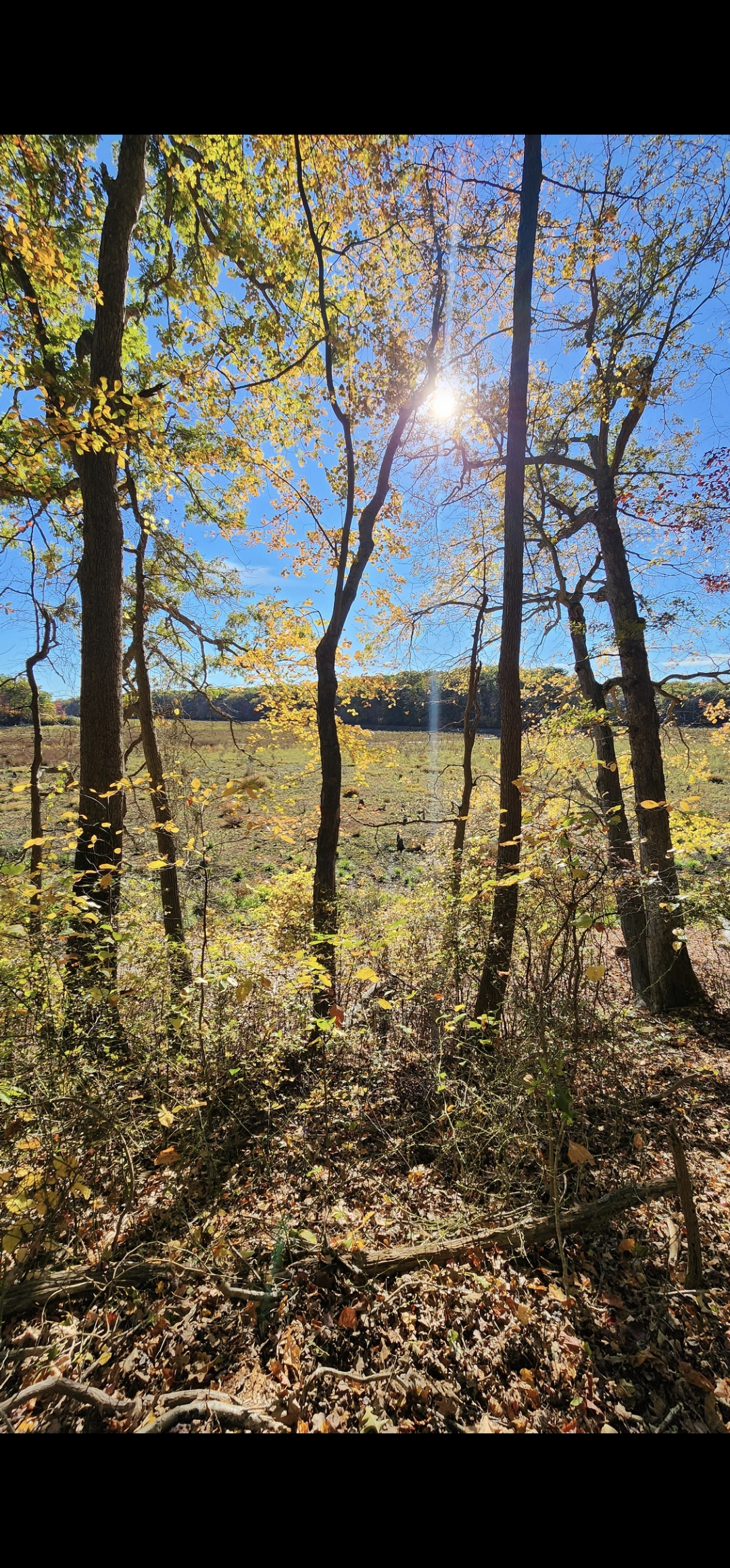
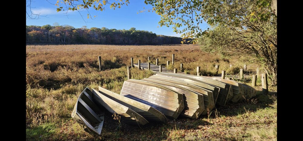
Blydenburgh County Park in Smithtown Friday afternoon

-
Blydenburgh was beautiful Friday afternoon. It's wild watching how fast the brush has taken over the lake bed.
-
2.04" here. If it had been all snow it would have melted down to 2.04"