buckeyefan1
-
Posts
13,470 -
Joined
Content Type
Profiles
Blogs
Forums
American Weather
Media Demo
Store
Gallery
Everything posted by buckeyefan1
-
How many times do I have to ban you? Sigh......goodbye
-
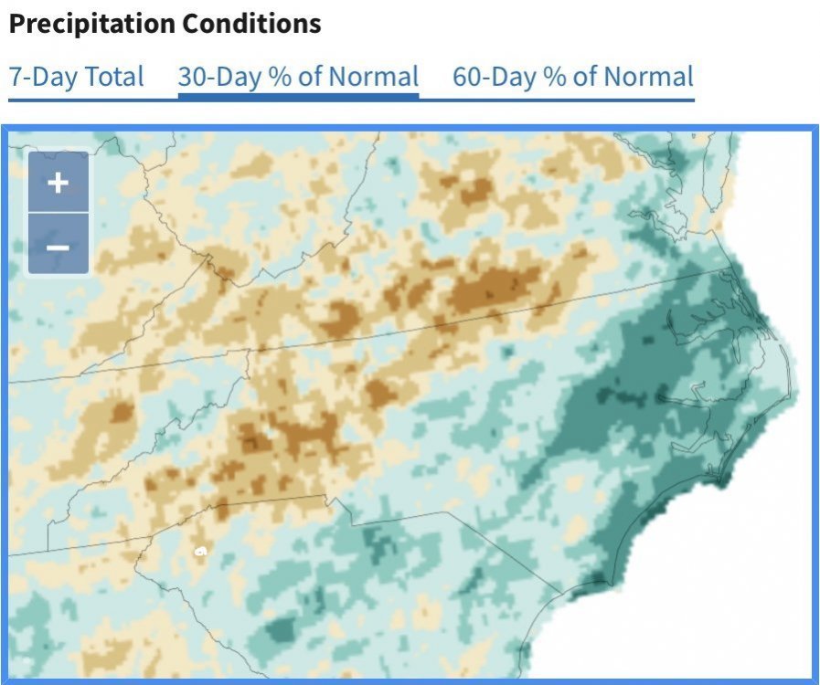
That little white dot in the middle of all the brown is mby. It’s feast or famine around the south, but thank gawd it’s not as bad as the west is currently
-
GSP is giving me about the same for Friday. mby shares your shield
-
Same Currently it's a disgustingly gross 88/72 imby
-
Hopefully the moisture squeeze will hit yby for some heat relief
-
Danny is so cute trying to organize at landfall I'll gladly take the rain
-
This makes me sad
-
I really hope the rain materializes, but I’m not holding my breath
-
Unfortunately, there are pretty good odds this is the way it happens
-
Once again I had another cell split and die before reaching mby yay
-
MBY finally picked up .40 in the bucket last night after days and days of rain all around me I will say that even though it’s been dry, I have benefited from outflow boundaries cooling things off
-
What an absolute beautiful day with a high of 70 after a morning low of 57
-
One of my favorites! Beautiful bloom
-
-

-
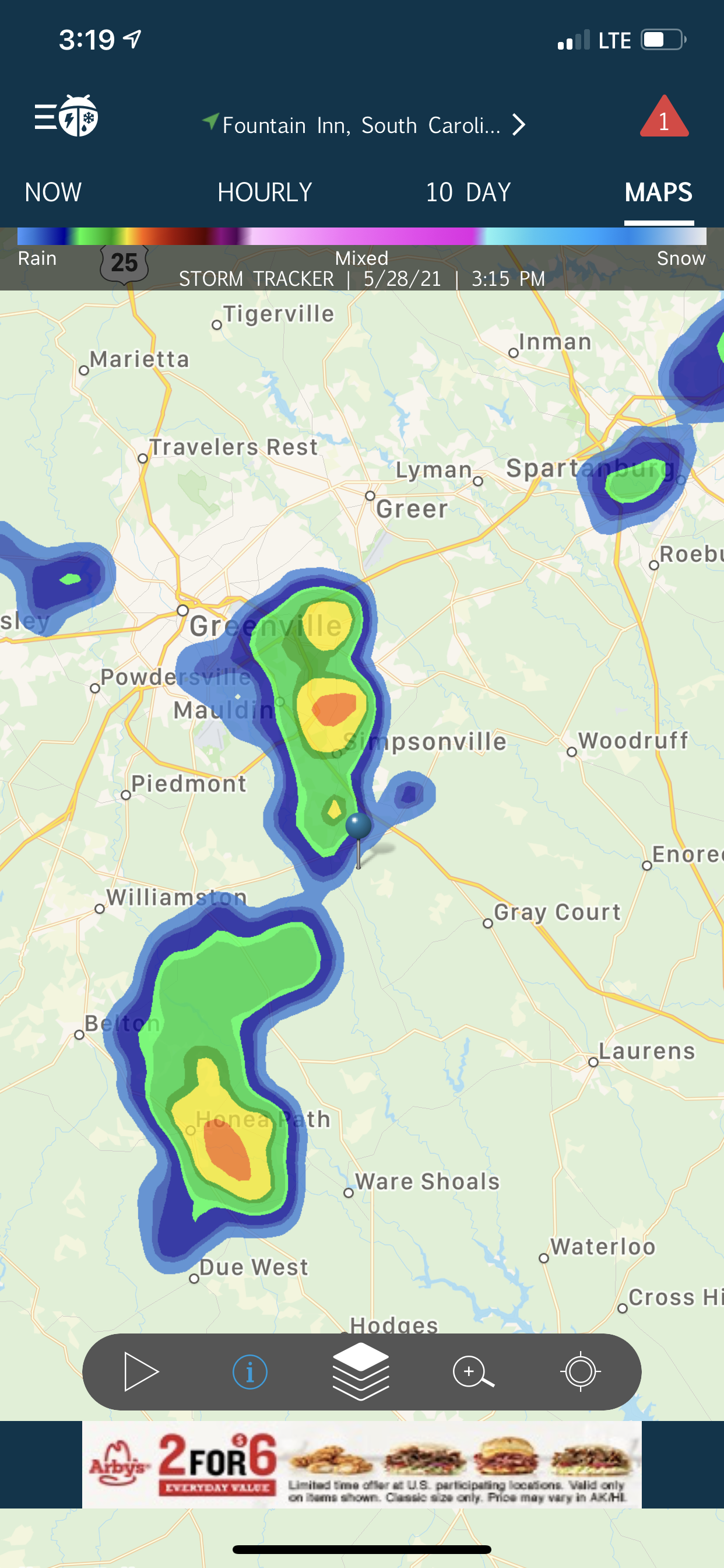
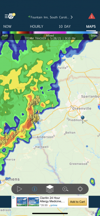
I’m refreshing the radar constantly hoping to see a blob of orange and red that little blip to my west gives me hope
-
He’s tired of the 90’s too
-
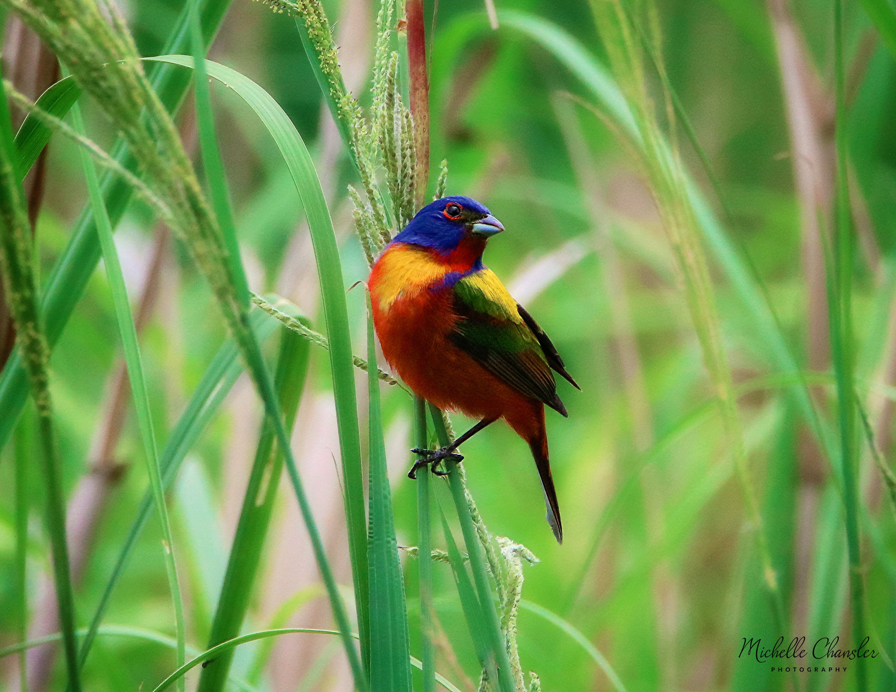
Here’s a painted bunting to brighten your day

-
There’s nothing worse than breaking heat records year after year after year
-
Me too and the outflow boundaries surrounding them In my day we called it buffalo summer because the day started and ended with wearing our buffalo robes to keep warm +1
-
I see a lot of waterfall chasing in my future. Currently 80 and sunny after a low of 57
-
Every time I look at the long range it gets worse It's the most absolute disgusting pattern there is. I'm already tired of it and it just started. I can't imagine how pissy I'll be once its been firmly planted for the next couple of weeks. Ugh
-
Insitu wedge ftw!
-
I’m not ready for 90’s
-
Year after year of the “hottest summer ever” has been the normal at CAE for the past couple of decades. I can’t remember the last time we had below normal temps for the year