buckeyefan1
-
Posts
13,470 -
Joined
Content Type
Profiles
Blogs
Forums
American Weather
Media Demo
Store
Gallery
Everything posted by buckeyefan1
-
I just can’t

-
Indeed
-
The amount of sea turtles they are rescuing there is unbelievable. I have friends that have been there(Texas, LA, OK, MO) for a week, rescuing dogs, cats, birds, horses and other livestock. People shouldn’t have animals if they can’t take care of them. The kill pens are horrible places under normal circumstances. Now it’s unprecedented how disgusting it is and rescue’s are beyond capacity. Ugh
-
Kemah does mean facing the wind/wind in my face
-
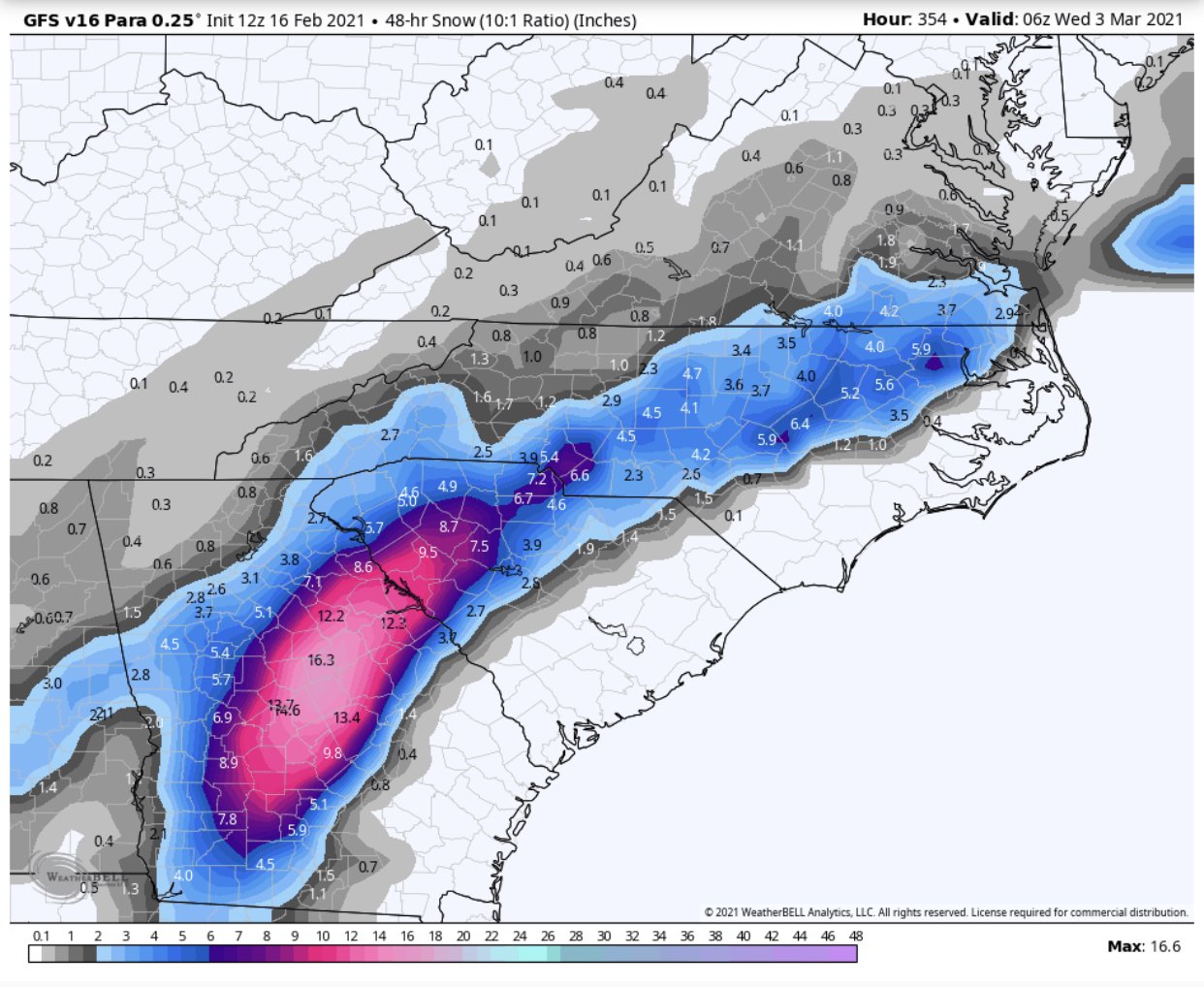
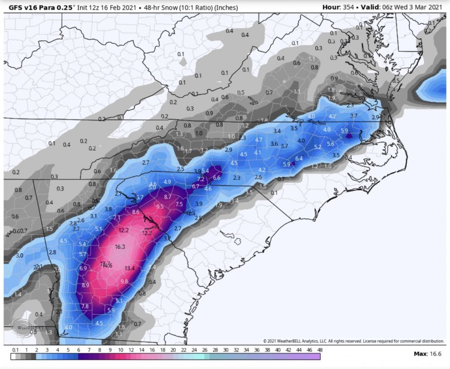
GFS Para......March will save us What could possibly go wrong?
-

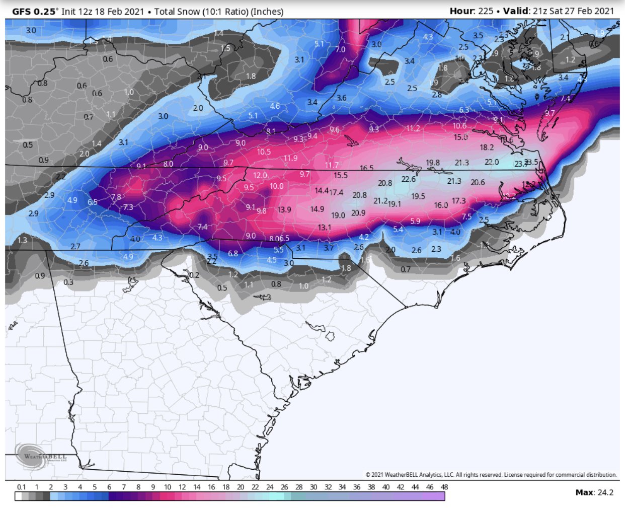
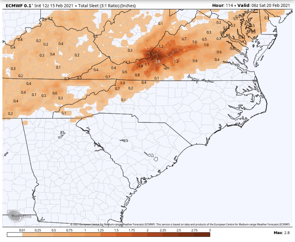
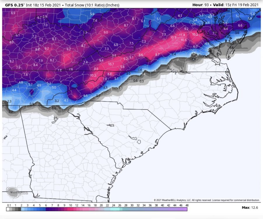
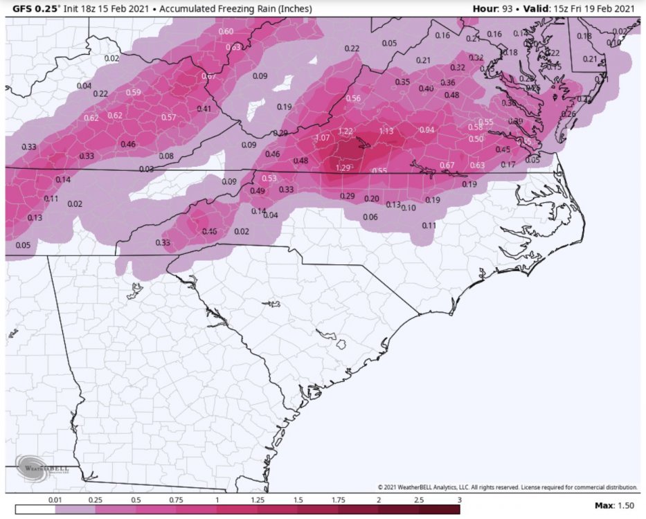
February 18-19 MAJOR Ice Storm Threat
buckeyefan1 replied to NorthHillsWx's topic in Southeastern States
I went from tracking a possible severe threat to tracking ice within a span of 4 days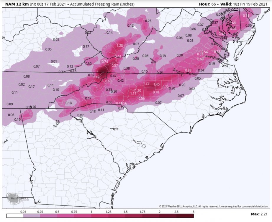
-
I use light plastic hung on command strips to block off a small area. I have a ton of candles and clay pots to help warm the room. That comes in handy when you don’t have a fireplace. Hand warmers, strategically placed, are a good investment. Adding hot water in plastic bottles under blankets helps to keep you warm. Keep the car filled up to unthaw as needed too.
-
It’s nice to see the sun again Afternoon high of 44, with wind chills in the mid 30’s.
-
Indeed The plus side is now she can’t use the skillet against you If it has to rain, thunder should always accompany it
-
Seriously. It’s freakin 40 degrees with lightning and low rumbling, ground shaking thunder and from El Paso to the gulf coast is snowed in 152300- Elbert GA-Hart GA-Franklin GA-Pickens Mountains SC- Greater Pickens SC-Greater Oconee SC-Laurens SC-Abbeville SC- Anderson SC-Greenwood SC-Greater Greenville SC- 527 PM EST Mon Feb 15 2021 ...STRONG THUNDERSTORMS WITH INTENSE LIGHTNING WILL IMPACT NORTHEASTERN FRANKLIN...NORTHEASTERN ELBERT...HART...LAURENS... SOUTHEASTERN GREENVILLE...ANDERSON...ABBEVILLE...PICKENS... SOUTHEASTERN OCONEE AND NORTHWESTERN GREENWOOD COUNTIES UNTIL 600 PM EST... At 527 PM EST, Doppler radar indicated strong thunderstorms with intense lightning along a line extending from 9 miles northwest of Hartwell to 7 miles south of Abbeville, and moving northeast at 40 mph. Locations to be impacted include... Anderson, Easley, Clemson, Laurens, Seneca, Abbeville, Hartwell, Pickens, Greenville Downtown and Greenwood. In addition to intense lightning, wind gusts up to 40 mph, pea size hail and very heavy rainfall rates up to 2 inches per hour will be possible in these areas.
-
-
Currently imby......thunderstorms
-
18z gfs isn’t quite there yet. Baby steps as temps are 3 degrees colder with a stronger wedge a bit further south
-
18z ICON is a couple degrees colder imby. Gives me 2.5” of rain with the temperature at 31-32 Thursday.
-
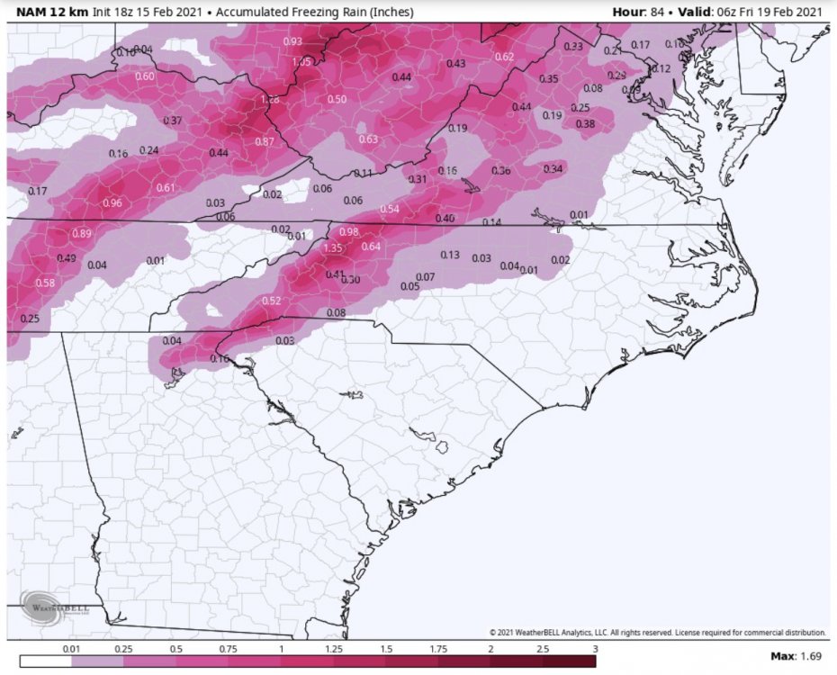
18z NAM
-
18z NAM keeps the upstate firmly locked in the wedge for Tuesday and keeps the threat of severe confined to the coastal counties.
-
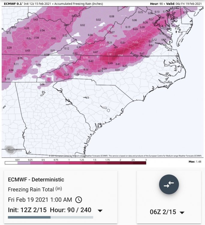
Verbatim the Euro keeps mby at 34 and a cold miserable rain
-

-
If you can’t back up a statement, please refrain from posting opinions in the discussion thread without anything to back it up.
-
This needs an explanation as to why
-
Just a friendly reminder to keep the discussion on track.
-
Regional Deterministic Prediction System-Canadian
-
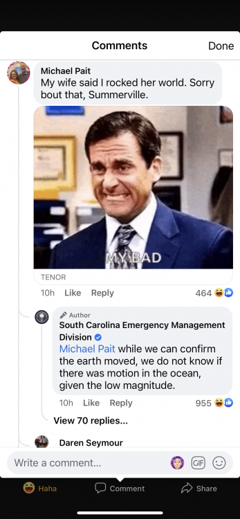
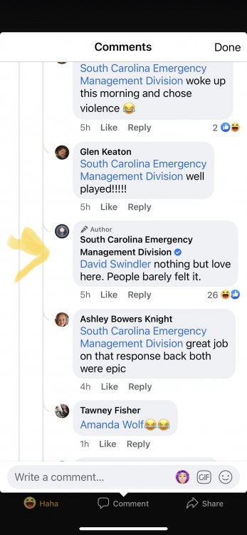
In response to a 2.1 earthquake in Summerville, SC
-
Had mby at 30-31 with a touch over 1.5” of freezing rain
-
The same Buckeyes that whooped clemsux azz?