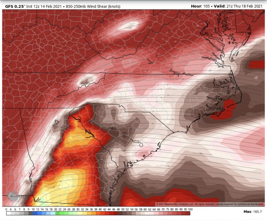
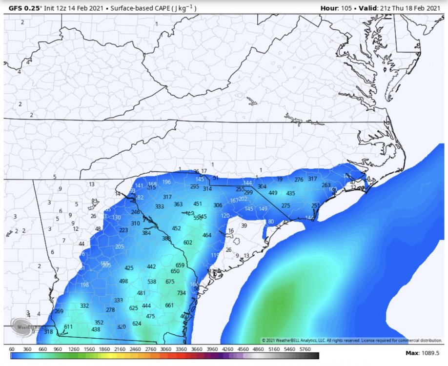
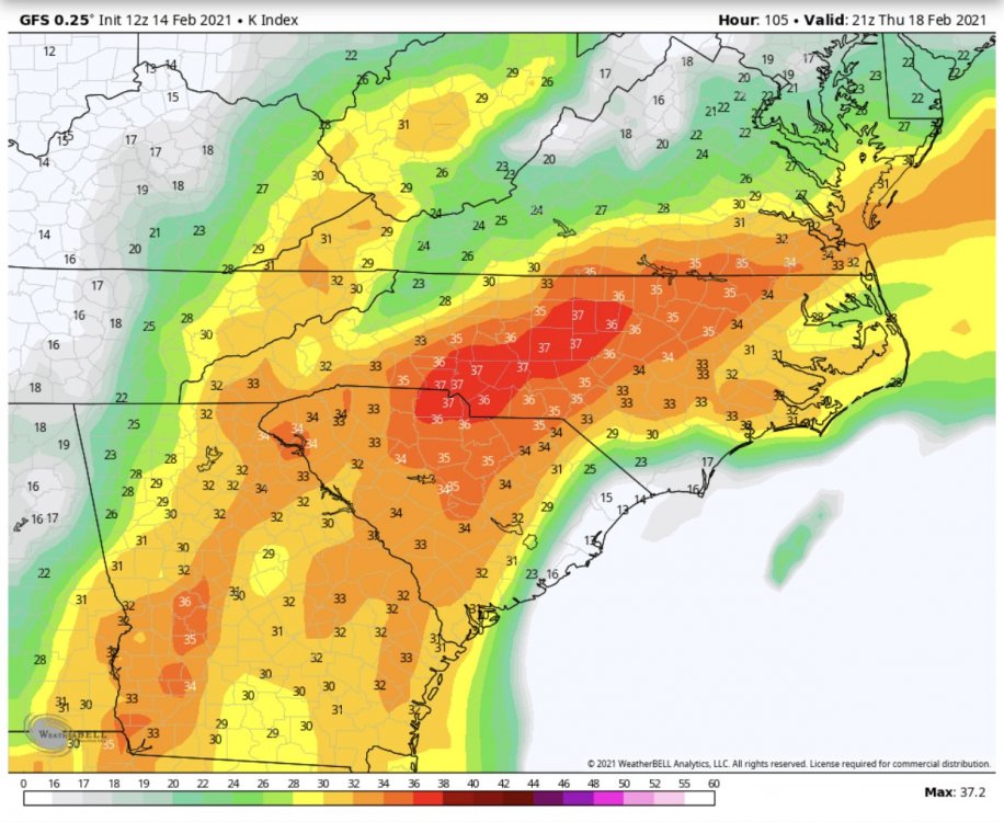
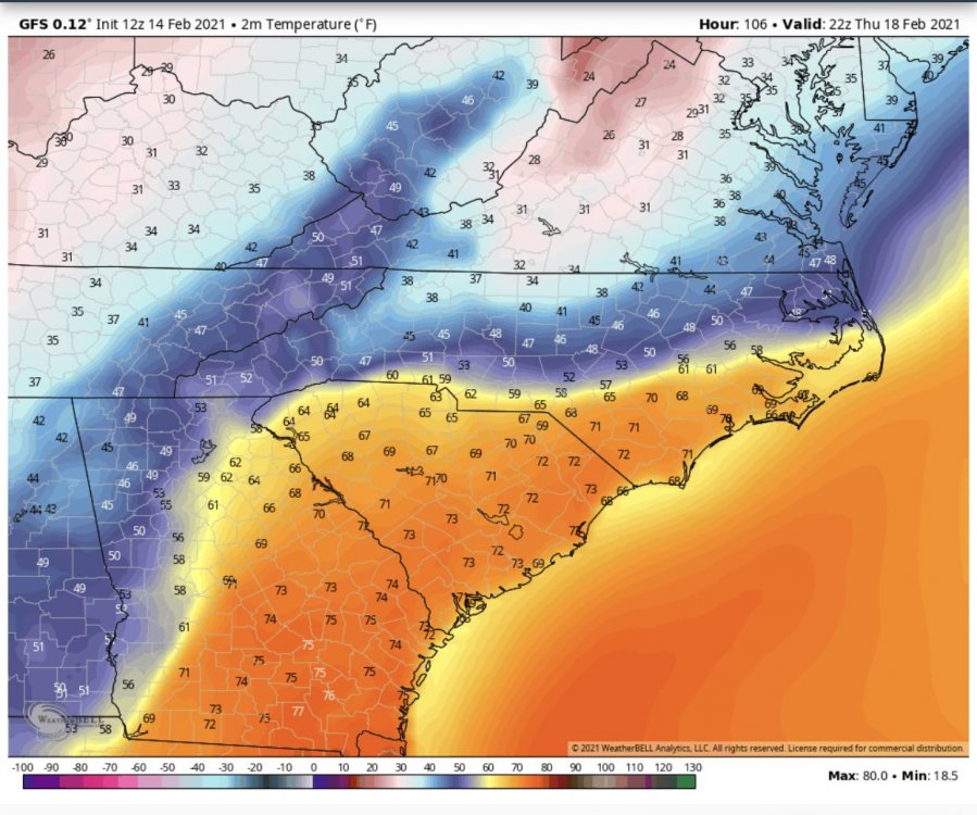
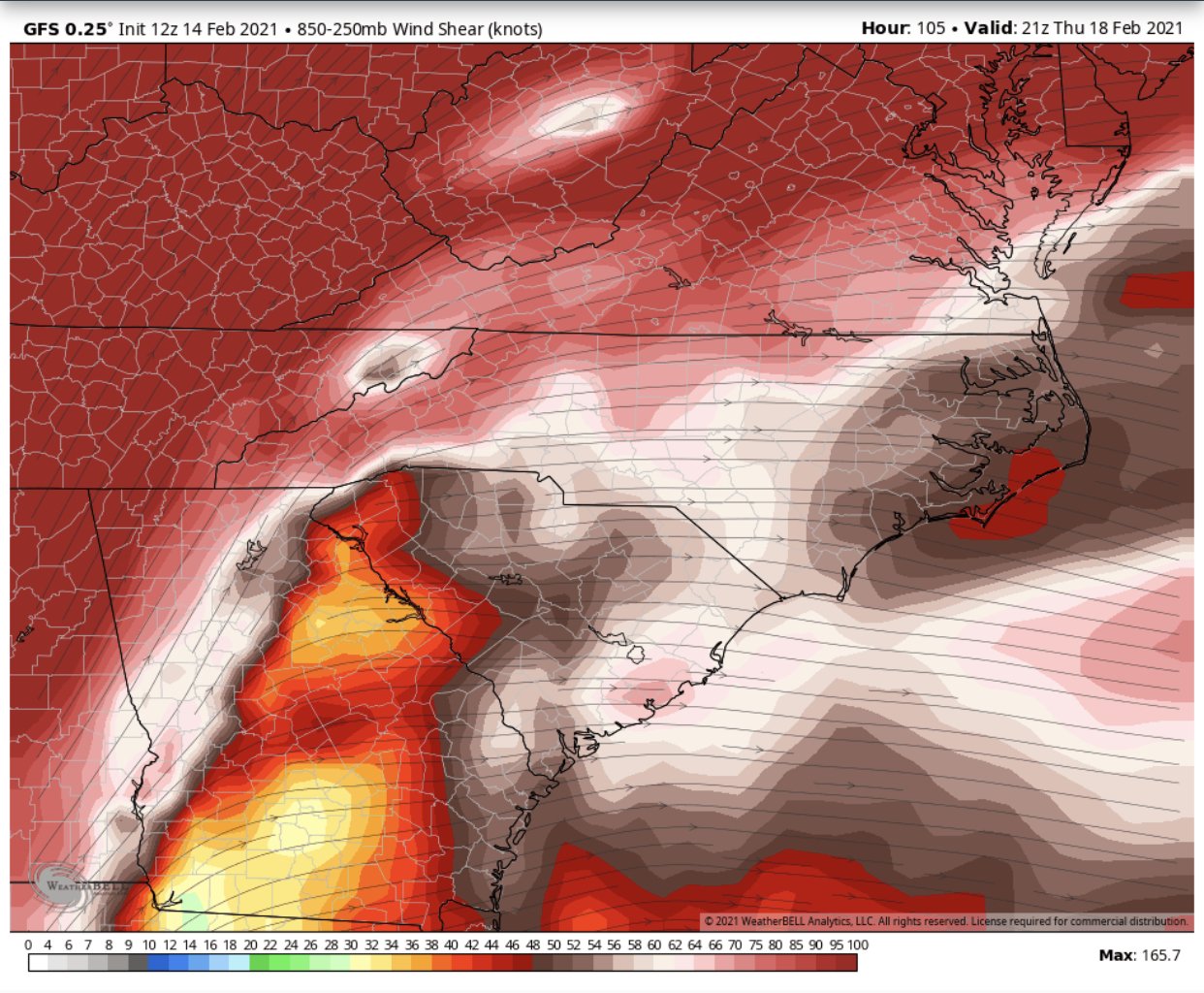
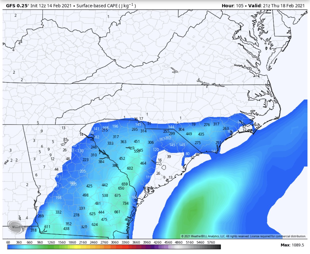
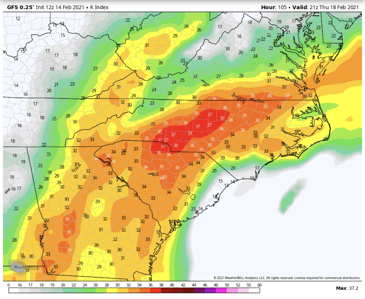
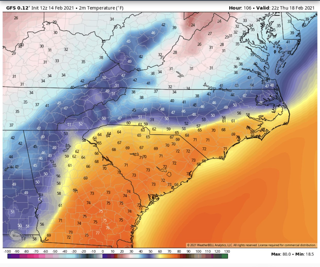
GSP is more interested in the severe aspect for both Tuesday and Thursday. Although Tuesday appears that we are locked into the wedge enough to have any severe weather to the east.
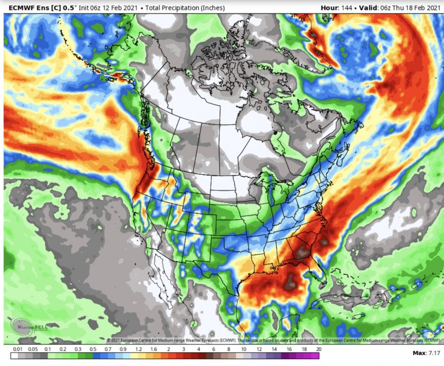
.SHORT TERM /MONDAY THROUGH TUESDAY NIGHT/... As of 130 AM Sun: WAA still looks to continue unabated over the CWA through Monday, and accordingly CAD looks to remain pretty well locked in for another day. The warm front however will carry the best isentropic lift and moisture to our north, so we may get a partial lull in precip. However, the deep and mature upper trough will start to move in our direction by the end of the day, and accordingly upper divergence and DPVA will ramp up at that time, so PoPs surge upward again in the late afternoon and evening. A frontal wave should spin up near the central Gulf Coast and track northeast; deterministic models have come into better agreement on the low passing east of the Appalachians. In light of the very strong low-level shear parameters afforded by the likely 60-kt 850mb jet crossing invof the low, and sfc theta-e progs from every consulted model aside from the 12km NAM and 3km NAM, a small HSLC threat would evolve south of the wedge boundary if it were able to retreat. The NAMs both maintain the wedge, and their prog soundings show the inversion remaining quite strong over practically the whole CWA until after the low and shear are gone. The other models do peel the wedge back as far as about one tier of counties into the CWA, so we won`t absolutely rule HSLC activity out; we`ve had many close calls in this kind of setup. Seeing the NAM plots, though, overall it is looking pretty unlikely any threat late Monday night or early Tuesday will make it up into our area. The bigger story probably will be near-record PWATs and an unseasonably deep warm-cloud layer, which may make for a brief heavy rain threat across a portion of the area. Most of the models also depict favorable mid to upper level lapse rates and decent MUCAPE at inversion level. That said, antecedent conditions and streamflows aren`t particularly concerning for a flash flood risk, but it is another aspect of the event to consider. The passage of the low should bring the cold front through the area and CAA should finally erode the wedge Tuesday. Temps fall below freezing in some of the higher mountain elevations by daybreak. A very low-end upslope precip event could occur in some of the more favored spots, but strong subsidence with the incoming sfc high will make for a shallow moist layer. Furthermore winds look likely to be closer to W than NW, and both the winds and moisture diminish before colder air can settle in later in the day. While temps will end up being colder Tuesday for the majority of the mountains owing to the CAA, the wedge could erode, and if this happens early enough in the day, temps might manage to approach 60 in some of the Piedmont. The wedge is so strong on the NAM that it only shows a rebound into the 40s, and the ECMWF MOS only shows lower to mid-50s. Thinking it will be best to go close to the 50th percentile of guidance for Tue maxes. Mins Tue night will fall back to near climo. && .LONG TERM /WEDNESDAY THROUGH SATURDAY/... As of 300 AM Sun: Dry high pressure will shift toward the East Coast and move back into position for hybrid CAD. This round will develop not unlike the CAD episode earlier in the week, as upper trough amplifies over the central CONUS, warm front activates across the Southeast, and diabatic cooling results with onset of precip, most likely Wednesday night. There are a couple of key differences compared to the CAD earlier in the week; the "fresh" high will be colder to begin with, so there will likely will be some wintry mix (largely FZRA) in the colder northern mountains/foothills and possibly far northern NC Piedmont. The sfc low looks to pass the area at a more favorable time of day for severe wx, being timed between 18z and 06z. Also, the upper trough driving the low is stronger and low level flow will be more meridional. But so far the sfc plots fall into the same camps as they once did for the early-week event--the GFS is the only one of the deterministic models eroding the wedge enough to put any but our southeastern fringe at risk for sfc-based convection. Wondering if it will trend toward the Euro/Canadian as it has done for the earlier week event. For now, have biased temps in favor of established CAD Wed night and Thursday, and think it is too early to raise any alarm for severe wx in e.g. the HWO, although it certainly bears watching. PoPs should taper off and skies clear Friday behind the low and its trailing cold front. Temps will fall to snowy temperatures near the TN/NC border. The northwest-flow snow potential does look reasonably good, owing to pretty cold BL temps and orthogonal winds across the mountains. There is some indication that could continue into Friday night. The weekend is looking pretty nice, if not a little chilly with temps a few degrees below normal. Anything will seem nice after basically a week of CAD.