

mahk_webstah
-
Posts
11,834 -
Joined
-
Last visited
Content Type
Profiles
Blogs
Forums
American Weather
Media Demo
Store
Gallery
Everything posted by mahk_webstah
-
 This is why the really good meteorologists use the models with a grain of salt. They look at the larger scale situation, at the analogues, at their own pattern recognition, etc. And then they put the model output in context in terms of what is more likely to happen in the end. It’s a bit like scientific detective work. We have some particularly gifted mets on this forum. it’s the weenies who have learned how to read model output who seem to be apoplectic about not having a model make an accurate projection.
 -
Was it a physical or moral fall? I hope you are okay, and have risen. Yes on the Euro. The GFS has led the way a few times this winter. It's been interesting.
-
I am optimistic not about any particular system, but about the pattern. There is a generally good sentiment, expressed here by GYX in their last 2 AFDs: .LONG TERM /WEDNESDAY THROUGH MONDAY/... Overview: Troughing will persist over New England through at least early next week which will favor below average temperatures and an active weather pattern favoring snow.
-
I resemble that driveway
-
Just want out for glute bustin walk in some man snow. We had more than I thought. My conservative estimate is 8.5, and we obviously had compaction from the 1/4 inch of rain at the end. It snowed very hard after I came in from my morning walk. We had around 7 then, so we probably got 9, but let's say 8.5. I have a 12" snowpack in the woods which is really nice for mid January with a cold snowy stretch ahead. Great storm up here today.
-
With your temperature perhaps he will stay or frozen which will be much better than the slush I just removed from walkways and part of my driveway. Yikes!
-
interesting. raining, but temp has dropped 2 degrees to 33
-
I was hoping we'd slot, but looks like pack damage is incoming. Hopefully not too bad as it would be nice to keep some softness in the pack for best hiking. Maybe Gene can hang onto frozen as that ugly batch of run comes north.
-
it'll probably be rain
-
I think we are done. light misty stuff now. changed over at 10:20
-
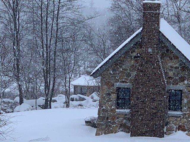
its awesome outside now. the stone cottage is a great backdrop for snow pics. We had that build before we built our house, by an a crotchety old stone mason who could barely walk but could build this.
-
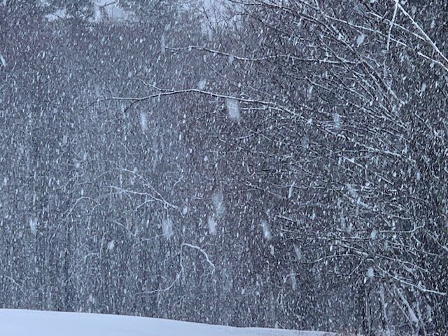
probably wet but now even heavier than the pic. it is like the atmosphere doesn't want to turn over. I just want the slot asap.
-
taken just now.
- 729 replies
-
- 13
-

-
I wonder if I'm being helped by being west of 93, while you are east of it? snow getting heavier lol. I should hit 8 if I haven't already.
-
this is good. we manpack
-
moderate/heavy snow 1/4 mile here. I bet you flip back.
-
it is coming in as heavy snow here. Well moderate but increasing.
-
a heavy band enroute moving north towards me. The moment for truth as to whether we get any rain of significance.
-
and in the means we can also see it goes north into the GOM which is good for most of us. A track near or inside the BM that goes into the GOM is a great storm for most all of us.
-
the temp spike might intensify the conditions. Too bad you aren't up there! But you'll get yourss
-
that is really what I like. That is why pack is so important to me. If I have 8 inches of pack and I get a 6 inch storm that has heavy snow, then I feel like I'm in a heavy blizzard when I got out to walk. That is the best part. And actually 2 ft of pack, while I love it, kinda sucks because I can't go for long walks unless I put on the snowshoes, which can be a pita.
-
it lightened up and looked a bit mixed, but now a heavier burst and mostly snow. maybe we hang on to mostly snow until it drizzles? somewhere north of 7 inches, but not sure. what was the Pope saying earlier about CAD rushing in quickly?
-
It’s good for both of us that I’ve still got mostly snow. Quite happy for everything to cut off ASAP
-
The win is wind conditions. It’s still snowing pretty decently so will finish between seven and eight I’d imagine. That was well predicted. The fact that we warmed enough, and as Brian said we broke through the inversion, created near blizzard conditions for a couple of hours that has been fantastic. Like I said earlier, we had the sort of heavy snow fog conditions where you can barely see, like when you’re in one of those 4 to 5 inch an hour deformation bands lead in a storm. I did not expect that! You’re going to find quite the man pack the next time you come up here
-
Tractor out to snowblower before the cement forms