

NavarreDon
-
Posts
2,819 -
Joined
-
Last visited
Content Type
Profiles
Blogs
Forums
American Weather
Media Demo
Store
Gallery
Posts posted by NavarreDon
-
-
Our winds are sustained @ 30+ and gusting over 40 here in Navarre. I have certainly been thru better looking TS’s that weren’t as impressive.
.-
 1
1
-
-
Welcome baby girl.....hahahaha!
WTNT43 KNHC 190859
TCDAT3

Tropical Storm Claudette Discussion Number   7
NWS National Hurricane Center Miami FL       AL032021
400 AM CDT Sat Jun 19 2021

The system that we have been tracking for a few days finally has
enough of a well-defined center and organized convection to be
considered a tropical storm.  While the organization is not
classical by any means, and there are some hybrid characteristics,
the cyclone most resembles a sheared tropical storm, so the system
is now Tropical Storm Claudette.  The initial wind speed remains 40
kt, in line with surface observations and radar.  These winds are
primarily occurring in a strong band on the eastern side of the
cyclone well away from the center.
-
Came home from FWB to Navarre (7-7:45pm). Bands of rain, in FWB no wind to speak of, Hurlburt field to Navarre was about *20mph sustained with gust to 30mph. About .9" of precip so far at the home gauge.
*estimated winds
-
Much better convection developing today as it approaches landfall—like the models suggested. Still lopsided, but better organized per recon.
I’m at work in Fort Walton Beach but we’re about to get a small taste at home.
.-
1
-
-
The first outer band is coming ashore in FL,AL,MS, & LA now.
-
3
-
-
They got degrees, I don't, but unless it just never closes a low, the current center, as dry as a bone, (still seeing 15C T/Td spreads) dissipates and a new center develops near 90W, or I suspect the entire cone should be shifted a couple of degrees to the East. Only way a 40 or 45 knot storm will occur is if there is a center jump fairly soon.
Edit, I have a BS, but not in met/atmospheric science or anything close. Engineering.
I’m no expert but the disco seems to account for what you’re saying.
Numerical intensity guidance do
not indicate a great deal of strengthening before the system
reaches the coastline, and the official forecast is at the high end
of the guidance.
Since the center is not that well-defined at this time, the initial
motion estimate, 360/8 is quite uncertain. The system is expected
to move northward into a weakness in the subtropical ridge for the
next day or so and then, after landfall along the central Gulf
Coast, turn toward the northeast on the northwest side of a
mid-level anticyclone near Florida. The official track forecast is
closest to the GFS and ECMWF predictions. It should be noted,
however, that these models suggest some reformation of the center
near the Louisiana coast rather than just motion from the southwest
Gulf to the expected coastal landfall point.
Given the current and anticipated structure of this system, users
should not focus on the exact track of the center, as rainfall and
wind hazards are likely to extend well east of the center and arrive
well in advance of landfall.
. -
And away we go…..lol

880
WTNT43 KNHC 172034
TCDAT3
Potential Tropical Cyclone Three Discussion Number 1
NWS National Hurricane Center Miami FL AL032021
400 PM CDT Thu Jun 17 2021
Visible satellite images show that the cloud pattern associated with
the broad area of low pressure located over the southwestern Gulf of
Mexico is gradually becoming better organized. Deep convection is
beginning to form a broad curved band over the eastern portion of
the system, similar to what one might see in a developing
subtropical cyclone. Although the upper-level winds are not
particularly favorable for development, with lots of westerly shear
over the area, the global models do suggest tropical/subtropical
cyclogenesis within the next 12 hours or so. Given the proximity of
the disturbance to land, which requires tropical storm warnings at
this time, advisories are being initiated on this system as a
potential tropical cyclone.
Earlier scatterometer data suggested that the circulation was still
rather broad. An Air Force Hurricane Hunter plane is currently
investigating the system and has not yet found a well-defined
center. Maximum winds based on surface observations and the
scatterometer pass are near 25 kt. Numerical intensity guidance do
not indicate a great deal of strengthening before the system
reaches the coastline, and the official forecast is at the high end
of the guidance.
Since the center is not that well-defined at this time, the initial
motion estimate, 360/8 is quite uncertain. The system is expected
to move northward into a weakness in the subtropical ridge for the
next day or so and then, after landfall along the central Gulf
Coast, turn toward the northeast on the northwest side of a
mid-level anticyclone near Florida. The official track forecast is
closest to the GFS and ECMWF predictions. It should be noted,
however, that these models suggest some reformation of the center
near the Louisiana coast rather than just motion from the southwest
Gulf to the expected coastal landfall point.
Given the current and anticipated structure of this system, users
should not focus on the exact track of the center, as rainfall and
wind hazards are likely to extend well east of the center and arrive
well in advance of landfall.
Key Messages:
1. The system is expected to produce heavy rainfall and considerable
flash, urban, and small stream flooding beginning Friday and
continuing through the weekend along the central Gulf coast and
spreading northeastward into the Southern Appalachians.
2. Tropical storm conditions are expected to begin Friday in areas
near and well to the east of the center along portions of the
central Gulf Coast from Intracoastal City, Louisiana, to the
Alabama/Florida border, including New Orleans.
FORECAST POSITIONS AND MAX WINDS
INIT 17/2100Z 22.9N 92.4W 25 KT 30 MPH...POTENTIAL TROP CYCLONE
12H 18/0600Z 24.5N 92.5W 25 KT 30 MPH...TROPICAL CYCLONE
24H 18/1800Z 26.5N 92.5W 35 KT 40 MPH
36H 19/0600Z 29.0N 92.0W 40 KT 45 MPH
48H 19/1800Z 31.5N 89.5W 30 KT 35 MPH...INLAND
60H 20/0600Z 34.0N 87.0W 25 KT 30 MPH...INLAND
72H 20/1800Z 35.0N 84.0W 20 KT 25 MPH...INLAND
96H 21/1800Z...DISSIPATED
$$
Forecaster Pasch/Brennan
. -
Big floods and possibly an inland tornado risk, but >1000 mb on any reasonable model, as a TC, it may not even waste the name Claudette.
Waiting to see if Eric Webb posts another PPV Euro skew-T a day after landfall inland, but the 400 m^2/s^2 1 km helicity with almost 1000 J/Kg MLCAPE he posted on Twitter yesterday, the tornado risk could be significant. Floods as well...
That would be some pretty bad flooding up in the mountains of WNC!
.-
3
-
-
92L has earned its cherry….

Tropical Weather Outlook
NWS National Hurricane Center Miami FL
200 PM EDT Mon Jun 14 2021
For the North Atlantic...Caribbean Sea and the Gulf of Mexico:
The National Hurricane Center is issuing advisories on newly formed
Tropical Depression Two, located about a hundred miles east of the
Outer Banks of North Carolina.
1. Showers and thunderstorms continue over the Bay of Campeche in
association with a broad low pressure area. Gradual development of
this disturbance is possible during the next couple of days while it
meanders near the coast of Mexico. The system should begin to move
northward by midweek, and a tropical depression is likely to form
late in the week when the low moves across the central or
northwestern Gulf of Mexico. Regardless of development, heavy
rainfall is possible over portions of Central America and southern
Mexico during the next several days. Heavy rains could also begin
to impact portions of the northern Gulf Coast on Friday. Please
consult products from your local meteorological service for more
information.
* Formation chance through 48 hours...low...20 percent.
* Formation chance through 5 days...high...70 percent.
. -
Hmmm.....

. -
-
Just talked to my brother (4063 elevation) on Bear Mnt outside of Glenville. He’s eyeballing 7-8” of wet paste!
.-
6
-
-
Congrats fellas!!!
-
2
-
-
Never made it out of the 40’s in the Western Panhandle today!
. -
Looks like snow to me up at Wolf Ridge.
https://skiwolfridgenc.com/the-mountain/web-cam
.-
2
-
-
I'll have a few more photos later once I have time to edit them but made it to the Viaduct and Boone Fork after work yesterday. Here's one of the shots. Absolutely beautiful snow. Probably the most annoying to hike in too because it was so wet. Came back home soaked.

Stunning pic!!!
.-
1
-
-
All of you tilt one back for me, love the beach & no second guessing on moving but.....oh boy I sure do miss the snow events!!!
.-
6
-
-
You guys gotta quit basing the whole system on one run of one model. It’s really kinda past model time anyway. Nowcast time is upon you, good luck to all of you but especially the OG’s!!!
.-
6
-
-
Morning folks, gonna be living vicariously through you for a bit. As 85 said above it’s about nowcast time. Models are going to do strange model things. The bottom line is a decent snow is upon the doorsteps for a bunch of you. As you know by now with any event there are always winners & losers. OBS from downstream this am is that there was very little convective aspects & what there was was out in the gulf. We are right in line with our qpf totals matching what MOB called for. Strap in and enjoy the ride!
.-
3
-
-
WSW just issued. Very odd range. The used the same for everyone in the WSW even over to the foothills.
* WHAT...Heavy mixed precipitation possible. Total snow accumulations of 1 to 5 inches along with a light glaze of ice possible.* WHERE...Much of the mountains, northern foothills, and northwest Piedmont of North Carolina.* WHEN...From Thursday evening through Friday evening.* IMPACTS...Travel could be very difficult. The hazardous conditions could impact the Friday morning commute.PRECAUTIONARY/PREPAREDNESS ACTIONS...Monitor the latest forecasts for updates on this situation.
This will get fine tuned with specific areas, precip. types, & amounts. As the event nears onset.
.-
2
-
-
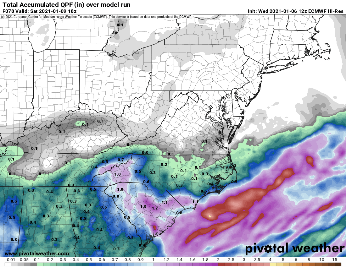
Big increase in QPF.

Interesting! The exact opposite of the normal French Broad Valley moisture starved hole.
.-
5
-
-
Morning folks, I’m still liking this set up for you. As always there’s the winners & losers aspect to it. Sometimes it helps to read different discos besides GSP. I’m not going to clog the thread with a giant copy & paste but if you have a minute, read MOB’s overnight and you’ll get a good idea of the downstream side of the system and what’s feeding your areas. Good luck to all!
.-
2
-
-
Happy New Year folks! Hope you don’t mind but I’m butting in on your thread. I like the potential set up that’s lurking for you. Lot’s of changes upcoming but if you look at synoptics & historical model biases. I think this could have the makings of a decent southern low pressure snowfall. Might not be be a gigantic event but it’s caught my eye!
.-
4
-
-
And here it is!!!
NEAR TERM /THROUGH TONIGHT/...
-- Changed Discussion --SOMETIMES I THINK I SHOULD HAVE BEEN A FARMER. AT LONG LAST...WE
/THINK/ WE ARE GETTING A SOLID HANDLE ON THE UNFOLDING WINTER
WEATHER EVENT ACROSS THE WESTERN CAROLINAS/NORTHEAST GEORGIA.
HOWEVER...IT SHOULD BE NOTED THAT CONFIDENCE DROPS OFF SHARPLY AFTER
THE FIRST 6 HOURS OR SO...AS MUCH OF THIS EVENT WILL BE DOMINATED BY
MESOSCALE AND EVEN CONVECTIVE SCALE PROCESSES.
AS OF 16Z...A BAND OF MODERATE TO HEAVY SNOW WAS WELL ESTABLISHED
OVER THE MOUNTAINS AND ALONG THE I-40 CORRIDOR EAST OF THE BLUE
RIDGE. THIS WILL ONLY GRADUALLY DRIFT/EXPAND TO THE SOUTH AND EAST
WITH TIME. IN FACT...THE BACK EDGE OF THE FRONTOGENETICALLY FORCED
PRECIP WILL PROBABLY NOT MAKE SIGNIFICANT EASTWARD PROGRESS UNTIL
THE SURFACE LOW MAKES THE JUMP TO OFF THE SOUTHEAST COAST THIS
EVENING. THEREFORE...THE SNOW WILL CONTINUE TO PILE UP WHERE ITS
ALREADY FALLING...AND ACCUMULATIONS WILL NEED AN UPWARD ADJUSTMENT.
WE WILL NOW ADVERTISE 8-12 INCHES THROUGH TONIGHT ACROSS A GOOD
CHUNK OF THE MOUNTAINS...AND BUMP THE I-40 PORTION OF THE
PIEDMONT/FOOTHILLS TO 5 TO 8 INCHES. AS USUAL...THE LOCALLY HIGHER
AMOUNTS CAVEAT APPLIES.-
1
-

Tropical Storm Claudette
in Tropical Headquarters
Posted