

NavarreDon
-
Posts
2,819 -
Joined
-
Last visited
Content Type
Profiles
Blogs
Forums
American Weather
Media Demo
Store
Gallery
Posts posted by NavarreDon
-
-
3 hours ago, Hvward said:
Got 7”-8” total here in southeast Asheville, after switching to sleet early Saturday morning. Looking forward to the next one!


Congrats man!....while your snow totals might have come up short, you're definitely over performing in the significant other department!!!
-
Mt. Mitchell picked up 34".
 Very pleased how this event turned out. So long..till the next big storm!
Hey Mike, quick question where did you get the info on Mitchell? Reason being is GSP did a contest on Twitter for the storm for where the most snow would fall. I predicted 33” on Mitchell. It was way above anyone else. I also threw in 45mph wind at some point during the storm for extra credit. Need to rag them a little bit if this is accurate.
. -
I apparently threw out my back last night pushing a car, people need to learn how to drive, I pushed close to 15 cars yesterday lol. What an amazing event overall. Got to have a lot of fun tracking it, actually might have enjoyed tracking it more than the event itself. I'm really excited to see what the rest of winter holds. But let's thaw out first.
Agree completely with the tracking. The Christmas 2010 storm hooked me bad!
. -
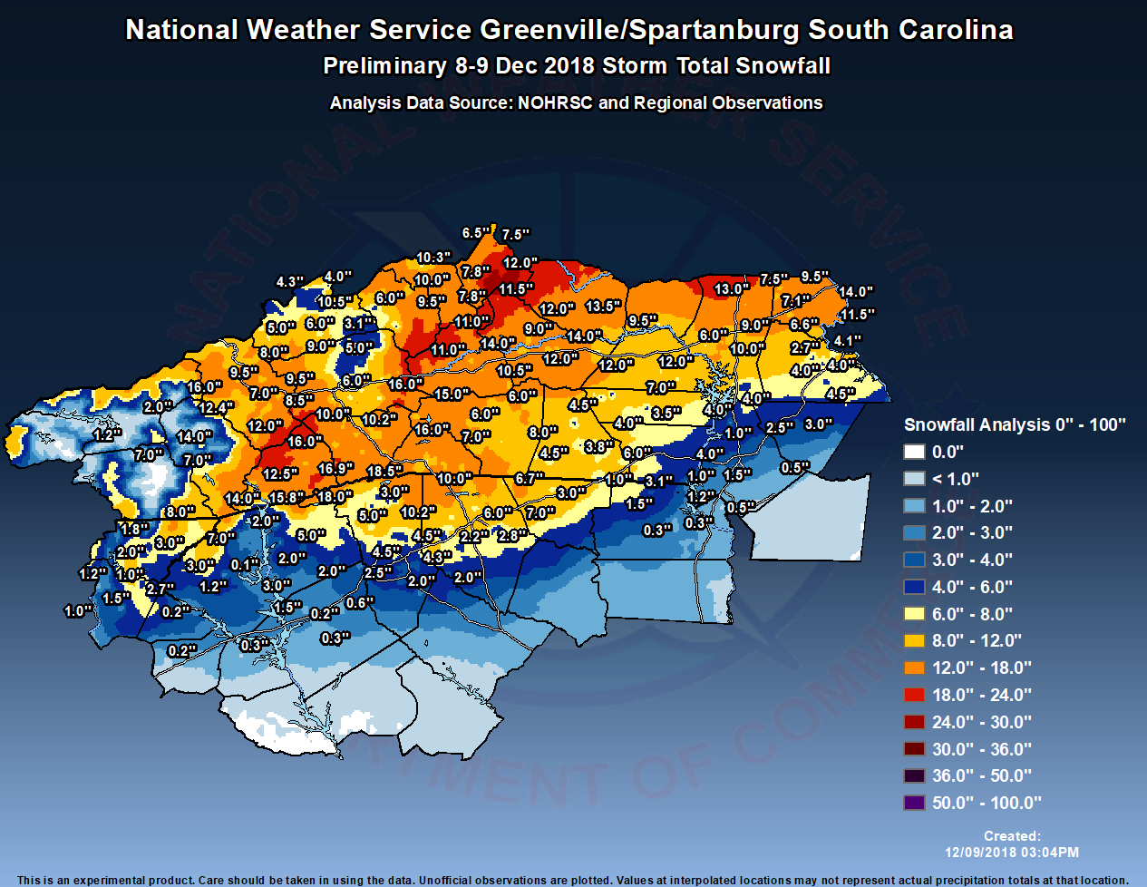
Curious as to how this lines up with y'alls totals? Remember it's a prelim. map

-
I doubt it. He sits on the patio, sippin' on a margarita in his underwear by the pool with his laptop.
No....that would be you Joe!!! My idol!
.-
 1
1
-
-
Very impressive! Do you miss it all, or does the beach outweigh this?
Miss the snowstorms terribly. I get to live the chase with you guys. I love the beach but in a perfect world I’d have a place up there for big events. A special thanks to all of you for letting me ride along with this group. I rarely venture outside of it except for the tropical forum.
.-
 3
3
-
-
Where is he at Don?
South central Jackson near the Transylvania line @ 4100’
. -
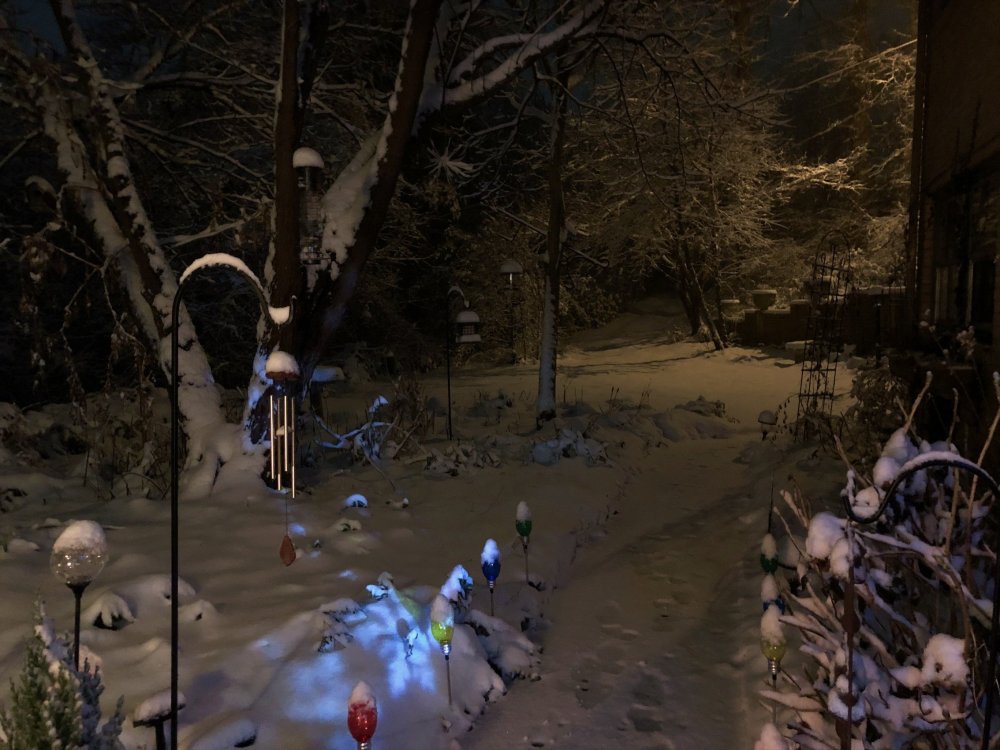
Got some pics from my brother in Jackson county. He’s done well!


.-
3
-
-
12 minutes ago, SnoJoe said:
Only 2 inches here.........Nah, about a foot. I'll measure shortly. It must have flat out snowed overnight. Still moderate snow but the back edge looks to be rapidly approaching. Maybe it'll back build some later on. It's 24.4 here with a stiff breeze.

-
3 minutes ago, Rainforrest said:
My phone and no not using taptalk
If you can download Taptalk it will be so much easier to post pics & vids. It should auto size them for you. Not sure how to do it via phone using a browser.
-
1 minute ago, Rainforrest said:
It always says my it’s to big How do I shrink it down to 1.95mb?
Wonder why my wife never says such!!! Sorry off topic, are you trying to post directly from your phone & if so are you using Taptalk or are you posting from a computer you downloaded to?
-
-
1 minute ago, Rainforrest said:
Ok guys how do you post pics and video on here?
Thru your phone or computer?
-
Just now, strongwxnc said:
Not sure I have ever seen it sleet some damn hard! Pounding it right now.. WOW.
"if" all snow here, easily would have been around the 10" mark.
Wow!!! Can you post a pic or 2 Mark? Would love to see it if you have the capability.
-
9 minutes ago, ncjoaquin said:
It sure looked bad for a while yesterday, but I am at 10 inches and it is still snowing. Unreal.
Congrats Jason!!!
-
Congrats folks! As per usual SE weather events we have some that over achieve and some that under achieve. Keeping it all in perspective (Dec. 8-10), it sounds like a pretty awesome chase & finish! Keep the obs, pics, & vids coming.
-
Here it comes fellas, strap in tight.

.
-
3
-
-
4 minutes ago, BretWheatley said:
Shoveled the sidewalk twice now - a little over 5 inches. Coming down hardest of the day yet now.
Nice!!! congrats!
-
1
-
-
Pics & or vid's whenever possible please!!!
-
Still at work and haven’t looked at any info but it only started raining in Fort Walton Beach about a half hour ago! Lots of moisture coming that way tonight and tomorrow!!!
.
-
1
-
-
Just got a text from my brother 4100’ South Central Jackson county near Transylvania border “getting pounded!”
.
-
1
-
-
Kelly CassVerified account @kellycass 9m9 minutes ago
We are tracking
#WinterStormDiego on@AMHQ with live reports all day long.@ReynoldsWolf is in#Asheville expecting a big#snow event! Stay with@weatherchannel all day through tonight!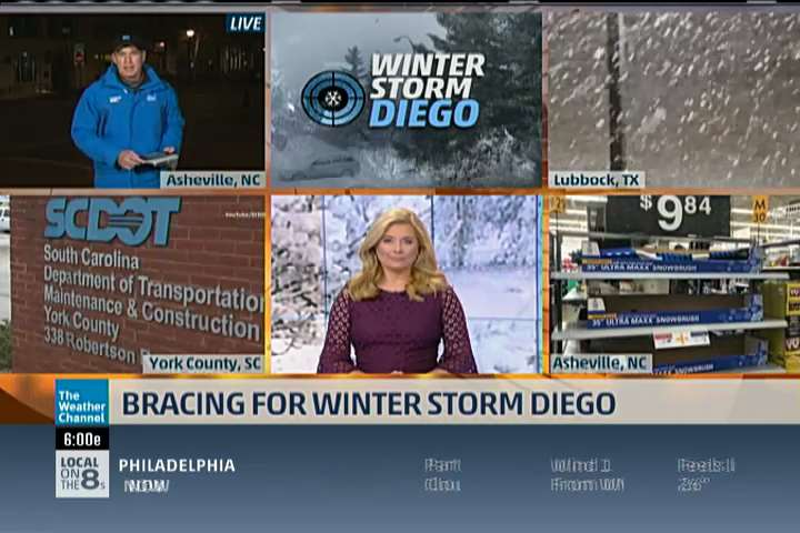
-
Here is the MOB morning disco. Gas meets fire for you guys upstream!
.NEAR TERM /Now Through Saturday night/...A strong upper level
shortwave will move eastward out of the southwest states today.
An associated area of low pressure will move eastward along the
coast this afternoon and evening with a warm front stretched
eastward from the low along the coast. Ahead of the low, a strong
low level jet of 50 to 60 knots is expected to develop and this
will help bring an increase surge of Gulf moisture into the
region by this afternoon. Precipitable water values are forecast
to climb to near 1.9 inches just in advance of the low. The
combination of the deep layer moisture and strong forcing
downstream of the upper shortwave and sfc low will lead to
development of heavy rain across the area primarily during the
afternoon and evening hours. Most areas can expect a general 2 to
4 inches of rain, with locally higher amounts before the rain
exists the area late tonight.

The severe weather potential continues to look very marginal and
confined to areas along the immediate coast where weak instability
may reach inland as the warm front moves north just ahead of the
approaching low pressure system. We cannot completely rule out an
isolated tornado or damaging wind gust due to the strong low level
shear. However, the best potential for rotating storms will remain
over the coastal waters. The primary threat will continue to be the
potential for flash flooding in the watch area. In addition, rip
currents and heavy surf can be expected at the beaches. Minor
coastal flooding will also be possible late this afternoon into
tonight.

There will be a very sharp temperature gradient along the warm front
today with locations north of the warm front staying in the mid/
upper 40s and low 50s. Locations south of the warm front could reach
into the upper 60s to near 70. Breezy conditions will also develop
today, especially in areas south of the warm front along the coast
where the higher momentum air aloft mix down to the surface. A
wind advisory may be required later today. /13
-
Another busy day at work for me! I know there is a dedicated obs thread that you folks will want to use. Please post or re-post in this thread. The dedicated one is just to much for me me to wade thru. Good luck to all you folks with a special shout out to the old timers Joe, Jason, Mark, Thomas, & anyone else I forgot!, lots of pics and vids please!
-
 3
3
-

2018/2019 Mountains and Foothills Fall/Winter Thread
in Southeastern States
Posted
What do you think will be the MAX snowfall amount in the
@NWSGSP forecast area w/ this winter storm? (Feel free to reply w/ WHERE you think it might be!) Note, we cover 46 counties in W NC, Upstate SC & NE GA: https://www.weather.gov/images/gsp/gsp_cwfa.gif …#ncwx#scwx#gawx#wncwx#cltwx#gspwx#avlwx33"
@MtMitchellStPk Extra credit.....45mph winds at times!