Terpeast
-
Posts
6,591 -
Joined
-
Last visited
Content Type
Profiles
Blogs
Forums
American Weather
Media Demo
Store
Gallery
Everything posted by Terpeast
-
That’s just smoothing across all ens members. But they’re converging on a max between dc and ezf. Still time to tick north, but probably not by a whole lot
-
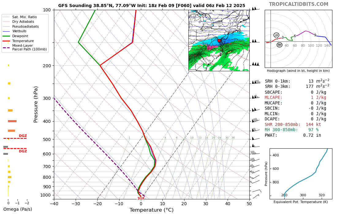
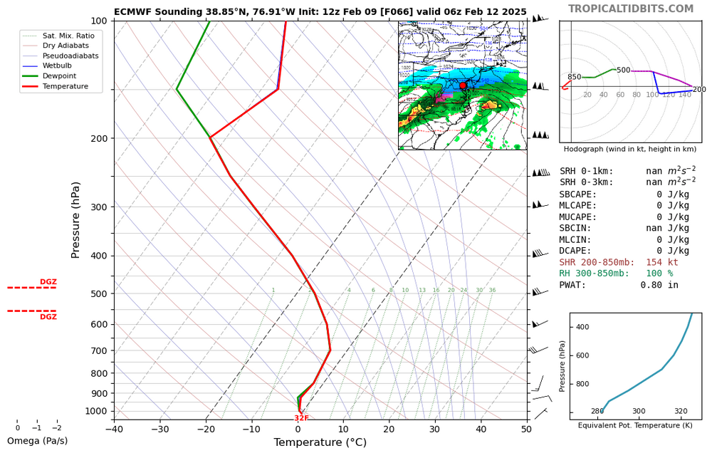
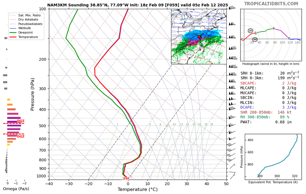
As a counterweight, here are gfs and euro soundings. Hrrr doesn’t go that far out, and rgem weirdly doesn’t have soundings on TT but guessing a degree or two warmer than 3k nam.

-
For posterity. DCA at the middle of the storm
-
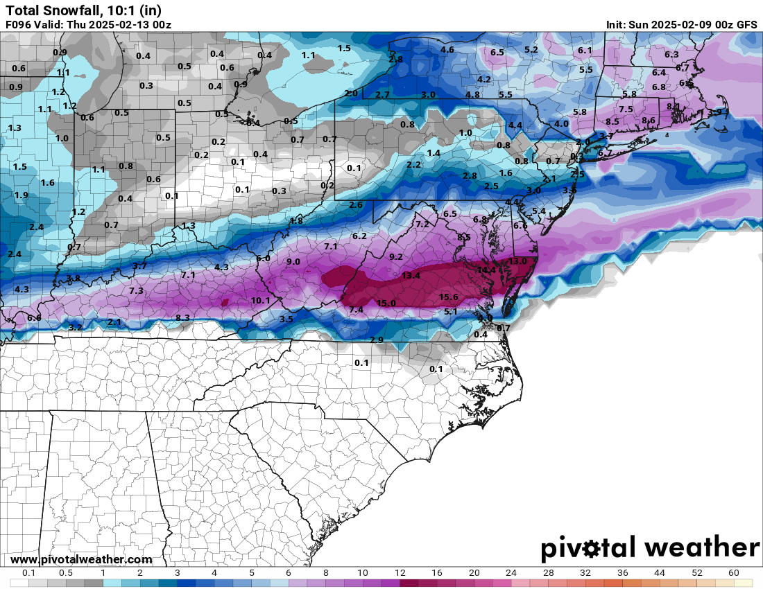
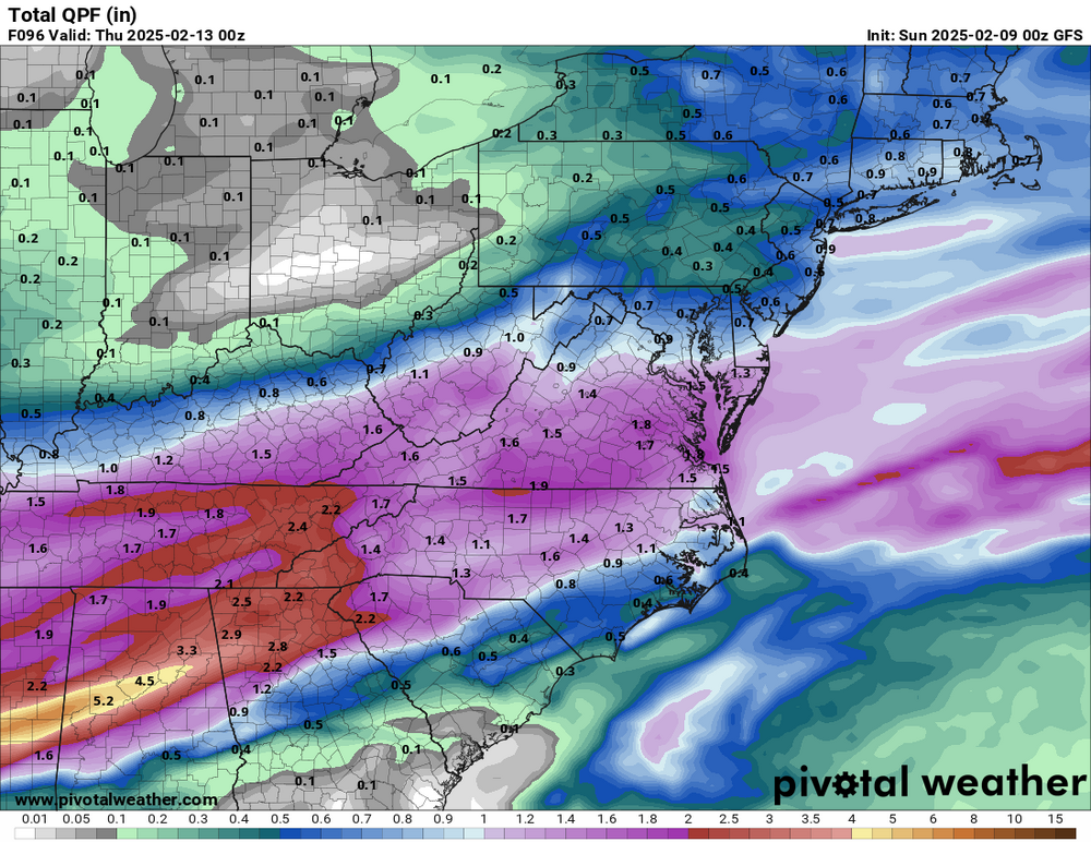
Biggest forecasting question for this storm, from a regional POV, is where the heaviest banding sets up and is someone going to see double digit totals out of this.
-
9” dc metro per NAM. i’m thinking 7” high end. 3-6” most likely
-
Agreed. The s/w for Tue-Wed is still off the CA and Baja coast. It will enter the conus tonight or early tomorrow morning.
-
Combine the 12k and 3k nam and we get the best of both worlds
-
NAM shows coastal enhancement that beefed up qpf imo
-
You’ll be fine on temps. It’s more for 66/50 and south as well as the UHIs
-
I think the one with higher amounts is computer generated, and the other was edited by a human. But that’s just my guess. 2-5/3-6” seems reasonable considering the marginal surface temps. Someone might good banding that could add an extra inch or two. 8” max upside
-
Could be right for the UHIs. Burbs like Ashburn and Columbia could see 1-2” otg before dark, then it’ll become easier to tack more on afterward.
-
Fixed. It’s hard to do this on mobile lol
-
Sorry I used the wrong snow map. Fixed it, looks even better
-
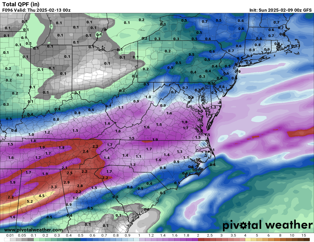
Qpf 10:1

-
Wetter. Good slug of moisture thru TN
-
At 63, more moisture and beefier precip shield
-
NAM shifted north too, at least with the precip shield
-
Not much difference in track vs recent runs of other models
-
Just loving this board. When models trend south, we say it’s not coming back north and bail from the storm. Then the second models shift north, we say it’s gonna go all the way to PA.
-
Pretty big shift north by the euro, or at least the northern extent. CMC has also the mix line coming up to DC and slightly north. It’s not over yet, folks.
-
I wouldn’t attempt driving in this for sure
-
Gefs 18z was nearly identical to 6z. Still windshield wipering a bit.
-
We’d need that 1051 high to reinforce cold air as that low gets east, or it’ll be mix to rain for all of us. Still time
-
Haha well more like baby icicles off my deck chairs and grill cover. They were so small and “cute” that when I showed them to my 4 year old daughter, she laughed like she saw the funniest thing
-
31. Rain. Icicles forming