

BrianW
-
Posts
2,507 -
Joined
-
Last visited
Content Type
Profiles
Blogs
Forums
American Weather
Media Demo
Store
Gallery
Everything posted by BrianW
-
BDR'S reports come up as Official NWS Obs. I assume that means they have an observer on site? Seems they have a good observer as I work in the area all the time and they seem spot on.
-
Nice 27 degree rise here in Branford.
-
Mid to upper 20's here around HVN.
-
Cold has been pretty tame here on the shoreline. BDR has 2 single digits lows this month. Looks like they hit 9 this morning for a low.
-
Lots of people caught with their pants down with empty oil tanks and a surge in heating oil spot prices around here. Jumped like a dollar or more in the last week around New Haven. Hearing there is huge waits for deliveries.
-
13 inches Branford.
-
BDR reported 13 at 4.
-
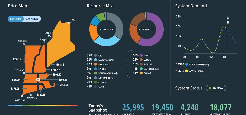
Always interesting to look at the ISO New England electricity grid data during these cold shots. Looks like New England will be burning millions of gallons of oil for power generation for the next week or so. Natural gas gets priority for heating and we fire up all the peak oil power stations due to pipeline constraints. Electricity is almost $1000 mwh right now. It usually around $25-50. https://www.iso-ne.com/
-
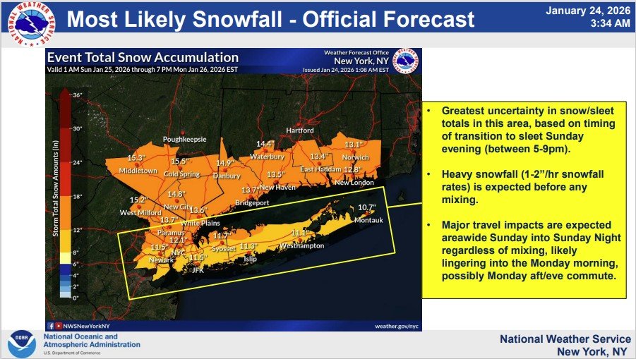
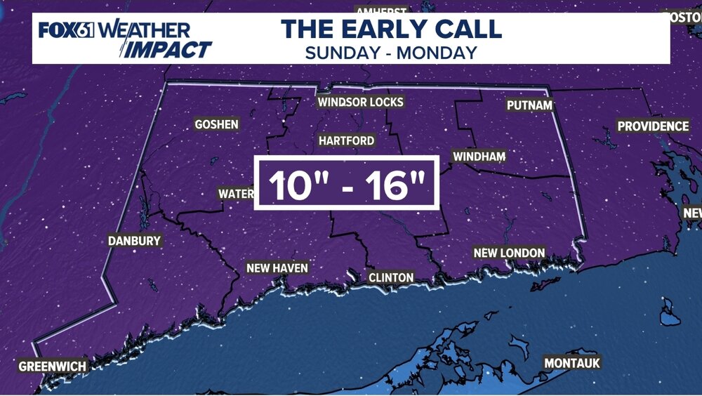
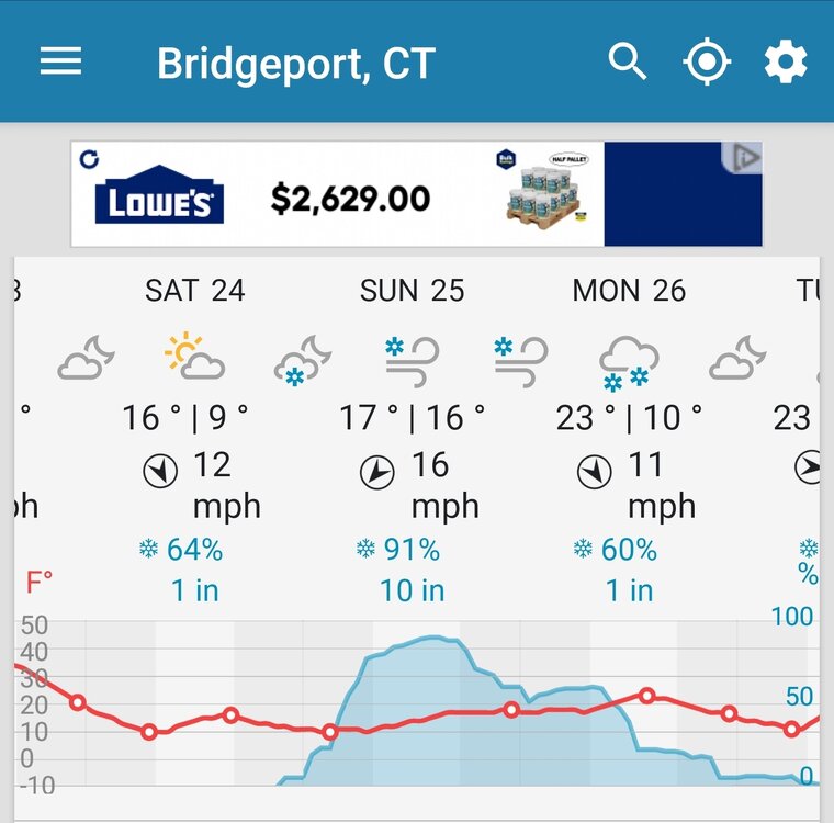
Yeah. WTNH mentioned that. Looks like Gil wrote it. Haha Sunday: Very cold with snow developing around 9 am give or take an hour. Steady and heavy snow continuing through the day and into the night. Some thunder-snow also possible! Blowing and drifting snow. There could be a little sleet mixing in SE CT. Highs 15-25. Travel near impossible Sunday evening-overnight!
-
-
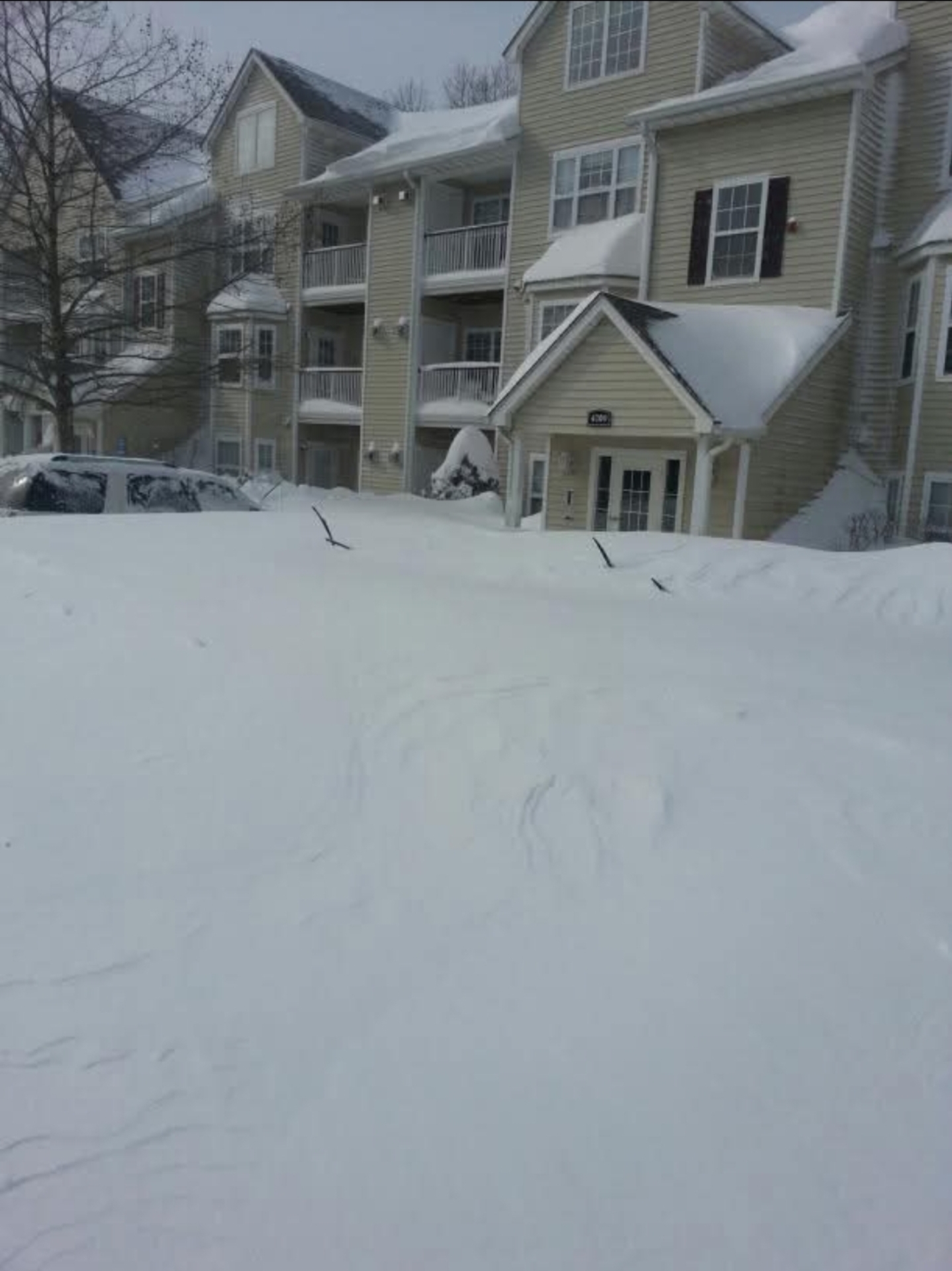
Hopefully you lived in Hamden in Feb 2013 for the 40 inches. My sister sent me this from her apartment there.

-
-
-
Congrats man.
-
Maybe Feb 8th 2013. My sister sent me this from her apartment in Hamden that recorded 40 inches.

-
What a winter for BDR. Wunderground has 12 inches and days and days of snow and cold..
-
Rise of the Machines: January 18-19 Winter Storm Obs Thread
BrianW replied to WxWatcher007's topic in New England
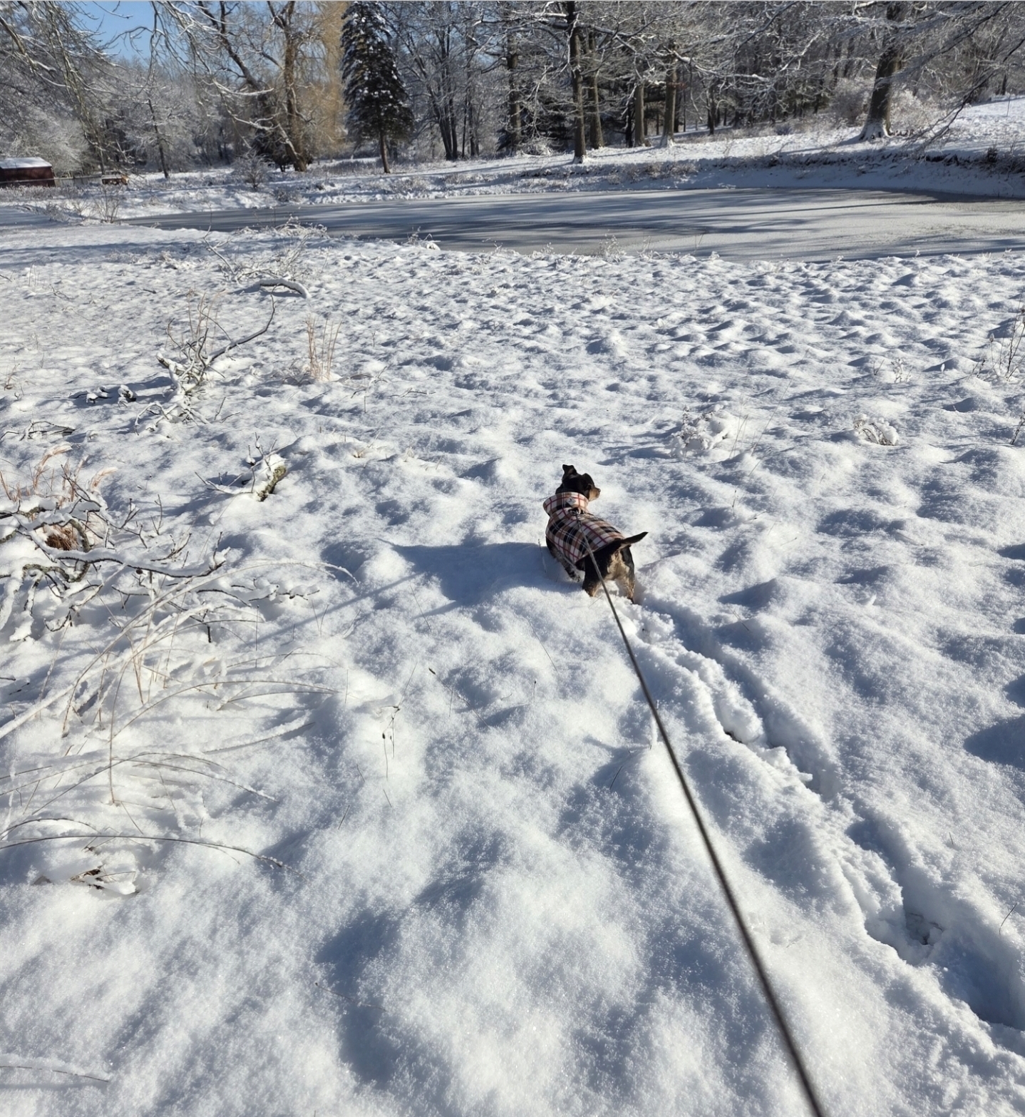
Nice snowy walk with the Weenie this morning. 5.5 total for all events.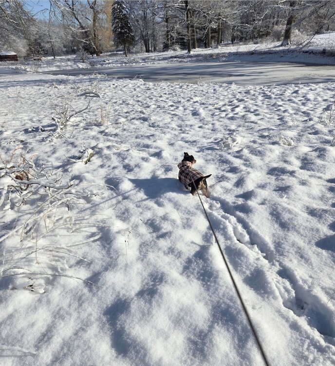
-
Rise of the Machines: January 18-19 Winter Storm Obs Thread
BrianW replied to WxWatcher007's topic in New England
Yeah. Been some nice lingering snows down here this morning. -
Rise of the Machines: January 18-19 Winter Storm Obs Thread
BrianW replied to WxWatcher007's topic in New England
And deep pack locked in with all the cold coming up..thumb.png.433998e875f6f58ace54588487ecef8e.png)
-
Rise of the Machines: January 18-19 Winter Storm Obs Thread
BrianW replied to WxWatcher007's topic in New England
1.5 here in Branford. Caught the edge of that band earlier. -
Another Coating of Snow Saturday - "It's all we Got"
BrianW replied to Sey-Mour Snow's topic in New England
.7 Branford -
Rise of the Machines: January 18-19 Winter Storm Obs Thread
BrianW replied to WxWatcher007's topic in New England
That band is expanding nicely towards HVN and GON. Rates really starting to pick up here. -
First Legit Storm Potential of the Season Upon Us
BrianW replied to 40/70 Benchmark's topic in New England
Nice band setting up into RI.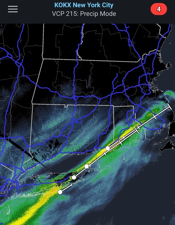
-
First Legit Storm Potential of the Season Upon Us
BrianW replied to 40/70 Benchmark's topic in New England
Yeah. One of the snowiest starts to winter down here on the shoreline in many years. Up untill this winter I haven't used my snowblower in like 5 years.


.png.c398d41e191357213fd09006cecc222a.png)
