MANDA
-
Posts
3,030 -
Joined
-
Last visited
Content Type
Profiles
Blogs
Forums
American Weather
Media Demo
Store
Gallery
Everything posted by MANDA
-
11.5 degrees currently with steady light to sometimes moderate snow. Windy as well. Looks like Old Forge, NY out there. Low gray overcast, deep snow cover and the air filled will falling and blowing snow. Gotta feel sorry for anyone who has had to work outside this month. Except for a several day pause in the cold earlier this month it has been brutal. December was no bargain for outdoor workers either.
-
I've not looked yet but that is surprising and not a good signal. I would have bet there would have been some at least some ensemble members with a decent hit.
-
Look at the first map in that loop, that was the model cycle that gave us the massive hit. Upper low closing off over eastern KY/TN and the trof was already starting to tilt negative. Much more the look of a big MA/NE snowstorm.
-
Not to mention that a closed upper low on the SC coast at 06Z Sunday is heading essentially due east. Just not a good look in my opinion. Just not closing off in the right place and trof axis which at that point is neutral is too far east. Wind max has already rounded the base of the trof. and add the kicker to that and you have an OTS solution as depicted. If we are going to get anymore than a coastal fringe up here there needs to be rather significant changes in how the 500MB flow evolves over the next several days. Not saying that is impossible just commenting on the way the EURO has things progged now.
-
Heads up... this map is MM, not inches of QPF. 25 mm = 1".
-
This look verbatim is not going to do it for us. Even a neutral tilt would be better than this.
-
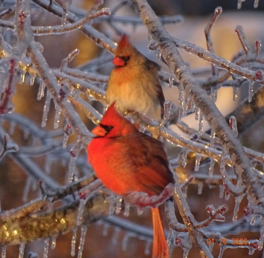
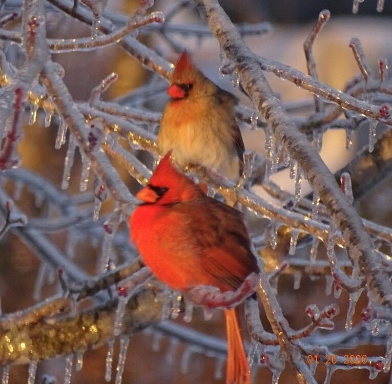
Some peaceful pictures on a cold morning. CP and cardinals puffing up to keep warm in Kentucky.
-
Looks great. Can you snap the same picture on Sunday morning for us!?
-
My opinion on this map and on this map only....Ridge out west not sharp enough and trof too far east and positively tilted and best 500 MB HT departures too far south and east. Not much downstream to force the trof to start to swing negative in time to make surface feature come up the coast and close enough. Hence probably why the OP is OTS. If the above ends up being close to reality not a good look for us. Having said all that....still lots of time for changes....for better or worse.
-
Well that stat says keep your enthusiasm in check.
-
Surprised no Kuchera maps posted yet.
-
The jokes just write themselves with that one !
-
I still think there are others on that map that are questionable, maybe not. I'd have to believe the CoCoRaHS folks know what they are doing.
-
I had 30 minutes of sleet here. Storm was a minimum of 95% snow. It warmed aloft and the ratios fell.
-
Melted total for storm just completed 1.55". Snowfall 13.5". Storm averaged ratio 8.71/1. Started out at 20:1 then fell as the event progressed. Temperature never got above 10 degrees through the entire event. Hopefully this puts an end to the "it is so cold ratios will be beyond words" stuff. Cold surface temperatures are not the driving factor in ratios. Look aloft.
-
What are we thinking for ratios on this next storm?
-
There are a few of those I think on that map I posted.
-
Storm total snowfall and QPF: Click to enlarge maps. QPF clearly over performed even the wettest guidance, in some cases by 1/2" or more depending on the location and model of choice. The models ticking up the QPF as we got closer to the event start time was clearly on the right track though. Quick spot checks on ratios and nothing to write home about when averaged out over the storm duration....roughly 8:1 to 12:1 along the I78-I80 corridor and east across the city and LI. Just did a quick spot check. I'd have to give a nod to the higher QPF totals for getting storm total snowfall to near or over the high end ranges of the forecast. If they had been more or less as modeled in the 1 to 1.25" and taking the actual ratios into consideration storm total snowfall would have been closer to the lower end of the forecast ranges. Just my 2 cents.
-
Storm total here from most recent storm: Snowfall for the event: 13.5". Was tricky to measure mid and late storm with the increasing wind and sleet mixed in at times. Changed to sleet here for no more than 30 minutes mid afternoon then went back to snow with just a few periods on intermittent sleet until it ended about 9:00 last night. I'd say 95% of the storm here was snow. Snow depth from current storm at 8 this morning was 12" even - total snow depth (includes snow on the ground prior to this event and some compaction of new snow pack) is 14". Drifts on the north side of house 20-24", even a bit higher in a few spots. Waiting on the cylinder to melt down so I can get a melted total and a ratio.
-
Been mostly light to sometimes moderate snow here last 2 hours. Some sleet mixed in at times. Not been out to measure. Will take measurements in the morning. Winds really gusting so lots of blowing show from rooftops. Currently 13 degrees. Also, someone stole about 17” of my snow. Busted Apple weather app. Winds really howling.
-
They are too busy with hair, makeup and wardrobe.
-
5:30 11.8 degrees. Light snow. Just came in from a measurement. Getting a little difficult to measure as winds a really gusting at times. Storm total 12" even. North side of the house drifts to 20-24". As wintry a day (temperature and snowfall combined) as we see around here. Everyone should be happy. Things went pretty much as advertised. Slightly exceed my expectations in my area. Was thinking a storm total of 9-11" here and I'm currently at 12.